Checleset Bay

Last updated
Checleset Bay
French: Baie Checleset
Big Bunsby Marine Park,.jpg
Canada British Columbia relief location map.jpg
Red pog.svg
Checleset Bay
Location in British Columbia
Location Vancouver Island, British Columbia
Coordinates 50°05′45″N127°35′37″W / 50.09583°N 127.59361°W / 50.09583; -127.59361 Coordinates: 50°05′45″N127°35′37″W / 50.09583°N 127.59361°W / 50.09583; -127.59361
Type Bay
Ocean/sea sources Pacific Ocean

Checleset Bay is a bay on the northwest coast of Vancouver Island, British Columbia, Canada. It is located southeast of Brooks Peninsula and northwest of Kyuquot Sound. Much of the land around the bay is part of Brooks Peninsula Provincial Park. Checleset Bay has three large inlets, Nasparti Inlet, [1] Ououkinsh Inlet, [2] and Malksope Inlet. [3]

Contents

Etymology

Checleset Bay was named in the late 1930s in association with the Kyuquot/Cheklesahht First Nation of nearby Kyuquot Sound. This First Nation, today officially spelled Che:k:tles7et'h', was historical spelled in various ways such as Checleset and Cheklesaht. They once occupied the shores of Checleset Bay until moving to Mission Island in the 1950s. Today they live at Houpsitas on Kyuquot Sound. [4]

Geography

Historically, Checleset Bay was the northernmost area of the Nuu-chah-nulth First Nations. The land north of Checleset Bay and Brooks Peninsula was Kwakwakaʼwakw territory, with the Klaskino being the southernmost of the Kwakwakaʼwakw people. Today the Klaskino are part of the Quatsino First Nation, whose territory lies just north of Checleset Bay and Brooks Peninsula. [5] The Che:k:tles7et'h' (Cheklesahht) people lived in the Checleset Bay area. Their main winter village was at Upsowis, and the summer village at Acous. Besides these there were at least 34 other village sites, 10 refuges, 8 camps, 7 fish traps, 3 fish weirs, 11 burial caves, and 2 cemeteries on the shores of Checleset Bay. [5]

Near the mouth of Nasparti Inlet is Columbia Cove, named for the maritime fur trade ship Columbia Rediviva , which under Captain Robert Gray anchored here in June 1791 and July 1792. The name dates back to the 1790s. It was used by Gray's officer Robert Haswell and several times by John Boit in his log of the Union , which anchored in the cove in 1795. [6] An islet at the entrance of Columbia Cove is known as Boit Rock, after John Boit. [7]

Deeper into Nasparti Inlet is Johnson Lagoon, an inlet-like saltwater lake narrowly connected to Nasparti Inlet. [8] Tidal currents are funneled through the narrow opening, resulting in dangerous tidal rapids. [5]

The Acous Peninsula lies between Nasparti Inlet and Ououkinsh Inlet. [9] Acous was the main Che:k:tles7et'h' (Cheklesahht) summer village, located near the point of Acous Peninsula. [10] Although long abandoned, the village site still contains old carvings and house posts. [5]

Just east of Acous Peninsula, at the entrance of Ououkinsh Inlet is Battle Bay. [11] Nearby is the former Cheklesahht village of Mahope. [12]

Near the head of Ououkinsh Inlet is the mouth of the Power River, [13] which flows through the Hisnit River Watershed Protected Area [14] and Power Lake [15] before emptying into Ououkinsh Inlet near the former Cheklesahht village of Hisnit. [16] Hisnit was an important sockeye salmon fishing site. [5] The Ououkinsh River flows into the head of Ououkinsh Inlet. [17] At the river's mouth is another former Cheklesahht village, called Ououkinsh. [18]

Between Ououkinsh Inlet and Malksope Inlet lie the Bunsby Islands, named in 1862 by Captain George Henry Richards after a character in the Charles Dickens novel Dombey and Son . [19] Among the islands is Big Bunsby Marine Provincial Park. [20] Che:k'tles7et'h' Island is one of the southwesternmost Bunsby Islands. This island was once an Indian Reserve but in 2011 was transferred in fee simple to the Kyuquot/Cheklesahht First Nation. [21]

Malksope Inlet, whose preferred modern spelling is Maq:cup, [3] is the easternmost inlet of Checleset Bay. Near its entrance is the site of Upsowis, the former main winter village of the Cheklesahht. [22] [5] The Malkscope (Maq:cup) River flows into the head of Malkscope Inlet. [23] Near the river's mouth is the former Cheklesahht village Maq:cup. [24]

Conservation

Most of Checleset Bay is protected as the 34,650-hectare (85,600-acre) Checleset Bay Ecological Reserve, which was established in 1981 for the reintroduction of sea otters, which were once abundant but hunted to local extinction in British Columbia during the maritime fur trade era. Around 1970 89 sea otters were brought from Alaska to Checleset Bay. By 1984 there were about 200 in the reserve and about 150 more in the surrounding area. By 2013 their range had expanded over much of the coasts of western and northern Vancouver Island and elsewhere, with a total population of about 5,600. [25] [26]

Long designated endangered, today sea otters are designated "Special Concern" under the federal Canadian Species at Risk Act . In addition they are protected by the Marine Mammal Regulations in the federal Fisheries Act. They are listed as "Threatened" under the British Columbia Wildlife Act. [27] For these reasons motorized watercraft are not allowed in Checleset Bay and there are restrictions or bans on activities like fishing and camping. To land on the shore requires a request for permission. Research and educational activities require special permits. [28]

Related Research Articles

Burrard Inlet coastal fjord in southwestern British Columbia

Burrard Inlet is a relatively shallow-sided fjord in northwestern Lower Mainland, British Columbia, Canada. Formed during the last Ice Age, it separates the City of Vancouver and the rest of the lowland Burrard Peninsula to the south from the coastal slopes of the North Shore Mountains, which span West Vancouver and the City and District of North Vancouver to the north.

Comox-Strathcona Regional District

The Regional District of Comox-Strathcona was a regional district of British Columbia, Canada from 1967 to 2008. On February 15, 2008, the regional district was abolished and replaced by two successor regional districts, Comox Valley and Strathcona.

Earls Cove, British Columbia Locality in British Columbia, Canada

Earls Cove is a small settlement located on Jervis Inlet in the Sunshine Coast region of British Columbia. It is a terminal for the BC Ferries route across the inlet to Saltery Bay, linking the Lower Sunshine Coast with the Upper Sunshine Coast. Earls Cove is at the north end of the Sechelt Peninsula and on the east side of the mouth of Jervis Inlet, adjacent to Agamemnon Channel, across which is Nelson Island.

Jervis Inlet

Jervis Inlet is one of the principal inlets of the British Columbia Coast, about 95 km (59 mi) northwest of Vancouver, and the third of such inlets north of the 49th parallel, the first of which is Burrard Inlet, Vancouver's harbour.

Knight Inlet

Knight Inlet is one of the principal inlets of the British Columbia Coast, and the largest of the major inlets in the southern part of the Coast. It is fifth in sequence of the great saltwater inlets north from the 49th parallel near Vancouver, but it is the first whose outflow points away from the Strait of Georgia, opening into Queen Charlotte Strait at the Kwakwakaʼwakw community of Memkumlis on Village Island.

Kingcome Inlet is one of the lesser principal fjords of the British Columbia Coast, north and east of Broughton Island. It is sixth in sequence of the major saltwater fjords north from the 49th parallel near Vancouver and similar in width, on average 2.5 km (1.6 mi), to longer inlets such as Knight Inlet and Bute Inlet, but it is only 35 km (22 mi) in length from the mouth of the Kingcome River to Sutlej Channel, which ultimately connects around Broughton Island to the main regional waterway of the Queen Charlotte Strait. Kingcome Inlet has a short side inlet, Wakeman Sound, fed by the Wakeman River.

Brooks Peninsula Provincial Park

Parts of this article have been adapted from the BC Parks website.

Big Bunsby Marine Provincial Park

Big Bunsby Marine Provincial Park is a provincial park on the west coast of northern Vancouver Island in British Columbia, Canada, to the southeast of the Brooks Peninsula in Checleset Bay. It is accessible only by boat.

Catala Island Marine Provincial Park

Catala Island Marine Provincial Park is a provincial park in British Columbia, Canada, located on the west coast of Vancouver Island at the mouth of Esperanza Inlet, between Kyuquot Sound (N) and Nootka Sound (S). The park is 955 ha. in size and was established in July 1995.

Vancouver Island Ranges

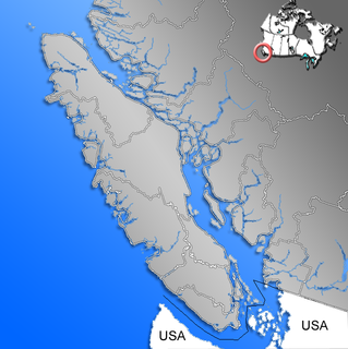
The Vancouver Island Ranges, formerly called the Vancouver Island Mountains, are a series of mountain ranges extending along the length of Vancouver Island which has an area of 31,788 km2 (12,273 sq mi). The Vancouver Island Ranges comprise the central and largest part of the island. The Geological Survey of Canada refers to Vancouver Island, Haida Gwaii, and the Alaska Panhandle as the Insular Belt including the sea floor out to 100 km (62 mi) west of Vancouver Island. The Vancouver Island Ranges are a sub-range of the Insular Mountains.

Kyuquot Sound is a complex of coastal inlets, bays and islands on northwestern Vancouver Island in the Canadian province of British Columbia.

Klahoose

The ƛoʔos Klahoose are one of the three groups comprising the ʔayʔaǰuθəm Tla'Amin or Mainland Comox. The other two divisions of this once-populous group are the χʷɛmaɬku Homalco and Sliammon. The Klahoose, Homalco and Sliammon are, according to oral tradition, the descendants of the survivors of the Great Flood. The three groups were split by colonialism into different band councils but united historically as the Tla A'min, known as the Mainland Comox, and K’ómoks, the larger grouping of the Comox people, also known as the Island Comox and before the merger with the Laich-kwil-tach culture. Historically both groups are a subgroup of the Coast Salish though the K’ómoks name is from, and their language today, is the Lik'wala dialect of Kwak'wala. The ancestral tongue is the Comox language, though the Sahtloot/Island dialect is extinct.

Campbell River (Vancouver Island)

The Campbell River is a river on Vancouver Island, British Columbia, Canada. It drains into Discovery Passage at the northwest end of the Strait of Georgia at the City of Campbell River. The Kwak'wala name for the river, or for the village near its mouth, is Tla'mataxw. The source of the river is Buttle Lake.

Smith Sound (British Columbia)

Smith Sound is a sound on the Central Coast of British Columbia, Canada, located to the south of Rivers Inlet and between the Queen Charlotte Strait region (S) and Fitz Hugh Sound (N).

Observatory Inlet Inlet in the North Coast region of British Columbia, Canada

Observatory Inlet is an inlet on the North Coast of British Columbia. It is a northward extension of Portland Inlet, other branches of which include the Portland Canal. The entrance of Observatory Inlet, from Portland Inlet, lies between Ramsden Point and Nass Point. Ramsden Point also marks, to the west, the entrance of Portland Canal. Observatory Inlet was named by George Vancouver in 1793, because he set up his observatory on the shore of the inlet, at Salmon Cove, in order to calibrate his chronometers. His two vessels, HMS Discovery and HMS Chatham, stayed in Salmon Cove from July 23 to August 17, 1793. During this time a boat surveying expedition under Vancouver himself explored Behm Canal. Vancouver also named three headlands at the entrance of Observatory Inlet: Maskelyne Point, for Nevil Maskelyne, the Astronomer Royal, Wales Point, for William Wales, the mathematical master who sailed with James Cook, and Ramsden Point, after the famed mathematical instrument-maker Jesse Ramsden.

Smith Inlet (British Columbia) Fjord in the Central Coast region of British Columbia, Canada

Smith Inlet is an inlet at the head of Smith Sound on the Central Coast of British Columbia, Canada. Smith Inlet and Smith Sound are notable as the home of the Gwaʼsala group of the Kwakwakaʼwakw peoples, who are also known as the Smith Inlet people. Nekite Indian Reserve No. 2, which is under the governance of the Gwaʼsala-ʼNakwaxdaʼxw Nations band government, is located at the head of Smith Inlet, at the mouth of the Nekite River.

Union was an American sloop built in Somerset, Massachusetts in 1792. It is best known for its circumnavigation of the world, 1794–1796, under the maritime fur trader John Boit.

John Boit Jr was one of the first Americans involved in the maritime fur trade. He sailed as fifth mate under Captain Robert Gray on the second voyage of the Columbia Rediviva, 1790–1793. During the voyage he wrote a short but important journal in which he described the discovery of the Columbia River.

The Nahwitti River is a 40-kilometre (25 mi) long river in northernmost Vancouver Island, British Columbia, Canada. It flows through Cape Scott Provincial Park into Goletas Channel near Hope Island and Queen Charlotte Sound. Its watershed, 229 km2 (88 sq mi) large, is located west and northwest of Port Hardy, north and northeast of Holberg, and north of Holberg Inlet, part of Quatsino Sound.

Nahwitti (trading site)

Nahwitti was a Kwakwakaʼwakw First Nation village and a major trading site during the maritime fur trade era of approximately 1790 to 1850. Today it is an Indian reserve under the administration of the Kwakwakaʼwakw Tlatlasikwala Nation. It is located near the northern tip of Vancouver Island, at Cape Sutil on Queen Charlotte Sound, near Hope Island and the Nahwitti River, east of Cape Scott, and not far from historic Fort Rupert and modern Port Hardy.

References

  1. "Nasparti Inlet". BC Geographical Names .
  2. "Ououkinsh Inlet". BC Geographical Names .
  3. 1 2 "Malksope Inlet". BC Geographical Names .
  4. "Checleset Bay". BC Geographical Names .
  5. 1 2 3 4 5 6 Kimantas, John (2018). The BC Coast Explorer Volume 1: North and West Vancouver Island. Wild Coast Publishing. pp. 79–81, 90–95. ISBN   978-0-9879851-0-1 . Retrieved 6 March 2020.
  6. "Columbia Cove". BC Geographical Names .
  7. "Boit Rock". BC Geographical Names .
  8. "Johnson Lagoon". BC Geographical Names .
  9. "Acous Peninsula". BC Geographical Names .
  10. "Acous". BC Geographical Names .
  11. "Battle Bay". BC Geographical Names .
  12. "Mahope". BC Geographical Names .
  13. "Power River". BC Geographical Names .
  14. "Hisnit River Watershed Protected Area". BC Geographical Names .
  15. "Power Lake". BC Geographical Names .
  16. "Hisnit". BC Geographical Names .
  17. "Ououkinsh River". BC Geographical Names .
  18. "Ououkinsh". BC Geographical Names .
  19. "Bunsby Islands". BC Geographical Names .
  20. "Big Bunsby Marine Park". BC Geographical Names .
  21. "Che:k'tles7et'h' Island". BC Geographical Names .
  22. "Upsowis". BC Geographical Names .
  23. "Malkscope River". BC Geographical Names .
  24. "Maq:cup". BC Geographical Names .
  25. "Trends in the Abundance and Distribution of Sea Otters (Enhydra lutris) in British Columbia Updated with 2013 Survey Results" (PDF). Department of Fisheries and Oceans. Retrieved 10 July 2018.
  26. "Sea Otter Recovery on Vancouver Island's West Coast". Bamfield Marine Sciences Centre Public Education Programme. Retrieved 22 August 2011.
  27. "Species Profile (Sea Otter) - Species at Risk Public Registry". Government of Canada. Retrieved 6 March 2020.
  28. "Checleset Bay Ecological Reserve". BC Parks . Retrieved 6 March 2020.