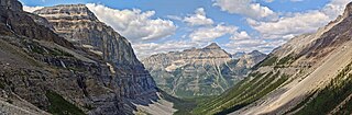
Kootenay National Park is a national park of Canada in southeastern British Columbia. The park consists of 1,406 km2 (543 sq mi) of the Canadian Rockies, including parts of the Kootenay and Park mountain ranges, the Kootenay River and the entirety of the Vermilion River. While the Vermilion River is completely contained within the park, the Kootenay River has its headwaters just outside the park boundary, flowing through the park into the Rocky Mountain Trench and eventually joining the Columbia River. The park ranges in elevation from 918 m (3,012 ft) at the southwestern park entrance to 3,424 m (11,234 ft) at Deltaform Mountain.

The Fraser Canyon is a major landform of the Fraser River where it descends rapidly through narrow rock gorges in the Coast Mountains en route from the Interior Plateau of British Columbia to the Fraser Valley. Colloquially, the term "Fraser Canyon" is often used to include the Thompson Canyon from Lytton to Ashcroft, since they form the same highway route which most people are familiar with, although it is actually reckoned to begin above Williams Lake at Soda Creek Canyon near the town of the same name.

The Marble Range is a small mountain range adjoining the Fraser River on the southwestern edge of the Interior Plateau of British Columbia. It has an area of 1,250 square kilometres and about 65 km NNW to SSE and about 20 km wide. Its southern flank is the north wall of Marble Canyon and the valley occupied by the ranching and First Nations community of Pavilion.

The Niut Range is 3600 km2 in area. It is a subrange of the Pacific Ranges of the Coast Mountains of British Columbia, although in some classifications it is considered part of the Chilcotin Ranges. The Niut is located in the angle of the Homathko River and its main west fork, Mosley Creek. It is isolated, island-like, by those rivers from its neighbour ranges, as both streams have their source on the Chilcotin Plateau in behind the range. Razorback Mountain is its highest peak.

The Camelsfoot Range is a sub-range of the Chilcotin Ranges subdivision of the Pacific Ranges of the Coast Mountains in British Columbia. The Fraser River forms its eastern boundary. The range is approximately 90 km at its maximum length and less than 30 km wide at its widest.
The Bonaparte Plateau, in British Columbia, Canada, is a sub-plateau of the Thompson Plateau which extends to the Quesnel River and lies between the Cariboo Mountains on the east and the Fraser River on the west. The Thompson Plateau is itself a sub-plateau of the larger Fraser Plateau.
Blue Earth Lake Provincial Park is a provincial park in the Upper Hat Creek area at the south end of the Cornwall Hills, just northwest of Ashcroft, British Columbia, Canada.
Cornwall Hills Provincial Park is a provincial park in British Columbia, Canada, immediately west of Cache Creek, protecting part of the Cornwall Hills including their highest summit which features an old fire lookout.
Junction Sheep Range Provincial Park is a provincial park in British Columbia, Canada, located near the confluence of the Chilcotin and Fraser Rivers on the west bank of the latter river.
Marble Range Provincial Park is a provincial park in British Columbia, Canada, located west of 100 Mile House and Clinton at the southwest edge of the Cariboo Plateau along the eastern edge of the Fraser Canyon south from Big Bar-Kostering and near Jesmond.
Oregon Jack Provincial Park is a provincial park in British Columbia, Canada located in the Clear Range west of Ashcroft. It protects the limestone canyon of Oregon Jack Creek, at the head of which is a waterfall named the Notch, above which is included a wetland area. The site was an important First Nations site and there are pictographs, culturally modified trees and a site known as the Three Sisters Rock Shelter.

The Spruce Lake Protected Area, formerly known variously as the Southern Chilcotin Mountains Provincial Park, Southern Chilcotins, and also as South Chilcotin Provincial Park, is a 71,347-hectare Protected Area in the British Columbia provincial parks system, approximately 200 km north of Vancouver. The area had been the subject of an ongoing preservationist controversy since the 1930s. In 2007, its status as a provincial park was downgraded to protected area.

Clinton is a village in British Columbia, Canada, located approximately 40 km (25 mi) northwest of Cache Creek and 30 km south of 70 Mile House.
Tyaughton Creek, formerly gazetted as the Tyaughton River, also historically known as Tyoax Creek, is a 50 kilometre tributary of British Columbia's Bridge River, flowing generally southeast to enter the main flow of that river about mid-way along the length of Carpenter Lake, a reservoir formed by Terzaghi Dam of the Bridge River Power Project.

Big Bar Ferry is a cable ferry across the Fraser River in British Columbia, Canada. It is located about 60 kilometres (37 mi) north of the town of Lillooet and 72 kilometres (45 mi) west of Clinton. 6 km upstream from the ferry is French Bar Canyon, while downstream is High Bar Canyon . The ferry connects the dirt ranch road up the west side of the Fraser from Lillooet to Big Bar and Kostering, which connect via road to Jesmond and Big Bar Lake, and beyond to BC Highway 97.

Hat Creek is a tributary of the Bonaparte River in British Columbia, Canada, joining that stream at Carquile, which is also known as Lower Hat Creek and is the site of the Hat Creek Ranch heritage museum and visitor centre. The Hat Creek basin includes a broad upper plateau area encircled by the gentle but high summits of the Clear Range and, to its east, the Cornwall Hills; this area is known as Upper Hat Creek. Adjacent to Upper Hat Creek is the gateway to Marble Canyon and a rancherie of the Pavilion First Nation, who are both a St'at'imc and Secwepemc people. During the Fraser Canyon and Cariboo Gold Rushes an important trail northwards from the lower Fraser Canyon led from Foster Bar on the Fraser via Laluwissen Creek into Upper Hat Creek, then via the creek to the Bonaparte River. The economy of the basin is ranching-based and includes some of the oldest ranches in the British Columbia Interior. On the northwest edge of the Upper Hat Creek basin there is a large lignite deposit and several exploratory pits, some dating back to the 19th century but some more recent, part of an intended, but now shelved Hat Creek coal-thermal proposal.

Churn Creek is a tributary of the Fraser River in the Canadian province of British Columbia.

The Cascade Mountains leeward forests are a temperate coniferous forest ecoregion of North America, as defined by the World Wildlife Fund (WWF) categorization system.
Jesmond is a ranching community in the South Cariboo region of the Interior of British Columbia, Canada, located in the area west of the town of Clinton on the road from Kelly Lake, which is on the Pavilion-Clinton Road, to Big Bar Creek and Big Bar Ferry. Jesmond once had a post office, starting in 1913, when the postmaster adopted the name of his father's birthplace in the United Kingdom as the name of the place, until 1960 when it was closed.
The Lillooet Land District is one of the 59 cadastral subdivisions of British Columbia, which were created by the Lands Act of the Colony of British Columbia in 1859, defined as "a territorial division with legally defined boundaries for administrative purposes". The land district's boundaries came to be used as the boundary of the initial Lillooet riding for the provincial Legislature from 1871, when the colony became a province. In addition to use in descriptions of land titles and lot surveys, the Land District was also the basis of the Lillooet Mining District.

