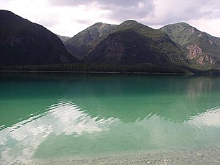
Liard River Hot Springs Provincial Park is a provincial park in British Columbia, Canada. It is home to the second largest natural hot springs in Canada, after Deer River Hot Springs 15 km to the north east. It is a natural river of hot water rather than a spring fed man made pool. The park is part of the larger Muskwa-Kechika Management Area. The community of Liard River, British Columbia is located nearby.
Burgoyne Bay Provincial Park is a provincial park in British Columbia, Canada located on southwestern Saltspring Island near Fulford Harbour and facing northwest to Sansum Narrows, which is the channel between Saltspring and Vancouver Island. Mount Maxwell Provincial Park lies adjacent, to the north. Burgoyne Bay was named in 1859 by Captain Richards for Commander Hugh Talbot Burgoyne VC, an officer aboard HMS Ganges.
Goldpan Provincial Park is a provincial park in British Columbia, Canada, located on the Trans-Canada Highway between Lytton (W) and Spences Bridge (E), on the Thompson River. The park has camping above the highway and a picnic area and riverfront below.
Hai Lake–Mount Herman Provincial Park is a provincial park in British Columbia, Canada. Established in 2004, it is 323 ha. and protects regionally significant bog ecosystems and old-growth forests. The park caters to outdoor pursuits such as day hiking, camping, fishing, and hunting.
Hyland River Provincial Park is a provincial park in British Columbia, Canada, located near the boundary with Yukon along the Alaska Highway just east of the community of Lower Post and north of the Liard River. Established in 1964, the park is 34 ha. in area.
Lakelse Lake Wetlands Provincial Park is a provincial park in British Columbia, Canada, located near the city of Terrace in that province's Skeena Country. It is 1214 ha. in size.

Monashee Provincial Park is a provincial park located just outside of Cherryville, British Columbia, Canada. It is located in the central Monashee Mountains between the Arrow Lakes and the upper Shuswap River drainage, just east of Sugar Lake. It is a remote grizzly habitat that is a walk-in only. Mount Fosthall is the highest peak in the area and can be hiked in a day. In addition to hiking and alpinism other activities include fishing.

Monck Provincial Park is a provincial park in British Columbia, Canada, located at Nicola Lake near the town of Merritt. The park's campground is one of those which accepts reservations. Activities including fishing, camping and hiking. Natural features other than Nicola Lake include lava beds associated with the Chilcotin Group.
Porcupine Meadows Provincial Park is a 2,704 hectare provincial park in British Columbia, Canada, located north of Tranquille Lake to the northwest of Kamloops. Its name is a direct translation of the Shuswap word for this area, "pisitsoolsia", named so for the numerous porcupine in the area.
Scatter River Old Growth Provincial Park is a provincial park in British Columbia, Canada, located on the Liard River downstream from Liard River Hot Springs Provincial Park and Liard River Corridor Provincial Park and Protected Area. The park includes the Grand Canyon of the Liard, a 30 km stretch of canyon and whitewater between the Toad and Trout River converges with the Liard. The park includes high upland plateau and muskeg as well as stands of old growth spruce forests. Established in 1999, the park is c.1140 ha. in area.

Seven Sisters Provincial Park and Protected Area is a provincial park in British Columbia, Canada, protecting part of the Howson Range between Hazelton and Terrace and comprising approximately 27,200 hectares.
Stuart River Provincial Park is a provincial park in British Columbia, Canada. It is located in two sections north and northwest of Vanderhoof along the Stuart River southeast of Stuart Lake and the city of Fort St. James. The upper section is located at 54°13′20″N124°00′00″W and comprises c.7391 ha. while the lower, eastern section is centred at 54°03′00″N123°37′00″W and comprises c.3390 ha. and is within the Greater Prince George area. The upper site, which is located around the confluence of the Stuart and Nechako Rivers, includes the site of Chinlac, a Dakelh village whose inhabitants were massacred and enslaved by the Tsilhqot'in of Anahim Lake c. 1745.
There are several lakes named Mud Lake within the Canadian province of Alberta.
The Kluskus First Nation is the band government of the Lhoosk’uz, a Dakelh people whose main reserve located on the Chilcotin Plateau 130 km west of the city of Quesnel, British Columbia, Canada. The First Nation is a member of the Carrier-Chilcotin Tribal Council, which includes both Tsilhqot'in and Carrier (Dakelh) communities.
The Tlʼesqox First Nation is a Tsilhqotʼin community located west of the Fraser Canyon in the Chilcotin region of the Canadian province of British Columbia. It is a member of the Carrier-Chilcotin Tribal Council, which includes both Tsilhqotʼin and Carrier (Dakelh) communities.

The Lil'wat First Nation, a.k.a. the Lil'wat Nation or the Mount Currie Indian Band, is a First Nation band government located in the southern Coast Mountains region of the Interior of the Canadian province of British Columbia. It is a member of the Lillooet Tribal Council, which is the largest grouping of band governments of the St'at'imc or Stl'atl'imx people. Other St'at'imc governments include the smaller In-SHUCK-ch Nation on the lower Lillooet River to the southwest, and the independent N'quatqua First Nation at the near end of Anderson Lake from Mount Currie, which is the main reserve of the Lil'wat First Nation, and also one of the largest Indian reserves by population in Canada.

The Katzie First Nation or Katzie Nation is the band government of the Katzie people of the Lower Fraser Valley region of British Columbia, Canada.
Kitselas First Nation is the band government of the Kitselas subgroup of the Tsimshian. The band government is based at Gitaus in the Skeena Valley in the Skeena River valley to the northeast of the city of Terrace, British Columbia, Canada. Though there is no Tsimshian tribal council, they are a participant in the Tsimshian First Nations treaty council.
Kitsumkalum First Nation is a band government of the Tsimshian people based at Kitsumkalum, British Columbia in the Skeena River valley in the North Coast region near Terrace, British Columbia, Canada. They are a member government of the Tsimshian First Nations treaty council.

The Terminal Range is the northernmost mountain range of the Canadian Rockies, so-named for its position at the northern terminus of the Rockies. Lying west of Muncho Lake and the Trout River, its northern perimeter is the Liard River. The Sentinel Range lies to its east.


