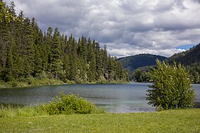
Marble Canyon is in the south-central Interior of British Columbia, a few kilometres east of the Fraser River and the community of Pavilion, midway between the towns of Lillooet and Cache Creek. The canyon stems from a collapsed karst formation.

Buse Lake Protected Area, informally known as Buse Lake Provincial Park, is a provincial park in British Columbia, Canada, 23 km east-southeast of Kamloops near Monte Creek. It was created in 2000 as part of the outcome of the Kamloops Landuse and Resource Management Plan (KLRMP) and is 228 hectares in size.
Bulkley Junction Provincial Park is a provincial park in British Columbia, Canada, located on the west side of the Skeena River opposite Hazelton. It was established in 1997 and expanded in 2004 from 133 ha. to its current size of 169 ha.

Tā Chʼilā Provincial Park, formerly Boya Lake Provincial Park, is a provincial park located in the Stikine Region of British Columbia, Canada. The park located 120 km north-by-northwest of the community of Dease Lake near BC Highway 37. Boya Lake is named for Charlie Boya, a First Nations man from the area.

Cathedral Provincial Park and Protected Area, usually known as Cathedral Provincial Park and also as Cathedral Park, is a provincial park in British Columbia, Canada. It is located east of E.C. Manning Provincial Park, south of BC Highway 3, and southeast of the town of Princeton and southwest of Keremeos. Its southern boundary is the border with the United States. Much of the park is the basin of the Ashnola River.

Canim Beach Provincial Park is a provincial park in British Columbia, Canada, located at the southwest end of Canim Lake in the Interlakes District of the South Cariboo region, adjacent to the Secwepemc Indian reserve community of Canim Lake, British Columbia just northeast of 100 Mile House. The park was established by Order-in-Council in 1956 and expanded by later legislation in 2000 and 2004 to total a current approximate of 8.2 hectares, 3.6 hectares of upland and 4.6 hectares of foreshore.
Animals of Conkle Lake Provincial Park
Emar Lakes Provincial Park is a provincial park in British Columbia, Canada.
Fort George Canyon Provincial Park is a provincial park south of Prince George in British Columbia, Canada. The park's area is 440 acres (180 ha) and includes part of the Fraser River. No camping, campfires, swimming, kayaking, horses, pets, or rock climbing are allowed. Skiing, fishing, and hunting are allowed.
High Lakes Basin Provincial Park is a provincial park in British Columbia, Canada.

Monck Provincial Park is a provincial park in British Columbia, Canada, located at Nicola Lake near the town of Merritt. The park's campground is one of those which accepts reservations. Activities including fishing, camping and hiking. Natural features other than Nicola Lake include lava beds associated with the Chilcotin Group.
Monte Lake Provincial Park is a provincial park in British Columbia, Canada, located on the east side of Monte Lake and to the south of the community of Monte Lake, British Columbia which is at the north end of the lake. About five hectares in size, it protects an area of Ponderosa pine and grasslands.
Pennask Lake Provincial Park is a provincial park in British Columbia, Canada, located on the easternmost heights of the Thompson Plateau,50 km (31 mi) to the northwest of the Okanagan town of Peachland.
Pine River Breaks Provincial Park is a provincial park in British Columbia, Canada in the Peace River Lowland between the communities of East Pine and Chetwynd.
Schoolhouse Lake Provincial Park, formerly known as Lang Lake Provincial Park, is a provincial park in British Columbia, Canada.
Tsintsunko Lakes Provincial Park is a 333-hectare provincial park in British Columbia, Canada, located south of the Deadman River between Kamloops (SE) and Bonaparte Lake (NW). It is located on the Bonaparte Plateau. It was established April 30, 1996.
The Lytton First Nation, a First Nations band government, has its headquarters at Lytton in the Fraser Canyon region of the Canadian province of British Columbia. While it is the largest of all Nlaka'pamux bands, unlike all other governments of the Nlaka'pamux (Thompson) people, it is not a member of any of the three Nlaka'pamux tribal councils, which are the Nicola Tribal Association, the Fraser Canyon Indian Administration and the Nlaka'pamux Nation Tribal Council.
The Mamalilikulla Band is a First Nations band government based on northern Vancouver Island in British Columbia, Canada. The home territory of the Mamalilikulla and Qwe-Qwa'Sot'Em groups of Kwakwaka'wakw was in the maze of islands and inlets of the eastern Queen Charlotte Strait region around the opening of Knight Inlet, mainly on Village Island, where their principal village Memkumlis is.

The Katzie First Nation or Katzie Nation is the band government of the Katzie people of the Lower Fraser Valley region of British Columbia, Canada.
Koksilah is a community located just southeast of the City of Duncan, British Columbia, Canada. Its name is derived, via that of the Koksilah River, from that of the Hwulqwselu people, one of the Hunqinum-speaking peoples of the area today organized as the Cowichan Tribes and government.


