The Boundary Waters Canoe Area Wilderness comprises 1,090,000 acres (440,000 ha) of pristine forests, glacial lakes, and streams in the Superior National Forest. Located entirely within the U.S. state of Minnesota at the Boundary Waters, the wilderness area is under the administration of the United States Forest Service. Efforts to preserve the primitive landscape began in the 1900s and culminated in the Boundary Waters Canoe Area Wilderness Act of 1978. The area is a popular destination for canoeing, hiking, and fishing, and is the most visited wilderness in the United States.

Quetico Provincial Park is a large wilderness park in Northwestern Ontario, Canada, known for its excellent canoeing and fishing. The 4,760 km2 (1,180,000-acre) park shares its southern border with Minnesota's Boundary Waters Canoe Area Wilderness, which is part of the larger Superior National Forest. These large wilderness parks are often collectively referred to as the Boundary Waters or the Quetico-Superior Country.

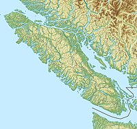
Garibaldi Provincial Park, also called Garibaldi Park, is a wilderness park located on the coastal mainland of British Columbia, Canada, 70 kilometres (43.5 mi) north of Vancouver. It was established in 1920 and named a Class A Provincial Park of British Columbia in 1927. The park is a popular destination for outdoor recreation, with over 30,000 overnight campers and over 106,000 day users in the 2017/2018 season.

Grand Portage National Monument is a United States National Monument located on the north shore of Lake Superior in northeastern Minnesota that preserves a vital center of fur trade activity and Anishinaabeg Ojibwe heritage. The area became one of the British Empire's four main fur trading centers in North America, along with Fort Niagara, Fort Detroit, and Michilimackinac.

Bowron Lake Provincial Park is a wilderness provincial park located in east-central British Columbia, Canada, near the border with Alberta. It is 117 km (73 mi) east of the city of Quesnel. Other nearby towns include Wells and the historic destination of Barkerville. Once a popular hunting and fishing destination, today the park is protected and known for its abundant wildlife, rugged glaciated mountains, and freshwater lakes.

The Snowbank Trail is a hiking trail in the Boundary Waters Canoe Area Wilderness (BWCAW) in northern Minnesota. The trail runs the perimeter of Snowbank Lake and crosses the Kekekabic Trail at the south side of Snowbank Lake. The entire trail comprises a 24-mile (39 km) loop, numerous campsites are available. During the BWCAW Visitor' Distribution Program, permits are required for overnight use of the trail. It is located in Fall Lake Township in northernmost Lake County.
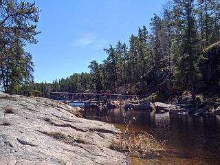
The Mantario Trail is a multipurpose trail in southeastern Manitoba. It is 63 kilometers long and meanders through rugged Canadian Shield. The trail is predominantly located within Whiteshell Provincial Park, although a very small portion of it enters Crown Land in Ontario. It is named after Mantario Lake, where one of several campsites that are along the trail sits. A large portion of the Mantario Trail is in a Wilderness Zone which is an area protected from motorized access and hunting.

Killarney Provincial Park is a provincial park in central Ontario, Canada.

Pinecone Burke Provincial Park is a provincial park in British Columbia, Canada. It extends from the southwest corner of Garibaldi Provincial Park, west of Pitt Lake and Pitt River to include Burke Mountain in the City of Coquitlam. Most of the park is unserviced wilderness with very rough trails such as the Fools Gold Trail in the Boise Valley. There is canoe access to Widgeon Slough and from there hiking trails that lead to Widgeon Lake, and a network of old logging roads, hiking and mountain biking trails on Burke Mountain. Visitors can also use the park for camping, backcountry skiing, and snowshoeing.
Cariboo River Provincial Park is a provincial park in British Columbia, Canada, located between Barkerville and Likely in the upper Cariboo River basin.

Quatsino Provincial Park is a provincial park in British Columbia, Canada, located on Quatsino Sound on northern Vancouver Island. The park was established July 12, 1995 and is 654 hectares in size. The park is 50 kilometres (31 mi) west of Port Hardy, British Columbia and is accessible by rough logging roads or by boat. Quatsino is on a popular kayaking route.
Goat Range Provincial Park is a provincial park in British Columbia, Canada.

Lockhart Beach Provincial Park is a provincial park Located 40 km north of Creston, British Columbia, Canada, on BC Highway 3A. "This park and the adjacent Lockhart Creek Provincial Park extend 3 hectares, from the sunny shores of Kootenay Lake to the headwaters of Lockhart Creek. "This small park provides the only easy access to public camping along the south arm of Kootenay Lake. An 18-site campground and day-use area are located near a sand and fine gravel beach."
Porcupine Meadows Provincial Park is a 2,704 hectare provincial park in British Columbia, Canada, located north of Tranquille Lake to the northwest of Kamloops. Its name is a direct translation of the Shuswap word for this area, "pisitsoolsia", named so for the numerous porcupine in the area.
Sutherland River Provincial Park and Protected Area is a provincial park in British Columbia, Canada.
The Obabika River Provincial Park is a provincial park in Ontario, Canada, straddling across the boundaries of the Sudbury, Nipissing, and Timiskaming Districts. While it is named after and includes the Obabika River, the bulk of the park extends north of Obabika Lake to the eastern boundary of Lady Evelyn-Smoothwater Provincial Park.

Lady Evelyn-Smoothwater Provincial Park is a remote wilderness park in northeastern Ontario, Canada, north of Lake Temagami. This operating park, requiring permits for all visitors, encompasses "rugged topography, clear lakes, stunning waterfalls, and rushing rivers".

Mount Carleton Provincial Park, established in 1970, is the largest provincial park in the Province of New Brunswick, Canada. It encompasses 174 square kilometres (67 sq mi) in the remote highlands of north-central New Brunswick. The park is a lesser-known gem of the Atlantic Canadian wilderness. Some outdoor enthusiasts refer to it as the "Algonquin of New Brunswick."

The Grand Portage State Forest is a state forest located near the community of Hovland in Cook County, in extreme northeastern Minnesota. The forest encloses Judge C. R. Magney State Park, Swamp River Wildlife Management Area, Hovland Woods Scientific and Natural Area, and Spring Beauty Hardwoods Scientific and Natural Area. It borders the Grand Portage Indian Reservation to the east, the Superior National Forest to the west, and Ontario to the north. The forest is named after the Grand Portage, a historic trade route between the Great Lakes and the Northwest.

The Sentier Nepisiguit Mi'gmaq Trail is a 147 kilometre wilderness hiking and backpacking trail in New Brunswick, Canada that follows the Nepisiguit River from the Daly Point’s Nature Reserve in Bathurst to Mount Carleton Provincial Park. Officially opened for hiking in 2018, the trail is a recommissioned ancient Mi'gmaq portage route and is one of the eleven signature hiking trails in New Brunswick.