
Mount Waddington, once known as Mystery Mountain, is the highest peak in the Coast Mountains of British Columbia, Canada. Although it is lower than Mount Fairweather and Mount Quincy Adams, which straddle the United States border between Alaska and British Columbia, Mount Waddington is the highest peak that lies entirely within British Columbia. It and the subrange which surround it, known as the Waddington Range, stand at the heart of the Pacific Ranges, a remote and extremely rugged set of mountains and river valleys.

Mount Robson is the most prominent mountain in North America's Rocky Mountain range; it is also the highest point in the Canadian Rockies. The mountain is located entirely within Mount Robson Provincial Park of British Columbia, and is part of the Rainbow Range. Mount Robson is the second highest peak entirely in British Columbia, behind Mount Waddington in the Coast Range. The south face of Mount Robson is clearly visible from the Yellowhead Highway, and is commonly photographed along this route.

Mount Tiedemann 3838m, prominence 848m, is one of the principal summits of the Pacific Ranges subdivision of the Coast Mountains of British Columbia. It is located 3 km (1.9 mi) northeast of Mount Waddington in the Waddington Range massif between the Homathko and Klinaklini Rivers.

The Franklin Glacier Complex is a deeply eroded volcano in the Waddington Range of southwestern British Columbia, Canada. Located about 65 km (40 mi) northeast of Kingcome, this sketchily known complex resides at Franklin Glacier near Mount Waddington. It is over 2,000 m (6,600 ft) in elevation and because of its considerable overall altitude, a large proportion of the complex is covered by glacial ice.

Asperity Mountain is a mountain located in British Columbia, Canada, rising to 3,716 metres (12,192 ft). It is located between Tellot and Tiedemann Glaciers on the north and south respectively, in the Waddington Range, a subrange of the Pacific Ranges. The gorge of the Homathko River runs north to south on the east side of the mountain, carrying runoff from the mountain and glaciers to the Pacific Ocean.
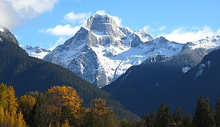
Mount Bute, also known as Bute Mountain, is a 2,810-metre (9,220-foot) mountain located in the Coast Mountains of British Columbia, Canada. Situated at the southern extreme of the Homathko Icefield, Mount Bute has an impressive 800-metre sheer granite west face, and Bute Glacier dominates the north aspect. This imposing mountain is visible from Waddington Harbour at the head of Bute Inlet, in a remote wilderness area that few visit. Its nearest higher peak is Mount Grenville, 13.0 km (8.1 mi) to the east-northeast. Mount Grenville is the highest summit of the icefield. Mount Bute is 63.0 km (39.1 mi) southeast of Mount Waddington, the highest peak of the entire Coast Mountains range.

Mount Rogers, is a 3,169-metre (10,397-foot) massif located in Glacier National Park in the Selkirk Mountains of British Columbia, Canada. Mount Rogers is situated at the north end of the Hermit Range, and is the highest point of the range. Its nearest higher peak is Mount Sir Donald, 12.57 km (7.81 mi) to the southeast. The peak is prominently visible from eastbound Highway 1, the Trans-Canada Highway at Rogers Pass. The Rogers massif includes five individually-named summits: Rogers Peak, Grant Peak, Fleming Peak, Swiss Peak, and Truda Peaks. Numerous glaciers radiate from all sides, including the Rogers Glacier, Swiss Glacier, Tupper Glacier, and Hermit Glacier.
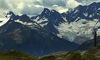
Mount Swanzy is a 2,891-metre (9,485-foot) mountain summit located in Glacier National Park in the Selkirk Mountains of British Columbia, Canada. Mount Swanzy is surrounded by ice including the Bonney Glacier, Clarke Glacier, and Swanzy Glacier. Its nearest higher peak is Mount Bonney, 1.0 km (0.62 mi) to the west.

Mount King George is a prominent 3,413-metre (11,198-foot) mountain summit located in Height of the Rockies Provincial Park, in the Canadian Rockies of British Columbia, Canada. The mountain is the highest point of The Royal Group, a subset of the Rockies, which includes Mount Queen Mary, Mount Princess Mary, Mount Prince George, Mount Prince Albert, Mount Prince Henry, Mount Prince John, and Mount Prince Edward. Its nearest higher peak is Mount Joffre, 16.0 km (9.9 mi) to the east. Mount King George is composed of sedimentary rock laid down during the Cambrian period. Formed in shallow seas, this sedimentary rock was pushed east and over the top of younger rock during the Laramide orogeny.

Chaos Glacier is part of the Waddington Range in the southern British Columbia Coast Mountains in Canada, located at 51°25′25″N125°15′5″W. It flows to the north from Mount Tiedemann for approximately four kilometers before joining the larger Scimitar Glacier. The name was officially adopted in 1978 from field sketches of the area by mountaineer Don Munday. The area's steep terrain makes this an excellent example of a continuous ice fall.

Mount Dione is a 2,589-metre (8,494-foot) summit located in the Tantalus Range, in Tantalus Provincial Park, in southwestern British Columbia, Canada. It is situated 17 km (11 mi) northwest of Squamish, and 0.24 km (0 mi) north of Mount Tantalus, which is its nearest higher peak and the highest peak in the Tantalus Range. The Dione Glacier lies on the southern slope, and the Rumbling Glacier lies to the northeast. Precipitation runoff from the peak drains east into tributaries of the Squamish River, or west into tributaries of the Clowhom River. The first ascent of the mountain was made in 1916 by Tom Fyles and his brother, John Fyles, via the southeast ridge. The mountain names in the Tantalus Range have a Greek mythology theme, and Mount Dione was named for Dione, the wife of Tantalus. The mountain's name was submitted by Neal Carter of the British Columbia Mountaineering Club, and was officially adopted on June 6, 1957, by the Geographical Names Board of Canada.

Mount Matier is a prominent 2,783-metre (9,131-foot) mountain summit located in the Coast Mountains, in Joffre Lakes Provincial Park, in southwestern British Columbia, Canada. It is the highest point of the Joffre Group, which is a subset range of the Coast Mountains. It is situated 26 km (16 mi) east of Pemberton, and 9 km (6 mi) northeast of Lillooet Lake. Its nearest higher peak is Mount Weart, 30 km (19 mi) to the southwest. The slopes of the mountain are covered by the Matier Glacier on the northwest, Anniversary Glacier on the northeast, Twin One Glacier on the southeast, and Hartzell Glacier to the south. Precipitation runoff from the peak drains into Joffre Creek and Twin One Creek, both tributaries of the Lillooet River.
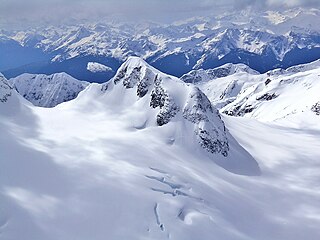
Mount Spetch is a 2,579-metre (8,461-foot) mountain summit located in the Coast Mountains, in Joffre Lakes Provincial Park, in southwestern British Columbia, Canada. It is part of the Joffre Group, which is a subset of the Lillooet Ranges. It is situated 25 km (16 mi) east of Pemberton, midway between Mount Matier and Slalok Mountain, both one kilometre either side of Spetch. The mountain's name was submitted by Karl Ricker of the Alpine Club of Canada to honor Samuel W. Spetch, who operated the general store at Birken, and other businesses in Pemberton. The name was officially adopted on January 23, 1979, by the Geographical Names Board of Canada. The first ascent of the mountain was made in 1971 by J. Oswald and G. Walter. Precipitation runoff from the peak drains into Joffre Creek and Twin One Creek, both tributaries of the Lillooet River. The mountain and its climate supports the Matier Glacier on the northern slope.
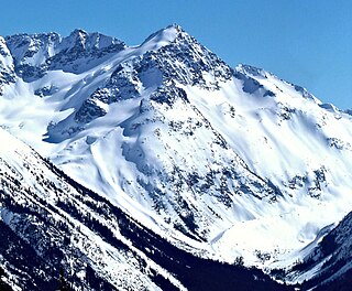
Mount Macbeth is a 2,639-metre (8,658-foot) glacier-clad peak located in the Garibaldi Ranges of the Coast Mountains, in Garibaldi Provincial Park of southwestern British Columbia, Canada. It is part of the Spearhead Range, which is a subset of the Garibaldi Ranges. It is situated 14 km (9 mi) southeast of Whistler, and 2 km (1 mi) south of Tremor Mountain, which is the highest point in the Spearhead Range. The Naden Glacier spreads out below the eastern aspect of the summit, the Macbeth Glacier lies below the south aspect, and the Curtain Glacier descends the northern slope. Precipitation runoff from the peak and meltwater from its glaciers drains into Fitzsimmons Creek which is a tributary of the Cheakamus River. Macbeth is most often climbed as part of the Spearhead Traverse. The first ascent of the mountain was made in 1969 by P. Starr, E. Bass, B. Ellis, and P. Macec via the northeast ridge. The peak was named in 1964 by an Alpine Club of Canada climbing party, to commemorate the 400th anniversary of William Shakespeare's birth. The mountain's name was officially adopted on August 27, 1965, by the Geographical Names Board of Canada.
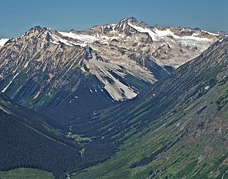
Mount Thiassi is a 2,772-metre (9,094-foot) mountain summit located in the Thiassi Range of the Coast Mountains, in southwestern British Columbia, Canada. It is the third-highest point in the Thiassi Range. Mount Thiassi is situated 56 km (35 mi) northwest of Pemberton, and 6.9 km (4 mi) south-southwest of Mount Vayu, which is its nearest higher peak. Precipitation runoff from the peak and meltwater from unnamed glaciers on its slopes drain into tributaries of the Lillooet, Bridge, and Hurley Rivers. The first ascent of the mountain was made in 1965 by Dick Culbert and Alice Purdey. The mountain's name was submitted by this first ascent party to commemorate Thiassi, the god of storms according to Norse mythology. The name was officially adopted June 22, 1967, by the Geographical Names Board of Canada.

Mount Wheeler, is a 3,336-metre (10,945-foot) mountain summit located in Glacier National Park of British Columbia, Canada. It is the third-highest peak in the park, and sixth-highest in the Selkirk Mountains range. The mountain is a remote 60 km (37 mi) east of Revelstoke, and 40 km (25 mi) southwest of Golden. Its nearest higher peak is Mount Selwyn, 5.1 km (3.2 mi) to the north-northwest. Mount Wheeler is surrounded by ice, including the Deville Glacier, Deville Névé, Black Glacier, and Thor Glacier. Precipitation runoff from the mountain and meltwater from its glaciers drains into tributaries of the Incomappleux and Beaver Rivers.

Mount Macoun is a 3,030-metre (9,940-foot) mountain summit located in Glacier National Park of British Columbia, Canada. It is part of the Selkirk Mountains range. The mountain is a remote 61 km (38 mi) east of Revelstoke, and 32 km (20 mi) southwest of Golden. Its nearest higher peak is Mount Fox, 3.7 km (2.3 mi) to the southwest, and Mount Topham rises 4.4 km (2.7 mi) to the south. The expansive Illecillewaet Névé lies to the northwest, and two small unnamed glaciers lie at the bottom of the steep east face. Precipitation runoff from the mountain drains into the Beaver River.
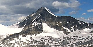
Mount Sifton is a 2,922-metre (9,587-foot) mountain summit located in Glacier National Park, in the Hermit Range of the Selkirk Mountains in British Columbia, Canada. Mount Sifton is situated 58 km (36 mi) northeast of Revelstoke, and 41 km (25 mi) west of Golden. It is also set 2.35 km (1.46 mi) north-northeast of Grizzly Mountain, and 4.5 km (2.8 mi) northwest of Rogers Pass from which it can be seen from the Trans-Canada Highway. The nearest higher peak is Mount Rogers, 2.17 km (1.35 mi) to the north-northeast. The first ascent of the mountain was made September 3, 1900, by Arthur Michael, Edward Feuz, and Friedrich Michel via the southeast ridge. The peak's name honors Sir Clifford Sifton (1861–1929), Canadian Minister of the Interior from 1896 through 1905. The mountain's name was adopted in 1906, then re-approved September 8, 1932, by the Geographical Names Board of Canada.

Mount Cooper is a prominent 3,094-metre (10,151 ft) glaciated mountain summit located in the Selkirk Mountains of southeast British Columbia, Canada. It is situated 36 km (22 mi) northwest of Kaslo, within Goat Range Provincial Park. Mt. Cooper is the highest peak in the Goat Range and Slocan Ranges, which are subsets of the Selkirks. The nearest higher peak is Truce Mountain, 33 km (21 mi) to the east-northeast. The first ascent of Mount Cooper was made August 10, 1962, by William Boulton, Terry Beck, Richard Hahn, Lorna Ream, Jack Steele, Edward Bouttin and Gary Johnson via the Spokane Glacier. This climbing party was from the Spokane Mountaineers organization. The mountain was named in association with Cooper Creek, which in turn was named after an 1880s Kaslo prospector and trapper. The mountain's name was officially adopted June 9, 1960, when approved by the Geographical Names Board of Canada. Prior to 1960 it was called Cooper Mountain.
Neal Marshall Carter was a Canadian marine biologist, cartographer, photographer, mountaineer and surveyor. He is most famous for his explorations in British Columbia, especially in the Coast Mountains where he made several first ascents.


