Orangeburg County is a county located in the U.S. state of South Carolina. As of the 2020 census, the population was 84,223. Its county seat is Orangeburg. The county was created in 1769.
Marlboro County is a county located in the Pee Dee region on the northern border of the U.S. state of South Carolina. As of the 2020 census, its population was 26,667. Its county seat is Bennettsville. The Great Pee Dee River runs through it. Marlboro County comprises the Bennettsville, SC Micropolitan Statistical Area.

Marion County is a county located in the coastal plain of the U.S. state of South Carolina. As of the 2020 census, its population was 29,183. Its county seat is Marion. It is a majority-minority county.

Horry County is the easternmost county in the U.S. state of South Carolina. As of the 2020 census, its population was 351,029. It is the fourth-most populous county in South Carolina. The county seat is Conway.

Georgetown County is a county located in the U.S. state of South Carolina. As of the 2020 census, the population was 63,404. Its county seat is Georgetown. The county was founded in 1769. It is named for George III of the United Kingdom.
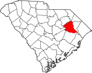
Florence County is a county located in the U.S. state of South Carolina. As of the 2020 census, its population was 137,059. Its county seat is Florence.

Dillon County is a county located in the U.S. state of South Carolina. As of the 2020 census, the county's population was 28,292. The county seat is Dillon.
Richmond County is a county located on the central southern border of the U.S. state of North Carolina. Its county seat is Rockingham. The county was formed in 1779 from a portion of Anson County and named in honor of Charles Lennox, 3rd Duke of Richmond and Lennox. As of the 2020 census, the population was 42,946.
Norwood is a town in Stanly County, North Carolina, United States. The population was 2,379 at the 2010 census.

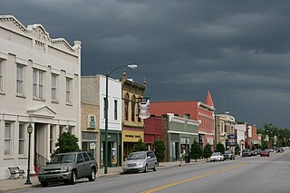
Society Hill is a town in Darlington County, South Carolina, United States alongside the Pee Dee River. It is the oldest community in Darlington County and one of the first towns founded in South Carolina. The town was once the intellectual center of the Pee Dee region. However, the town's fortunes declined in the 19th century after rivers became less important as means of transportation. It is part of the Florence Metropolitan Statistical Area.
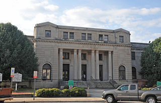
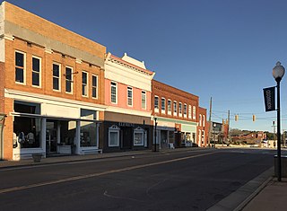
Dillon is a city in Dillon County in eastern South Carolina, United States. It is the county seat and largest city of Dillon County. It was established on December 22, 1888. Both the name of the city and county comes from James W. Dillon, an early settler and key figure in bringing a railroad through the area. The population was 6,788 in the 2010 U.S. census.

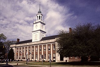
Florence is a city in and the county seat of Florence County, South Carolina, United States. It lies at the intersection of Interstates 20 and 95 and is the eastern terminus of the former. It is the primary city within the Florence metropolitan area. The area forms the core of the historical Pee Dee region of South Carolina, which includes the eight counties of northeastern South Carolina, along with sections of southeastern North Carolina. As of the 2020 census, the population of Florence was 39,899.
Johnsonville is a city in Florence County, South Carolina, United States. The population was 1,480 at the 2010 census. It is part of the Florence Metropolitan Statistical Area.
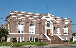
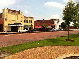
Marion is a city in and the county seat of Marion County, South Carolina, United States. It is named for Francis Marion, a brigadier general from South Carolina in the American Revolutionary War. The population was 6,939 at the 2010 census.
The Pee Dee River, also known as the Great Pee Dee River, is a river in the Carolinas of the United States. It originates in the Appalachian Mountains in North Carolina, where its upper course, above the mouth of the Uwharrie River, is known as the Yadkin River. The river empties into Winyah Bay, and then into the Atlantic Ocean near Georgetown.
The Pee Dee is a region in the northeast corner of the U.S. state of South Carolina. It lies along the lower watershed of the Pee Dee River, which was named after the Pee Dee, a Native American tribe that historically inhabited the region.

The 7th congressional district of South Carolina is a congressional district for the United States House of Representatives in South Carolina, established in 2011 following apportionment of another seat to the state in the redistricting cycle following the 2010 census. It is located in the Pee Dee region, and includes all of Chesterfield, Darlington, Dillon, Georgetown, Horry, Marion, and Marlboro Counties and most of Florence County. The district is represented by Republican Russell Fry who was elected in 2022 and took office on January 3, 2023.
Britton's Neck is an unincorporated community in Marion County, South Carolina, United States. Brittons Neck is located in the southern part of Marion County on SC 908 south of Centenary and north of US 378. One of the oldest settlements in Marion County, Britton's Neck lay between the Great and the Little Pee Dee Rivers extending northward from the mouth of the Little Pee Dee River. It was named for Francis, Timothy, Daniel, Moses, Joseph, and Philip Britton, who settled in the neck about 1735–1736. They were the sons of Francis Britton, who was in Carolina by 1697. Britton's Ferry sat on the Great Pee Dee River at the Junction of the Williamsburg, Georgetown, and Marion County lines. The ferry was established by Francis Britton and two other commissioners under an Act of 1747. Britton's Neck was the center of patriot sympathy during the American Revolution, making the ferry important to both sides. Brittons Neck Elementary School is located near the community.

South Carolina Highway 41 (SC 41) is a 121.5-mile (195.5 km) state highway, connecting the Charleston region with eastern portions of the Pee Dee region in South Carolina. It serves as an alternative route to U.S. Route 52.

The Wilmington, Charlotte and Rutherford Railroad, originally the Wilmington and Charlotte Railroad, was a railway company in the United States. It was incorporated in 1855 and reorganized as the Carolina Central Railway in 1873. It built 152 miles (245 km) of track, in two unconnected sections, in the southern part of North Carolina. The company was again reorganized as the Carolina Central Railroad in 1880. In 1900, the Carolina Central Railroad was merged into the Seaboard Air Line Railroad. Its lines are now owned by CSX Transportation.