
The Overland Track is an Australian bushwalking track, traversing Cradle Mountain-Lake St Clair National Park, within the Tasmanian Wilderness World Heritage Area. It's walked by more than nine thousand people each year, with numbers limited in the warmer months. Officially the track runs for 65 kilometres (40 mi) from Cradle Mountain to Lake St Clair however many choose to extend it by walking along Lake St Clair for an extra day, bringing it to 82 kilometres (51 mi). It winds through terrain ranging from glacial mountains, temperate rainforest, wild rivers and alpine plains.

The Great Western Tiers are a collection of mountain bluffs that form the northern edge of the Central Highlands plateau in Tasmania, Australia. The bluffs are contained within the Tasmanian Wilderness World Heritage Site.
Olegas Truchanas was a Lithuanian-Australian conservationist and nature photographer.

The Warrumbungles is a mountain range in the Orana region of New South Wales, Australia. The nearest town is Coonabarabran. The area is easiest accessed from the Newell Highway which is the major road link directly between Melbourne, Victoria and Brisbane, Queensland and cuts across inland New South Wales from the north to the south.

The West Coast Range is a mountain range located in the West Coast region of Tasmania, Australia.
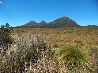
Mount Darwin is a mountain located in the West Coast region of Tasmania, Australia.

The Arthur Range is a mountain range in the South West Wilderness, located in south-west Tasmania, Australia. The range is broken into two main sections, the Western Arthurs and the Eastern Arthurs. Both sections of the range are popular overnight bushwalking destinations, generally in summer.

Federation Peak is a Tasmanian mountain with a sharp spire-like shape, which marks the southern end of the Eastern Arthur Range in the Southwest National Park. The peak, approximately 90 kilometres (56 mi) south-west from Hobart, was named after the Federation of Australia.
Mount Geikie is a mountain in the West Coast Range of Western Tasmania, Australia.
The Sticht Range is a mountain range located in the West Coast region of Tasmania, Australia. The range runs between two tributaries of the Eldon River and is located within the eastern part of the West Coast Range and has an unnamed peak with an elevation of 1,080 metres (3,540 ft) above sea level.

The Eldon Range is a mountain range located in the west coast region of Tasmania, Australia.

Quamby Bluff is a mountain in Northern Tasmania, Australia that is an outlying part of the Great Western Tiers mountain range.

Mount Pelion West is a mountain located in the Central Highlands region of Tasmania, Australia. The mountain is part of the Pelion Range and is situated within the Cradle Mountain-Lake St Clair National Park at the easternmost boundary of the Murchison River catchment.

The Stacks Bluff is a peak in northeast Tasmania, Australia. The mountain is situated on the Ben Lomond plateau.

The Frankland Range is a mountain range that is located in the south-west region of Tasmania, Australia. The range forms part of a natural south-western border to the impounded Lake Pedder, formed by the damming of the Serpentine and Huon rivers.

The Tyndall Range, commonly called The Tyndalls, is a mountain range that is part of the West Coast Range located in the Western region of Tasmania, Australia.
The Giblin Peak is a mountain of the Ben Lomond mountain range in northeast Tasmania, Australia. It is the highest elevation on Giblin Fells, a prominent bluff south of Ben Lomond's highest elevation - Legges Tor.
The King William Range is a mountain range in the South West Wilderness, Tasmania, Australia. It is situated south of the Lyell Highway and Derwent Bridge. It is the source of the Gordon River catchment.
The Spires is a mountain range in the South West Wilderness, Tasmania, Australia. It is situated east of the Denison River. It lies to the west of the upper Gordon River, and north of Lake Gordon.
This page is based on this
Wikipedia article Text is available under the
CC BY-SA 4.0 license; additional terms may apply.
Images, videos and audio are available under their respective licenses.
