Spero River

Last updated

Spero
Relief Map of Tasmania.png
Red pog.svg
Location of the Spero River mouth in Tasmania
Location
Country Australia
State Tasmania
Region West Coast, South West
Physical characteristics
Source 
  locationbelow Thirkell Hill
  coordinates 42°40′35″S145°34′1″E / 42.67639°S 145.56694°E / -42.67639; 145.56694
  elevation291 m (955 ft)
Mouth Spero Bay, Southern Ocean
  location
Point Hibbs
  coordinates
42°38′10″S145°19′58″E / 42.63611°S 145.33278°E / -42.63611; 145.33278 Coordinates: 42°38′10″S145°19′58″E / 42.63611°S 145.33278°E / -42.63611; 145.33278
  elevation
0 m (0 ft)
Length29 km (18 mi)
Basin features
Tributaries 
  leftPery River
Reservoir Lake Burbury
[1]

The Spero River is a perennial river located in the West Coast or South West region of Tasmania, Australia.

Contents

Course and features

The Spero River rises below Thirkell Hill on an unnamed range within the Southwest Conservation Area. The river flows generally north by west, joined by the Pery River and one minor tributary before reaching its mouth and emptying into Spero Bay, south east of Point Hibbs, eventually flowing into the Southern Ocean. The river descends 287 metres (942 ft) over its 29-kilometre (18 mi) course. [1]

The river mouth is located on a walking track entitled the Hibbs Lagoon to Low Rocky Point , approximately 58 kilometres (36 mi), 12-days plus, along the south western coast of Tasmania that is considered the most difficult section of the coast. [2] The mouth area has also been subjected to both plans and actual modification of reefs and blockages for navigation of the lower portion of the river. [3] Access to the area in the 1930s was also augmented by tracks from Birchs Inlet on Macquarie Harbour. [4] [5]

Much of the course of the river is isolated with very limited direct contact with the outside world, however a Huon Pine timber venture in the 1930s and 1940s saw some level of activity in the area. [6]

A small steam ship the SS Gundiah was specifically bought to service the Spero River timber industry. [7] [8] [9] [10]

The river name is also applied to the cartographic material available from Tasmap for the area. [11]

See also

Related Research Articles

Strahan, Tasmania Town and port in Tasmania, Australia

Strahan, is a small town and former port on the west coast of Tasmania. It is now a significant locality for tourism in the region.

Macquarie Harbour Large inlet on the West Coast of Tasmania

Macquarie Harbour is a shallow fjord located in the West Coast region of Tasmania, Australia. It is approximately 315 sq.km, and has an average depth of 15m, with deeper places up to 50m. It is navigable by shallow-draft vessels. The main channel is kept clear by the presence of a rock wall on the outside of the channel's curve. This man-made wall prevents erosion and keeps the channel deep and narrow, rather than allowing the channel to become wide and shallow. A reported Aboriginal name for the harbour is Parralaongatek.

Zeehan Town in Tasmania, Australia

Zeehan is a town on the west coast of Tasmania, Australia 139 kilometres (86 mi) south-west of Burnie. It is located north of Strahan, Tasmania and Queenstown, Tasmania.

Lyell Highway Highway in Western and Central Tasmania

The Lyell Highway is a highway in Tasmania, running from Hobart to Queenstown. It is the one of two transport routes that passes through the West Coast Range, the other being the Anthony Road.

Trial Harbour is a rural locality in the local government area (LGA) of West Coast in the North-west and west LGA region of Tasmania. The locality is about 20 kilometres (12 mi) south-west of the town of Zeehan. The 2016 census has a population of 24 for the state suburb of Trial Harbour.

Queen River, Tasmania River in Tasmania, Australia

The Queen River, part of the King River catchment, is a minor perennial river located in the West Coast region of Tasmania, Australia.

Strahan Airport Airport at Strahan, Tasmania, Australia

Strahan Airport is an airport located 2 nautical miles west of Strahan, Tasmania, Australia. It is the main airport for the West Coast of Tasmania, and is owned and maintained by the West Coast Council. The need for an airport in the area was suggested in the 1950s, and suggestions for upgrades have occurred over time.

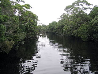
West Coast Piners were groups of men who worked on the West Coast of Tasmania, Australia, logging Huon pine.

The mines of the West Coast of Tasmania have a rich historical heritage as well as an important mineralogical value in containing or having had found, specimens of rare and unusual minerals. Also, the various mining fields have important roles in the understanding of the mineralization of the Mount Read Volcanics, and the occurrence of economic minerals.

The history of the Railways on the West Coast of Tasmania has fascinated enthusiasts from around the world, because of the combination of the harsh terrain in which the railways were created, and the unique nature of most of the lines.

The Strahan–Zeehan Railway, also known as the "Government Railway", was a railway from Strahan to Zeehan on the west coast of Tasmania.

Henty River River in Western Tasmania, Australia

The Henty River is a perennial river in the West Coast region of Tasmania, Australia. The river generally lies north of Queenstown and south of Zeehan.

Hibbs Pyramid Island in Tasmania, Australia

The Hibbs Pyramid is a pyramidal dolerite island, located in the Indian Ocean, off the south western coast of Tasmania, Australia. The island is contained within the Southwest National Park, part of the Tasmanian Wilderness World Heritage Site.

Point Hibbs is a headland on the south-west coast of Tasmania, Australia. The headland is located south of the most southern point of Macquarie Harbour, and west of the Gordon River. It is the next named feature along the coast south of Cape Sorell that is used to delineate sections of the coast. Like South West Cape, it is used as a reference point for nearby wrecks.

Birchs Inlet

The Birchs Inlet, also spelt Birch's Inlet or Birches Inlet, is a narrow cove or coastal inlet on the south-western side of Macquarie Harbour on the west coast of Tasmania, Australia. The inlet is located within the Southwest National Park, part of the Tasmanian Wilderness World Heritage Area.

Queenstown Airport (Tasmania) Airport in Tasmania, Australia

The Queenstown Airport is a former airport, now an unregistered landing ground located at Howard's Plains west of Queenstown, Tasmania, Australia.

Howard's Plains is a plain just west and above the river valley location of Queenstown in Western Tasmania, Australia. It is located to the east of the Henty River catchment area.

Zeehan Highway is a road between Zeehan and Queenstown in Western Tasmania.

Queenstown to Strahan road is a road that connects Queenstown with Strahan in Western Tasmania.

Zeehan-Strahan Road is a road that links Strahan with Zeehan in Western Tasmania.

References

  1. 1 2 "Map of Spero River, TAS". Bonzle Digital Atlas of Australia. 2015. Retrieved 30 June 2015.
  2. Chapmans, John (2008). South West Tasmania (5th ed.). p. 186. ISBN   978-1-920995-03-4.
  3. "WEST COAST NEWS". The Advocate . Tasmania. 27 July 1948. p. 4. Retrieved 24 November 2016 via National Library of Australia.
  4. "STRAHAN COUNCIL". The Mercury . Vol. CXLIII, no. 20, 245. Tasmania. 13 September 1935. p. 2. Retrieved 24 November 2016 via National Library of Australia.
  5. "STRAHAN". The Advocate . Tasmania. 7 September 1935. p. 8 (DAILY). Retrieved 24 November 2016 via National Library of Australia.
  6. Kerr, Garry; McDermott, Harry (1999). "Chapter 5; The Spero River Venture". The Huon Pine Story – A History of the harvest and use of a unique timber. Portland, Victoria: Mainsail Books. pp. 85–95. ISBN   0-9577917-0-4.
  7. "GUNDIAH AT HOBART". The Mercury . Vol. CXLVI, no. 20, 758. Tasmania. 12 May 1937. p. 9. Retrieved 24 November 2016 via National Library of Australia.
  8. "STRAHAN". The Advocate . Tasmania. 19 February 1938. p. 8. Retrieved 24 November 2016 via National Library of Australia.
  9. "TIMBER FROM SPERO RIVER". The Advocate . Tasmania. 20 February 1937. p. 10. Retrieved 24 November 2016 via National Library of Australia.
  10. "GUNDIAH ARRIVES AT STRAHAN". The Mercury . Vol. CXLVI, no. 20, 776. Tasmania. 2 June 1937. p. 7. Retrieved 24 November 2016 via National Library of Australia.
  11. Tasmania. Land Information Bureau (1996), Spero (Ed. 2, 1996 ed.), Tasmap, retrieved 24 November 2016