The West Coast Range is a mountain range located in the West Coast region of Tasmania, Australia.
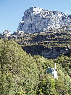
Frenchmans Cap is a mountain in the West Coast region of Tasmania, Australia. The mountain is situated in the Franklin-Gordon Wild Rivers National Park.

The Huon River is a perennial river located in the south-west and south-east regions of Tasmania, Australia. At 174 kilometres (108 mi) in length, the Huon River is the fifth-longest in the state, with its course flowing east through the fertile Huon Valley and emptying into the D'Entrecasteaux Channel, before flowing into the Tasman Sea.

Lake Burbury is a man-made water reservoir created by the Crotty Dam inundating the upper King River valley that lies east of the West Coast Range. Discharge from the reservoir feeds the John Butters Hydroelectric Power Station, owned and operated by Hydro Tasmania.
Mount Jukes is a mountain located on the Jukes Range, a spur off the West Coast Range, in the West Coast region of Tasmania, Australia.

Mount Sedgwick is a mountain located within the West Coast Range, in the West Coast region of Tasmania, Australia.

The Arthur Range is a mountain range in the South West Wilderness, located in south-west Tasmania, Australia. The range is broken into two main sections, the Western Arthurs and the Eastern Arthurs. Both sections of the range are popular overnight bushwalking destinations, generally in summer.
Mount Geikie is a mountain in the West Coast Range of Western Tasmania, Australia.
The Eldon Range is a mountain range located in the west coast region of Tasmania, Australia.

South West Tasmania is a region in Tasmania that has evoked curiosity as to its resources over the duration of European presence on the island.
Lake Dora is a 48-hectare (120-acre) lake and also short-lived mining area of the late 1890s located in the West Coast Range of Western Tasmania, Australia. It has a surface level of 756 metres (2,480 ft) AHD .
The Gordon River Road, sometimes called the Strathgordon Road, (B61), is a road in the south western region of Tasmania, Australia.
Scotts Peak is a mountain in South West Tasmania which is associated with the construction and flooding of the original Lake Pedder, as the lake now completely surrounds the peak. It lies east of the Frankland Range and has an elevation of 669 metres.
Murpheys Bluff is a mountain in South West Tasmania. It lies on the North West end of the Frankland Range jutting out toward the East from the range toward the impoundment Lake Pedder. It is directly East of The Citadel and North West of Cleft Peak. It towers above Bluff Tarn to the North West.
Cleft Peak is a mountain in South West Tasmania. It lies on the North West end of the Frankland Range jutting out toward the East from the range toward the impoundment Lake Pedder. It is South East of Murpheys Bluff and North West of Greycap.
Greycap is a mountain in South West Tasmania. It lies near the centre of the Frankland Range towards the impoundment Lake Pedder. It is south east of Cleft Peak and north west of Frankland Saddle. It is a wider than most of the other peaks on the Frankland Range, with less steep sloping sides.
Mount Lloyd Jones is a mountain in South West Tasmania named after aviator and adventurer, Lloyd Lindsay Jones MBE (1916–2004). It lies on the South East end of the Frankland Range jutting out towards the east from the range towards the impoundment Lake Pedder. It is west of the end of the ridge line leading to the edge of Lake Pedder at Terminal Peak and North East of Secheron Peak.
Secheron Peak is a mountain in South West Tasmania. It lies on the southeastern end of the Frankland Range near the impoundment Lake Pedder. It is east of Frankland Peak and towers over Lake Surprise to the north. Right Angle Peak lies one kilometre to the southwest.
Terminal Peak is a mountain in South West Tasmania.
Lake Westwood is a 35-hectare (86-acre) glacial lake in the Tyndalls peaks to the east of Mount Read, in the West Coast Range, West Coast of Tasmania.
