
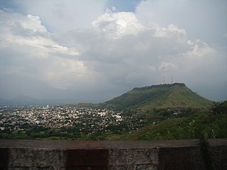
Ahmednagar, is a city located in the Ahmednagar district in the state of Maharashtra, India, about 120 km northeast of Pune and 114 km from Aurangabad. Ahmednagar takes its name from Ahmad Nizam Shah I, who founded the town in 1494 on the site of a battlefield where he won a battle against superior Bahamani forces. It was close to the site of the village of Bhingar. With the breakup of the Bahmani Sultanate, Ahmad established a new sultanate in Ahmednagar, also known as Nizam Shahi dynasty.

Ratnagiri is a port city on the Arabian Sea coast in Ratnagiri District in the southwestern part of Maharashtra, India. The district is a part of Konkan division of Maharashtra. The city is known for the Hapus or Alphonso mangoes. Ratnagiri is the birthplace of Lokmanya Tilak. Thibaw, The king of Burma was exiled in the city.

Amravati is the second largest city in the Vidarbha region and ninth largest city in Maharashtra, India. It is administrative headquarter of Amravati district and Amravati division which includes Akola, Buldhana, Washim and Yavatmal districts. It is one of the Maharashtra's nominated city under Smart Cities Mission.

Lonavala is a hill station town and a Municipal Council in the Pune district, Maharashtra, India. It is about 64 km west of Pune and 96 km to the east of Mumbai. It is known for its production of the hard candy chikki and is also a major stop on the railway line connecting Mumbai and Pune. From the Pune suburbs, local trains are available from Pune Junction. Both the Mumbai-Pune Expressway as well as the Mumbai-Bengaluru highway pass through Lonavala.
Satara is a city located in the Satara District of Maharashtra state of India, near the confluence of the river Krishna and its tributary, the Venna. The city was established in the 16th century and was the seat of the Chhatrapati of Maratha Empire, Shahu I. It is the headquarters of Satara Tehsil, as well as the Satara District. The city gets its name from the seven forts (Sat-Tara) which are around the city. The city is known as a Soldier's city as well as Pensioner's city.

New Panvel is a residential, commercial and educational node of Navi Mumbai, Maharashtra and comes under the Konkan division. New Panvel was developed on marshy land and was previously a Mango cultivated area. New Panvel is divided into two parts: New Panvel (E), on the eastern side of Panvel railway station and Khanda Colony or New Panvel (W) on the western side of it. Both parts of New Panvel are connected by a flyover bridge also known as Khanda Colony Flyover. New Panvel (W) is also popularly called Khanda Colony by the local villagers, as the city is adjacent to two small villages Dhakta Khanda and Motha Khanda.

Pimpri Chinchwad, Pune is the northwestern city limits of Pune, India. Geographically, it is located at an altitude 590 m (1,940 ft) above sea level, at a distance of about 15 km (9.3 mi) northwest of its historic centre. The neighbourhood is home to extensive industry and is well known for its automotive, IT and manufacturing industry.
Panvel is a city and taluka in Raigad district of Maharashtra, India. It is highly populated due to its closeness to Mumbai. Panvel is also governed for development purpose by the body of Mumbai Metropolitan Region. Panvel Municipal Corporation is the first Municipal Corporation in Raigad and the 27th Municipal corporation of Maharashtra State.

Neral is a town in Raigad district in the Indian state of Maharashtra. It is 83 km + developing city of a Raigad district which is well connected to Panvel, Mumbai, Thane and Pune. Neral along with Karjat is also known as Eastern Mumbai District. The village was founded around in 12th century by Chanche family, due to heavy floods wiped out their most of the cultivating land. The place where Chanche family shifted originally is now known as Chanche Pada. Many other families from surrounding villages followed the same in following years to safeguard themselves from regular floods affecting their homes, farms and animals.

The Mumbai–Pune Expressway is India's first 6-lane wide concrete, access-controlled tolled expressway. It spans a distance of 94.5 km connecting Mumbai, the capital of Maharashtra state and the financial capital of India, with Pune, the cultural and educational capital of Maharashtra. The expressway, which was fully operationalized in 2002, introduced new levels of speed and safety in automobile transportation to Indian roads. It is one of India's busiest roads.
Tamhini Ghat is a mountain passage located between Mulshi and Tamhini in Maharashtra, India.

Chiplun is a city in Ratnagiri district in the state of Maharashtra, India. It is the financial and commercial Hub of Ratnagiri, and the headquarters of Chiplun taluka. It is about 320 km south of Mumbai in the Konkan region of Maharashtra, on the Mumbai–Goa highway (NH-66). It has a long history and a strong cultural background. Recent decades have seen much industrial development in it and its and surrounding areas.
Kolad is a village in Raigad district, Maharashtra State, India. It is 117 km from Mumbai on the National Highway no 66(Mumbai-Goa) its also connected Pune via kolad Pune- kolad state highaway. It lies on the banks of River Kundalika. The village post office Postal Index Number is 402304 & 402109.
Swargate is an area of Pune, Maharashtra, India. This is one of the busiest areas in Pune. The Swargate connects Pune to various areas like Hadapsar, Fursungi, Dhankawadi, Bibwewadi, etc. The areas under Swargate include Guru Nanak Nagar, Mukund Nagar, and Municipal Colony. The old city of Pune ends here.

Pune Junction railway station is the main railway junction of the city of Pune, India. It is one of the major railway junctions in Maharashtra. Pune Junction consists of 6 Platforms. It also has a Suburban Train Network.
Shivajinagar is an suburb of the city of Pune, India.
Kausa is a suburb of Mumbra in Thane District in the state of Maharashtra in India. It is administered by the Thane Municipal Corporation.
Swargate bus station consists of two adjacent bus stations in Pune, operated by the Maharashtra State Road Transport Corporation (MSRTC) and the Pune Mahanagar Parivahan Mahamandal Limited (PMPML). It is located in the locality of Swargate in Pune, opposite the Swargate Police Station.
Pune is a city in the state of Maharashtra in India. It is situated in western Maharashtra on the Deccan Plateau. Pune's public transport consists primarily of a bus service, a suburban rail service, metro, public taxis and auto rickshaws. In 2020 it was awarded the Sustainable Transport Award.
Lonand is a city and municipal council in Satara district, Maharashtra. It is 227km from Mumbai, 81km from Pune, 47km from Wai & Satara,179km from Sangli and 30km from Phaltan.
