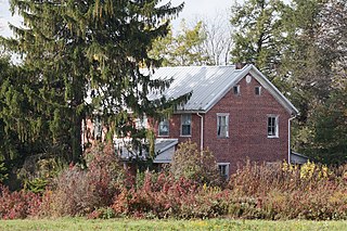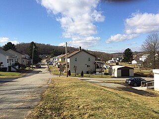
Crawford County is a county located in the U.S. state of Pennsylvania. As of the 2010 census, the population was 88,765. Its county seat is Meadville. The county was created on March 12, 1800, from part of Allegheny County and named for Colonel William Crawford.

Nanty Glo is a borough in Cambria County, Pennsylvania, United States. It is part of the Johnstown, Pennsylvania Metropolitan Statistical Area. The population was 2,734 at the 2010 census. The name comes from the Welsh Nant Y Glo, meaning "The Ravine of Coal."

Newport Township is a township in Luzerne County, Pennsylvania, United States. As of 2010, the population was 5,374. Newport is located on the outskirts of Nanticoke City.

McIntyre Township is a township in Lycoming County, Pennsylvania, United States. The population was 520 at the 2010 census. It is part of the Williamsport Metropolitan Statistical Area.

Jenner Township is a township in Somerset County, Pennsylvania, United States. The population was 4,054 at the 2000 census. It is part of the Johnstown, Pennsylvania, Metropolitan Statistical Area.

Shade Township is a township in Somerset County, Pennsylvania, United States. The population was 2,886 at the 2000 census. It is part of the Johnstown, Pennsylvania, Metropolitan Statistical Area.

Yatesboro is an unincorporated community located in Cowanshannock Township, Armstrong County, Pennsylvania. The community is located 1.0 mile (1.6 km) west of Rural Valley. Yatesboro has a post office with ZIP code 16263.

Highsplint is a former coal town with an extinct post office in Harlan County, Kentucky, United States. It was named for the High Splint and Seagraves Coal Companies which operated a mine in the town at that time. Highsplint's first post office was established on February 7, 1918, with John D. Casey as postmaster, remaining in operation until 1974.

Luxor is an unincorporated community and coal town in Hempfield Township, Westmoreland County, Pennsylvania, United States.
Jenners is an unincorporated community in Jenner Township, Somerset County, Pennsylvania, United States. It is part of the Johnstown, Pennsylvania Metropolitan Statistical Area. Other nearby unincorporated communities within Jenner Township include Jenner Crossroad, Ferrellton, Acosta, Gray and Ralphton. Also nearby but with separate municipal governments are the boroughs of Jennerstown, Pennsylvania and Boswell, Pennsylvania. Jenners is also part of the North Star School District. Jenners area code: 814; zip code: 15546.
Broughton is an unincorporated community in South Park Township, Pennsylvania. Originally named Curry after Dr. Joseph Curry, frontier physician and Coroner of Allegheny County in 1810, it was renamed Broughton, to avoid confusion with the nearby Curry Hollow and the Curry in Blair County, Pennsylvania. It is located at the junction of Brownsville Road, Curry Road, and Broughton Road. It was racially integrated in the early 20th century, due to coal miners working nearby mines in Horning, Pennsylvania. It was the location of Pittsburgh Terminal Coal Company's No. 5 mine.

Harco is an unincorporated community in Saline County, Illinois, United States. The Harrisburg Colliery Coal Company Mine was sunk in November 1916, in the center of section 27, township 8, range 5, Saline County, Illinois, and the town of Harco soon grew up around it. The name of the town is derived from the first three letters of Harrisburg and the first two letters of Colliery, spelling “Harco.”

Norton is an unincorporated community in Randolph County, West Virginia, United States. Norton is 6.5 miles (10.5 km) west of Elkins, at the junction of County Route 151 and Corridor H. Norton had a post office, which closed on November 12, 2011. It is a former coal town operated by the West Virginia Coal and Coke Company from the early 1900s until the late 1950s. Besides the mine, the town was once home to a company store, a company bank, and the Norton Grade School. The denominationally unaffiliated Norton Community Church still serves the town.

Coulter is an unincorporated community in South Versailles Township, Allegheny County, Pennsylvania, United States. The community is located along the Youghiogheny River 14.3 miles (23.0 km) southeast of Pittsburgh.

Brenizer, also known as Breinizer, is an unincorporated community and coal town in Derry Township, Westmoreland County, Pennsylvania, United States.

Bovard is an unincorporated community and coal town in Hempfield Township, Westmoreland County, Pennsylvania, United States. The community is located near U.S. Route 119, 2.3 miles (3.7 km) northeast of Greensburg and is also the former home of baseball standout, Anthony Marazza. Marazza, dubbed "MR. BOVARD", is notable for leading Bovard to 6 championships in the past decade in the ICL and Pittsburgh Leagues.

Hazel Kirk is an unincorporated community and coal town located in Washington County, in the southwestern corner of the U.S. state of Pennsylvania. Hazel Kirk was part of Carroll Township and was the location of four bituminous coal mines, known as "Hazel Kirk Mine," "Hazel Kirk No. 1," "Hazel Kirk No. 2," and "Hazel Kirk No. 3."

Nu Mine is an unincorporated community in Cowanshannock Township, Armstrong County, Pennsylvania, United States. The community is located along Pennsylvania Route 85 1.6 miles (2.6 km) east of Rural Valley. Nu Mine has a post office with ZIP code 16244.

Pleasant Unity is an unincorporated community in a rural part of Unity Township, Westmoreland County, Pennsylvania, United States. It is located at the junction of Pennsylvania Route 130 and Pennsylvania Route 981 6.3 miles (10.1 km) southeast of Greensburg.

Darragh is an unincorporated community in Hempfield Township, Westmoreland County, Pennsylvania, United States. Originally a coal town, the community is located along Pennsylvania Route 136 1 mile (1.6 km) west of Arona. Darragh has a post office with ZIP code 15625, which opened on July 21, 1892.


