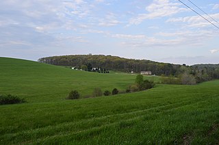
Garrett County is the westernmost county of the U.S. state of Maryland. As of the 2020 census, the population was 28,806, making it the third-least populous county in Maryland. Its county seat is Oakland. The county was named for John Work Garrett (1820–1884), president of the Baltimore and Ohio Railroad. Created from Allegany County, Maryland in 1872, it was the last Maryland county to be formed.

Ramseur is a town in Randolph County, North Carolina, United States. The population was 1,692 at the 2010 census.

Donegal Township is a township in Butler County, Pennsylvania, United States. The population was 1,864 at the 2010 census.

Pleasant Valley is a city in Marion County, West Virginia, United States. The population was 3,506 at the 2020 census.

Saint George is an administrative parish of Saint Vincent and the Grenadines, situated in the most southerly portion of the island of Saint Vincent. With an area of 52 km² it is the country's third largest parish by total area. According to the 2000 census it has a population of approximately 52,400 making it the most populous parish in Saint Vincent and the Grenadines and by extent, the most densely populated as well. Its population accounts for 44% of that of the country and its area, only 13%.

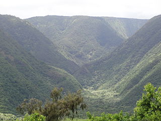
Pololū is the northernmost of a series of erosional valleys forming the east coast of Kohala Mountain on the Island of Hawaiʻi. The word pololū means "long spear" in the Hawaiian language.

Malaga is an unincorporated community in northern Malaga Township, Monroe County, Ohio, United States. Malaga has a ZIP code of 43747. It lies at the intersection of State Routes 145 and 800.
The Winston County School System consists of the public schools serving Winston County, Alabama.

Kouba is a suburb situated on a height just south-east of the central city of Algiers in northern Algeria. It is home to the Kouba city council and the church of Kouba, which was built during the French colonial times. Its name refers to "Qubba", which means "dome".
Iowa Township is a civil township in Benson County, North Dakota, United States. As of the 2000 census, its population was 33.
Cottage Hill is an unincorporated community in Posey Township, Clay County, Indiana. It is part of the Terre Haute Metropolitan Statistical Area.
Wyndham Hills is a community in York County, Pennsylvania, United States. One of the suburbs of York, Wyndham Hills is located in Spring Garden Township on the hills of the same name. Among the other suburbs of York, Wyndham Hills is on the highest elevation.
Tangjiazhuang is a subdistrict in the city of Tangshan, Hebei, China. The population (2005) is 79,100.
Freeman is an unincorporated community in the center of Clay Township, Owen County, in the U.S. state of Indiana. It lies near the intersection of County Road 650 South and Indiana Highway 43, which is a community nearly nine miles south of the city of Spencer, the county seat. Its elevation is 541 feet (165 m), and it is located at 39°11′44″N86°44′1″W.
Lockville is an unincorporated community in Fairfield County, in the U.S. state of Ohio.
Stoneville is an unincorporated community in Meade County, in the U.S. state of South Dakota.
Richland Creek is a stream in Howard County in the U.S. state of Missouri. It is a tributary of the Missouri River.

Kharchakund is a mountain of the Garhwal Himalaya in Uttarakhand, India. The elevation of Kharchakund is 6,612 metres (21,693 ft) and its prominence is 835 metres (2,740 ft). It is 64th highest located entirely within the Uttrakhand. Nanda Devi, is the highest mountain in this category. It is surrounded by Gangotri Glacier and Ghanoim Bamak. Its nearest higher neighbor Kedarnath Dome 6,831 metres (22,411 ft) lies 6.4 km WNW. It is located 1.2 km NNE of Sumeru Parbat 6,351 metres (20,837 ft) and 10.7 km east lies Janhukut 6,829 metres (22,405 ft).
Kirti Stambh is a mountain of the Garhwal Himalaya in Uttarakhand India.The elevation of Kirti Stambh is 6,270 metres (20,571 ft) and its prominence is 100 metres (328 ft). It is 128th highest located entirely within the Uttrakhand. Nanda Devi, is the highest mountain in this category. It lies between Thalaysagar and Bhartekunta. Its nearest higher neighbor Bhartekunta 6,578 metres (21,581 ft) lies 2.3 km SE. It is located 5.1 km SSE of Thalaysagar 6,904 metres (22,651 ft) and 12.8 km NEE lies Bhagirathi I 6,856 metres (22,493 ft).

Bhartekunta is a mountain of the Garhwal Himalaya in Uttarakhand India.The elevation of Bhartekunta is 6,578 metres (21,581 ft) and its prominence is 280 metres (919 ft). It is 69th highest located entirely within the Uttrakhand. Nanda Devi, is the highest mountain in this category. It lies between Kirti Stambh and Kedarnath (mountain). Its nearest higher neighbor Kedarnath (mountain) 6,940 metres (22,769 ft) lies 3 km ESE. It is located 2.3 km SE of Kirti Stambh 6,279 metres (20,600 ft) and 6.9 km north lies Meru Peak 6,660 metres (21,850 ft).


