Summit Township, Somerset County, Pennsylvania

Last updated

Summit Township,
Somerset County,
Pennsylvania
Western Maryland Railroad Viaduct from north.jpg
A massive rail viaduct between Meyersdale and Garrett
Map of Somerset County, Pennsylvania highlighting Summit Township.PNG
Map of Somerset County, Pennsylvania Highlighting Summit Township
Map of Pennsylvania highlighting Somerset County.svg
Map of Somerset County, Pennsylvania
Country United States
State Pennsylvania
County Somerset
Area
[1]
  Total45.26 sq mi (117.22 km2)
  Land45.23 sq mi (117.14 km2)
  Water0.03 sq mi (0.09 km2)
Population
 (2020) [2]
  Total2,141 Decrease2.svg
  Estimate 
(2021) [2]
2,125
  Density48.20/sq mi (18.61/km2)
Time zone UTC-5 (Eastern (EST))
  Summer (DST) UTC-4 (EDT)
FIPS code 42-111-75232

Summit Township is a township in Somerset County, Pennsylvania, United States. The population was 2,141 at the 2020 census. [2] It is part of the Johnstown, Pennsylvania, Metropolitan Statistical Area.

Contents

History

Summit Township, Somerset County, Pennsylvania, 1860 Map of Summit Township from 1860 Somerset County, Pennsylvania, Map by Edward L Walker.jpg
Summit Township, Somerset County, Pennsylvania, 1860

Portions of Elk Lick and Brothersvalley Townships were taken to form Summit Township in 1842. [3] Some of the first settlers in this area included John Trusel, John Klingaman, Peter Miller, Stephen Yoder, and John J. Beachly. [3] Some of the companies operating coal mines in the area in the 1880s included the Baltimore & Cumberland Coal Co., the Cumberland & Elk Lick Coal Co., the Keystone Coal Co., and the Casselman Coal Co. [3]

The W. Bollman and Company Bridge was added to the National Register of Historic Places in 1978. [4]

Geography

According to the United States Census Bureau, the township has a total area of 45.1 square miles (116.8 km2), of which 45.1 square miles (116.7 km2) is land and 0.1 square miles (0.1 km2) (0.11%) is water. Summit Township is bordered by Larimer Township to the east, Greenville Township to the southeast, Elk Lick Township to the southwest, Black Township to the northwest, and Brothersvalley Township to the northeast. The borough of Meyersdale is surrounded by Summit Township, and the borough of Garrett is located along Summit Township's border with Brothersvalley Township.

Pennsylvania Route 653 passes through part of Summit Township, generally running southeast from the borough of Rockwood and Milford Township, through Black Township, and into Summit Township, reaching its eastern terminus in the borough of Garrett as it intersects with Mason Dixon Highway / SR 2047.

Demographics

Historical population
CensusPop.Note
2010 2,271
2020 2,141−5.7%
2021 (est.)2,125 [2] −0.7%
U.S. Decennial Census [5]

At the 2000 census there were 2,368 people, 864 households, and 691 families living in the township. The population density was 52.6 inhabitants per square mile (20.3/km2). There were 930 housing units at an average density of 20.6/sq mi (8.0/km2). The racial makeup of the township was 99.11% White, 0.21% African American, 0.08% Native American, 0.04% Asian, and 0.55% from two or more races. Hispanic or Latino of any race were 0.04%. [6]

Of the 864 households 33.2% had children under the age of 18 living with them, 70.3% were married couples living together, 5.8% had a female householder with no husband present, and 20.0% were non-families. 17.8% of households were one person and 10.0% were one person aged 65 or older. The average household size was 2.73 and the average family size was 3.09.

The age distribution was 24.2% under the age of 18, 8.0% from 18 to 24, 26.4% from 25 to 44, 25.7% from 45 to 64, and 15.7% 65 or older. The median age was 39 years. For every 100 females, there were 100.3 males. For every 100 females age 18 and over, there were 98.8 males.

The median household income was $32,115 and the median family income was $36,029. Males had a median income of $27,414 versus $20,559 for females. The per capita income for the township was $13,853. About 12.2% of families and 16.7% of the population were below the poverty line, including 20.8% of those under age 18 and 18.7% of those age 65 or over.

Related Research Articles

<span class="mw-page-title-main">Ridgway, Pennsylvania</span> Borough in Pennsylvania, United States

Ridgway is a borough in and the county seat of Elk County, Pennsylvania. As of the 2020 census it had a population of 4,039

<span class="mw-page-title-main">Elk Creek Township, Pennsylvania</span> Township in Pennsylvania, United States

Elk Creek Township is a township in Erie County, Pennsylvania, United States. The population was 1,785 at the 2020 census, down from 1,798 at the 2010 census.

<span class="mw-page-title-main">Dunkard Township, Greene County, Pennsylvania</span> Township in Pennsylvania, United States

Dunkard Township is a township in Greene County, Pennsylvania, United States. The population was 2,174 at the 2020 census.

<span class="mw-page-title-main">Washington Township, Jefferson County, Pennsylvania</span> Township in Pennsylvania, United States

Washington Township is a township in Jefferson County, Pennsylvania, United States. The population was 1,892 at the 2020 census. It was named for President George Washington.

<span class="mw-page-title-main">Slocum Township, Pennsylvania</span> Township in Pennsylvania, United States

Slocum Township is a township in Luzerne County, Pennsylvania, United States. The population was 1,053 at the 2020 census.

<span class="mw-page-title-main">Addison Township, Pennsylvania</span> Township in Pennsylvania, United States

Addison Township is a township in Somerset County, Pennsylvania, United States. The population was 932 at the 2020 census. It is part of the Johnstown, Pennsylvania, Metropolitan Statistical Area. The township is named for Alexander Addison, the first president judge overseeing Somerset County.

<span class="mw-page-title-main">Allegheny Township, Somerset County, Pennsylvania</span> Township in Pennsylvania, United States

Allegheny Township is a township in Somerset County, Pennsylvania, United States. The population was 615 at the 2020 census. It is part of the Johnstown, Pennsylvania, Metropolitan Statistical Area.

<span class="mw-page-title-main">Berlin, Pennsylvania</span> Borough in Pennsylvania, United States

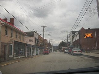
Berlin is a borough located approximately 75 miles southeast of Pittsburgh in Somerset County, Pennsylvania, United States. The population was 2,004 at the 2020 census. It is part of the Johnstown, Pennsylvania Metropolitan Statistical Area.

<span class="mw-page-title-main">Black Township, Pennsylvania</span> Township in Pennsylvania, United States

Black Township is a township in Somerset County, Pennsylvania, United States. The population was 899 at the 2020 census. It is part of the Johnstown, Pennsylvania, Metropolitan Statistical Area. The township was named for Jeremiah Sullivan Black, a native of Somerset County who became Chief Justice of the Supreme Court of Pennsylvania, U.S. Attorney General, and U.S Secretary of State.

<span class="mw-page-title-main">Brothersvalley Township, Pennsylvania</span> Township in Pennsylvania, United States

Brothersvalley Township is a township in Somerset County, Pennsylvania, United States. The population was 2,377 at the 2020 census. It is part of the Johnstown, Pennsylvania, Metropolitan Statistical Area.

<span class="mw-page-title-main">Elk Lick Township, Pennsylvania</span> Township in Pennsylvania, United States

Elk Lick Township is a township in Somerset County, Pennsylvania, United States. The population was 2,264 at the 2020 census. Mount Davis, the highest point in Pennsylvania, is located within the township.

<span class="mw-page-title-main">Garrett, Pennsylvania</span> Borough in Pennsylvania, United States

Garrett is a borough in Somerset County, Pennsylvania, United States. It is part of the Johnstown, Pennsylvania, Metropolitan Statistical Area. The population was 416 at the 2020 census.

<span class="mw-page-title-main">Greenville Township, Pennsylvania</span> Township in Pennsylvania, United States

Greenville Township is a township in Somerset County, Pennsylvania, United States. The population was 752 at the 2020 census. It is part of the Johnstown, Pennsylvania, Metropolitan Statistical Area.

<span class="mw-page-title-main">Larimer Township, Pennsylvania</span> Township in Pennsylvania, United States

Larimer Township is a township in Somerset County, Pennsylvania, United States. The population was 543 at the 2020 census. It is part of the Johnstown, Pennsylvania, Metropolitan Statistical Area. Larimer Township was named for General William Larimer, Jr., president of the Pittsburgh & Connellsville Railroad.

<span class="mw-page-title-main">Lower Turkeyfoot Township, Pennsylvania</span> Township in Pennsylvania, United States

Lower Turkeyfoot Township is a township in Somerset County, Pennsylvania, United States. The population was 543 at the 2020 census. It is part of the Johnstown, Pennsylvania, Metropolitan Statistical Area.

<span class="mw-page-title-main">Northampton Township, Somerset County, Pennsylvania</span> Township in Pennsylvania, United States

Northampton Township is a township in Somerset County, Pennsylvania, United States. The population was 303 at the 2020 census. It is part of the Johnstown, Pennsylvania, Metropolitan Statistical Area.

<span class="mw-page-title-main">Quemahoning Township, Pennsylvania</span> Township in Pennsylvania, United States

Quemahoning Township is a township in Somerset County, Pennsylvania, United States. The population was 1,838 at the 2020 census. It is part of the Johnstown, Pennsylvania, Metropolitan Statistical Area.

<span class="mw-page-title-main">Salisbury, Pennsylvania</span> Borough in Pennsylvania, United States

Salisbury is a borough in Somerset County, Pennsylvania, United States. The population was 707 at the 2020 census. It is part of the Johnstown, Pennsylvania, Metropolitan Statistical Area.

<span class="mw-page-title-main">Upper Turkeyfoot Township, Pennsylvania</span> Township in Pennsylvania, United States

Upper Turkeyfoot Township is a township in Somerset County, Pennsylvania, United States. The population was 1,063 at the 2020 census. It is part of the Johnstown, Pennsylvania metropolitan statistical area.

<span class="mw-page-title-main">Fredericktown-Millsboro, Pennsylvania</span> Former CDP in Pennsylvania, United States

Fredericktown-Millsboro was a census-designated place (CDP) in East Bethlehem Township, Washington County, Pennsylvania, United States. The population was 1,094 at the 2000 census. For the 2010 census the area was split into two CDPs, Fredericktown and Millsboro.

References

  1. "2016 U.S. Gazetteer Files". United States Census Bureau. Retrieved August 14, 2017.
  2. 1 2 3 4 Bureau, US Census. "City and Town Population Totals: 2020—2021". Census.gov. US Census Bureau. Retrieved July 24, 2022.
  3. 1 2 3 History of Bedford, Somerset and Fulton Counties, Pennsylvania. Chicago: Waterman, Watkins & Co. 1884. pp. 484–491.
  4. "National Register Information System". National Register of Historic Places . National Park Service. July 9, 2010.
  5. "Census of Population and Housing". Census.gov. Retrieved June 4, 2016.
  6. "U.S. Census website". United States Census Bureau . Retrieved January 31, 2008.

39°49′30″N78°59′58″W / 39.82500°N 78.99944°W / 39.82500; -78.99944