Rosamond, California

Last updated

Rosamond
Rosamond.jpg
View of part of Rosamond, CA
Kern County California Incorporated and Unincorporated areas Rosamond Highlighted.svg
Location in Kern County and the state of California
Usa edcp location map.svg
Red pog.svg
Rosamond
Location in the United States
Coordinates: 34°51′51″N118°09′48″W / 34.86417°N 118.16333°W / 34.86417; -118.16333
Country Flag of the United States.svg  United States
State Flag of California.svg  California
County Kern
Government
   Senate Jean Fuller (R)
   Assembly Tom Lackey (R)
   U. S. Congress Kevin McCarthy (R)
Area
[1]
  Total52.336 sq mi (135.550 km2)
  Land52.121 sq mi (134.993 km2)
  Water0.215 sq mi (0.557 km2)  0.41%
Elevation
[2]
2,517 ft (767 m)
Population
 (2010)
  Total18,150
  Density350/sq mi (130/km2)
Time zone UTC-8 (PST)
  Summer (DST) UTC-7 (PDT)
ZIP code
93560
Area code 661
FIPS code 06-62826
GNIS feature ID1661329

Rosamond is a unincorporated community in Kern County, California, US, near the Los Angeles county line. Rosamond is part of Greater Los Angeles and is located in the Mojave Desert just north of Lancaster and Palmdale, two of the largest cities in Antelope Valley. As of the 2010 Census, Rosamond's population was 18,150. [3] For statistical purposes, the United States Census Bureau has defined Rosamond as a census-designated place (CDP).

Contents

Rosamond is a suburban bedroom community with many residents employed by nearby Edwards Air Force Base or commuting to Los Angeles, Lancaster, and Palmdale for work. The town is about 15 minutes north of the Lancaster Metrolink station providing direct access to Los Angeles Union Station in just two hours.

History

Rosamond was established in 1877 as a townsite owned by the Southern Pacific Railroad; it was named for the daughter of one of the railroad's officials. [4] [5] The first local industries were mining and cattle. During the 1890s, gold was discovered in the area, quickly drawing miners and prospectors. After the initial boom, gold mining gradually declined, though it had a second, smaller boom during the 1930s. In 1933, Muroc Army Air Field was established some 20 miles (32 km) miles away; it was later renamed Edwards Air Force Base in honor of fallen test pilot Glenn Edwards.

The Rosamond post office opened in 1885, closed in 1887, and re-opened in 1888. [4]

1932 Ford V-8 endurance test

In July 1932, racing driver Eddie Pullen and his team demonstrated the endurance of the newly developed Ford V-8 engine, by driving a Ford V-8, model 18,  33,301 miles (53,593 km) in 33 days, in the Mojave desert. [6] The average speed was 42 miles per hour (68 km/h) over course of 82 miles (132 km) of difficult desert terrain, where temperatures were as high as 114 °F (46 °C). Fuel consumption averaged 19.64 miles per U.S. gallon (8.35 km/L). [7]

Geography

Rosamond sits in the northern end of the Antelope Valley, the westernmost valley of the Mojave Desert. Because the elevation is 2,000 to 3,000 feet (610 to 910 m) above sea level, the area, like the other parts of the Mojave Desert region, is referred to as the High Desert. Some cities and communities within the trading area of Rosamond include Lancaster, Palmdale, Hi Vista, Roosevelt, Redman, Lake Los Angeles, Quartz Hill, Ridgecrest, and Santa Clarita. Residents of these desert cities and unincorporated communities share Sierra Highway, Angeles Forest Highway, Angeles Crest Highway (State Route 2), and the Antelope Valley Freeway (State Route 14) for commutes to the San Fernando Valley and Los Angeles Basin in order to get to work.

Willow Springs lies west of central Rosamond and was a watering hole for stagecoach travelers for generations, though its springs have dried up. Willow Springs Raceway is nearby, which hosts a variety of motor racing events, attracting people from all over Southern California and beyond.

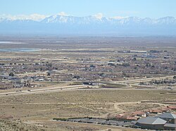
According to the United States Census Bureau, the CDP has a total area of 52.336 square miles (135.550 km2), of which, 52.121 square miles (134.993 km2) of it is land and 0.215 square miles (0.557 km2) of it (0.41%) is water. The Census Bureau definition of the area may not precisely correspond to the local understanding of the historical area of the community. [2]

Demographics

2010

At the 2010 census Rosamond had a population of 18,150. The population density was 346.8 inhabitants per square mile (133.9/km2). The racial makeup of Rosamond was 11,294 (62.2%) White, 1,476 (8.1%) African American, 221 (1.2%) Native American, 658 (3.6%) Asian, 66 (0.4%) Pacific Islander, 3,258 (18.0%) from other races, and 1,177 (6.5%) from two or more races. Hispanic or Latino of any race were 6,230 persons (34.3%) [8]

The census reported that 18,145 people (100% of the population) lived in households, 5 (0%) lived in non-institutionalized group quarters, and no one was institutionalized.

There were 6,197 households, 2,603 (42.0%) had children under the age of 18 living in them, 3,254 (52.5%) were opposite-sex married couples living together, 843 (13.6%) had a female householder with no husband present, 390 (6.3%) had a male householder with no wife present. There were 432 (7.0%) unmarried opposite-sex partnerships, and 40 (0.6%) same-sex married couples or partnerships. 1,317 households (21.3%) were one person and 342 (5.5%) had someone living alone who was 65 or older. The average household size was 2.93. There were 4,487 families (72.4% of households); the average family size was 3.43.

The age distribution was 5,290 people (29.1%) under the age of 18, 1,956 people (10.8%) aged 18 to 24, 4,708 people (25.9%) aged 25 to 44, 4,716 people (26.0%) aged 45 to 64, and 1,480 people (8.2%) who were 65 or older. The median age was 32.0 years. For every 100 females, there were 100.6 males. For every 100 females age 18 and over, there were 100.2 males.

There were 6,968 housing units at an average density of 133.1 per square mile, of the occupied units 4,202 (67.8%) were owner-occupied and 1,995 (32.2%) were rented. The homeowner vacancy rate was 4.5%; the rental vacancy rate was 12.7%. 12,388 people (68.3% of the population) lived in owner-occupied housing units and 5,757 people (31.7%) lived in rental housing units.

2000

At the 2000 census there were 14,349 people, 4,988 households, and 3,626 families in the CDP. The population density was 274.7 inhabitants per square mile (106.1/km2). There were 5,597 housing units at an average density of 107.2 per square mile (41.4/km2). The racial makeup of the CDP was 72.0% White, 6.6% Black or African American, 1.3% Native American, 3.0% Asian, 0.2% Pacific Islander, 11.7% from other races, and 5.2% from two or more races. [9] Of the 4,988 households 41.2% had children under the age of 18 living with them, 54.7% were married couples living together, 12.5% had a female householder with no husband present, and 27.3% were non-families. 21.9% of households were one person and 6.2% were one person aged 65 or older. The average household size was 2.88 and the average family size was 3.38.

The age distribution was 32.9% under the age of 18, 7.9% from 18 to 24, 32.0% from 25 to 44, 19.3% from 45 to 64, and 7.9% 65 or older. The median age was 33 years. For every 100 females, there were 102.4 males. For every 100 females age 18 and over, there were 101.5 males.

The median household income was $42,307 and the median family income was $46,918. Males had a median income of $42,484 versus $26,745 for females. The per capita income for the CDP was $17,440. About 11.6% of families and 14.1% of the population were below the poverty line, including 19.2% of those under age 18 and 12.0% of those age 65 or over.

Education

There are five schools in Rosamond: Rosamond Elementary School, West Park Elementary School, Tropico Middle School, Rosamond High School and Rare Earth High School (alternative education). [10]

There also was a special education schooling facility that went by the name "Ascend Academy". It got defunded by the Southern Kern Unified School District (SKUSD) in mid-2019.

Transportation

Rosamond sits along the California State Route 14, also known as the Antelope Highway, providing direct access to Los Angeles to the south and Mojave to the north.

Bus service from Rosamond to Bakersfield and Lancaster is provided by Kern Transit. The nearest Metrolink station is located about 15 minutes south in Lancaster. Expansion of the Metrolink train north to Rosamond has been discussed in a 2012 Kern County Council of Governments report. [11] [12] [13]

Notable people

Related Research Articles

<span class="mw-page-title-main">Boron, California</span> Census-designated place in California, United States

Boron is a census-designated place (CDP) in Kern County, California, United States. Boron is 15 miles (24 km) southwest of Red Rock Mountain at an elevation of 2,467 feet (752 m). The population was 2,086 at the 2020 census, up from 2,025 at the 2000 census. Boron is named after the element boron and is the site of the world's largest source of the boron compound boric acid.

<span class="mw-page-title-main">California City, California</span> City in California, United States

California City is a city located in northern Antelope Valley in Kern County, California, United States. It is 100 miles (160 km) north of the city of Los Angeles, and the population was 14,973 at the 2020 census. Covering 203.63 square miles (527.4 km2), California City has the third-largest land area of any city in the state of California, and is the largest city by land area in California that is not a county seat.

<span class="mw-page-title-main">Inyokern, California</span> Census designated place in California, United States

Inyokern is a census-designated place (CDP) in Kern County, California, United States. Its name derives from its location near the border between Inyo and Kern Counties. Inyokern is located 8 miles (13 km) west of Ridgecrest, at an elevation of 2,434 feet (742 m). It is on the western side of the Indian Wells Valley. The population was 988 in the 2020 census, down from 1,099 in the 2010 census. It was a railroad town established along the Southern Pacific railroad's Lone Pine Branch and with WWII became site of the Naval Air Weapons Station China Lake.

<span class="mw-page-title-main">Mojave, California</span> Unincorporated community in California, United States

Mojave is an unincorporated community in Kern County, California, United States. Mojave is located 50 miles (80 km) east of Bakersfield, and 100 miles (161 km) north of Los Angeles, at an elevation of 2,762 feet (842 m). The town is located in the western region of the Mojave Desert, below and east of Oak Creek Pass and the Tehachapi Mountains. Mojave is on the Pacific Crest Trail.

<span class="mw-page-title-main">Ridgecrest, California</span> City in California, United States

Ridgecrest is a city in Kern County, California, United States, along U.S. Route 395 in the Indian Wells Valley in northeastern Kern County, adjacent to the Naval Air Weapons Station China Lake. It was incorporated as a city in 1963. The population was 27,959 at the 2020 census, up slightly from 27,616 at the 2010 census.

<span class="mw-page-title-main">Acton, California</span> Census designated place in Los Angeles County, California

Acton is an unincorporated census-designated place in Los Angeles County, California, near the Antelope Valley. According to the 2010 census, Acton had a population of 7,596.

<span class="mw-page-title-main">Desert View Highlands, California</span> Census designated place in California, United States

Desert View Highlands is a census-designated place (CDP) in Los Angeles County, California, United States. The population was 2,360 at the 2010 census, up from 2,337 at the 2000 census. It is surrounded by the City of Palmdale.

<span class="mw-page-title-main">Lancaster, California</span> City in California, United States

Lancaster is a charter city in northern Los Angeles County, in the Antelope Valley of the western Mojave Desert in Southern California. As of the 2020 census, the population was 173,516, making Lancaster the 153rd largest city in the United States and the 30th largest in California. Lancaster is a twin city with its southern neighbor Palmdale; together, they are the principal cities within the Antelope Valley region.

<span class="mw-page-title-main">Littlerock, California</span> Census-designated place in California, United States

Littlerock is a census-designated place in California United States. The population was 1,377 at the 2010 census, down from 1,402 at the 2000 census. The Littlerock, and Sun Village community, which is typically referred to as Littlerock, has a population around 15,000. According to the Greater Antelope Valley Economic Alliance report of 2009, the Palmdale / Lancaster urban area has a population of 483,998, which Littlerock is a part of.

<span class="mw-page-title-main">Palmdale, California</span> City in California, United States

Palmdale is a city in northern Los Angeles County in the U.S. state of California. The city lies in the Antelope Valley of Southern California. The San Gabriel Mountains separate Palmdale from the Los Angeles Basin to the south.

<span class="mw-page-title-main">Quartz Hill, California</span> Census-designated place in California, United States

Quartz Hill is a census-designated place (CDP) in Los Angeles County, California, United States. The population was 10,912 at the 2010 census, up from 9,890 at the 2000 census. The name is also shared with the neighboring district areas of its border cities, Palmdale, and Lancaster. Quartz Hill was once home to the Quartz Hill Airport. According to the Greater Antelope Valley Economic Alliance report of 2009, the Palmdale / Lancaster urban area of which Quartz Hill is a part, has a population of 483,998.

<span class="mw-page-title-main">Lake Los Angeles, California</span> Census-designated place in California, United States

Lake Los Angeles is a census-designated place (CDP) in Los Angeles County, California, United States. The population was 12,328 at the 2010 census, up from 11,523 at the 2000 census. It is located 17 miles (27 km) east of Palmdale's Civic Center. According to the Greater Antelope Valley Economic Alliance report of 2009, the Palmdale / Lancaster urban area has a population of 483,998, of which Lake Los Angeles is a part.

<span class="mw-page-title-main">Antelope Valley</span> Valley in Southern California, United States

The Antelope Valley is located in northern Los Angeles County, California, United States, and the southeast portion of California's Kern County, and constitutes the western tip of the Mojave Desert. It is situated between the Tehachapi, Sierra Pelona, and the San Gabriel Mountains. The valley was named for the pronghorns that roamed there until they were all eliminated in the 1880s, mostly by hunting, or resettled in other areas. The principal cities in the Antelope Valley are Palmdale and Lancaster.

<span class="mw-page-title-main">California State Route 14</span> State highway in Los Angeles and Kern counties in California, United States

State Route 14 is a north–south state highway in the U.S. state of California that connects Los Angeles to the northern Mojave Desert. The southern portion of the highway is signed as the Antelope Valley Freeway. The route connects Interstate 5 on the border of the city of Santa Clarita to the north and the Los Angeles neighborhoods of Granada Hills and Sylmar to the south, with U.S. Route 395 (US 395) near Inyokern. Legislatively, the route extends south of I-5 to SR 1 in the Pacific Palisades area of Los Angeles; however, the portion south of the junction with I-5 has not been constructed. The southern part of the constructed route is a busy commuter freeway serving and connecting the cities of Santa Clarita, Palmdale, and Lancaster to the rest of the Greater Los Angeles area. The northern portion, from Vincent to US 395, is legislatively named the Aerospace Highway, as the highway serves Edwards Air Force Base, once one of the primary landing strips for NASA's Space Shuttle, as well as the Naval Air Weapons Station China Lake that supports military aerospace research, development and testing. This section is rural, following the line between the hot Mojave desert and the forming Sierra Nevada mountain range. Most of SR 14 is loosely paralleled by a rail line originally built by the Southern Pacific Railroad, and was once the primary rail link between Los Angeles and Northern California. While no longer a primary rail line, the southern half of this line is now used for the Antelope Valley Line of the Metrolink commuter rail system.

<span class="mw-page-title-main">Leona Valley, California</span> Census-designated place in California, United States

Leona Valley is a census-designated place located in the geographic Leona Valley of northern Los Angeles County, California, in the transition between the Sierra Pelona Mountains and Mojave Desert, just west of Palmdale and the Antelope Valley. The population was 1,607 at the 2010 census.

Sun Village is an unincorporated community and census-designated place (CDP) in Los Angeles County, California, United States. It is in the eastern Antelope Valley at an elevation of 2,723 feet (830 m). The center of Sun Village may be considered to be Palmdale Boulevard and 87th Street East as noted at the Los Angeles County Assessors office. As of the 2010 census the population of Sun Village was 11,565, up from 9,375 at the 2000 census.

Phelan is an unincorporated community and census-designated place in San Bernardino County, California, in the Victor Valley of the Mojave Desert, north of the San Gabriel Mountains. The population was 14,304 in the 2010 census.

<span class="mw-page-title-main">Lake Hughes, California</span> Unincorporated community in California, United States

Lake Hughes is an unincorporated community in northern Los Angeles County, California. It is in the Sierra Pelona Mountains, northwest of Palmdale and north of the Santa Clarita Valley, in the Angeles National Forest. It is on the sag pond waters of Lake Hughes and Elizabeth Lake. The community is rural in character, with a population of 649 in 2010, but also has a strong recreational element centered on the three lakes in the vicinity. The community of Elizabeth Lake is located just east of Lake Hughes, sharing the same ZIP code.

<span class="mw-page-title-main">Elizabeth Lake, California</span> Census-designated place in California, United States

Elizabeth Lake is a census-designated place (CDP) and unincorporated community on Elizabeth Lake (lake), in Los Angeles County, California, United States. As of the 2010 census it had a population of 1,756.

<span class="mw-page-title-main">High Desert (California)</span> Geographic area of southern California

High Desert is a vernacular region with non-discrete boundaries applying to areas of the western Mojave Desert in southern California. The "High Desert" region is an area that generally is situated between 2,000 feet (610 m) and 4,000 feet (1,200 m) in elevation, and located just north of the San Gabriel, San Bernardino, and Little San Bernardino Mountains.

References

  1. U.S. Census Archived 2012-01-25 at the Wayback Machine
  2. 1 2 U.S. Geological Survey Geographic Names Information System: Rosamond, California
  3. "U.S. Census Bureau QuickFacts: Rosamond CDP, California". www.census.gov. Retrieved October 25, 2020.
  4. 1 2 Durham, David L. (1998). California's Geographic Names: A Gazetteer of Historic and Modern Names of the State. Clovis, Calif.: Word Dancer Press. p. 1098. ISBN   1-884995-14-4.
  5. Capace, Nancy (1999). Encyclopedia of California. North American Book Dist LLC. Page 393. ISBN   9780403093182.
  6. "1932—The Invention of the Ford V8 Engine". YouTube . Retrieved February 5, 2022.
  7. "FORD V-8 SHOWS ENDURANCE IN GRUELING TEST". Healdsburg Tribune, Enterprise and Scimitar. Vol. LV, no. 5. July 28, 1932. Retrieved February 5, 2022.
  8. "2010 Census Interactive Population Search: CA - Rosamond CDP". U.S. Census Bureau. Archived from the original on July 15, 2014. Retrieved July 12, 2014.
  9. "U.S. Census website". United States Census Bureau . Retrieved January 31, 2008.
  10. District Schools, Southern Kern Unified School District, retrieved April 18, 2014.
  11. "Draft report" (PDF). kerncog.org. 2010. Retrieved November 13, 2019.
  12. "Commuter Rail Report" (PDF). www.kerncog.org. 2012. Retrieved September 28, 2019.
  13. "Rail System Plan" (PDF). scagrtpscs.net. 2016. Retrieved September 28, 2019.
  14. Fay, Sarah. "Paris Review – The Art of Poetry No. 94, Kay Ryan". The Paris Review . Retrieved September 16, 2010.