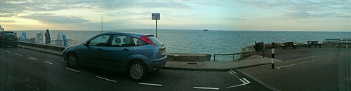
Seaview, Isle of Wight

Last updated

Seaview
Seaview, IW, UK.jpg
Village centre, Seaview
Isle of Wight UK location map.svg
Red pog.svg
Seaview
Location within the Isle of Wight
OS grid reference SZ625915
Civil parish
Unitary authority
Ceremonial county
Region
Country England
Sovereign state United Kingdom
Post town SEAVIEW
Postcode district PO34
Dialling code 01983
Police Hampshire and Isle of Wight
Fire Hampshire and Isle of Wight
Ambulance Isle of Wight
UK Parliament
List of places
UK
England
Isle of Wight
50°43′12″N1°06′53″W / 50.7201°N 1.11484°W / 50.7201; -1.11484

Seaview is a small Edwardian resort located on the north-eastern corner of the Isle of Wight, overlooking the Solent. The village is popular with tourists and is 2+13 miles (3.8 km) from the town of Ryde, where most tourists reach the island by ferry or hovercraft. Together with Nettlestone, it forms a civil parish [1] of Nettlestone and Seaview.

Contents

The village

Sign one sees on entering Seaview Seaview2.jpg
Sign one sees on entering Seaview
The seafront at Seaview, looking towards Ryde, with Ryde Pier visible in the far distance Seaview seafront, IOW, Hampshire.jpg
The seafront at Seaview, looking towards Ryde, with Ryde Pier visible in the far distance

The High Street is perpendicular to the shore. On the seafront lies the Old Fort pub, a drinking spot popular with both residents and summer visitors. The Salterns Cottages used to house salt pan workers. One street is named Rope Walk because long sections of rope for rigging ships were laid out there.

The well-known Priory Bay is approximately a ten-minute walk from the village. This stretch of beach can only be reached at low tide. It is filled with white sand and offers excellent swimming conditions. In addition, Seagrove Bay, between the village and Priory Bay, is quite popular. Some of the largest houses in the area are along Pier Road and Bluett Avenue, and this is partly responsible for the nickname "millionaires avenues". Further large period houses, now largely divided into flats, can be found in Ryde Road.

In 1870, Augustus Gough-Calthorpe, 6th Baron Calthorpe, had a French Renaissance style house, Woodlands Vale, built by Samuel Sanders Teulon. The nearby Calthorpe Road is named after the family. [2]

Seaview has many holiday homes including some with sea views. This leads to a seasonal variation in the activity in the village - with many second-home owners visiting only in the summer months or holiday periods. [3] There are two hotels, the Seaview Hotel and the Northbank Hotel. There is a pub, pizza place / café, stationery shop, pharmacist, Post office, Community grocery shop, Beauty Clinic, wine shop, seaside clothing shop, Seaview Beach Shop and an art gallery. [4]

No Man's Land Fort, formerly part of the coast defences and now a luxury residence, is visible in the Solent one mile from Seaview.

Public transport is available on Southern Vectis bus route 8, which operates between Ryde, Bembridge, Sandown and Newport. [5]

St. Peter's Church the village's Church of England church built in 1859.

Boating

The village is home to the Sea View Yacht Club, founded in 1893. In summer, the village hosts the Seaview Regatta, during which locals and tourists can take part in many traditional activities, such as the greasy pole where people line up and see how far they can slide along a pole covered in grease. Once they have slipped off, they drop into the sea below. There is also a diving competition and a firework display concludes the event each year.

Seaview Pier

Panorama of the Solent as seen from Seaview Seaview, Isle of Wight.jpg
Panorama of the Solent as seen from Seaview

In 1877 the Seaview Pier Company was formed to build Seaview a promenading pier, and approval for a 350-yard-long pier was given by Parliament in 1878. The suspension pier was designed by Frank Caws, a Seaview-born engineer/architect then working in Sunderland. The pier was finished in 1881 and was 1000 foot-long and 15 feet wide, in 1889 it was extended another 50 feet. [6] There were four towers from which the pier deck was suspended with chains.

In its heyday, the pier received passenger ferries from Portsmouth and other south-coast towns. At the entrance to the pier was the Pier Hotel, which catered for holidaymakers.

The Pier was still in use after World War II and in August 1948 became the first pier 'listed' under the Town and Country Planning Act. However, it was severely damaged in a storm in late December 1951 (only leaving around 100 ft of promenade intact) and later demolished in 1952. [6]

Related Research Articles

<span class="mw-page-title-main">Isle of Wight</span> County and island of England

The Isle of Wight is an island, English county and unitary authority in the English Channel, 2 to 5 miles off the coast of Hampshire, across the Solent. It is the largest and second-most populous island in England. Referred to as "The Island" by residents, the Isle of Wight has resorts that have been popular holiday destinations since Victorian times. It is known for its mild climate, coastal scenery, and verdant landscape of fields, downland, and chines. The island is historically part of Hampshire. The island is designated a UNESCO Biosphere Reserve.

<span class="mw-page-title-main">Sandown</span> Human settlement in England

Sandown is a seaside resort town and civil parish on the south-east coast of the Isle of Wight, United Kingdom with the resort of Shanklin to the south and the settlement of Lake in between. Sandown has a population of 11,654 according to the 2021 Census and together with Shanklin and Lake forms a built-up area of around 25,000 inhabitants.

<span class="mw-page-title-main">Yarmouth, Isle of Wight</span> Human settlement in England

Yarmouth is a town, port and civil parish in the west of the Isle of Wight, off the south coast of England. The town is named for its location at the mouth of the small Western Yar river. The town grew near the river crossing, originally a ferry, which was replaced with a road bridge in 1863.

<span class="mw-page-title-main">Ryde</span> English seaside town

Ryde is an English seaside town and civil parish on the north-east coast of the Isle of Wight. The built-up area had a population of 24,096 according to the 2021 Census. Its growth as a seaside resort came after the villages of Upper Ryde and Lower Ryde were merged in the 19th century, as can still be seen in the town's central and seafront architecture. The resort's expansive sands are revealed at low tide. Their width means the regular ferry service to the mainland requires a long listed pier – the fourth longest in the United Kingdom, and the oldest surviving.

<span class="mw-page-title-main">Shanklin</span> Human settlement in England

Shanklin is a seaside resort town and civil parish on the Isle of Wight, England, located on Sandown Bay. Shanklin is the southernmost of three settlements which occupy the bay, and is close to Lake Sandown. The sandy beach, its Old Village and a wooded ravine, Shanklin Chine, are its main attractions. The esplanade along the beach is occupied by hotels and restaurants for the most part, and is one of the most tourist-oriented parts of the town. The other is the Old Village, at the top of Shanklin Chine. Together with Lake and Sandown to the north, Shanklin forms a built up area of around 25,000 inhabitants.

<span class="mw-page-title-main">Bembridge</span> Village on the Isle of Wight

Bembridge is a village and civil parish located on the easternmost point of the Isle of Wight. It had a population of 3,848 according to the 2001 census of the United Kingdom, leading to the implausible claim by some residents that Bembridge is the largest village in England. Bembridge is home to many of the Island's wealthiest residents. The population had reduced to 3,688 at the 2011 Census.

<span class="mw-page-title-main">Ryde Pier</span> Pier in the Isle of Wight, England

<span class="mw-page-title-main">St Helens, Isle of Wight</span> Settlement in England

St Helens is a village and civil parish located on the eastern side of the Isle of Wight.

<span class="mw-page-title-main">Southern Vectis</span> British bus operator on the Isle of Wight, England

Southern Vectis is a bus operator on the Isle of Wight. The company was founded in 1921 as "Dodson and Campbell" and became the "Vectis Bus Company" in 1923. The company was purchased by the Southern Railway before being nationalised in 1969. In 1987, the company was re-privatised. In July 2005, it became a subsidiary of Go-Ahead Group.

<span class="mw-page-title-main">Nettlestone</span> Human settlement in England

Nettlestone is a village on the Isle of Wight, England about 4 miles (6 km) south east from Ryde. It is listed in the Domesday Book and was established c.1086. Together with Seaview, it forms the civil parish of Nettlestone and Seaview.

<span class="mw-page-title-main">Nettlestone and Seaview</span> Civil parish in Isle of Wight, England

Nettlestone and Seaview is a civil parish and electoral ward on the Isle of Wight. It contains the villages of Nettlestone and Seaview.

<span class="mw-page-title-main">Transport on the Isle of Wight</span> Various transport methods used on the Isle of Wight, England

There are several modes of Transport on the Isle of Wight, an island in the English Channel.

<span class="mw-page-title-main">Isle of Wight Coastal Path</span> Long-distance footpath on the Isle of Wight, England

The Isle of Wight Coastal Path is a circular long-distance footpath of 70 miles (113 km) around the Isle of Wight, UK. It follows public footpaths and minor lanes, with some sections along roads.

<span class="mw-page-title-main">Elmfield</span>

<span class="mw-page-title-main">Seaview Services</span>

Seaview Services is a coach hire and tour operator operating on the Isle of Wight. It is a subsidiary of Xelabus.

<span class="mw-page-title-main">Seagrove Bay</span> Human settlement in England

Seagrove Bay is a bay on the northeast coast of the Isle of Wight, England. It lies to the east of the village of Seaview facing towards Selsey Bill with a 23 mile (1.1 km) shoreline stretching from Nettlestone Point in the north to Horestone Point in the south. The bay has both the Seaside Award Flag and the Water Quality Award.

<span class="mw-page-title-main">Puckpool</span>

Stephen Salter was an English architect who practised in Oxford, Maidenhead, and the Isle of Wight. He should not be confused with another (unrelated) architect called Stephen Salter who lived from 1826 to 1896 and worked in London.

<span class="mw-page-title-main">Woodlands Vale</span> House in Isle of Wight, England

Woodlands Vale is a Victorian era house in Seaview on the Isle of Wight. It is a Grade II* listed building.

References

  1. English Parishes & Welsh Communities N&C 2004
  2. "Woodlands Vale". British Listed Buildings.
  3. Wright, Richard. "Pay to have bins put back, idea". Isle of Wight County Press. Retrieved 2 April 2014.
  4. "Home". seaviewart.co.uk.
  5. "Southern Vectis bus routes". Southern Vectis. Archived from the original on 30 November 2009. Retrieved 20 December 2009.
  6. 1 2 "Seaview Chain Pier". National Piers Society. 21 March 2016. Retrieved 22 December 2018.