Segreganset River

Last updated
View of Segreganset River at low tide, Dighton, Massachusetts Segreganset River.JPG
View of Segreganset River at low tide, Dighton, Massachusetts

The Segreganset River is a small river in Bristol County, Massachusetts that flows 9.6 miles (15.4 km) [1] in a southeasterly direction through Taunton and Dighton into the Taunton River. [2] Named tributaries include the Maple Swamp, Poppasquash Swamp, Sunken Brook and Cedar Swamp.

River Natural flowing watercourse

A river is a natural flowing watercourse, usually freshwater, flowing towards an ocean, sea, lake or another river. In some cases a river flows into the ground and becomes dry at the end of its course without reaching another body of water. Small rivers can be referred to using names such as stream, creek, brook, rivulet, and rill. There are no official definitions for the generic term river as applied to geographic features, although in some countries or communities a stream is defined by its size. Many names for small rivers are specific to geographic location; examples are "run" in some parts of the United States, "burn" in Scotland and northeast England, and "beck" in northern England. Sometimes a river is defined as being larger than a creek, but not always: the language is vague.

Bristol County, Massachusetts county in Massachusetts

Bristol County is a county in the Commonwealth of Massachusetts. As of the 2010 census, the population was 548,285. The county seat is Taunton. Some governmental functions are performed by the Commonwealth of Massachusetts, others by the county, and others by local towns and cities. See administrative divisions of Massachusetts. The property deed records are kept in Taunton, Attleboro, Fall River, and New Bedford.

Taunton, Massachusetts City in Massachusetts, United States

Taunton is a city in Bristol County, Massachusetts, United States. It is the seat of Bristol County. Taunton is situated on the Taunton River which winds its way through the city on its way to Mount Hope Bay, 10 miles (16 km) to the south. At the 2010 census, the city had a population of 55,874. Thomas Hoye Jr. is the current mayor of Taunton, and has held the position since 2012.

The USGS maintains a gaging station on the Segreganset River near Center Street in Dighton. [3]

See also

Cole River river in the United States of America

The Cole River is located in Bristol County, Massachusetts. It flows 11.8 miles (19.0 km) from its headwaters in Dighton, Massachusetts through the towns of Rehoboth and Swansea into Mount Hope Bay, an arm of Narragansett Bay. The Cole River becomes tidal after crossing under the G.A.R. Highway in Swansea. It was named after Sgt. Hugh Cole.

Taunton River Watershed

The Taunton River watershed or Taunton River basin is made up of 562 square miles (1,500 km2) of rivers, lakes, ponds, streams, and wetlands in southeastern Massachusetts, USA. It is the second largest watershed in the state. Also, it is a significant part of a much larger multi-state watershed, the Narragansett Bay watershed.

Three Mile River river in the United States of America

The Three Mile River or Threemile River is a river in Bristol County, Massachusetts. It is formed by the junction of the Rumford and Wading rivers in the town of Norton. It flows in a southeasterly direction for 13.5 miles (21.7 km) through the towns of Norton, Taunton and Dighton, where it joins the Taunton River.

Related Research Articles

Berkley, Massachusetts Town in Massachusetts, United States

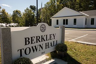
Berkley is a town in Bristol County, Massachusetts, United States, located south of Boston and east of Providence, Rhode Island. The population was 6,411 at the 2010 census, making it the least populated town in the county.

Dighton, Massachusetts Town in Massachusetts, United States

Dighton is a town in Bristol County, Massachusetts, United States. The population was 7,086 at the 2010 census. The town is located on the western shore of the Taunton River in the southeastern part of the state.

Assonet River river in the United States of America

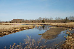
The Assonet River is located in Bristol County, Massachusetts. It flows 7.4 miles (11.9 km) in a westerly direction through Freetown and joins the Taunton River near Assonet Neck in Berkley, Massachusetts.

The Cotley River is a small river in Taunton and Berkley, Massachusetts that is a tributary of the Taunton River. It flows approximately 5.8 miles (9.2 km) in a northwesterly direction from the southeast part of Taunton near Seekell Street to Barstows Pond near the village of East Taunton where it joins the Taunton River.

The Hockomock Swamp is a vast wetland encompassing much of the northern part of southeastern Massachusetts. This 16,950-acre (6,859 ha) land is considered the largest freshwater swamp in the state. It acts as a natural flood control mechanism for the region.

Forge River river in the United States of America

The Forge River is a 5.1-mile-long (8.2 km) river in the town of Raynham in southeastern Massachusetts. It is a tributary of the Taunton River. It rises from Gushee Pond near Interstate 495 and flows northwest through Titicut Swamp, then turns southwest for the rest of its course. It flows through Hewitt Pond, passes the neighborhood of Tracy Corner, then continues through Johnson Pond and the village of Raynham Center to its junction with the Taunton River.

Town River river in the United States of America

The Town River is a river in Plymouth County, Massachusetts, United States. It flows 10.6 miles (17.1 km) from the northeast end of Lake Nippenicket in the town of Bridgewater, flowing easterly through West Bridgewater, then south back into Bridgewater where it joins with the Matfield River to form the Taunton River.

Nemasket River river in the United States of America

The Nemasket or Namasket River is a small river in southeastern Massachusetts. It flows north 11.2 miles (18.0 km) from Assawompset Pond in Lakeville and through Middleborough where it empties into the Taunton River.

Assonet Bay

Assonet Bay is a small inland bay in Assonet, a village within the town of Freetown, Massachusetts. The Assonet River connects the waters of the bay with the Taunton River.

The Rumford River is a small river in southeastern Massachusetts, United States, that is a tributary of the Threemile River in the Taunton River watershed. The Rumford River, 23.1 kilometres (14.4 mi) long, begins within the town of Foxborough and flows south through Mansfield to the Norton Reservoir, within the town of Norton, then continues to its confluence with the Wading River to form the Threemile River.

Bungay River river in the United States of America

The Bungay River is a short river in southeastern Massachusetts that is a tributary of the Ten Mile River.

Canoe River river in the United States of America

The Canoe River is a river in southeastern Massachusetts. It is 14.4 miles (23.2 km) long and part of the Taunton River Watershed.

The Sevenmile River or Seven Mile River is a river in the U.S. states of Massachusetts and Rhode Island. It flows approximately 9.8 miles (15.8 km).

The Runnins River is a river in the U.S. states of Massachusetts and Rhode Island. It flows approximately 14 km (9 mi).

Weir Village, Massachusetts human settlement in United States of America

Weir Village is a village of the city of Taunton in Bristol County, Massachusetts, located about one mile south of the city center on the banks of the Taunton River, near the point where it becomes tidal. The village takes its name from fishing weirs which were placed across the Taunton River from pre-colonial times until the early 20th century, to catch herring. While much of the commercial part of the village lies on the west side of the river, along Weir Street , a dense residential area extends in an easterly direction across the river along Plain and Berkley Streets.

The Cedar Swamp River is a small river in Lakeville, Massachusetts that flows 4.6 miles (7.4 km) in a northwesterly direction through the western part of the town to where it forms the Assonet River near the Freetown line, just south of the village of Myricks. It is a tributary of the Taunton River.

The Cocasset River is a small river in Foxborough, Massachusetts. It flows approximately 4.7 miles (7.5 km) in a southwesterly direction to where it joins the Wading River near Green Street. It is a tributary of the Taunton River.

The Salisbury Plain River is a 4.7-mile-long (7.6 km) river in Plymouth County, Massachusetts that flows from the city of Brockton into the towns of West Bridgewater and East Bridgewater where it joins the Matfield River, a major tributary of the Taunton River.

References

  1. U.S. Geological Survey. National Hydrography Dataset high-resolution flowline data. The National Map, accessed April 1, 2011
  2. USGS Quadrangle Map
  3. USGS Real-time Water Information System

Coordinates: 41°49′30″N71°07′08″W / 41.825°N 71.119°W / 41.825; -71.119

Geographic coordinate system Coordinate system

A geographic coordinate system is a coordinate system that enables every location on Earth to be specified by a set of numbers, letters or symbols. The coordinates are often chosen such that one of the numbers represents a vertical position and two or three of the numbers represent a horizontal position; alternatively, a geographic position may be expressed in a combined three-dimensional Cartesian vector. A common choice of coordinates is latitude, longitude and elevation. To specify a location on a plane requires a map projection.