
The Assonet River is located in Bristol County, Massachusetts. It flows 7.4 miles (11.9 km) in a westerly direction through Freetown and joins the Taunton River near Assonet Neck in Berkley, Massachusetts.

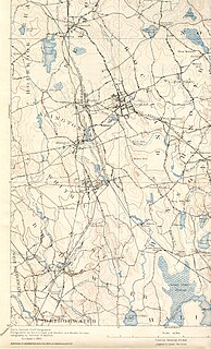
The Mill River is a tributary of the Taunton River that flows 4.0 miles (6.2 km) from Lake Sabbatia, through the center of Taunton, Massachusetts, to the Taunton River.
The Cotley River is a small river in Taunton and Berkley, Massachusetts that is a tributary of the Taunton River. It flows approximately 5.8 miles (9.2 km) in a northwesterly direction from the southeast part of Taunton near Seekell Street to Barstows Pond near the village of East Taunton where it joins the Taunton River.

The Three Mile River or Threemile River is a river in Bristol County, Massachusetts. It is formed by the junction of the Rumford and Wading rivers in the town of Norton. It flows in a southeasterly direction for 13.5 miles (21.7 km) through the towns of Norton, Taunton and Dighton, where it joins the Taunton River.
The Matfield River is a 6.3-mile-long (10.1 km) river in Plymouth County, Massachusetts. It flows south through the town of East Bridgewater to a confluence with the Town River, forming the Taunton River. The Matfield River, where it flows through the historic village of Elmwood and flows under Route 18, is commonly known as the Elmwood River.
The Satucket River is 5.5-mile-long (8.9 km) river in southeastern Massachusetts within the Taunton River Watershed. It flows generally west from Robbins Pond in East Bridgewater, and into the Matfield River.
The Winnetuxet River is a 12.1-mile-long (19.5 km) river in southeastern Massachusetts. It flows west from an unnamed pond near Cole Mill in Carver, through Plympton and Halifax, to the Taunton River.
The Wading River is a 13.1-mile-long (21.1 km) river in southeastern Massachusetts in the United States. It rises from Lake Miramichi in the town of Foxborough and flows southeast through Mansfield into the town of Norton, where it turns east, flows through Barrowsville Pond, and continues to its confluence with the Rumford River, forming the Three Mile River. The river is part of the Taunton River watershed.
The Jones River is a 7.5-mile-long (12.1 km) river running through Kingston, Massachusetts. The river drains about 30 square miles (78 km2), has its source in Silver Lake and drains into Kingston Bay. Land surrounding the river is 52% forested, of which 22% has been developed for residential use. There is a USGS stream gauge along 16 square miles (41 km2) of the river and it has measured the flow at 0.7 cubic feet per second (0.020 m3/s) per square mile of drainage area.

The Powwow River is a 22.8-mile-long (36.7 km) river located in New Hampshire and Massachusetts in the United States. It is a tributary of the Merrimack River, part of the Gulf of Maine watershed.

The Quaboag River is a 25.7-mile-long (41.4 km) river in Massachusetts that heads at Quaboag Pond in Brookfield at an elevation of 594 feet (181 m) above sea level. It flows west to the village of Three Rivers, Massachusetts, at an elevation of 290 feet (88 m).
The Back River is a 6.5-mile-long (10.5 km) river located in New Hampshire and Massachusetts in the United States. It is a tributary to the Powwow River, part of the Merrimack River watershed. Approximately 3.0 miles (4.8 km) of the river are in New Hampshire, with the remaining 3.5 miles (5.6 km) in Massachusetts.

The Five Mile River is a 10.1-mile-long (16.3 km) river in central Massachusetts, part of the Chicopee River watershed. It rises north of Dean Pond in the Town of Oakham within Rutland State Forest and flows south through Dean Pond to Brooks Pond, 2.5 miles (4.0 km) northeast of North Brookfield, then continues south to its mouth at the north end of Lake Lashaway, also in North Brookfield.

The Canoe River is a river in southeastern Massachusetts. It is 14.4 miles (23.2 km) long and part of the Taunton River Watershed.

Browning Pond is located in Oakham and Spencer, Massachusetts. This 89-acre (360,000 m2) great pond forms the headwaters of the Seven Mile River. It is part of the Chicopee River Watershed.

Weir River is a short stream and estuary that empties into Hingham Bay, part of Boston Harbor in Massachusetts, United States. The name is attributed to the location of a fishing weir in the stream. The river gives its name to a larger watershed and Weir River Farm, a park and nature reserve owned by The Trustees of Reservations.
The Cocasset River is a small river in Foxborough, Massachusetts. It flows approximately 4.7 miles (7.5 km) in a southwesterly direction to where it joins the Wading River near Green Street. It is a tributary of the Taunton River.
The Salisbury Plain River is a 4.7-mile-long (7.6 km) river in Plymouth County, Massachusetts that flows from the city of Brockton into the towns of West Bridgewater and East Bridgewater where it joins the Matfield River, a major tributary of the Taunton River.


