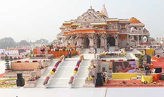
Ayodhya is a city situated on the banks of the Sarayu river in the Indian state of Uttar Pradesh. It is the administrative headquarters of the Ayodhya district as well as the Ayodhya division of Uttar Pradesh, India.

Shravasti ; Pali: 𑀲𑀸𑀯𑀢𑁆𑀣𑀻, romanized: Sāvatthī) is a town in Shravasti district in Indian State of Uttar Pradesh. It was the capital of the ancient Indian kingdom of Kosala and the place where the Buddha lived most after his enlightenment. It is near the Rapti river in the northeastern part of Uttar Pradesh India, close to the Nepalese border.

Shravasti district is one of the districts of the Uttar Pradesh state of India, with Bhinga town as its district headquarters. Shravasti district is a part of Devipatan Division. According to Government of India, it is among the 121 minority concentrated districts in India. It is the fourth most backward district in India, according to the 2018 Niti Aayog ranking. This district is the most poverty stricken district in the country.

Deorkothar is a location of archaeological importance in Madhya Pradesh, Central India. It is known for its Buddhist stupas and was discovered in 1982.These stupas are credited to the Mauryan emperor, Ashoka.

Uttar Pradesh is the most populous state in India with a population of nearly 240 million people. The economy of Uttar Pradesh is the fifth largest among states in India. At current prices, the gross state domestic product (GSDP) of Uttar Pradesh is estimated to be ₹24.39 lakh crore (US$310 billion) in 2023–24. Merchandise exports from Uttar Pradesh reached US$21.03 billion in FY22.
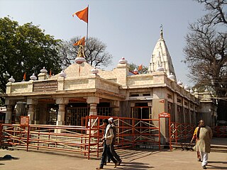
Balrampur district is one of the district of the Indian state of Uttar Pradesh and is a part of Devipatan division as well as the historic Awadh regions. It has been cut from the adjacent district Gonda in 1997. Located on the banks of the West Rapti River. Balrampur is known for the temple of Pateshwari Devi, a Shakti Pitha, and for the ruins of the nearby ancient city of Sravasti, now a pilgrimage site for Buddhists and Jains. The nearest airport is Shravasti airport 23.3 kilometres (14.5 mi) from the town but it is not an international and regular airport; the nearest international and regular airport is Chaudhary Charan Singh International Airport in Lucknow, 235 kilometres (146 mi) away. Lucknow is the capital city of Uttar Pradesh and is 220 kilometres (140 mi) from Balrampur district headquarters.

The Culture of Uttar Pradesh is an Indian culture which has its roots in Hindi, Bhojpuri and Urdu literature, music, fine arts, drama and cinema. Lucknow, the capital of Uttar Pradesh, has historical monuments including Bara Imambara and Chhota Imambara, and has preserved the damaged complex of the Oudh-period British Resident's quarters, which are being restored.

The Lucknow Metro is a mass rapid transit (MRT) system in Lucknow, Uttar Pradesh, India. The metro is owned and operated by the Uttar Pradesh Metro Rail Corporation (UPMRC). The frequency of the metro's services is around 5 - 7 minutes.
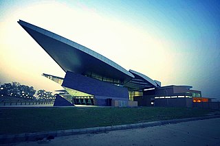
Chaudhary Charan Singh International Airport is an international airport serving Lucknow, the capital of the Indian state of Uttar Pradesh. It is located in Amausi, 14 km (8.7 mi) from the city centre, and was earlier known as ''Amausi Airport''. It is named after Chaudhary Charan Singh, the fifth Prime Minister of India. It is owned and operated by the Lucknow International Airport Limited (LIAL), a public–private consortium led by Adani Group.
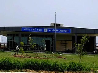
Aligarh Airport is an domestic airport situated at Aligarh - Sikandra Rao Road in outskirts of Aligarh city in the Indian state of Uttar Pradesh. It is being developed by upgrading the existing government airstrip.

Jhansi Airstrip is a military airstrip situated in Jhansi city in the Bundelkhand region of Indian state of Uttar Pradesh, which is run by the Army Aviation Corps and owned by Uttar Pradesh Government. The airstrip covers an area of 198 acres. Establishment of an airport was proposed by government by upgrading the existing government airstrip, which is now replaced by a new greenfield airport project.
Muirpur Airport also spelled as Myorpur Airport is an upcoming airport, situated at Myorpur approx 12 km (7.5 mi) from the Renukut in the Sonbhadra district in the Indian state of Uttar Pradesh. Airport is developing by upgrading the existing government airstrip. It serves nearby towns, Northern Coalfields Limited (NCL), NTPC projects Renukut and Robertsganj, the Other towns of Sonbhadra and Singrauli district of Madhya Pradesh. Balrampur-Ramanujganj district of Chhattisgarh and Garhwa district of Jharkhand. The airport serves the region which has many electrical power stations, known as the "Energy Capital of India". It is 26.5 km (16.5 mi) away from DUDHI TEHSIL. The proposed airport will boost the power sector of the nation and more investment will be made in the power sector internationally. This Airport will be connected to a nearby railway and bus station.
Azamgarh Airport is a Domestic Airport at Manduri Village outside of Azamgarh city, near Kuan Devchand Patti, in the Indian state of Uttar Pradesh. It is being developed by upgrade of the existing government airstrip. The existing airstrip can support aircraft weighing up to 5,700 kg (12,600 lb) with a runway of 1,400 by 23 metres.

Moradabad Airport is a domestic airport in the city of Moradabad, situated midway between Moradabad and Rampur on National Highway 9 in Uttar Pradesh (UP). Being 19 km (12 mi) from the Moradabad Railway Station and 15 kms from the Rampur Railway Station, it's strategically located to serve both districts. It has been developed by upgrading the existing government airstrip.
Chitrakoot Airport is operational now domestic airport which will serve the city of Chitrakoot, Uttar Pradesh, India. It is located at Dewangna in Chitrakoot district, 12 km (7.5 mi) from the city center. The existing airstrip with a runway is currently owned by the Civil Aviation Department of the Government of Uttar Pradesh. In January 2019, the State Government decided to expand the airstrip and construct an airport terminal by acquiring additional land from the forest department. The airport has a pre-fabricated passenger terminal covering 525 square meters and can accommodate 20 arriving and 20 departing passengers. In October 2020, Gurugram-based Aviation Connectivity and Infrastructure Developers Pvt Ltd won the rights to operate flights from the airport to Kanpur, Prayagraj and Varanasi, under the government's UDAN Regional Connectivity Scheme. Currently, the airport is not operational, and the terminal is being handled only for private operations. To make it a full-fledged commercial airport, it is undergoing expansion, which includes a new 2,500-metre runway, suitable for handling Airbus A320 and Boeing 737 type aircraft, an apron, and a new passenger terminal. Before the completion of the expansion project, the existing terminal is announced to restart operations, and for that, is expected to get the license within 4-5 months from now, as of February 2023. The expansion project is expected to be completed by 2024.

Saifai is a large village and university town in the Etawah district of the Indian state of Uttar Pradesh. It is also a sub-division (Tehsil) and Block of the Etawah district. It is the birthplace of Mulayam Singh Yadav, the founding president of the Samajwadi Party, former Minister of Defence in India, and former Chief Minister of Uttar Pradesh.
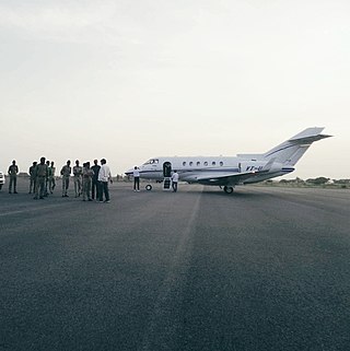
The Saifai Airstrip is an airstrip in Saifai tehsil of Etawah District, Uttar Pradesh with only unscheduled chartered flights. This airstrip has an existing land area of 370 acres and it is suitable for Airbus A320/Boeing 737 with turning pads at both ends.
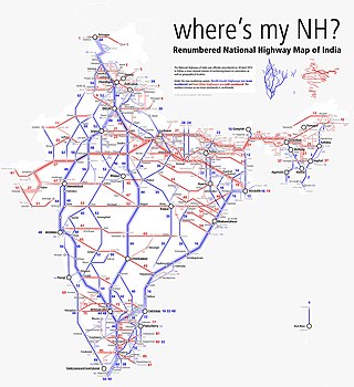
National Highway 230, also known as Kisan Path or Lucknow Outer Ring Road is National Highway in Uttar Pradesh, India which also includes sections of Lucknow Inner Ring Road. The Lucknow outer ring road is an 8 lane that expand to 10 lanes at key junctions and 104 km long quadruple carriageway road project with a speed limit of 100kmph for Light Vehicles and 80kmph for Heavy vehicles. The 6 lane 11 km long stretch between Kursi Road to Sultanpur road has been constructed by the NHAI. This Ring Road has multiple 6 lane flyovers for smooth and swift commuting of the travellers. This Outer Ring Road will play a major role in the establishment of the Lucknow State Capital Region or the Uttar Pradesh State Capital Region as many IT cities, Housing Societies, Integrated Mega-Townships, Wellness City, Educational Hubs, and Commercial Hubs etc. across Multiple 1000's of acres of land are proposed to be established around this Ring Road. It is set to offload nearly 1.60 lakh vehicles off the main roads of the city of Lucknow as of now.
Saifai International Cricket Stadium is a cricket stadium of International Standard in Saifai, Uttar Pradesh, India. It is situated inside Major Dhyan Chand Sports College's campus. With a seating capacity of 43,000 people, it is one of the largest scoreboard display for a cricket stadium in India. There is an All-weather Swimming Pool, Athletics Stadium and Indoor Stadium too in the campus of Sports College along with this cricket stadium. It was inaugurated on 1Jun 2018, along with Etawah Safari Park and Abhinav Vidyalaya, Saifai at a function in Etawah city.
Gainsari is a nagar panchayat in Tulsipur tehsil, Balrampur district in the state of Uttar Pradesh, India. It is near the India-Nepal border and is 238 km far from Lucknow capital city of Uttar Pradesh. It has an average elevation of 109 metres above sea level.


