Smiths Grove, Kentucky

Last updated

Smiths Grove, Kentucky
Main Street, downtown Smiths Grove.jpg
Main Street
Warren County Kentucky Incorporated and Unincorporated areas Smiths Grove Highlighted 2171454.svg
Location of Smiths Grove in Warren County, Kentucky.
Coordinates: 37°3′12″N86°12′27″W / 37.05333°N 86.20750°W / 37.05333; -86.20750
Country United States
State Kentucky
County Warren
Area
[1]
  Total0.78 sq mi (2.02 km2)
  Land0.78 sq mi (2.02 km2)
  Water0.00 sq mi (0.00 km2)
Elevation
636 ft (194 m)
Population
 (2020)
  Total752
  Density964.10/sq mi (372.44/km2)
Time zone UTC-6 (Central (CST))
  Summer (DST) UTC-5 (CDT)
ZIP code
42171
Area code 270
FIPS code 21-71454
GNIS feature ID0503812
Website www.smithsgrove.org

Smiths Grove is a home rule-class city in Warren County, Kentucky, United States. The population was 752 as of the 2020 Census. It is included in the Bowling Green, Kentucky Metropolitan Statistical Area.

Contents

Geography

Smiths Grove is located at 37°3′12″N86°12′27″W / 37.05333°N 86.20750°W / 37.05333; -86.20750 (37.053448, -86.207569). [2]

According to the United States Census Bureau, the city has a total area of 0.8 square miles (2.1 km2), all land.

Demographics

Historical population
CensusPop.Note
1880 388
1900 411
1910 72676.6%
1920 81512.3%
1930 718−11.9%
1940 699−2.6%
1950 683−2.3%
1960 613−10.2%
1970 75623.3%
1980 7671.5%
1990 703−8.3%
2000 78411.5%
2010 714−8.9%
2020 7525.3%
U.S. Decennial Census [3]

As of the census [4] of 2000, there were 784 people, 298 households, and 228 families residing in the city. The population density was 945.3 inhabitants per square mile (365.0/km2). There were 329 housing units at an average density of 396.7 per square mile (153.2/km2). The racial makeup of the city was 84.82% White, 12.12% African American, 1.91% from other races, and 1.15% from two or more races. Hispanic or Latino of any race were 1.91% of the population.

There were 298 households, out of which 35.9% had children under the age of 18 living with them, 60.4% were married couples living together, 12.4% had a female householder with no husband present, and 23.2% were non-families. 20.8% of all households were made up of individuals, and 12.4% had someone living alone who was 65 years of age or older. The average household size was 2.62 and the average family size was 3.03.

In the city, the population was spread out, with 27.2% under the age of 18, 4.7% from 18 to 24, 31.0% from 25 to 44, 22.2% from 45 to 64, and 14.9% who were 65 years of age or older. The median age was 38 years. For every 100 females, there were 86.2 males. For every 100 females age 18 and over, there were 81.8 males.

The median income for a household in the city was $36,058, and the median income for a family was $43,750. Males had a median income of $32,292 versus $23,365 for females. The per capita income for the city was $19,335. About 7.0% of families and 7.8% of the population were below the poverty line, including 6.5% of those under age 18 and 14.4% of those age 65 or over.

Education

North Warren Elementary, a school in the Warren County Public School System, is located in Smiths Grove. Secondary students in Smiths Grove attend Warren East Middle and High Schools, located west of the town and on the northeastern outskirts of Bowling Green.

Smiths Grove has a lending library, a branch of the Warren County Public Library. [5]

Transportation

Interstate 65 provides direct access to Smiths Grove via the Exit 38 interchange. KY 101 is known locally as Main Street and provides the central road through town.

Downtown Smiths Grove is bisected by a CSX Transportation line, formerly part of the Louisville and Nashville Railroad.

Related Research Articles

<span class="mw-page-title-main">Warren County, Kentucky</span> County in Kentucky, United States

Warren County is a county located in the south central portion of the U.S. state of Kentucky. As of the 2020 census, the population was 134,554, making it the fifth-most populous county in Kentucky. The county seat is Bowling Green. Warren County is now classified as a wet county after voters approved the measure in 2018. The measure became law in January 2019 that allows alcohol to be sold county wide.

<span class="mw-page-title-main">Simpson County, Kentucky</span> County in Kentucky, United States

Simpson County is a county located in the south central portion of the U.S. state of Kentucky. As of the 2020 census, the total population was 19,594. Its county seat is Franklin.

<span class="mw-page-title-main">Edmonson County, Kentucky</span> County in Kentucky, United States

Edmonson County is a county located in the south central portion of the U.S. state of Kentucky. As of the 2020 census, the population was 12,126. Its county seat and only municipality is Brownsville. The county was formed in 1825 and named for Captain John "Jack" Edmonson (1764–1813), who was killed at the Battle of Frenchtown during the War of 1812. This is a dry county where the sale of alcohol is prohibited. Edmonson County is included in the Bowling Green, Kentucky Metropolitan Statistical Area.

<span class="mw-page-title-main">Butler County, Kentucky</span> County in Kentucky, United States

Butler County is a county located in the US state of Kentucky. As of the 2020 Census, the population was 12,371. Its county seat is Morgantown. The county was formed in 1810, becoming Kentucky's 53rd county. Butler County is included in the Bowling Green, Kentucky, Metropolitan Statistical Area.
<span class="mw-page-title-main">Allen County, Kentucky</span> County in Kentucky, United States

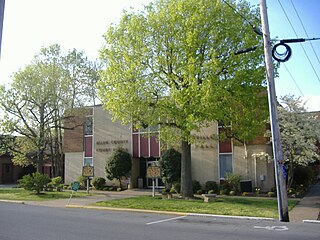
Allen County is a county located in the U.S. state of Kentucky. As of the 2020 census, the population was 20,588. Its county seat and only municipality is Scottsville. The county is named for Colonel John Allen, a state senator and soldier who was killed leading the 1st Regiment of Kentucky Rifleman at the Battle of Frenchtown, Michigan during the War of 1812. Allen County was a dry county until 2023, when it voted to legalize the sale of alcohol. It was formed in 1815 from parts of Barren and Warren counties. Allen County is included in the Bowling Green, KY Metropolitan Statistical Area.

<span class="mw-page-title-main">Zeigler, Illinois</span> City in Illinois, United States

Zeigler is a city in Franklin County, Illinois, United States. The population was 1,801 at the 2010 census. The current mayor is Dennis Mitchell.

<span class="mw-page-title-main">Irvington, Kentucky</span> City in Kentucky, United States

Irvington is a home rule-class city in Breckinridge County, Kentucky, in the United States. The population was 1,181 at the 2010 census.

<span class="mw-page-title-main">Morgantown, Kentucky</span> City in Kentucky, United States

Morgantown is a home rule-class city in, and the seat of Butler County, Kentucky, United States. The population was 2,471 at the time of the 2020 Census.
<span class="mw-page-title-main">Whitesville, Kentucky</span> City in Kentucky, United States

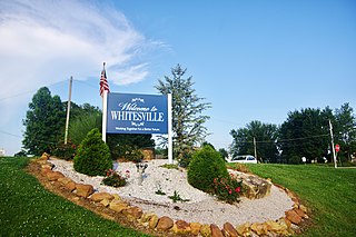
Whitesville is a home rule-class city in Daviess County, Kentucky, United States. The population was 552 at the 2010 census, down from 632 at the 2000 census. It is included in the Owensboro, Kentucky Metropolitan Statistical Area. The city was founded in 1844 by Dr. William White, and named for him. The current mayor of Whitesville is Patsy Mayfield.

<span class="mw-page-title-main">Brownsville, Kentucky</span> City in Kentucky, United States

Brownsville is a home rule-class city in Edmonson County, Kentucky, in the United States. It is the county seat and is a certified Kentucky Trail Town. The population was 836 at the time of the 2010 census, down from 921 at the 2000 census. It is included in the Bowling Green metropolitan area. It is just outside Mammoth Cave National Park.

<span class="mw-page-title-main">Hawesville, Kentucky</span> City in Kentucky, United States

Hawesville is a home rule-class city on the south bank of the Ohio River in Hancock County, Kentucky, in the United States. It is the seat of its county. The population was 945 at the 2010 census. It is included in the Owensboro metropolitan area.

<span class="mw-page-title-main">Vine Grove, Kentucky</span> City in Kentucky, United States

Vine Grove is a home rule-class city in Hardin County, Kentucky, United States. The population was 6,559 as of the 2020 Census, up from 4,520 at the 2010 census,. It is part of the Elizabethtown–Fort Knox Metropolitan Statistical Area.

<span class="mw-page-title-main">Munfordville, Kentucky</span> City in Kentucky, United States

Munfordville is a home rule-class city in, and the county seat of, Hart County, Kentucky, United States. The population was 1,615 at the 2010 U.S. census.

<span class="mw-page-title-main">Auburn, Kentucky</span> City in Kentucky, United States

Auburn is a home rule-class city in Logan County, Kentucky, in the United States. The population was 1,340 at the 2010 census.

<span class="mw-page-title-main">Brandenburg, Kentucky</span> City in Kentucky, United States

Brandenburg is a home rule-class city on the Ohio River in Meade County, Kentucky, in the United States. The city is 40 miles (64 km) southwest of Louisville. It is the seat of its county. The population was 2,894 at the 2020 census.

<span class="mw-page-title-main">Oakland, Kentucky</span> City in Kentucky, United States

Oakland is a home rule-class city in Warren County, Kentucky, in the United States. The population was 198 during the 2020 Census. It is included in the Bowling Green metropolitan area.

<span class="mw-page-title-main">Plum Springs, Kentucky</span> City in Kentucky, United States

Plum Springs is a home rule-class city in Warren County, Kentucky, in the United States. The population was 497 as of the 2020 Census. It is included in the Bowling Green metropolitan area. It is named for its location on Plum Springs Road.
<span class="mw-page-title-main">Woodburn, Kentucky</span> City in Kentucky, United States

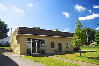
Woodburn is a home rule-class city in Warren County, Kentucky, United States. The population was 303 as of the 2020 Census. It is included in the Bowling Green, Kentucky Metropolitan Statistical Area.

<span class="mw-page-title-main">Grove City, Minnesota</span> City in Minnesota, United States

Grove City is a city in Meeker County, Minnesota, United States. Most of the city lies in Acton Township, with the northern portion in Swede Grove Township. The population was 624 at the 2020 census.

<span class="mw-page-title-main">Grain Valley, Missouri</span> City in Missouri, United States

Grain Valley is a city in Jackson County, Missouri, United States. Grain Valley is located in the Kansas City Metropolitan Area and is a suburb of Kansas City. The population was 12,854 at the 2010 census and an estimated 15,627 in 2020. It is 23 miles (37 km) east of downtown Kansas City.

References

  1. "2020 U.S. Gazetteer Files". United States Census Bureau. Retrieved March 18, 2022.
  2. "US Gazetteer files: 2010, 2000, and 1990". United States Census Bureau. February 12, 2011. Retrieved April 23, 2011.
  3. "Census of Population and Housing". Census.gov. Retrieved June 4, 2015.
  4. "U.S. Census website". United States Census Bureau . Retrieved January 31, 2008.
  5. "Kentucky Public Library Directory". Kentucky Department for Libraries and Archives. Archived from the original on January 11, 2019. Retrieved June 7, 2019.

Further reading