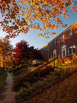
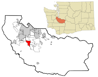
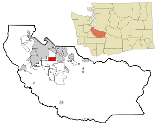
South Hill is a census-designated place (CDP) in Pierce County, Washington, immediately south of Puyallup. The population was 64,708 at time of the 2020 census, up from 52,431 in 2010.[3] The area primarily consists of suburban housing and shopping with several retail shopping centers, residential neighborhoods, and apartment/condo complexes throughout.
Most commercial areas are located along the main thoroughfare, Meridian Avenue (SR161). Major neighborhoods include Manorwood, Sunrise (Sunrise Master Association), Lipoma Firs, Silvercreek, and Gem Heights. There are also a few popular public parks: Bradley Lake Park, South Hill Community Park/Nathan Chapman Memorial Trail and Wildwood Park.
The area was first settled in the 1880s after a military road was built through the area in the 1850s. Several logging camps, farms, and hunting grounds sprouted up as the area was settled. It also was the main route to the towns of Kapowsin and Eatonville (Meridian Avenue or SR 161). Population growth was slow until after World War II, when roads improved and people could commute to nearby Tacoma, Fort Lewis, and Seattle.
The community's name describes its location above the south side of the Puyallup River valley. This also contrasts with the nearby Edgewood and Milton areas, which are known informally as North Hill.
According to the United States Census Bureau, the CDP has a total area of 18.1square miles (46.8km2), of which, 18.0square miles (46.6km2) of it is land and 0.1square miles (0.2km2) of it (0.39%) is water.
Climate
Climate data for McMillin Reservoir, Washington, 1991–2020 normals, extremes 1941–present
As of the census[1] of 2000, there were 31,623 people, 10,929 households, and 8,721 families residing in the CDP. The population density was 1,756.3 people per square mile (677.9/km2). There were 11,398 housing units at an average density of 633.0/sqmi (244.4/km2). The racial makeup of the CDP was 87.41% White, 2.42% African American, 0.94% Native American, 3.36% Asian, 0.49% Pacific Islander, 1.45% from other races, and 3.94% from two or more races. Hispanic or Latino of any race were 4.13% of the population.
There were 10,929 households, out of which 45.7% had children under the age of 18 living with them, 65.3% were married couples living together, 9.8% had a female householder with no husband present, and 20.2% were non-families. 15.1% of all households were made up of individuals, and 4.4% had someone living alone who was 65 years of age or older. The average household size was 2.89 and the average family size was 3.20.
In the CDP, the age distribution of the population shows 31.3% under the age of 18, 7.6% from 18 to 24, 33.9% from 25 to 44, 20.4% from 45 to 64, and 6.9% who were 65 years of age or older. The median age was 33 years. For every 100 females, there were 97.4 males. For every 100 females age 18 and over, there were 93.8 males.
The median income for a household in the CDP was $60,524, and the median income for a family was $64,544. Males had a median income of $45,637 versus $30,306 for females. The per capita income for the CDP was $22,700. About 2.6% of families and 4.2% of the population were below the poverty line, including 4.6% of those under age 18 and 3.2% of those age 65 or over.
2010 Census
As of the census of 2010,[8] there were 52,431 people, 17,962 households, and 13,990 families residing in the CDP. There were 19,081 housing. The racial makeup of the CDP was 78.2% White, 4.3% African American, 1.0% Native American, 6.0% Asian, 1.1% Pacific Islander, 3.1% from other races, and 6.5% from two or more races. Hispanic or Latino of any race were 8.5% of the population.
There were 17,962 households, out of which 45.7% had children under the age of 18 living with them, 60.6% were married couples living together, 11.7% had a female householder with no husband present, and 22.1% were non-families. 16.1% of all households were made up of individuals, and 4.9% had someone living alone who was 65 years of age or older. The average household size was 2.92 and the average family size was 3.25.
In the CDP, the age distribution of the population shows 29.7% under the age of 18, 70.3% over the age of 18, and 7.7% who were 65 years of age or older. The median age was 33.6 years.
2009–2013 American Community Survey
According to the 2013 American Community Survey Estimates,[9] the median income for a household in the CDP was $72,789, and the median income for a family was $87,874. Males had a median income of $59,965 versus $41,749 for females. The per capita income for the CDP was $28,201. About 6.1% of families and 8.4% of the population were below the poverty line.
The Puyallup School District is the public school district for South Hill.[10]Governor John R. Rogers High School and Emerald Ridge High School are both located in South Hill, as well as three junior high schools: Glacier View Junior High, Stahl Junior High, and Ballou Junior High, and several elementary schools. Elementary schools include Hunt Elementary, Edgerton Elementary, Carson Elementary, Pope Elementary, Brouillet Elementary, Firgrove Elementary, Zeiger Elementary, Ridgecrest Elementary, and Dessie F. Evans Elementary.
History
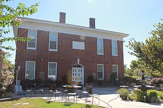
South Hill Historical Society gathers data and memories on the history of South Hill.
Major events
1853- Longmire-Biles wagon train crosses South Hill
1870- South Hill inhabited
1895- Firgrove School District is established
1905- Main route through South Hill named Ball-Wood Road
1909- Tacoma-Puyallup Interurban Line rail operates through South Hill
1930- SagMiller Airstrip opens
1944- Thun Field opens (Pierce County Airport today), although John Thun doesn't buy it until 1949
1945- Japan uses balloon bomb system to bomb mainland USA in World War II, and two of the bombs landed in South Hill [11]
1950- Firgrove School District consolidates with Puyallup School District
1972- State Route 512 is completed
1986- EPA places Pierce County Landfill in South Hill on the National Priorities List [12]
1998- Proposal for South Hill's incorporation into Southview is defeated by voters [13]
Parks and recreation
South Hill is home to three major parks owned and operated by Pierce County.
Heritage Recreation Center is a 40-acre sports complex with baseball fields, soccer fields, and multi-purpose fields located between Rogers High School and Zeiger Elementary School.[14]
South Hill Community Park is a 40-acre park with a playground, two soccer fields, and both the South Hill Loop Trail and the Nathan Chapman Memorial Trail, a 1.6 mile paved pathway through forest and wetlands that connects the park to the Heritage Recreation Center. According to the Pierce County website, the Nathan Chapman Memorial Trail was named after Sgt. Nathan Chapman, a South Hill resident and the first American soldier to die in the war in Afghanistan.[15]
Meridian Habitat Park & Community Center is a 36-acre park located on State Route 161.[16] The site was previously an amphitheatre owned by Champion Center Church and home to the annual Jesus of Nazareth passion play from 1982 to 2006. The church sold the amphitheatre to Pierce County for $6.9 million in 2006, but the stage caught fire and was destroyed by an electric fire in 2007.[17]
Bradley Lake Park and Wildwood Park are within the city limits of Puyallup.
Melanie Stambaugh - Elected to the Washington state House of Representatives in November 2014
Brandon Gibson - Rogers High school graduate, notable football and basketball player at Washington State University. Sixth-round draft pick in the 2009 NFL Draft.
Related Research Articles
Pierce County is a county in the U.S. state of Washington. As of the 2020 census, the population was 921,130, up from 795,225 in 2010, making it the second-most populous county in Washington, behind King County, and the 60th-most populous in the United States. The county seat and largest city is Tacoma. Formed out of Thurston County on December 22, 1852, by the legislature of Oregon Territory, it was named for U.S. President Franklin Pierce. Pierce County is in the Seattle metropolitan area.
Naranja is an unincorporated community and census-designated place (CDP) in Miami-Dade County, Florida, United States. Many orange groves were once located in this area, so the community name came from the Spanish word for orange, naranja, though the pronunciation among the local residents is "Na-Ran-Jah". Naranja was also a stop for the Florida East Coast Railroad that once ran through this area. The population was 13,509 at the 2020 census, up from 8,303 in 2010.
North Decatur is a census-designated place (CDP) in DeKalb County, Georgia, United States. The population was 16,698 at the 2010 census.
Parkville is an unincorporated community and census-designated place in Baltimore County, Maryland, United States. As of the 2010 census, the population was 30,734.
Coral Hills is an unincorporated area and census-designated place (CDP) in Prince George's County, Maryland, United States. As of the 2020 census, the population was 9,997.
Carrollwood is a census-designated place (CDP) in northwestern Hillsborough County, Florida, United States. The population was 33,365 at the 2010 census. The census area includes the unincorporated communities of Carrollwood and Carrollwood Village. For the 2000 census the area was enumerated under the name "Greater Carrollwood" and had a population of 33,519. A similar area was listed as "Lake Carroll" in 1970 and 1980; for the 1990 census it was split into the smaller Carrollwood and Carrollwood Village CDPs.
Ooltewah is a census-designated place (CDP) in Hamilton County, Tennessee, United States. It is a community near Chattanooga. The population was 684 at the 2020 census. Ooltewah is an enclave in the city of Collegedale.
Bryn Mawr-Skyway is a census-designated place (CDP) in King County, Washington, United States. The population was 17,397 at the 2020 census.
White Center is a census-designated place (CDP) in King County, Washington, United States. It lies between West Seattle and Burien. The population was 16,631 at the 2020 census.
Manchester is an unincorporated community and census-designated place (CDP) in Kitsap County, Washington, United States. The population was 5,714 at the 2020 census. Manchester is located on the Puget Sound approximately 10 miles from downtown Seattle, and is adjacent to county seat Port Orchard to its east. Today, Manchester labels itself as a village. It is small in size but is home to a Kitsap Regional Library (KRL) branch, a post office, an elementary school, and a beachfront park to serve its residents.
Edgewood is a city in Pierce County, Washington, United States. The population was 12,327 at the 2020 census. Neighboring towns include Fife to the west, Milton to the northwest, Federal Way to the north, Sumner to the east, and Puyallup to the south.
Elk Plain is a census-designated place (CDP) in Pierce County, Washington, United States. The population was 14,534 at the 2020 census.
Frederickson is a census-designated place (CDP) in Pierce County, Washington, United States. The population was 24,906 at the 2020 census.
Graham is a census-designated place (CDP) in Pierce County, Washington, United States. It is located 16 miles southeast of Tacoma. The population was 23,491 at the 2010 census and grew to 32,658 at the 2020 census.
Midland is a census-designated place (CDP) in Pierce County, Washington. The population was 9,962 at the time of the 2020 census.
Parkland is a census-designated place (CDP) in Pierce County, Washington. The population was 35,803 at the time of the 2010 census and had grown to 38,623 as of the 2020 census. It is an unincorporated suburb of the city of Tacoma and is home to Pacific Lutheran University.
Puyallup is a city in Pierce County, Washington, United States, located about 10 miles southeast of Tacoma and 35 miles south of Seattle. It had a population of 42,973 at the 2020 census. The city's name comes from the Puyallup Tribe of Native Americans and means "the generous people." Puyallup is home to the Washington State Fair, the state's largest fair. The name of the city is notably used in mailing addresses for adjacent unincorporated areas, such as the larger-populated South Hill.
Spanaway is a census-designated place (CDP) in Pierce County, Washington, United States. The population was 35,476 at the 2020 census, up from 27,227 in 2010. Spanaway is an unincorporated area near Tacoma, and is often identified together with the more urban, less wealthy Parkland.
Summit is a census-designated place (CDP) in Pierce County, Washington, United States. The population was 8,270 at the 2020 census.
Waller is a census-designated place (CDP) in Pierce County, Washington, United States. The population was 8,189 at the 2020 census. The population has seen significant growth in the last decade.
This page is based on this Wikipedia article Text is available under the CC BY-SA 4.0 license; additional terms may apply. Images, videos and audio are available under their respective licenses.