University Place, Washington

Last updated
University Place, Washington
Chambers Bay Golf Course Setup Staging (18000263879).jpg
Chambers Bay Golf Course
Pierce County Washington Incorporated and Unincorporated areas University Place Highlighted.svg
Location of University Place, Washington
Coordinates: 47°13′10″N122°32′30″W / 47.21944°N 122.54167°W / 47.21944; -122.54167 Coordinates: 47°13′10″N122°32′30″W / 47.21944°N 122.54167°W / 47.21944; -122.54167
CountryUnited States
State Washington
County Pierce
Government
  Type Council–manager [1]
   Mayor Steve Worthington [1]
Area
[2]
  Total8.51 sq mi (22.03 km2)
  Land8.34 sq mi (21.60 km2)
  Water0.17 sq mi (0.44 km2)
Elevation
200 ft (61 m)
Population
 (2020) [3]
  Total34,866
  Estimate 
(2021) [4]
34,900
  Density4,076.86/sq mi (1,574.17/km2)
Time zone UTC-8 (PST)
  Summer (DST) UTC-7 (PDT)
ZIP codes
98464, 98466, 98467
Area code 253
FIPS code 53-73465
GNIS feature ID1512752 [5]
Website cityofup.com

University Place is a city in Pierce County, Washington, United States. Its population was 34,866 at the 2020 census. [3]

Contents

Based on per capita income, University Place ranks 81st of 522 areas in the state of Washington to be ranked.

History

University Place received its name in the 1800s when the University of Puget Sound, a private liberal-arts college in North Tacoma, purchased land along the primary north–south route of Grandview Drive. The school sought to build a new campus there, but ended up selling the land back to the city for about $11,000. University Place remained an unincorporated part of Pierce County until the City of University Place was formed on August 31, 1995. [6]

Today, University Place is largely suburban in character and functions as a mixed business and residential area with waterfront on the Puget Sound. The town is home to Curtis Senior High School and Charles Wright Academy.

Chambers Bay golf course opened in 2007 to favorable reviews. [7] A Scottish links-style course, Chambers Bay hosted the 2010 U.S. Amateur and the 2015 U.S. Open. [8]

University Place's news is primarily covered by The News Tribune (Tacoma), and is also covered by University Place Patch, a hyper-local news website that launched in October 2010, and sometimes by news media in Seattle. Earlier newspapers for the community were the weekly Suburban Times (1970s), published by Dave Sclair (who, starting in 1970, also published Western Flyer); and, in the 1980s, the Lakewood Press, published by Grace T. Eubanks and later Dane S. Claussen, which launched the University Place Press as a monthly and then biweekly before it folded in early 1989.

Geography

University Place is located at 47°13′10″N122°32′30″W / 47.21944°N 122.54167°W / 47.21944; -122.54167 (47.219545, -122.541610). [9]

According to the United States Census Bureau, the city has a total area of 8.56 square miles (22.17 km2), of which, 8.42 square miles (21.81 km2) is land and 0.14 square miles (0.36 km2) is water. [10]

Demographics

Historical population
CensusPop.Note
1970 13,230
1980 20,38154.1%
1990 27,70135.9%
2000 29,9338.1%
2010 31,1444.0%
2020 34,86612.0%
2021 (est.)34,900 [4] 0.1%
U.S. Decennial Census [11]
2020 Census [3]

2010 census

As of the census [12] of 2010, there were 31,144 people, 12,819 households, and 8,476 families living in the city. The population density was 3,698.8 inhabitants per square mile (1,428.1/km2). There were 13,573 housing units at an average density of 1,612.0 per square mile (622.4/km2). The racial makeup of the city was 71.0% White, 8.5% African American, 0.8% Native American, 9.0% Asian, 0.8% Pacific Islander, 1.7% from other races, and 8.2% from two or more races. Hispanic or Latino of any race were 6.7% of the population.

There were 12,819 households, of which 32.7% had children under the age of 18 living with them, 47.9% were married couples living together, 14.0% had a female householder with no husband present, 4.2% had a male householder with no wife present, and 33.9% were non-families. 27.7% of all households were made up of individuals, and 9.5% had someone living alone who was 65 years of age or older. The average household size was 2.41 and the average family size was 2.94.

The median age in the city was 39.4 years. 23.6% of residents were under the age of 18; 9.3% were between the ages of 18 and 24; 24.3% were from 25 to 44; 28.9% were from 45 to 64; and 14.1% were 65 years of age or older. The gender makeup of the city was 47.0% male and 53.0% female.

2000 census

As of the census of 2000, there were 29,933 people, 12,149 households, and 8,212 families living in the city. The population density was 3,569.0 people per square mile (1,377.5/km2). There were 12,684 housing units at an average density of 1,512.4 per square mile (583.7/km2). The racial makeup of the city was 75.87% White, 8.74% African American, 0.72% Native American, 7.47% Asian, 0.56% Pacific Islander, 1.35% from other races, and 5.29% from two or more races. Hispanic or Latino of any race were 3.84% of the population.

There were 12,149 households, out of which 34.7% had children under the age of 18 living with them, 51.6% were married couples living together, 12.7% had a female householder with no husband present, and 32.4% were non-families. 26.1% of all households were made up of individuals, and 7.3% had someone living alone who was 65 years of age or older. The average household size was 2.45 and the average family size was 2.97.

In the city, the age distribution of the population shows 26.0% under the age of 18, 9.2% from 18 to 24, 28.6% from 25 to 44, 25.0% from 45 to 64, and 11.2% who were 65 years of age or older. The median age was 36 years. For every 100 females, there were 91.0 males. For every 100 females age 18 and over, there were 86.5 males.

The median income for a household in the city was $50,287, and the median income for a family was $60,401. Males had a median income of $42,452 versus $30,045 for females. The per capita income for the city was $25,544. About 6.0% of families and 7.3% of the population were below the poverty line, including 9.5% of those under age 18 and 3.8% of those age 65 or over.

Education

Most of University Place is in the University Place School District, [13] which manages eight public schools. Primary schools teach kindergarten through fourth grade. Intermediate schools teach grades five through seven. Junior high is grades eight and nine. High school students are in grades ten through twelve. [14]

Portions are in Tacoma Public Schools and in the Steilacoom Historical School District. [13]

Notable people

Related Research Articles

<span class="mw-page-title-main">Chambers County, Alabama</span> County in Alabama, United States

Chambers County is a county located in the east central portion of the U.S. state of Alabama. As of the 2020 census the population was 34,772. Its county seat is LaFayette. Its largest city is Valley. Its name is in honor of Henry H. Chambers, who served as a United States Senator from Alabama.

<span class="mw-page-title-main">Tallapoosa County, Alabama</span> County in Alabama, United States

Tallapoosa County is located in the east-central portion of the U.S. state of Alabama. As of the 2020 census, the population was 41,311. Its county seat is Dadeville. Its largest city is Alexander City.

<span class="mw-page-title-main">Hancock County, Kentucky</span> County in Kentucky, United States

Hancock County, Kentucky is a county located in the U.S. state of Kentucky. As of the 2020 census, the population was 9,095. Its county seat is in the city of Hawesville located in the Northern part of the county, and its largest city of Lewisport is located in the Northwestern part of the county.

<span class="mw-page-title-main">Rockford, Alabama</span> Town in Alabama, United States

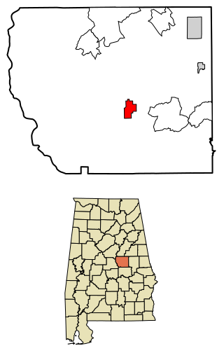
Rockford is a town in Coosa County, Alabama, United States. At the 2020 census, the population was 349. The town is the county seat of Coosa County and is part of the Talladega-Sylacauga Micropolitan Statistical Area.

<span class="mw-page-title-main">Chambers, Nebraska</span> Village in Nebraska, United States

Chambers is a village in Holt County, Nebraska, United States. The population was 268 at the 2010 census.

<span class="mw-page-title-main">Lake Morton-Berrydale, Washington</span> Census-designated place in Washington, United States

Lake Morton-Berrydale is a census-designated place (CDP) in King County, Washington, United States. The population was 10,474 at the 2020 census.

<span class="mw-page-title-main">Lakeland South, Washington</span> Census-designated place in Washington, United States

Lakeland South is a census-designated place (CDP) in King County, Washington, United States. The population was 11,574 at the 2010 census.

<span class="mw-page-title-main">Normandy Park, Washington</span> City in Washington, United States

Normandy Park is a city in King County, Washington, United States. The population was 6,771 at the 2010 census.

<span class="mw-page-title-main">Tukwila, Washington</span> City in Washington, United States

Tukwila is a suburban city in King County, Washington, United States, located immediately to the south of Seattle. The population was 21,798 at the 2020 census.

<span class="mw-page-title-main">Navy Yard City, Washington</span> Census-designated place in Washington, United States

Navy Yard City is a census-designated place (CDP) in Kitsap County, Washington, United States. The population was 2,477 at the 2010 census.

<span class="mw-page-title-main">Elk Plain, Washington</span> CDP in Washington, United States

Elk Plain is a census-designated place (CDP) in Pierce County, Washington, United States. The population was 14,534 at the 2020 census.

<span class="mw-page-title-main">Fife, Washington</span> City in Washington, United States

Fife is a city in Pierce County, Washington, United States and a suburb of Tacoma. The population was 10,999 at the 2020 census. Fife is contained within the Puyallup Indian Reservation.

<span class="mw-page-title-main">Fircrest, Washington</span> City in Washington, United States

Fircrest is a city in Pierce County, Washington, United States. The population was 7,156 at the 2020 census.

<span class="mw-page-title-main">Frederickson, Washington</span> CDP in Washington, United States

Frederickson is a census-designated place (CDP) in Pierce County, Washington, United States. The population was 24,906 at the 2020 census.

<span class="mw-page-title-main">Lakewood, Washington</span> City in Washington, United States

Lakewood is a city in Pierce County, Washington, United States. The population was 63,612 at the 2020 census.

<span class="mw-page-title-main">Parkland, Washington</span> Census-designated place in Washington, United States

Parkland is a census-designated place (CDP) in Pierce County, Washington. The population was 35,803 at the time of the 2010 census and had grown to 38,623 as of the 2020 census. It is an unincorporated suburb of the city of Tacoma and is home to Pacific Lutheran University.

<span class="mw-page-title-main">Roy, Washington</span> City in Washington, United States

Roy is a city in Pierce County, Washington, United States. The population was 816 at the 2020 census.

<span class="mw-page-title-main">Ruston, Washington</span> Town in Washington, United States

Ruston is a city in Pierce County, Washington, United States. The population was 1,055 at the 2020 census.

<span class="mw-page-title-main">Steilacoom, Washington</span> Town in Washington, United States

Steilacoom is a town in Pierce County, Washington, United States. The population was 6,727 at the 2020 census. Steilacoom incorporated in 1854 and became the first incorporated town in what is now the state of Washington. It has also become a bedroom community for service members stationed at Joint Base Lewis–McChord.

<span class="mw-page-title-main">Sumner, Washington</span> City in Washington, United States

Sumner is a city in northern Pierce County, Washington, United States. The population was 10,621 at the 2020 census. Nearby cities include Puyallup to the west, Auburn to the north, and Bonney Lake to the east.

References

  1. 1 2 "City Council". City of University Place. Retrieved April 3, 2022.
  2. "2019 U.S. Gazetteer Files". United States Census Bureau. Retrieved August 7, 2020.
  3. 1 2 3 "Explore Census Data". United States Census Bureau . Retrieved May 16, 2022.
  4. 1 2 "City and Town Population Totals: 2020-2021". United States Census Bureau. June 22, 2022. Retrieved June 22, 2022.
  5. "US Board on Geographic Names". United States Geological Survey. October 25, 2007. Retrieved January 31, 2008.
  6. "History | University Place". www.cityofup.com. Retrieved June 16, 2019.
  7. "Chambers Bay first impressions: Wow!", Brent Champaco, Tacoma The News Tribune, June 24, 2007
  8. "Chambers Bay: Links on Puget Sound Cause More than a Ripple", Crai Bower, Washington CEO, October 17, 2007
  9. "US Gazetteer files: 2010, 2000, and 1990". United States Census Bureau. February 12, 2011. Retrieved April 23, 2011.
  10. "US Gazetteer files 2010". United States Census Bureau. Archived from the original on January 25, 2012. Retrieved December 19, 2012.
  11. United States Census Bureau. "Census of Population and Housing" . Retrieved June 4, 2016.
  12. "U.S. Census website". United States Census Bureau . Retrieved December 19, 2012.
  13. 1 2 "2020 CENSUS - SCHOOL DISTRICT REFERENCE MAP: Pierce County, WA" (PDF). U.S. Census Bureau. pp. 1-2 (PDF p. 2-3/4). Retrieved 2022-07-20.
  14. "University Place School District, Schools" . Retrieved January 21, 2009.
  15. "National Women's Soccer League Official Site | NWSL".