Terryville, New York

Last updated
Terryville, New York
Terryville NY Fire Dept Bdlg in 2021.jpg
The Terryville Fire Department in 2021.
USA New York location map.svg
Red pog.svg
Terryville, New York
Location of Terryville in New York.
Coordinates: 40°54′19″N73°3′55″W / 40.90528°N 73.06528°W / 40.90528; -73.06528 Coordinates: 40°54′19″N73°3′55″W / 40.90528°N 73.06528°W / 40.90528; -73.06528
CountryFlag of the United States.svg  United States
StateFlag of New York.svg  New York
Region Suffolk
Town Brookhaven
Area
[1]
  Total3.15 sq mi (8.17 km2)
  Land3.15 sq mi (8.17 km2)
  Water0.00 sq mi (0.00 km2)
Population
 (2020)
  Total11,472
  Density3,636.13/sq mi (1,404.02/km2)
Time zone UTC-5 (EST)
  Summer (DST) UTC-4 (EDT)
Postal code
11776
Area codes 631
934
FIPS code 36-73352

Terryville is a census-designated place (CDP) in the Town of Brookhaven, Suffolk County, New York, United States. The population was 11,849 at the 2010 census. [2]

Contents

Geography

According to the United States Census Bureau, the CDP has a total area of 3.2 square miles (8.3 km2), all land.

Demographics

Historical population
CensusPop.
2020 11,472
U.S. Decennial Census [3]

As of the census [4] of 2000, there were 10,589 people, 3,313 households, and 2,739 families residing in the CDP. The population density was 3,295.6 per square mile (1,273.7/km2). There were 3,437 housing units at an average density of 1,069.7/sq mi (413.4/km2). The racial makeup of the CDP was 91.81% White, 1.62% African American, 0.10% Native American, 2.29% Asian, 0.01% Pacific Islander, 2.67% from other races, and 1.49% from two or more races. Hispanic or Latino of any race were 7.51% of the population.

There were 3,313 households, of which 41.4% had children under the age of 18 living with them, 71.1% were married couples living together, 8.3% had a female householder with no husband present, and 17.3% were non-families. 13.6% of all households were made up of individuals, and 4.9% had someone living alone who was 65 years of age or older. The average household size was 3.18 and the average family size was 3.49.

In the CDP, the population was spread out, with 27.4% under the age of 18, 7.3% from 18 to 24, 33.5% from 25 to 44, 23.3% from 45 to 64, and 8.4% who were 65 years of age or older. The median age was 35 years. For every 100 females, there were 97.7 males. For every 100 females age 18 and over, there were 96.5 males.

The median income for a household in the CDP was $68,034, and the median income for a family was $71,160. Males had a median income of $47,500 versus $32,332 for females. The per capita income for the CDP was $24,422. About 2.1% of families and 3.2% of the population were below the poverty line, including 4.2% of those under age 18 and 1.6% of those age 65 or over.

Education

Terryville is served primarily by the Brookhaven–Comsewogue Union Free School District. [5] However, small parts of the southern and western sections are served by the Middle Country Central School District and the Three Village Central School District, respectively. [5]

Related Research Articles

<span class="mw-page-title-main">Littletown, Arizona</span> CDP in Pima County, Arizona

Littletown was a census-designated place (CDP) in Pima County, Arizona, United States. The population was 1,010 at the 2000 census. The area was annexed into Tucson in 2017.

<span class="mw-page-title-main">Terryville, Connecticut</span> Census-designated place in Connecticut, United States

Terryville is a census-designated place (CDP) in Litchfield County, Connecticut, United States, and is the largest village within the town of Plymouth. In the 2010 census, Terryville had a population of 5,387, out of 12,243 in the entire town of Plymouth. The village is named for Eli Terry Jr., the son of the well-known clockmaker Eli Terry Sr. Terryville is also home to the Lock Museum of America. There is a water wheel located in downtown Terryville that is dedicated to the son of Eli Terry Sr.

Roosevelt Gardens is a census-designated place (CDP) in Broward County, Florida, United States. The population was 2,456 at the 2010 census.
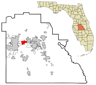
<span class="mw-page-title-main">Fussels Corner, Florida</span> Census-designated place in Florida, United States

Fussels Corner is a census-designated place (CDP) in Polk County, Florida, United States. The population was 5,313 at time of the 2000 census. It is part of the Lakeland–Winter Haven Metropolitan Statistical Area.

<span class="mw-page-title-main">Victory Lakes, New Jersey</span> Census-designated place in New Jersey, United States

Victory Lakes is an unincorporated community and census-designated place (CDP) located within Monroe Township, in Gloucester County, New Jersey, United States. As of the 2010 United States Census, the CDP's population was 2,111.

<span class="mw-page-title-main">Holiday Heights, New Jersey</span> Census-designated place in New Jersey, United States

Holiday Heights is an unincorporated community and census-designated place (CDP) located within Berkeley Township, in Ocean County, New Jersey, United States. As of the 2010 United States Census, the CDP's population was 2,099.
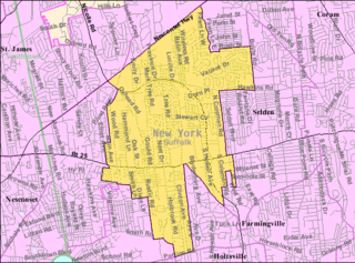
<span class="mw-page-title-main">Centereach, New York</span> Hamlet and census-designated place in New York, United States

Centereach is a hamlet and census-designated place in Suffolk County, New York, United States. The population was 31,578 at the 2010 census.

<span class="mw-page-title-main">Coram, New York</span> Hamlet and census-designated place in New York, United States

Coram is a hamlet and census-designated place in the town of Brookhaven, Suffolk County, Long Island, New York, United States. As of the 2010 United States census, the CDP population was 39,113.

<span class="mw-page-title-main">East Shoreham, New York</span> Hamlet and census-designated place in New York, United States

East Shoreham is a hamlet and census-designated place (CDP) in the Suffolk County town of Brookhaven, New York, United States. The population was 6,841 at the 2020 census.

<span class="mw-page-title-main">Mastic, New York</span> Hamlet and census-designated place in New York, United States

Mastic is a hamlet and a census-designated place (CDP) in the southeastern part of the town of Brookhaven in central Suffolk County, New York, United States. The population was 15,481 at the 2010 census.

<span class="mw-page-title-main">North Patchogue, New York</span> Hamlet and census-designated place in New York, United States

North Patchogue is a hamlet and census-designated place (CDP) located within the Town of Brookhaven, in Suffolk County, New York, United States. The CDP population was 7,246 at the 2010 census.

<span class="mw-page-title-main">Port Jefferson Station, New York</span> Hamlet & census-designated place in New York, United States

Port Jefferson Station is a hamlet and census-designated place (CDP) in the Town of Brookhaven, in Suffolk County, in New York, United States. The population was 7,838 as of the 2010 census.
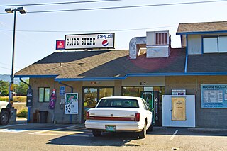
<span class="mw-page-title-main">Glide, Oregon</span> Census-designated place in Oregon, United States

Glide is a census-designated place (CDP) in Douglas County, Oregon, United States. The population was 1,795 at the 2010 census.

<span class="mw-page-title-main">Marion, Oregon</span> Unincorporated community in the state of Oregon, United States

Marion is an unincorporated community in Marion County, Oregon, United States. For statistical purposes, the United States Census Bureau has defined Marion as a census-designated place (CDP). The census definition of the area may not precisely correspond to local understanding of the area with the same name. The population was 313 at the 2010 census. Marion is part of the Salem Metropolitan Statistical Area.

Forestville is a census-designated place (CDP) in Schuylkill County, Pennsylvania, United States. The population was 431 at the 2000 census.
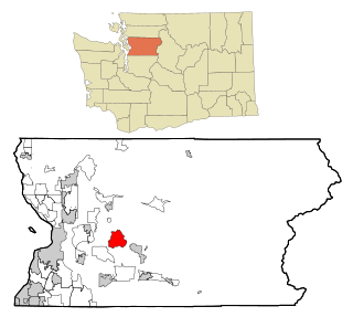
<span class="mw-page-title-main">Lake Roesiger, Washington</span> CDP in Washington, United States

Lake Roesiger is a census-designated place (CDP) in Snohomish County, Washington, United States. The population was 503 at the 2010 census.

<span class="mw-page-title-main">Lochsloy, Washington</span> CDP in Washington, United States

Lochsloy is a census-designated place (CDP) in Snohomish County, Washington, United States. The population was 2,533 at the 2010 census.

<span class="mw-page-title-main">Red Jacket, West Virginia</span> Census-designated place in West Virginia, United States

Red Jacket is a census-designated place (CDP) in Mingo County, West Virginia, United States. The population was 581 at the 2010 census. The community was named for Red Jacket, a Seneca chief.
<span class="mw-page-title-main">Brookhaven, West Virginia</span> CDP in West Virginia

Brookhaven is a census-designated place (CDP) in Monongalia County, West Virginia, United States. The population was 5,171 at the 2010 census. It is included in the Morgantown, West Virginia Metropolitan Statistical Area.
<span class="mw-page-title-main">Brookhaven (CDP), New York</span> Hamlet and census-designated place in New York, United States

Brookhaven is a hamlet and census-designated place in Suffolk County, New York, United States. The population was 3,451 at the 2010 census.

References

  1. "ArcGIS REST Services Directory". United States Census Bureau. Retrieved September 20, 2022.
  2. "Geographic Identifiers: 2010 Demographic Profile Data (G001): Terryville CDP, New York". U.S. Census Bureau, American Factfinder. Archived from the original on 2020-02-12. Retrieved 2013-01-10.
  3. "Census of Population and Housing". Census.gov. Retrieved June 4, 2016.
  4. "U.S. Census website". United States Census Bureau . Retrieved 2008-01-31.
  5. 1 2 "Long Island Index: Interactive Map". www.longislandindexmaps.org. Retrieved 2021-08-04.