Wading River, New York

Last updated

Wading River, New York
Tuthill-Lapham House.JPG
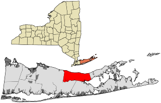
Wading-river-map.gif
Location map Long Island.png
Red pog.svg
Wading River
USA New York location map.svg
Red pog.svg
Wading River
Usa edcp location map.svg
Red pog.svg
Wading River
Coordinates: 40°57′9″N72°49′48″W / 40.95250°N 72.83000°W / 40.95250; -72.83000
Country United States
State New York
County Suffolk
Town Brookhaven and Riverhead
Area
[1]
  Total12.52 sq mi (32.41 km2)
  Land9.78 sq mi (25.33 km2)
  Water2.73 sq mi (7.08 km2)
Elevation
92 ft (28 m)
Population
 (2020)
  Total7,731
  Density790.41/sq mi (305.19/km2)
Time zone UTC-5 (Eastern (EST))
  Summer (DST) UTC-4 (EDT)
ZIP code
11792
Area code(s) 631, 934
FIPS code 36-77772
GNIS feature ID0968624
Website www.brookhavenny.gov

Wading River is a hamlet and census-designated place (CDP) in Suffolk County, New York, United States, on the North Shore of Long Island. As of the 2010 census, the CDP population was 7,719. [2] It is adjacent to Shoreham and shares a school district.

Contents

Most of Wading River lies within the Town of Riverhead, but a small portion is in the Town of Brookhaven. The name of the hamlet comes from the original Algonquian name for the area, Pauquaconsuk, meaning "the place where we wade for thick, round-shelled clams". It was also previously known as “Lonsefekwa”. "Wading in the River" or Wading River was adopted by the first English colonists.

History

1671

The earliest English records show a settlement known as Wading River was founded by eight colonial families. "The spot for the village was chosen with care. There was a stream adequate for water power and abounding in seafood...good water for drinking...soil rich enough to grow essential crops, woodland for fuel, building material and food, topography to offer protection from the elements, meadowland for its grass." [3]

Until 1947

Between 1895 and 1938, the Port Jefferson Branch of the Long Island Rail Road extended to Wading River. It was once planned to continue eastward to rejoin the Main Line at Riverhead or Calverton. From 1905 to 1928, Wading River was also the site of an LIRR demonstration farm. Another was east of Medford Station on the Main Line. The Wading River station closed in 1938. During World War II the Benson House was used by the FBI as the site of a secret counterintelligence operation to feed the Nazis deceptive information.

The hamlet of Wading River had a year-round population of less than 500. But during the summer months, hundreds of visitors filled the town to use Wildwood State Park, the cottages on the cliffs and dunes and, of course, the beaches.

It was in Wading River that Walter Lippmann wrote his books Public Opinion and The Phantom Public in the summers of 1921 and 1923 respectively [4]

1947

This year was a landmark year of change for the sleepy little hamlet; noteworthy accomplishments include:

Geography

Wading River is located at 40°57′9″N72°49′48″W / 40.95250°N 72.83000°W / 40.95250; -72.83000 (40.952599, -72.829907). [6]

According to the United States Census Bureau, the CDP has a total area of 9.8 square miles (25.5 km2), of which 0.04 square miles (0.1 km2), or 0.40%, is water. [2]

Historical population
CensusPop.Note
2020 7,731
U.S. Decennial Census [7]

Demographics

As of the census [8] of 2000, there were 6,668 people, 2,370 households, and 1,813 families residing in the CDP. The population density was 680.5 inhabitants per square mile (262.7/km2). There were 2,713 housing units at an average density of 276.9 per square mile (106.9/km2). The racial makeup of the CDP was 95.10% White, 1.96% African American, 0.04% Native American, 0.97% Asian, 0.13% Pacific Islander, 0.81% from other races, and 0.97% from two or more races. Hispanic or Latino of any race were 3.69% of the population.

There were 2,370 households, out of which 35.6% had children under the age of 18 living with them, 68.7% were married couples living together, 5.3% had a female householder with no husband present, and 23.5% were non-families. 18.7% of all households were made up of individuals, and 7.6% had someone living alone who was 65 years of age or older. The average household size was 2.75 and the average family size was 3.16.

In the CDP, the population was spread out, with 27.0% under the age of 18, 5.5% from 18 to 24, 30.7% from 25 to 44, 26.5% from 45 to 64, and 10.3% who were 65 years of age or older. The median age was 38 years. For every 100 females, there were 100.1 males. For every 100 females age 18 and over, there were 97.1 males.

The median income for a household in the CDP was $63,938, and the median income for a family was $73,059. Males had a median income of $58,214 versus $34,594 for females. The per capita income for the CDP was $26,322. About 2.0% of families and 3.1% of the population were below the poverty line, including 0.7% of those under age 18 and 1.3% of those age 65 or over.

Related Research Articles

Tribes Hill is a census-designated place (CDP) located in the Towns of Mohawk (80%) and Amsterdam (20%) in Montgomery County, New York, United States. The population was 1,003 at the 2010 census. One theory is the name is based on this location having been a gathering spot for the Mohawk nation, the dominant Iroquois tribe in the area during colonial times. Tribes Hill spans the border of the Town of Mohawk and Town of Amsterdam, approximately five miles west of the City of Amsterdam on Route 5.

<span class="mw-page-title-main">Aquebogue, New York</span> Hamlet and census-designated place in New York, United States

Aquebogue is a census-designated place (CDP) roughly corresponding to the hamlet by the same name in the Town of Riverhead in Suffolk County, on Long Island, in New York, United States. The CDP's population was 2,438 at the 2010 census.

<span class="mw-page-title-main">Baiting Hollow, New York</span> Hamlet and census-designated place in New York, United States

Baiting Hollow is a census-designated place (CDP) roughly corresponding to the hamlet by the same name in the Town of Riverhead in Suffolk County, on Long Island, in New York, United States. The CDP's population was 1,642 at the 2010 census.

<span class="mw-page-title-main">Calverton, New York</span> Hamlet and census-designated place in New York, United States

Calverton is a hamlet and census-designated place (CDP) on eastern Long Island in Suffolk County, New York, United States. The population was 6,510 at the 2010 census.

<span class="mw-page-title-main">East Patchogue, New York</span> Census-designated place in New York, United States

East Patchogue is a census-designated place (CDP) in the Town of Brookhaven in Suffolk County, on the South Shore of Long Island, in New York, United States. The population was 22,469 at the 2010 census. The CDP is a proximate representation of the East Patchogue hamlet used for statistical purposes of the Census Bureau.

<span class="mw-page-title-main">East Shoreham, New York</span> Hamlet and census-designated place in New York, United States

East Shoreham is a hamlet and census-designated place (CDP) in the Suffolk County town of Brookhaven, New York, United States. The population was 6,841 at the 2020 census.

<span class="mw-page-title-main">Farmingville, New York</span> Hamlet and census-designated place in New York, United States

Farmingville is a hamlet and census-designated place (CDP) in the Suffolk County town of Brookhaven, New York, United States. The population was 15,481 at the 2010 census.

<span class="mw-page-title-main">Flanders, New York</span> Hamlet and census-designated place in New York, United States

Flanders is a hamlet and a census-designated place (CDP) in Suffolk County, New York, United States. The population was 4,472 at the 2010 census. It is the location of the Big Duck.
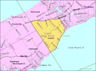
<span class="mw-page-title-main">Laurel, New York</span> Hamlet and census-designated place in New York, United States

Laurel is a census-designated place (CDP) roughly corresponding to the hamlet of Laurel in Suffolk County, New York, United States. It is located mostly within the Town of Southold, with a small portion in the Town of Riverhead. The population was 1,394 at the 2010 census.
<span class="mw-page-title-main">Manorville, New York</span> Hamlet and census-designated place in New York, United States

Manorville is a hamlet and census-designated place (CDP) in Suffolk County, New York, United States. The population was 14,314 at the 2010 census.

<span class="mw-page-title-main">Mastic, New York</span> Hamlet and census-designated place in New York, United States

Mastic is a hamlet and a census-designated place (CDP) in the southeastern part of the town of Brookhaven in central Suffolk County, New York, United States. The population was 15,481 at the 2010 census.

<span class="mw-page-title-main">Moriches, New York</span> Hamlet and census-designated place in New York, United States

Moriches is a hamlet and census-designated place (CDP) in the Suffolk County town of Brookhaven, New York, United States. The population was 2,838 at the 2010 census.

<span class="mw-page-title-main">North Patchogue, New York</span> Hamlet and census-designated place in New York, United States

North Patchogue is a hamlet and census-designated place (CDP) located within the Town of Brookhaven on Long Island, in Suffolk County, New York, United States. The CDP population was 7,246 at the 2010 census.

<span class="mw-page-title-main">Quiogue, New York</span> Hamlet and census-designated place in New York, United States

Quiogue is a hamlet and census-designated place (CDP) in the Town of Southampton, in Suffolk County, New York, United States. The population was 816 at the 2010 census. The name of the CDP was corrected from "Quioque" to "Quiogue" by the U.S. Census Bureau in 2010.

<span class="mw-page-title-main">Ridge, New York</span> Hamlet and census-designated place in New York, United States

Ridge is a hamlet and census-designated place (CDP) in the town of Brookhaven, Suffolk County, New York, United States. The population was 13,336 at the 2010 census.

<span class="mw-page-title-main">Shirley, New York</span> Hamlet and census-designated place in New York, United States

Shirley is a hamlet in Suffolk County, New York, United States. At the 2010 census, the population of Shirley was 27,854. Shirley is the western terminus of Atlantic Crossing 1, a major submarine telecommunications cable linking the United States with the UK, Germany, and the Netherlands. Soon, the Emerald Express transatlantic communications cable will provide data connectivity between Europe and North America, landing in Shirley.

<span class="mw-page-title-main">Sound Beach, New York</span> Hamlet and census-designated place in New York, United States

Sound Beach, established in 1929, is a hamlet and census-designated place (CDP) in the north part of the Town of Brookhaven in Suffolk County, New York, United States. The population of the CDP was 7,612 at the 2010 census.
<span class="mw-page-title-main">Brookhaven (CDP), New York</span> Hamlet and census-designated place in New York, United States

Brookhaven is a hamlet and census-designated place in Brookhaven Town, Suffolk County, New York, United States. The population was 3,451 at the 2010 census.
<span class="mw-page-title-main">Riverhead (CDP), New York</span> Hamlet and census-designated place in New York, United States

Riverhead is a census-designated place (CDP) roughly corresponding to the hamlet by the same name located in the Town of Riverhead in Suffolk County, on Long Island, in New York, United States. The CDP's population was 13,299 at the 2010 census.
<span class="mw-page-title-main">Riverhead, New York</span> Town in New York, United States

Riverhead is a town in Suffolk County, New York, United States, on the north shore of Long Island. Since 1727, Riverhead has been the county seat of Suffolk County, though most county offices are in Hauppauge. As of the 2020 census, the population was 35,902. The town rests on the mouth of the Peconic River, from which it derives its name. The smaller hamlet of Riverhead lies within it, and is the town's principal economic center. The town is 166 miles (267 km) southwest of Boston via the Orient Point-New London Ferry, and is 76 miles (123 km) northeast of New York City.

References

  1. "ArcGIS REST Services Directory". United States Census Bureau. Retrieved September 20, 2022.
  2. 1 2 "Geographic Identifiers: 2010 Demographic Profile Data (G001): Wading River CDP, New York". U.S. Census Bureau, American Factfinder. Archived from the original on February 12, 2020. Retrieved January 10, 2013.
  3. Newsday, written and edited by the staff of (1998). Long Island, our story : the celebrated series. Melville, N.Y.: Newsday. ISBN   9781885134141. OCLC   40145139.{{cite book}}: |first= has generic name (help)
  4. Ronald Steel. Walter Lippmann and the American Century. Boston, 1980.
  5. Wading River Historical Society (Official Site)
  6. "US Gazetteer files: 2010, 2000, and 1990". United States Census Bureau. February 12, 2011. Retrieved April 23, 2011.
  7. "Census of Population and Housing". Census.gov. Retrieved June 4, 2016.
  8. "U.S. Census website". United States Census Bureau . Retrieved January 31, 2008.