East Williamsburg is a name for the area in the northwestern portion of Brooklyn, New York City, United States. East Williamsburg consists roughly of what was the 3rd District of the Village of Williamsburgh and what is now called the East Williamsburg In-Place Industrial Park (EWIPIP), bounded by the neighborhoods of Northside and Southside Williamsburg to the west, Greenpoint to the north, Bushwick to the south and southeast, and both Maspeth and Ridgewood in Queens to the east. Much of this area is still referred to as either Bushwick, Williamsburg, or Greenpoint with the term East Williamsburg falling out of use since the 1990s.

The Flatiron District is a neighborhood in the borough of Manhattan of New York City, named after the Flatiron Building at 23rd Street, Broadway and Fifth Avenue. Generally, the Flatiron District is bounded by 14th Street, Union Square and Greenwich Village to the south; the Avenue of the Americas and Chelsea to the west; 23rd Street and Madison Square to the north; and Park Avenue South and Gramercy Park to the east.

Williamsburg is a neighborhood in the New York City borough of Brooklyn, bordered by Greenpoint to the north; Bedford–Stuyvesant to the south; Bushwick and East Williamsburg to the east; and the East River to the west. It was an independent city until 1855, when it was annexed by Brooklyn; around that time, the spelling was changed from Williamsburgh to Williamsburg.

Bushwick is a neighborhood in the northern part of the New York City borough of Brooklyn. It is bounded by the neighborhood of Ridgewood, Queens, to the northeast; Williamsburg to the northwest; East New York and the cemeteries of Highland Park to the southeast; Brownsville to the south; and Bedford–Stuyvesant to the southwest.

Ridgewood is a neighborhood in the New York City borough of Queens. It borders the Queens neighborhoods of Maspeth to the north, Middle Village to the east, and Glendale to the southeast, as well as the Brooklyn neighborhoods of Bushwick to the southwest and East Williamsburg to the west. Historically, the neighborhood straddled the Queens-Brooklyn boundary.

Ocean Hill is a subsection of Bedford–Stuyvesant in the New York City borough of Brooklyn. The neighborhood is part of Brooklyn Community Board 16 and was founded in 1890. The ZIP code for the neighborhood is 11233. Ocean Hill's boundaries start from Broadway and the neighborhood of Bushwick in the north, Ralph Avenue and the neighborhoods of Bedford–Stuyvesant proper and Crown Heights to the west, East New York Avenue and the neighborhood of Brownsville to the south, and Van Sinderen Avenue and the neighborhood of East New York to the east.

Jamaica Estates is a neighborhood in the New York City borough of Queens. Jamaica Estates is part of Queens Community District 8 and located in the northern portion of Jamaica. It is bounded by Union Turnpike to the north, Hillside Avenue to the south, Utopia Parkway and Homelawn Street to the west, and 188th Street to the east. The main road through the neighborhood is Midland Parkway.

Cabrini Boulevard spans the Manhattan neighborhood of Hudson Heights, running from West 177th Street in the south, near the George Washington Bridge, to Fort Tryon Park in the north, along an escarpment of Manhattan schist overlooking the Henry Hudson Parkway and the Hudson River. It is the westernmost city street in the neighborhood except for a one block loop formed by Chittenden Avenue between West 186th and 187th Streets.

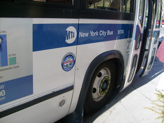
MTA Regional Bus Operations operates local and express buses serving New York City in the United States out of 29 bus depots. These depots are located in all five boroughs of the city, plus one located in nearby Yonkers in Westchester County. 21 of these depots serve MTA New York City Transit (NYCT)'s bus operations, while the remaining eight serve the MTA Bus Company These facilities perform regular maintenance, cleaning, and painting of buses, as well as collection of revenue from bus fareboxes. Several of these depots were once car barns for streetcars, while others were built much later and have only served buses. Employees of the depots are represented by local divisions of the Transport Workers Union of America (TWU), particularly the TWU Local 100 or of the Amalgamated Transit Union (ATU)'s Local's 726 for all depots in Staten Island, 1056 for Casey Stengel, Jamaica, and Queens Village Depots, 1179 for JFK & Far Rockaway Depots, and 1181 for Spring Creek Depot.

Rose Hill is a neighborhood in the New York City borough of Manhattan, between the neighborhoods of Murray Hill to the north and Gramercy Park to the south, Kips Bay to the east, the Flatiron District to the southwest, and NoMad to the northwest. The formerly unnamed area is sometimes considered to be a part of NoMad, because the name "Rose Hill" was chiefly used for the area in the 18th and 19th centuries, and is not very commonly used to refer to the area in the 2010s.

Fresh Pond was a small middle class neighborhood in the New York City borough of Queens, separated from Juniper Valley by the Lutheran and Mount Olivet cemeteries. In present day, it is now considered part of the surrounding neighborhoods of Maspeth, Middle Village, Glendale, and Ridgewood and is no longer referred to by the name "Fresh Pond." The area was originally named for two freshwater ponds that, in the early 1900s, were filled in. Other ponds were lower, and brackish due to Newtown Creek being estuarine.

The West Side Community Garden is a privately owned 501(c)(3) garden in Manhattan, New York City, United States. It is located between West 89th Street and West 90th Street in the middle of the block between Amsterdam Avenue and Columbus Avenue.

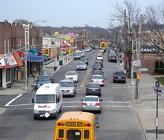
Metropolitan Avenue is a major east-west street in Queens and northern Brooklyn, New York City. Its western end is at the East River in Williamsburg, Brooklyn, and the eastern end at Jamaica Avenue in Jamaica, Queens. The avenue was constructed in 1816 as the Williamsburgh and Jamaica Turnpike, though previously it served as an Indian trail.

Wyckoff Heights is an area within the New York City boroughs of Brooklyn and Queens, straddling the border between Bushwick, Brooklyn, and southwest Ridgewood, Queens. Wyckoff Heights was urbanized starting in the late 19th century, and took its name from the Wyckoff family, who owned the land. The area was home first to many German immigrants, later followed by Italian and more recently Latino and Eastern-European residents.

Maria Hernandez Park is a municipal park in Bushwick, Brooklyn, New York City. It is located between Knickerbocker Avenue on the southwest to Irving Avenue on the northeast, and Starr Street on the northwest to Suydam Street on the southeast. The park is 6.87 acres (2.78 ha) and is near the Jefferson Street station of the New York City Subway.

Broadway is an avenue in the New York City borough of Brooklyn that extends from the East River in the neighborhood of Williamsburg in a southeasterly direction to East New York for a length of 4.32 miles (6.95 km). It was named for the Broadway in Manhattan. The East New York terminus is a complicated intersection with East New York Avenue, Fulton Street, Jamaica Avenue, and Alabama Avenue. The BMT Jamaica Line of the New York City Subway runs on elevated tracks over Broadway from the Williamsburg Bridge to East New York on its way to Queens. Broadway forms the boundary between the neighborhoods of Bushwick, which lies above Broadway to the northeast, and Bedford–Stuyvesant, which is to the southwest.
Estella Diggs Park is a 0.9-acre (0.36 ha) public park in the Morrisania neighborhood of the Bronx, New York City. It was built on one of many vacant lots in Morrisania that resulted after some of the neighborhood's buildings were abandoned and demolished in the 1960s. The New York City Parks Department acquired this property in 1978 and it was briefly used as a community garden but later became vacant again. At the time, community organizer Megan Charlop led a protest effort against the movie Fort Apache, The Bronx arguing that it negatively depicted the neighborhood. As a compromise, the producers issued a $15,000 check to the fledgling Rock Greening Association, a community land trust Charlop had helped establish to acquire the empty lot where filming took place. The lot was then given to the city. In 1990, additional lots were acquired by Parks and the site was named Rocks and Roots Park.
William A. Harris Garden is a .11-acre city-owned community garden in the Sugar Hill section of the Harlem neighborhood in New York City. It is located on the northwest corner of West 153rd Street and St. Nicholas Avenue.
Taqwa Community Farm is a half-acre park operated as a community garden in the Highbridge neighborhood of the Bronx, New York City.

Carmen Pabón del Amanecer Jardín, also known as Carmen's Garden and El Bello Amanecer Boriqueño Garden, is a 4,635-square-foot (430.6 m2) community garden at 117 Avenue C, in the East Village of Manhattan, New York City. Carmen Pabón del Amanecer Jardín is named after Carmen Pabon, a Lower East Side poet and gardener who died in 2016 at the age of 95.


