Fordham station, also known as Fordham–East 190th Street station, is a commuter rail stop on the Metro-North Railroad's Harlem and New Haven Lines, serving Fordham Plaza in the Fordham neighborhood of the Bronx, New York City. The platforms are situated just below street level and feature two expanded side platforms that serve eight cars each, on the outer tracks. The station building sits above the tracks on the Fordham Road overpass, and still bears the name New York Central Railroad on its facade. The station is among the busiest rail stations in the Bronx.

The IRT Third Avenue Line, commonly known as the Third Avenue Elevated, Third Avenue El, or Bronx El, was an elevated railway in Manhattan and the Bronx, New York City. Originally operated by the New York Elevated Railway, an independent railway company, it was acquired by the Interborough Rapid Transit Company (IRT) and eventually became part of the New York City Subway system.

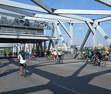
Third Avenue is a north-south thoroughfare on the East Side of the New York City borough of Manhattan, as well as in the center portion of the Bronx. Its southern end is at Astor Place and St. Mark's Place. It transitions into Cooper Square, and further south, the Bowery, Chatham Square, and Park Row. The Manhattan side ends at East 128th Street. Third Avenue is two-way from Cooper Square to 24th Street, but carries only northbound (uptown) traffic while in Manhattan above 24th Street; in the Bronx, it is again two-way. However, the Third Avenue Bridge carries vehicular traffic in the opposite direction, allowing only southbound vehicular traffic, rendering the avenue essentially non-continuous to motor vehicles between the boroughs.

The Willis Avenue Bridge is a swing bridge that carries road traffic northbound over the Harlem River between the New York City boroughs of Manhattan and the Bronx, United States. It connects First Avenue in Manhattan with Willis Avenue in the Bronx. The New York City Department of Transportation is responsible for maintaining and operating the bridge.

Franklin D. Roosevelt East River Drive, commonly called FDR Drive for short, is a controlled-access parkway on the east side of the New York City borough of Manhattan. It starts near South and Broad Streets, just north of the Battery Park Underpass, and runs north along the East River to the 125th Street / Robert F. Kennedy Bridge interchange, where it becomes Harlem River Drive. All of FDR Drive is designated New York State Route 907L (NY 907L), an unsigned reference route.
The Macombs Dam Bridge is a swing bridge across the Harlem River in New York City, connecting the boroughs of Manhattan and the Bronx. The bridge is operated and maintained by the New York City Department of Transportation (NYCDOT).

Harlem River Drive is a 4.20-mile (6.76 km) controlled-access parkway in the New York City borough of Manhattan. It runs along the west bank of the Harlem River from the Triborough Bridge in East Harlem to 10th Avenue in Inwood, where the parkway ends and the road continues northwest as Dyckman Street. South of the Triborough Bridge, the parkway continues toward lower Manhattan as FDR Drive. All of Harlem River Drive is designated New York State Route 907P (NY 907P), an unsigned reference route.

The IRT Second Avenue Line, also known as the Second Avenue Elevated or Second Avenue El, was an elevated railway in Manhattan, New York City, United States, from 1878 to 1942. It was operated by the Interborough Rapid Transit Company until 1940, when the city took over the IRT. Service north of the 57th Street station ended on June 11, 1940; the rest of the line closed on June 13, 1942.

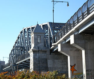
The Madison Avenue Bridge is a four-lane swing bridge crossing the Harlem River in New York City, connecting Madison Avenue in Manhattan with East 138th Street in the Bronx. It was designed by Alfred P. Boller and built in 1910, doubling the capacity of an earlier swing bridge built in 1884. The bridge is operated and maintained by the New York City Department of Transportation.
The 145th Street Bridge is a four-lane swing bridge across the Harlem River in New York City, connecting 145th Street and Lenox Avenue in Manhattan with 149th Street and River Avenue in the Bronx. The bridge is operated and maintained by the New York City Department of Transportation.

The University Heights Bridge is a steel-truss revolving swing bridge across the Harlem River in New York City. It connects West 207th Street in the Inwood neighborhood of Manhattan with West Fordham Road in the University Heights neighborhood of the Bronx. The bridge is operated and maintained by the New York City Department of Transportation.
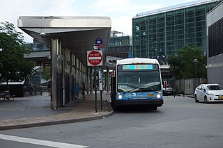
The First and Second Avenues Line, also known as the Second Avenue Line, is a bus line in Manhattan, New York City, running mostly along Second Avenue from Lower Manhattan to East Harlem. Originally a streetcar line along Second Avenue, it is now the M15 bus route, the busiest bus route in the city and United States, carrying 16.4 million riders annually. MTA Regional Bus Operations, under the New York City Bus and Select Bus Service brands, operates the local out of the Tuskegee Airmen Bus Depot and the SBS from the Mother Clara Hale Bus Depot. Service is operated exclusively with articulated buses.

The Third and Lexington Avenues Line, also known as the Third Avenue Line, is a public transit line in Manhattan, New York City, running from Lower Manhattan to Fort George in Washington Heights. Originally a streetcar line, it now consists of the M98, M101, M102, and M103 bus routes, operated by the New York City Transit Authority. The M98 bus route operates on Third Avenue between East 65th Street and East 127th Street, although it previously continued to 32nd Street. The M101, M102 and M103 bus routes run southbound on Lexington Avenue north of East 24th Street.

The Eighth Avenue Line is a public transit line in Manhattan, New York City, running mostly along Eighth Avenue from Lower Manhattan to Harlem. Originally a streetcar line, it is now the M10 bus route and the M20 bus route, operated by the New York City Transit Authority. The M10 bus now only runs north of 57th Street, and the M20 runs south of 66th Street. The whole line was a single route, the M10, until 2000 when the M20 was created.

The Columbus Avenue Line is a public transit line in Manhattan, New York City, running mostly along Columbus Avenue, 116th Street, and Lenox Avenue from Lower Manhattan to Harlem. Originally a streetcar line, it is now the M7 bus route, operated by the New York City Transit Authority, a division of the Metropolitan Transportation Authority.
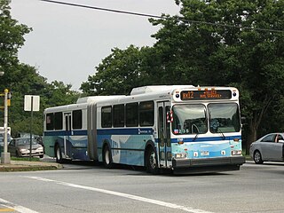
The Bx12 is a public transit line in New York City running along the 207th Street Crosstown Line, within the boroughs of Manhattan and the Bronx. The line runs along 207th Street in Upper Manhattan and along the continuous Fordham Road and Pelham Parkway in the Bronx.
The 129th Street station was a transfer station on the IRT Third Avenue Line in Manhattan, New York City, shared by elevated trains of both the Third Avenue Line and IRT Second Avenue Line. The next stop to the north was 133rd Street for the main line and Willis Avenue for the Willis Avenue spur, both of which were across a swing bridge above the Harlem River in the Bronx. The next stop to the south was 125th Street−Third Avenue for Third Avenue Line trains and 125th Street−Second Avenue for Second Avenue Line trains.

Since 1963, New York City has been using a system of bus lanes that are intended to give priority to buses, which contain more occupants than passenger and commercial vehicles. Most of these lanes are restricted to buses only at certain days and times, but some bus lanes are restricted 24/7. As of May 2021, there are 138.4 miles (222.7 km) of bus lanes within New York City.

The Bx15 and M125 bus routes constitute the Third Avenue/125th Street Line, a public transit line in New York City. The Bx15 runs between Fordham Plaza and the Hub in the Bronx, running primarily along Third Avenue. The M125 runs between the Hub in the Bronx and Manhattanville in Manhattan, running along Willis Avenue in the South Bronx and along 125th Street in Harlem, Manhattan.
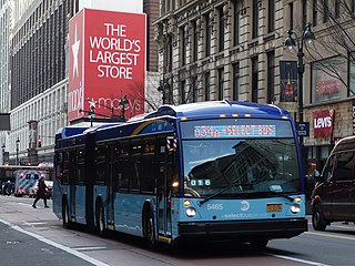
The 34th Street Crosstown Line is a surface transit line on 34th Street in Manhattan, New York City, United States. It currently hosts the M34/M34A SBS routes of MTA's Regional Bus Operations. The M34 runs from 12th Avenue to FDR Drive via 34th Street, while the M34A runs from Port Authority Bus Terminal to Waterside Plaza.