
Houston Street is a major east–west thoroughfare in Lower Manhattan in New York City, United States. It runs the full width of the island of Manhattan, from FDR Drive along the East River in the east to the West Side Highway along the Hudson River in the west. The street is divided into west and east sections by Broadway.
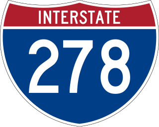
Interstate 278 (I-278) is an auxiliary Interstate Highway in New Jersey and New York in the United States. The road runs 35.62 miles (57.32 km) from US Route 1/9 (US 1/9) in Linden, New Jersey, northeast to the Bruckner Interchange in the New York City borough of the Bronx. The majority of I-278 is in New York City, where it serves as a partial beltway and passes through all five of the city's boroughs. I-278 follows several freeways, including the Union Freeway in Union County, New Jersey; the Staten Island Expressway (SIE) across Staten Island; the Gowanus Expressway in southern Brooklyn; the Brooklyn–Queens Expressway (BQE) across northern Brooklyn and Queens; a small part of the Grand Central Parkway in Queens; and a part of the Bruckner Expressway in the Bronx. I-278 also crosses multiple bridges, including the Goethals, Verrazzano-Narrows, Kosciuszko, and Robert F. Kennedy bridges.

The Q Second Avenue/Broadway Express/Brighton Local is a rapid transit service in the B Division of the New York City Subway. Its route emblem, or "bullet", is colored yellow since it is a part of the BMT Broadway Line in Manhattan.
The Brooklyn–Battery Tunnel, officially the Hugh L. Carey Tunnel and commonly referred to as the Battery Tunnel or Battery Park Tunnel, is a tolled tunnel in New York City that connects Red Hook in Brooklyn with the Battery in Manhattan. The tunnel consists of twin tubes that each carry two traffic lanes under the mouth of the East River. Although it passes just offshore of Governors Island, the tunnel does not provide vehicular access to the island. With a length of 9,117 feet (2,779 m), it is the longest continuous underwater vehicular tunnel in North America.

Riverside Drive is a scenic north–south boulevard in the New York City borough of Manhattan. The road runs on the west side of Upper Manhattan, generally paralleling the Hudson River and Riverside Park between 72nd Street and the vicinity of the George Washington Bridge at 181st Street. North of 96th Street, Riverside Drive is a wide divided roadway. At several locations, a serpentine service road diverges from the main road, providing access to the residential buildings. The avenue was opened in 1880, and several viaducts were completed over the subsequent decades to connect the various segments of Riverside Drive.

The Joe DiMaggio Highway, commonly called the West Side Highway and formerly the Miller Highway, is a 5.42-mile-long (8.72 km) mostly surface section of New York State Route 9A (NY 9A), running from West 72nd Street along the Hudson River to the southern tip of Manhattan in New York City. It replaced the West Side Elevated Highway, built between 1929 and 1951, was shut down in 1973 due to neglect and lack of maintenance, and was dismantled by 1989. North of 72nd Street, the roadway continues north as the Henry Hudson Parkway.

The Henry Hudson Parkway is a 10.95-mile (17.62 km) controlled-access parkway in New York City. The southern terminus is in Manhattan at 72nd Street, where the parkway continues south as the West Side Highway. It is often erroneously referred to as the West Side Highway throughout its entire course in Manhattan. The northern terminus is at the Bronx–Westchester county boundary, where it continues north as the Saw Mill River Parkway. All but the northernmost mile of the road is co-signed as New York State Route 9A (NY 9A). In addition, the entirety of the parkway is designated New York State Route 907V (NY 907V), an unsigned reference route.

Riverside South is an urban development project in the Lincoln Square neighborhood of the Upper West Side of Manhattan, New York City. It was originated by six civic associations – The Municipal Art Society, Natural Resources Defense Council, New Yorkers for Parks, Regional Plan Association, Riverside Park Fund, and Westpride – in partnership with real estate developer Donald Trump. The largely residential complex, located on the site of a former New York Central Railroad yard, includes Freedom Place and Riverside Center. The $3 billion project is on 57 acres (23 ha) of land along the Hudson River between 59th Street and 72nd Street.
The IRT Broadway–Seventh Avenue Line is a New York City Subway line. It is one of several lines that serves the A Division, stretching from South Ferry in Lower Manhattan north to Van Cortlandt Park–242nd Street in Riverdale, Bronx. The Brooklyn Branch, known as the Wall and William Streets Branch during construction, from the main line at Chambers Street southeast through the Clark Street Tunnel to Borough Hall in Downtown Brooklyn, is also part of the Broadway–Seventh Avenue Line. The IRT Broadway–Seventh Avenue Line is the only line to have elevated stations in Manhattan, with two short stretches of elevated track at 125th Street and between Dyckman and 225th Streets.

Franklin D. Roosevelt East River Drive, commonly called FDR Drive for short, is a controlled-access parkway on the east side of the New York City borough of Manhattan. It starts near South and Broad Streets, just north of the Battery Park Underpass, and runs north along the East River to the 125th Street / Robert F. Kennedy Bridge interchange, where it becomes Harlem River Drive. All of FDR Drive is designated New York State Route 907L (NY 907L), an unsigned reference route.

Harlem River Drive is a 4.20-mile (6.76 km) controlled-access parkway in the New York City borough of Manhattan. It runs along the west bank of the Harlem River from the Triborough Bridge in East Harlem to 10th Avenue in Inwood, where the parkway ends and the road continues northwest as Dyckman Street. South of the Triborough Bridge, the parkway continues toward lower Manhattan as FDR Drive. All of Harlem River Drive is designated New York State Route 907P (NY 907P), an unsigned reference route.
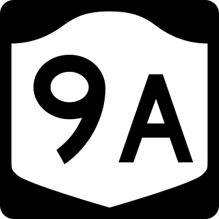
New York State Route 9A (NY 9A) is a state highway in the vicinity of New York City in the United States. Its southern terminus is at Battery Place near the northern end of the Brooklyn–Battery Tunnel in New York City, where it intersects with both the unsigned Interstate 478 (I-478) and FDR Drive. The northern terminus of NY 9A is at U.S. Route 9 (US 9) in Peekskill. It is predominantly an alternate route of US 9 between New York City and Peekskill; however, in New York City, it is a major route of its own as it runs along the West Side Highway and Henry Hudson Parkway. It is also one of only two signed New York State routes in Manhattan. In northern Westchester County, NY 9A follows the Briarcliff–Peekskill Parkway.
The West Side Elevated Highway was an elevated section of New York State Route 9A running along the Hudson River in the New York City borough of Manhattan to the tip of the island. It was an elevated highway, one of the first urban freeways in the world, and served as a prototype for urban freeways elsewhere, including Boston's Central Artery.

South Street is a street in Lower Manhattan, New York City, located immediately adjacent to the East River. It runs from Whitehall Street near the southern tip of Manhattan to Jackson Street near the Williamsburg Bridge. An elevated portion of FDR Drive, known as the South Street Viaduct, runs along the entire length of the street.

The Manhattan Waterfront Greenway is a waterfront greenway for walking or cycling, 32 miles (51 km) long, around the island of Manhattan, in New York City. The largest portions are operated by the New York City Department of Parks and Recreation. It is separated from motor traffic, and many sections also separate pedestrians from cyclists. There are three principal parts — the East, Harlem and Hudson River Greenways.

The East River Greenway is an approximately 9.44-mile-long (15.19 km) foreshoreway for walking or cycling on the east side of the island of Manhattan on the East River. It is part of the Manhattan Waterfront Greenway. The largest portions are operated by the New York City Department of Parks and Recreation. It is separated from motor traffic, and many sections also separate pedestrians from cyclists. The greenway is parallel to the Franklin D. Roosevelt East River Drive for a majority of its length.

The Battery, formerly known as Battery Park, is a 25-acre (10 ha) public park located at the southern tip of Manhattan Island in New York City facing New York Harbor. It is bounded by Battery Place on the north, with Bowling Green to the northeast, State Street on the east, New York Harbor to the south, and the Hudson River to the west. The park contains attractions such as an early 19th-century fort named Castle Clinton; multiple monuments; and the SeaGlass Carousel. The surrounding area, known as South Ferry, contains multiple ferry terminals, including the Staten Island Ferry's Whitehall Terminal; a boat launch to the Statue of Liberty National Monument ; and a boat launch to Governors Island.

The SIM1, SIM1C, SIM7,SIM10, and SIM11 bus routes constitute a public transit line in Staten Island and Manhattan, New York. The routes all operate on Richmond Avenue and Hylan Boulevard on Staten Island, but go to three separate terminals in Manhattan.

