Atakora is the northwesternmost department of Benin. Externally it borders Togo to the west and Burkina Faso to the north; internally it borders the departments of Alibori, Borgou and Donga. Major towns in the Atakora include Natitingou and Tanguiéta, and the major tourist areas include the Tata Somba houses, Pendjari National Park, and various waterfalls. The department of Atakora was bifurcated in 1999, with its southern territory removed to form the newly created Donga Department. The capital of Atakora Department is Natitingou, which lies among the Atakora Mountains.

Natitingou, informally referred to as Nati, is a city and commune in north western Benin and the capital of Atakora Department. The commune covers an area of 3045 square kilometres and as of 2013 had a population of 104,010 people.
Boukoumbé or Boukombé is a town, arrondissement and commune in north western Benin on the border with Togo. It is known for its market, its whipping ceremony and for its tradition of pipe making. Mount Kousso-Kovangou, the highest point in Benin, lies nearby.

Athiémè is a town and arrondissement located in the Mono Department of Benin. The commune covers an area of 220 square kilometres and as of 2013 had a population of 56,483 people.
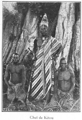
Kétou is a Yoruba town, arrondissement, and commune located in the Plateau Department of the Republic of Benin. The commune covers an area of 2183 square kilometres and as of 2013 had a population of 156,497 people, making it the 13th largest settlement in Benin.
Nikki is a town, arrondissement, and commune located in the Borgou Department of Benin. The commune covers an area of 3171 square kilometres and as of 2002 had a population of 99,251 people.
Péhunco or Péhonko is a town, arrondissement and commune located in the Atakora Department of Benin. The commune covers an area of 1,900 kilometres (1,200 mi) and as of 2013 had a population of 78,217 people.
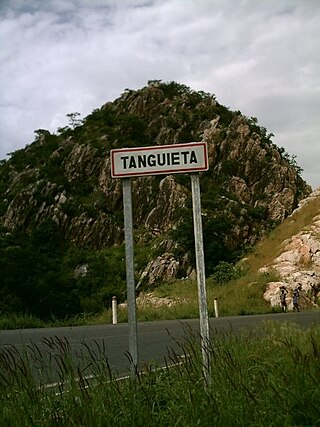
Tanguiéta is a town, arrondissement and commune located in the Atakora Department of Benin.The commune covers an area of 5465 square kilometres and as of 2013 had a population of 74,675 people. As of 2007 the town had an estimated population of 21,290. It lies on the RNIE 3 highway which connects it to Natitingou.
Matéri is a town, arrondissement and commune in the Atakora Department of north-western Benin. The commune covers an area of 4740 square kilometres and as of 2013 had a population of 113,958 people.
Kalalè is a town, arrondissement, and commune in the Borgou Department of eastern Benin. The commune covers an area of 3,586 square kilometres (1,385 sq mi) and as of 2013 had a population of 168,882 people.
Sinendé is a town, arrondissement, and commune in the Borgou Department of central Benin. The commune covers an area of 2289 square kilometres and as of 2013 had a population of 91,672 people.
Ouaké is a town, arrondissement, and commune in the Donga Department of western Benin. The commune covers an area of 663 square kilometres and as of 2013 had a population of 74,289 people.

Lalo is a town, arrondissement, and commune in the Kouffo Department of south-western Benin. The commune covers an area of 432 square kilometres (167 sq mi) and as of 2013 had a population of 119,926 people.
Toviklin is a town, arrondissement, and commune in the Kouffo Department of south-western Benin. The commune covers an area of 120 square kilometres and as of 2013 had a population of 88,611 people.
Bopa is a town, arrondissement, and commune in the Mono Department of south-western Benin.The commune covers an area of 365 square kilometres and as of 2002 had a population of 70,268 people.
Houéyogbé is a town, arrondissement, and commune in the Mono Department of south-western Benin. The commune covers an area of 290 square kilometres and as of 2002 had a population of 74,492 people.
Agbangnizoun is a town, arrondissement, and commune in the Zou Department of south-western Benin. The town lies 20 kilometres south-east of Abomey. The commune covers an area of 244 square kilometres and as of 2002 had a population of 55,001 people.
Ouinhi is a town, arrondissement, and commune in the Zou Department of south-western Benin. The commune covers an area of 483 square kilometres and as of 2013 had a population of 59,381 people. It is bounded on the north-west by the commune of Zagnanado, south-west by the commune of Zogbodomey, south by the commune of Bonou and east by the commune of Adja-Ouèrè. The commune is divided into arrondissements which include Dasso, Ouinhi, and Tohu, comprising 28 villages.
Kouarfa is a town and arrondissement in the Atakora Department of northwestern Benin. It is an administrative division under the jurisdiction of the commune of Toucountouna. According to the population census conducted by the Institut National de la Statistique Benin on February 15, 2002, the arrondissement had a total population of 9,809.
Tampégré is a town and arrondissement in the Atakora Department of northwestern Benin. It is an administrative division under the jurisdiction of the commune of Toucountouna. According to the population census conducted by the Institut National de la Statistique Benin on February 15, 2002, the arrondissement had a total population of 8,560.