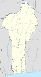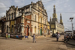
Porto-Novo, also known as Hogbonu and Ajashe, is the capital of Benin. The commune covers an area of 110 square kilometres (42 sq mi) and as of 2002 had a population of 223,552 people.
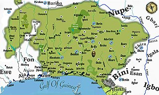
Yorubaland is the homeland and cultural region of the Yoruba people in West Africa. It spans the modern-day countries of Nigeria, Togo and Benin, and covers a total land area of 142,114 km2 or about 60% of the land area of Ghana. Of this land area, 106,016 km2 (74.6%) lies within Nigeria, 18.9% in Benin, and the remaining 6.5% is in Togo. Prior to European colonization, a portion of this area was known as Yoruba country. The geo-cultural space contains an estimated 55 million people, the majority of this population being ethnic Yorubas.
Dassa-Zoumé, also known as Igbo Idaasha or simply Dassa, is a city in central Benin, on the Cotonou-to-Parakou railway and the main north-south highway. It is the capital of Collines Department. The commune covers an area of 1,711 square kilometres (661 sq mi), and as of 2013 had a population of 112,118.

Parakou is the largest city in northern Benin, with an estimated population of around 206,667 people, and capital of the Borgou Department. Administratively the commune of Parakou makes up one of Benin's 77 communes. Since 2015, its mayor is Souradjou Adamou Karimou.
Malanville is a city, arrondissement and commune in the Alibori Department of northeastern Benin, located across the River Niger from Niger. It is known as a centre of cross-border trade and has a major market. Malanville is also a centre for rice-growing. The commune covers an area of 3016 square kilometres and as of 2013 had a population of 168,006 people.

Savè is a city in Benin, lying on the Cotonou-Parakou railway and the main north–south road. It is known for its local boulders, popular with climbers. "Savè" is from the historical Yoruba name Ṣábẹ̀ẹ́.
Cové is a city in the Zou Department of Benin. The commune covers an area of 525 square kilometres and as of 2012 had a population of 43,554 people.
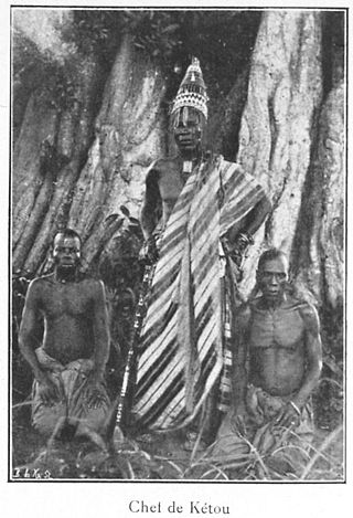
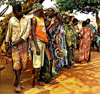
Kétou is a Yoruba town, arrondissement, and commune located in the Plateau Department of the Republic of Benin. The commune covers an area of 2183 square kilometres and as of 2013 had a population of 156,497 people, making it the 13th largest settlement in Benin.
Pobè is a city and arrondissement located in the Plateau Department of Benin. The commune covers an area of 400 square kilometres and as of 2013 had a population of 123,740 people.

Linguère Department is one of the 45 departments of Senegal, one of the three making up the Louga Region. Its capital is Linguère, and it encompasses an area of 15,375 km2 (5,936 sq mi).
Ouèssè is a town, arrondissement, and commune in the Collines Department of central Benin.The commune covers an area of 3200 square kilometres and as of 2013 had a population of 141,760 people.
Adja-Ouèrè is a town, arrondissement, and commune in the Plateau Department of south-eastern Benin. The commune covers an area of 550 square kilometres and as of 2013 had a population of 115,953 people.

Zagnanado or Zangnanado is a town, arrondissement, and commune in the Zou Department of southern-central Benin. It is located 47 kilometres from Abomey and 165 kilometres north of Cotonou. The commune covers an area of 750 square kilometres and as of 2013 had a population of 132,401 people.
Zogbodomey or Zogbodomè is a town, arrondissement, and commune in the Zou Department of south-western Benin. The commune covers an area of 600 square kilometres and as of 2002 had a population of 72,338 people.
Kika is a town and arrondissement in the Borgou Department of Benin. It is an administrative division under the jurisdiction of the commune of Tchaourou. According to the population census conducted by the Institut National de la Statistique Benin on February 15, 2002, the arrondissement had a total population of 12398.
Sanson is a town and arrondissement in the Borgou Department of Benin. It is an administrative division under the jurisdiction of the commune of Tchaourou. According to the population census conducted by the Institut National de la Statistique Benin on February 15, 2002, the arrondissement had a total population of 10,784.
Akpassi is a town and arrondissement in the Collines Department of Benin. It is an administrative division under the jurisdiction of the commune of Bantè. According to the population census conducted by the Institut National de la Statistique Benin on February 15, 2002, the arrondissement had a total population of 8979.
Lougba is a town and arrondissement in the Collines department of Benin. It is an administrative division under the jurisdiction of the commune of Bantè. According to the population census conducted by the Institut National de la Statistique Benin on February 15, 2002, the arrondissement had a total population of 6,006.
The Isha sometimes spelt Ica, and Itcha are a relatively small group of the Yoruba people, situated in the western parts of middle Benin, West Africa, especially in the town of Bantè and other surrounding communities in the Collines Department.