Transportation in Oregon

Last updated

Transportation in Oregon
Overview
Transit type Rapid transit, commuter rail, buses, private automobile, Taxicab, bicycle, pedestrian, ferries
Operation
Operator(s) Oregon Department of Transportation

The transportation system of Oregon is a cooperation of complex systems of infrastructure.

Contents

Background

An advertisement for the celebration of the new Coos Bay Railroad Coos Bay Railroad ad.jpg
An advertisement for the celebration of the new Coos Bay Railroad

History

The history of rail in Oregon predates the transcontinental railroad in 1869. [1]

As Oregon was aligned with the union states during the American Civil War, a railroad connection was proposed to help supply the Union and build morale. [1]

Environmental and social issues

Mass Transit

Metropolitan Area Express (MAX) is a light rail system in the Portland metropolitan area in the U.S. state of Oregon. It is operated by TriMet and currently has five lines: Blue, Green, Red, Yellow, and Orange.

Rail

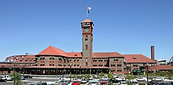
As of 2004, the state of Oregon has over 2,400 mi (3,862 km) (route-miles) of track, and 170 mi (274 km) of railroad right-of-way after peaking in the 1930s at about 4,350 miles (7,001 km) of track. [2] Oregon is served by two Class 1 railroads, which account for over 1,100 miles (1,770 km) of trackage, and over twenty Class 2 and Class 3 operators. Three Amtrak routes serve the state, primarily through the Willamette Valley and south-central Oregon. [3] Rail is a key element of the mass transit system in the city of Portland and surrounding communities. And numerous tourist railways operate in the state.

Oregon is currently served by two Class 1 railroads, the BNSF Railway and the Union Pacific Railroad (UP). Prior to its acquisition by the UP in 1996, Oregon was also served by the Southern Pacific Transportation Company; the UP continues to operate on tracks acquired from the SP.

Portland's Union Station UnionStationPortland.jpg
Portland's Union Station

Long-haul passenger service is provided by Amtrak, which operates in Oregon on the north-south Union Pacific mainline south of Portland, and on BNSF tracks into Washington to the north and east. Three Amtrak routes provide service to Oregon:

Transit and commuter rail

PortlandTriMetMAX.jpg
WES train.JPG
PortlandStreetcar5.jpg
Left to Right: MAX light rail, WES commuter rail car, Portland Streetcar.

Rail transit is a key part of the local and regional transportation network in Portland and its surrounding communities. Two electrically powered rail systems and one diesel-powered commuter rail system presently provide transit service in the Portland metropolitan area.

Bus

Buses at the Downtown Transit Center in Corvallis Buses at Corvallis Transit's Downtown Transit Center (2018).jpg
Buses at the Downtown Transit Center in Corvallis

The Emerald Express (EmX) is a bus rapid transit (BRT) system in the Eugene-Springfield metropolitan area in Oregon, United States. It is provided by the Lane Transit District (LTD) which is the public transit authority in Lane County, Oregon.

The Lane Transit District (LTD) is a public agency that provides public transportation in Lane County, Oregon, United States. The transit district serves the Eugene metropolitan area, including the neighboring cities of Springfield, Junction City, Creswell, Cottage Grove, Veneta, and Lowell. LTD began service in 1970 with 20 vehicles, and today provides over 20,000 bus trips a week, with a fleet of 102 buses. Many of LTD's riders are students; University of Oregon and Lane Community College students ride for free. Both programs are subsidized by student fees, as well as limited late-night service until about 2am. [10]

Roads and freeways

Map of Oregon showing major roads and cities Map of Oregon NA.png
Map of Oregon showing major roads and cities

From 1951-2023, Oregon did not allow citizens to pump their own gas, but the ban was lifted in 2023 statewide. [11]

OR I-84 near Pendleton.png
Highway84Clouds.jpg
I-84 near Pendleton (top) and past Deadman Pass and the Blue Mountains (bottom).

In the U.S. state of Oregon, Interstate 84 travels eastwest, following the Columbia River and the rough path of the old Oregon Trail from Portland east to Idaho. For this reason, it is also known as most of the Columbia River Highway No. 2 and all of the Old Oregon Trail Highway No. 6 (see Oregon highways and routes). It also follows along or near U.S. Route 30. The entire highway carried the designation Interstate 80N (I-80N, or Interstate 80 North) until 1980, when this was changed to I-84. [12]

Bridges and tunnels

Bridge of the Gods named after a famous geologic event also known as Bridge of the Gods. Bridgeofthegods.jpg
Bridge of the Gods named after a famous geologic event also known as Bridge of the Gods.

The Bridge of the Gods is a steel truss cantilever bridge that spans the Columbia River between Cascade Locks, Oregon and Washington state near North Bonneville. It is approximately 40 miles (64 kilometers) east of Portland, Oregon and 4 miles (6.4 km) upriver from the Bonneville Dam. It currently serves as a toll bridge operated by the Port of Cascade Locks.

The bridge was built by the Wauna Toll Bridge Company of Walla Walla, Washington and opened in 1926 at a length of 1,127 feet (343 m). The higher river levels resulting from the construction of the Bonneville Dam required the bridge to be further elevated and extended to its current length of 1,856 feet (565 m).

The Robertson Tunnel is a tunnel through the west hills of Portland, Oregon, U.S. for the TriMet public transit MAX Light Rail system. The tunnel is 3.1 miles (5.0 km) long and consists of twin 21 foot (6.4 m) diameter tunnels. There is one station within the tunnel at Washington Park, the third deepest such station in the world. The tunnel has won several worldwide engineering and environmental awards. [13] It was placed into service September 12, 1998. [14]

Personal transportation

Private automobiles

Private automobiles still fulfill the majority of transportation needs.

Pedestrians, and bicycles

The Springwater Trail, part of the 40-Mile Loop, crosses over McLoughlin Boulevard (Oregon Route 99E) near Sellwood. Johnsoncreek2.jpg
The Springwater Trail, part of the 40-Mile Loop, crosses over McLoughlin Boulevard (Oregon Route 99E) near Sellwood.

At 2.5% in 2012, Oregon had the highest bicycle commuting mode share of any state (behind only Washington, D.C.) with the cities of Portland, Eugene, Corvallis, and Baker City each reporting bicycle commuting rates in excess of 5%. [15] [16]

The 40-Mile Loop is a partially completed greenway trail around and through Portland in the U.S. State of Oregon. It was proposed in 1903 [17] by the Olmsted Brothers architecture firm as part of the development of Forest Park. [18] [19] One greenway expert calls it "one of the most creative and resourceful greenway projects in the country." [20]

Port Infrastructure

Airports

City servedFAAIATAICAOAirport nameRole
[ clarification needed ]
Enpl.
[ clarification needed ]
Commercial Service – Primary Airports
Eugene EUG EUGKEUG Eugene Airport (Mahlon Sweet Field)P-N358,819
Klamath Falls LMT LMTKLMT Klamath Falls Airport (Kingsley Field)P-N26,970
Medford MFR MFRKMFR Rogue Valley International-Medford Airport P-N287,688
North Bend OTH OTHKOTH Southwest Oregon Regional Airport (was North Bend Municipal)P-N35,458
Portland PDX PDXKPDX Portland International Airport P-M7,090,526
Redmond RDM RDMKRDM Redmond Municipal Airport (Roberts Field)P-N235,192

Ports and Harbors

The Port of Bandon is the port authority for Bandon Harbor in the city of Bandon, Oregon, United States. The port has full marina facilities for boat launching and sport fishing. It also serves as a waypoint stopover for commercial fishing and recreation vessels, and has a scenic boardwalk with a nature pathway and observation areas. [21] The United States Coast Guard operates Search and Rescue Detachment Coquille River in Bandon Harbor in the summer and on halibut season weekend openers in the spring, and is equipped with a 47-foot motor life boat and crew. [22] [23]

See also

Related Research Articles

<span class="mw-page-title-main">MAX Light Rail</span> Light rail system serving Portland, Oregon

The Metropolitan Area Express (MAX) is a light rail system serving the Portland metropolitan area in the U.S. state of Oregon. Owned and operated by TriMet, it consists of five lines that together connect the six sections of Portland; the communities of Beaverton, Clackamas, Gresham, Hillsboro, Milwaukie, and Oak Grove; and Portland International Airport to Portland City Center. Trains run seven days a week with headways of between 30 minutes off-peak and three minutes during rush hours. In 2019, MAX had an average daily ridership of 120,900, or 38.8 million annually. Due to the COVID-19 pandemic, which impacted public transit use globally, annual ridership plummeted, with only 14.8 million riders recorded in 2021.

<span class="mw-page-title-main">Milwaukie, Oregon</span> City in Oregon, United States

Milwaukie is a city mostly in Clackamas County, Oregon, United States; a very small portion of the city extends into Multnomah County. The population was 21,119 at the 2020 census. Founded in 1847 on the banks of the Willamette River, the city, known as the Dogwood City of the West, was incorporated in 1903 and is the birthplace of the Bing cherry. The city is now a suburb of Portland and also adjoins the unincorporated areas of Clackamas and Oak Grove.

<span class="mw-page-title-main">Portland Streetcar</span> Streetcar system in Portland, Oregon

The Portland Streetcar is a streetcar system in Portland, Oregon, that opened in 2001 and serves areas surrounding downtown Portland. The 3.9-mile (6.3 km) NS Line runs from Northwest Portland to the South Waterfront via Downtown and the Pearl District. The Loop Service, which opened in September 2012 as the Central Loop, runs from Downtown to the Oregon Museum of Science and Industry via the Pearl District, the Broadway Bridge across Willamette River, the Lloyd District, and the Central Eastside Industrial District and added 3.3 miles (5.3 km) of route. In September 2015 the line was renamed as the Loop Service, with the A Loop traveling clockwise, and the B Loop traveling counterclockwise. The two-route system serves some 20,000 daily riders.

<span class="mw-page-title-main">TriMet</span> Oregon government-owned corporation responsible for public transit in the Portland area

The Tri-County Metropolitan Transportation District of Oregon (TriMet) is a public agency that operates mass transit in a region that spans most of the Portland metropolitan area in the U.S. state of Oregon. Created in 1969 by the Oregon legislature, the district replaced five private bus companies that operated in the three counties: Multnomah, Washington, and Clackamas. TriMet started operating a light rail system, MAX, in 1986, which has since been expanded to five lines that now cover 59.7 miles (96.1 km), as well as the WES Commuter Rail line in 2009. It also provides the operators and maintenance personnel for the city of Portland-owned Portland Streetcar system. In 2022, the system had a ridership of 53,889,500, or about 196,100 per weekday as of the third quarter of 2023.

<span class="mw-page-title-main">Oregon Electric Railway</span> Former interurban railroad

The Oregon Electric Railway (OE) was an interurban railroad line in the U.S. state of Oregon that linked Portland to Eugene.

<span class="mw-page-title-main">MAX Blue Line</span> Light rail line in Portland, Oregon

The MAX Blue Line is a light rail service in Portland, Oregon, United States, operated by TriMet as part of the MAX Light Rail system. It travels east–west for approximately 33 miles (53 km)—the longest in the network—between Hillsboro, Beaverton, Portland, and Gresham and serves 48 stations from Hatfield Government Center to Cleveland Avenue. The line carried an average 55,370 riders each day on weekdays in September 2018, the busiest of the five MAX lines. It runs for 2212 hours per day from Monday to Thursday, with headways of between 30 minutes off-peak and five minutes during rush hour. Service runs later in the evening on Fridays and Saturdays and ends earlier on Sundays.

<span class="mw-page-title-main">MAX Red Line</span> Light rail line in Portland, Oregon

The MAX Red Line is a light rail service in Portland, Oregon, United States, operated by TriMet as part of the MAX Light Rail system. An airport rail link, it connects Beaverton, Portland City Center and Northeast Portland to Portland International Airport. The Red Line serves 26 stations; it interlines with the Blue Line and partially with the Green Line from Beaverton Transit Center to Gateway/Northeast 99th Avenue Transit Center and then branches to the 5.5-mile (8.9 km) Airport MAX segment to Portland Airport station. Its trains run for 22 hours per day with headways of up to 15 minutes. The Red Line carried an average 10,310 passengers per weekday in September 2021, the second-busiest MAX service after the Blue Line.

<span class="mw-page-title-main">MAX Yellow Line</span> Light rail line in Portland, Oregon

The MAX Yellow Line is a light rail service in Portland, Oregon, United States, operated by TriMet as part of the MAX Light Rail system. It connects North Portland to Portland City Center and Portland State University (PSU) with 17 stops from Expo Center station to PSU South/Southwest 6th and College station. The line travels from Portland Expo Center in the north, south to the Rose Quarter through a 5.8-mile (9.3 km) light rail segment along the median of Interstate Avenue. From the Rose Quarter, it crosses the Willamette River via the Steel Bridge and enters downtown Portland, where it operates as a northbound-only service of the Portland Transit Mall on 6th Avenue. Service runs for approximately 21 hours daily with a headway of 15 minutes during most of the day.

<span class="mw-page-title-main">Washington Park station (TriMet)</span> Light rail station in Portland, Oregon, US

Washington Park is a light rail station in Portland, Oregon, United States, served by TriMet as part of the MAX Light Rail system. Situated between Sunset Transit Center and Goose Hollow/Southwest Jefferson Street station, it is the 17th and 3rd station eastbound on the Blue Line and the Red Line, respectively. The station's two tracks and island platform are part of the Robertson Tunnel beneath Portland's West Hills. Its head house and surface-level plaza occupy the middle of a parking lot surrounded by the Hoyt Arboretum, Oregon Vietnam Veterans Memorial, Oregon Zoo, and World Forestry Center. Washington Park is the only completely underground station in the MAX system. At 260 feet (79 m) below ground, it is the deepest transit station in North America and in the western hemisphere. It is also the seventh-deepest in the world.

<span class="mw-page-title-main">Library/Southwest 9th Avenue and Galleria/Southwest 10th Avenue stations</span>

Library/Southwest 9th Avenue and Galleria/Southwest 10th Avenue are light rail stops on the MAX Blue and Red Lines in Portland, Oregon. It was the original western terminus and is now the Eastside MAX line's first stop eastbound/last stop westbound in downtown.

<span class="mw-page-title-main">Transportation in Portland, Oregon</span> Overview of movement of goods and passengers in Portland

Like transportation in the rest of the United States, the primary mode of local transportation in Portland, Oregon is the automobile. Metro, the metropolitan area's regional government, has a regional master plan in which transit-oriented development plays a major role. This approach, part of the new urbanism, promotes mixed-use and high-density development around light rail stops and transit centers, and the investment of the metropolitan area's share of federal tax dollars into multiple modes of transportation. In the United States, this focus is atypical in an era when automobile use led many areas to neglect their core cities in favor of development along interstate highways, in suburbs, and satellite cities.

Portland is "an international pioneer in transit orientated developments."

<span class="mw-page-title-main">Beaverton Transit Center</span> Transport hub located in Beaverton, Oregon, U.S.

Beaverton Transit Center is a multimodal transport hub in Beaverton, Oregon, United States. Owned and operated by TriMet, it is served by bus, commuter rail, and light rail. The transit center is MAX Light Rail's 15th station eastbound on the Blue Line and western terminus on the Red Line. It is also the northern terminus of WES Commuter Rail and a hub for bus routes mostly serving the westside communities of the Portland metropolitan area. Beaverton Transit Center is situated on Southwest Lombard Avenue, just north of Southwest Canyon Road in central Beaverton, connected by walkway to Canyon Place Shopping Center. It recorded 9,709 average weekday boardings for all modes in fall 2018, making it TriMet's busiest transit center.

<span class="mw-page-title-main">Willow Creek/Southwest 185th Avenue Transit Center</span> Light rail station and transit center on the MAX Blue Line in Hillsboro, Oregon, United States

Willow Creek/Southwest 185th Avenue Transit Center is a multimodal transport hub in Hillsboro, Oregon, United States. Owned and operated by TriMet, it is served by bus and light rail. The transit center is the ninth station eastbound on the Blue Line and a hub for bus routes mostly serving Washington County in the Portland metropolitan area. It is located by the intersection of Southwest Baseline Road and 185th Avenue near the city's boundary with Beaverton.

<span class="mw-page-title-main">MAX Green Line</span> Light rail line in Portland, Oregon

The MAX Green Line is a light rail service in Portland, Oregon, United States, operated by TriMet as part of the MAX Light Rail system. It is 15 miles (24.1 km) long and serves 30 stations from the PSU South stations to Clackamas Town Center Transit Center; it connects Portland State University (PSU), Portland City Center, Northeast Portland, Southeast Portland, and Clackamas. The Green Line is the only service that shares parts of its route with the four other MAX services, sharing the Portland Transit Mall with the Orange and Yellow lines and the Banfield segment of the Eastside MAX with the Blue and Red lines. Southbound from Gateway/Northeast 99th Avenue Transit Center, it operates the Interstate 205 (I-205) segment through to Clackamas Town Center. Service runs for approximately 2112 hours daily with a headway of 15 minutes during most of the day. It is the third-busiest line in the system, carrying an average of 19,160 riders per day on weekdays in September 2019.

<span class="mw-page-title-main">MAX Orange Line</span> Light rail line in Portland, Oregon

The MAX Orange Line is a light rail service in Portland, Oregon, United States, operated by TriMet as part of the MAX Light Rail system. It connects Portland City Center, Portland State University (PSU), Southeast Portland, Milwaukie, and Oak Grove. The line serves 17 stations from Union Station/Northwest 5th & Glisan to Southeast Park Avenue and runs for 2012 hours daily with a minimum headway of 15 minutes during most of the day. It averaged 3,480 daily weekday riders in September 2020.

<span class="mw-page-title-main">Portland and Western Railroad</span> Class II railroad in Oregon

The Portland and Western Railroad is a 516-mile (830 km) Class II railroad serving the U.S. state of Oregon, and is a wholly owned subsidiary of shortline and regional railroad holding company Genesee & Wyoming Inc. The PNWR includes a subsidiary, the Willamette and Pacific Railroad.

<span class="mw-page-title-main">WES Commuter Rail</span> Commuter train system serving northwest Oregon

The Westside Express Service (WES) is a commuter rail line in the U.S. state of Oregon serving parts of Washington and Clackamas counties in the Portland metropolitan area. Owned by TriMet and operated by Portland & Western Railroad (P&W), the line is 14.7 miles (23.7 km) long and travels north–south from Beaverton to Wilsonville along a route just west of Oregon Highway 217 and Interstate 5 (I-5). WES consists of five stations and connects with MAX Light Rail at Beaverton Transit Center. Service operates on a 45-minute headway on weekdays during the morning and evening rush hours. In Spring 2022, WES saw a daily ridership of 420 passengers or about 109,000 riders annually.

<span class="mw-page-title-main">Robertson Tunnel</span> Train tunnel near Portland, Oregon

The Robertson Tunnel is a twin-bore light rail tunnel through the Tualatin Mountains west of Portland, Oregon, United States, used by the MAX Blue and Red Lines. The tunnel is 2.9 miles long and consists of twin 21-foot-diameter (6.4 m) tunnels. There is one station within the tunnel at Washington Park, which at 259 feet (79 m) deep is the deepest subway station in the United States and the fifth-deepest in the world. Trains are in the tunnel for about 5 minutes, which includes a stop at the Washington Park station. The tunnel has won several worldwide engineering and environmental awards. It was placed into service September 12, 1998.

Rail transportation is an important element of the transportation network in the U.S. state of Oregon. Rail transportation has existed in Oregon in some form since 1855, and the state was a pioneer in development of electric railway systems. While the automobile has displaced many uses of rail in the state, rail remains a key means of moving passengers and freight, both within the state and to points beyond its borders.

<span class="mw-page-title-main">Hall/Nimbus station</span> Train station in Beaverton, Oregon

Hall/Nimbus is a train station in Beaverton, Oregon, United States, served by TriMet as part of WES Commuter Rail. It is the second station southbound on the commuter rail line, which runs between Beaverton and Wilsonville in the Portland metropolitan area's Washington County. Opened in February 2009, the TriMet-owned station is located west of Oregon Route 217 near the Washington Square shopping mall on Hall Boulevard. It includes a 50-car park and ride and connections to TriMet bus routes 76–Hall/Greenburg and 78–Beaverton/Lake Oswego. WES connects with the Blue and Red lines of MAX Light Rail at Beaverton Transit Center.

References

  1. 1 2 Deumling, Dietrich (May 1972). The roles of the railroad in the development of the Grande Ronde Valley (masters thesis). Flagstaff, Arizona: Northern Arizona University. OCLC   4383986.
  2. Janet Adkins, Legislative Committee Services (May 2004). "Background Brief on Freight and Passenger Rail" (PDF). Oregon Legislature. Archived from the original (PDF) on May 22, 2005. Retrieved October 10, 2007.
  3. "Oregon Transportation Plan Technical Appendices" (PDF). Oregon Department of Transportation. September 2006. Retrieved October 6, 2007.
  4. "Coast Starlight". Amtrak. Retrieved October 5, 2007.
  5. "Amtrak Cascades". Amtrak. Retrieved October 5, 2007.
  6. "Empire Builder". Amtrak. Retrieved October 5, 2007.
  7. "Systems News [regular news section]". Tramways & Urban Transit . UK: Ian Allan Publishing. December 2000. p. 471. ISSN   1460-8324. With the light rail system due to expand to two services in September 2001, and three in 2004 (with all three using the same routing and stops in the city centre), Tri-Met has decided to assign route colours as follows ...
  8. "South Corridor Phase II: Portland-Milwaukie Light Rail Project". Metro. Retrieved October 5, 2007.
  9. "Portland Streetcar" . Retrieved October 5, 2007.
  10. Malkin, Whitney (December 9, 2008). "Late-night bus to cater to UO Students". The Register Guard . p. C1. Retrieved January 15, 2012.
  11. Rose, Andy (August 6, 2023). "Oregon drivers are now allowed to pump their own fuel after the state lifted a ban dating back to 1951". CNN. Retrieved November 29, 2023.
  12. "I-80N becomes I-84 May 1". (April 1, 1980). The Oregonian , p. B4.
  13. "Awards & Recognition". TriMet . Retrieved July 30, 2007.
  14. "Westside MAX Blue Line Project History". TriMet. Archived from the original on September 27, 2007. Retrieved July 30, 2007.
  15. Steve Law (2013). "Oregon tops in nation for bicycle commuting". Portland Tribune . Retrieved December 5, 2013.
  16. Beaumont, Constance (2013). "Plans to Boost Bicycle and Pedestrian Travel in Oregon: A Best Practices Report" (PDF). Oregon Department of Land Conservation and Development. Retrieved November 7, 2013.
  17. Sources disagree over the date of the park loop proposal: some give 1903, some 1904.
  18. "Forest Park". Portland Parks & Recreation Department, City of Portland. 2008. Retrieved May 30, 2008.
  19. "History of the 40-Mile Loop". 40-Mile Loop Land Trust. Archived from the original on July 23, 2011. Retrieved May 30, 2008.
  20. Charles E. Little (1990). Greenways for America. JHU Press. pp. 76–80. ISBN   0-8018-5140-8 . Retrieved May 30, 2008.
  21. Bandon, Oregon Community Profile Retrieved December 3, 2008.
  22. "Group North Bend Units". United States Coast Guard . Retrieved December 3, 2008.
  23. "Coast Guard". Port of Bandon. Archived from the original on July 15, 2011. Retrieved November 23, 2010.