 Aere shortly before being named on 7 May | |
| Meteorological history | |
|---|---|
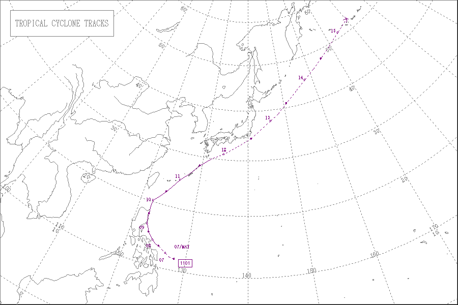
| Formed | 5 May 2011 |
| Extratropical | 12 May 2011 |
| Dissipated | 15 May 2011 |
| Tropical storm | |
| 10-minute sustained (JMA) | |
| Highest winds | 75 km/h (45 mph) |
| Lowest pressure | 992 hPa (mbar);29.29 inHg |
| Tropical storm | |
| 1-minute sustained (SSHWS/JTWC) | |
| Highest winds | 95 km/h (60 mph) |
| Lowest pressure | 985 hPa (mbar);29.09 inHg |
| Overall effects | |
| Fatalities | 44 direct,4 indirect |
| Damage | $34.4 million (2011 USD) |
| Areas affected | Philippines,Japan |
| IBTrACS | |
Part of the 2011 Pacific typhoon season | |
Tropical Storm Aere,known in the Philippines as Tropical Storm Bebeng,was a mild tropical storm that affected eastern Philippines and southern Japan in early-May 2011. It was the first named storm of the 2011 Pacific typhoon season. Aere is the Marshallese word for storm . [1]
Contents
- Meteorological history
- Preparations
- Philippines
- Taiwan
- Impact and aftermath
- Philippines 2
- Retirement
- See also
- References
- External links
In the Philippines,Aere brought very heavy rainfall triggering landslides and floods knocking out power in several areas across Luzon. More than 50 flights were canceled or diverted because of the bad weather conditions and President Benigno Aquino III delayed his flight home from a summit in Indonesia by a day. The coastguards have stopped smaller boats from leaving ports in Catanduanes and surrounding areas,leaving 1,379 people stranded. More than 7,200 hectares (17,800 acres - 27 square miles) of rice,corn and high-value crops costing more than 118 million pesos ($2.7 million) were destroyed or damaged. At least 35 people have been killed and two more are missing as a result of Aere. Agricultural losses are estimated at PHP1.37 billion (US$31.7 million).


