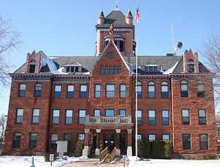
Monroe County is a county in the U.S. state of Wisconsin. As of the 2010 census, the population was 44,673. Its county seat is Sparta.

The Chicago, Milwaukee, St. Paul and Pacific Railroad (CMStP&P), often referred to as the "Milwaukee Road", was a Class I railroad that operated in the Midwest and Northwest of the United States from 1847 until 1986.

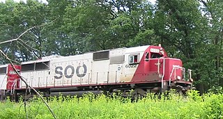
The Soo Line Railroad is the primary United States railroad subsidiary of the Canadian Pacific Railway, one of seven U.S. Class I railroads, controlled through the Soo Line Corporation. Although it is named for the Minneapolis, St. Paul and Sault Ste. Marie Railroad (MStP&SSM), which was commonly known as the Soo Line after the phonetic spelling of Sault, it was formed in 1961 by the consolidation of that company with two other CP subsidiaries: The Duluth, South Shore and Atlantic Railway, and the Wisconsin Central Railway. It is also the successor to other Class I railroads, including the Minneapolis, Northfield and Southern Railway and the Chicago, Milwaukee, St. Paul and Pacific Railroad. On the other hand, a large amount of mileage was spun off in 1987 to Wisconsin Central Ltd., now part of the Canadian National Railway. The Soo Line Railroad and the Delaware and Hudson Railway, CP's other major subsidiary, presently do business as the Canadian Pacific Railway. Most equipment has been repainted into the CP scheme, but the U.S. Surface Transportation Board groups all of CP's U.S. subsidiaries under the Soo Line name for reporting purposes. The Minneapolis headquarters are located in the Canadian Pacific Plaza building, having moved from the nearby Soo Line Building.

The Wisconsin and Southern Railroad is a Class II regional railroad in Southern Wisconsin and Northeastern Illinois currently operated by Watco. It operates former Chicago, Milwaukee, St. Paul and Pacific Railroad and Chicago and North Western Railway (C&NW) trackage, mostly acquired by the state of Wisconsin in the 1980s.

The Chicago and North Western Transportation Company was a Class I railroad in the Midwestern United States. It was also known as the "North Western". The railroad operated more than 5,000 miles (8,000 km) of track as of the turn of the 20th century, and over 12,000 miles (19,000 km) of track in seven states before retrenchment in the late 1970s. Until 1972, when the employees purchased the company, it was named the Chicago and North Western Railway.

The Milwaukee District / North Line (MD-N) is a Metra commuter rail line in Chicago, Illinois, and its northern suburbs. Although Metra does not refer to any of its lines by color, the timetable accents for the Milwaukee District / North line are pale "Hiawatha Orange" in honor of the Milwaukee Road's Hiawatha passenger trains.

The Elroy-Sparta State Trail is a 32.5-mile (52.3 km) Wisconsin State rail trail between Elroy and Sparta, Wisconsin. Considered to be the first rail trail when it opened in 1967, it was designed for foot, bicycle, equestrian and light motorized traffic. Designated a multi-use trail, it offers recreational access to the routes and is open to the public. The trail is part of the larger Wisconsin bike trail system operated by the state of Wisconsin. It passes through rural scenery and three tunnels. It is one of six connecting trails in west-central Wisconsin. It was added to the Rails-to-Trails Conservancy hall of Fame in September 2008. It is one of the most popular trails in Wisconsin.

The La Crosse Rail Bridge is a swing bridge that spans the Mississippi River between La Crescent, Minnesota and La Crosse, Wisconsin. The first bridge in this location initially was designed and ready to build by June 1876, and was completed in November 1876 by the Milwaukee and St. Paul Railway, a predecessor of the Chicago, Milwaukee, St. Paul and Pacific Railroad. It was later replaced in 1902. It is at the Western end of the Canadian Pacific Railway Tomah Subdivision. Amtrak's Empire Builder crosses this bridge.

Rondout is an unincorporated community in Lake County, Illinois, United States that first formed around a railroad junction. The area is located within Libertyville Township. As Rondout is an unincorporated community rather than a municipality, it lacks clearly defined borders, and shares postal codes with Lake Bluff, Lake Forest and Libertyville, Illinois. It has its own elementary school which comes under Rondout School District 72. Illinois Route 176 passes east–west through Rondout, serving as the "main street" of the community, where it is also called "Rockland Road".

La Crosse is an Amtrak intercity train station in La Crosse, Wisconsin, served by Amtrak's daily Empire Builder line. The train station was originally built in 1926 by the Chicago, Milwaukee, St. Paul, and Pacific Railroad, but was also used by the Minneapolis, St. Paul and Sault Ste. Marie Railroad. The station was renovated in 1997 and today is listed on the National Register of Historic Places in Wisconsin as the Chicago, Milwaukee and St. Paul Railway Depot, as well as the Milwaukee Road Passenger Depot.

The Winona station, formerly known as the Chicago. Milwaukee & St. Paul Railway Station, is a historic train station in Winona, Minnesota, United States. It is served by Amtrak's daily Empire Builder service. It was originally built in 1888 by the Chicago, Milwaukee, St. Paul and Pacific Railroad, known later as the Milwaukee Road. A former Milwaukee Road freight house also exists here.
The St. Croix Subdivision or St. Croix Sub is an American rail line operated by the BNSF Railway. It runs approximately 150 miles (240 km) from La Crosse, Wisconsin to Saint Paul, Minnesota, following the Mississippi River. It runs through the communities of La Crosse, Onalaska, Brice Prairie, Trempealeau, East Winona, Fountain City, Cochrane, Buffalo City, Alma, Nelson, Pepin, Stockholm, Maiden Rock, Bay City, Diamond Bluff, and Prescott, Wisconsin. This section of track sees 55-60 trains a day and is double tracked for most of the 150 miles with exceptions of Burns to Prescott, Mears to Trevino, and Winona Jct. to East Winona.

The River Subdivision or River Sub is a railway line along the Mississippi River that runs approximately 124 miles (200 km) from Saint Paul, Minnesota south to La Crescent. U.S. Highway 61 closely parallels the route between La Crescent and Red Wing. The line is operated by the Canadian Pacific Railway through its primary United States subsidiary, the Soo Line Railroad. BNSF Railway operates a complementary St. Croix Subdivision which traces the eastern side of the river in Minnesota and Wisconsin. The two routes share some track between Saint Paul and St. Croix Junction, near Hastings.
The Tomah Subdivision or Tomah Sub is a railway line that runs about 103 miles (166 km) from La Crosse, WI in the west to Portage, WI in the east.

The Watertown Subdivision or Watertown Sub is a 92.7-mile (149.2 km) railway line in Wisconsin operated by the Canadian Pacific Railway (CP) through its primary United States subsidiary, the Soo Line Railroad. It meets CP's Tomah Subdivision in the west in Portage and runs to Milwaukee in the east where it meets the C&M Subdivision. The Watertown Subdivision had previously been operated by the Chicago, Milwaukee, St. Paul and Pacific Railroad, though the Soo Line Railroad took it over when the Milwaukee Road folded. Canadian Pacific gained ownership via taking over Soo Line.

Marshland is an unincorporated community located in the town of Buffalo, in Buffalo County, Wisconsin, United States. Marshland is located on Wisconsin Highway 35 and Wisconsin Highway 54 8.5 miles (13.7 km) east-southeast of Fountain City.

Medary is an unincorporated community located in the town of Medary, La Crosse County, Wisconsin, United States.
The Winona and St. Peter Railroad was a railroad in the Midwestern United States. It was founded in 1861 in Winona, Minnesota. The first 11 miles (18 km) from Winona to Stockton, Minnesota, were completed by the end of 1862, making the it the second operational railroad in Minnesota, after the St. Paul and Pacific Line from Saint Paul to St. Anthony Falls.
The Winona Subdivision or Winona Sub is a railway line operated by Union Pacific Railroad. The Union Pacific owns 1.8 miles (2.9 km) of rail in downtown Winona, Minnesota. The UP reaches Winona using the River Subdivision and Tomah Subdivision of the Canadian Pacific Railway. The railroad services the Winona Terminal area on the Mississippi River.
The Winona Rail Bridge was a swing bridge that spanned the Mississippi River between Winona, Minnesota, and Winona Junction in Buffalo, Buffalo County, Wisconsin. It was built to link the Winona and St. Peter Railroad with The La Crosse, Trempealeau & Prescott Railroad. Both became part of the Chicago and North Western Transportation Company The swing span was removed, but the box girder portion of the bridge still extends from Latsch Island just downstream of the current Main Channel Bridge. Piers from the original 1871 bridge and the box girders are in the North Channel just downstream of the current North Channel Bridge.


