


Victoria Bridge is a category A listed road bridge spanning the River Clyde in Glasgow, Scotland. [1] Victoria Bridge is the oldest surviving bridge in Glasgow, lying at the foot of Stockwell Street in the city centre. [2]


Victoria Bridge is a category A listed road bridge spanning the River Clyde in Glasgow, Scotland. [1] Victoria Bridge is the oldest surviving bridge in Glasgow, lying at the foot of Stockwell Street in the city centre. [2]
Victoria Bridge is built on the site of the first recorded bridge over the Clyde; a timber bridge believed to exist in 1285 and described as "Glaskow bryg, that byggt was of tre" in Henry the Minstrel's epic poem on Sir William Wallace. [3] In 1345 Bishop William Rae replaced the timber bridge with the Bishop's Bridge, located on the same site. Bishop's Bridge was originally 12 feet (3.7 m) wide, but was widened by 10 feet (3.0 m) in 1777. [4]
By 1851 Glasgow's population had risen to 329,000 [5] having doubled in the previous 25 years and the old bridge couldn't cope with current demands, and needed to be replaced.
A new masonry arch bridge was designed by James Walker and constructed by William Scott, although some references name William York, Esquire as the builder. [6] [7] The bridge has five segmental arches which vary in span from 20.4 meters to the widest in the center, which measures 24.4 m wide. [8] The construction replaced Bishop's bridge, with foundations 6 meters below those of the old bridge, and timber piles which were steam-driven a further 4 meters below that. [9]
Named after Queen Victoria, when the bridge opened in 1854, Glasgow had one of the two widest bridges in Britain – London's widest at that time was only 54 feet (16 m). [10]
The bridge is one way city-bound with two lanes. However, it also has a contraflow bus, cycle and taxi lane. It is complemented by the Albert Bridge on the other side of the railway bridge, which is also two-way.
As a numbered route, the bridge forms one arm of the A8, which then passes through the Bridgegate north of the river and meets the other arm from Albert Bridge at Saltmarket. The A814 (Clyde Street) begins at Saltmarket going west only, but becomes two-way after passing the north end of Victoria Bridge. Most traffic crossing the river here either feeds west onto the A814 or carries on north-easterly on the Bridgegate, as the road straight on (Stockwell Street) soon becomes a bus gate, with private vehicles only able to access a few local premises and car parks. South of the bridge, the designation becomes the A730 (Gorbals Street) which runs through the Gorbals district and on to Rutherglen (as mentioned above, it is a bus lane only at this point, with other southbound traffic using the nearby A728 Laurieston Road).
The Gorbals is an area in the city of Glasgow, Scotland, and former burgh, on the south bank of the River Clyde. By the late 19th century, it had become densely populated; rural migrants and immigrants were attracted by the new industries and employment opportunities of Glasgow. At its peak, during the 1930s, the wider Gorbals district had swollen in population to an estimated 90,000 residents, giving the area a very high population density of around 100,000 per sq. mi. (40,000/km2). Redevelopment after WWII has taken many turns, and the area's population is substantially smaller today. The Gorbals was also home to 16 high rise flat blocks; only six are standing as of 2023, and two of them are set to come down in the next couple of years.
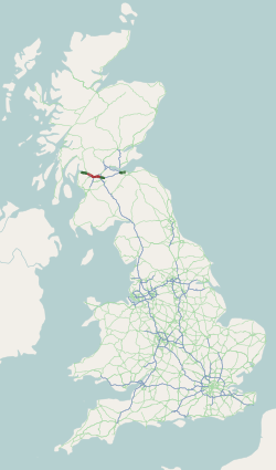
The A8 is a major road in Scotland, connecting Edinburgh to Greenock via Glasgow. Its importance diminished following the construction of the M8 motorway which also covers the route between Edinburgh and Glasgow.
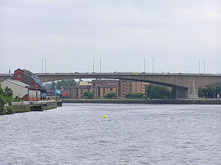
The Kingston Bridge is a balanced cantilever dual-span ten lane road bridge made of triple-cell segmented prestressed concrete box girders crossing the River Clyde in Glasgow, Scotland.
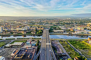
The city of Glasgow, Scotland, has a transport system encompassing air, rail, road and an underground light metro line. Prior to 1962, the city was also served by trams. Commuters travelling into Glasgow from the neighbouring local authorities of North and South Lanarkshire, Renfrewshire, East Renfrewshire, and East and West Dunbartonshire have a major influence on travel patterns, with tens of thousands of residents commuting into the city each day. The most popular mode of transport in the city is the car, used by two-thirds of people for journeys around the city.

This article is intended to show a timeline of the history of Glasgow, Scotland, up to the present day.

Glasgow Central is a constituency of the House of Commons of the Parliament of the United Kingdom. In its current form, the constituency was first used at the 2005 general election, but there was also a Glasgow Central constituency that existed from 1885 to 1997. The sitting MP is Alison Thewliss of the Scottish National Party (SNP), who was first elected in May 2015. This constituency was also the seat of the former Conservative Prime Minister Bonar Law, who was the shortest-serving UK Prime Minister of the twentieth century.
Glasgow Bridgeton was a parliamentary constituency in the city of Glasgow. From 1885 to 1974, it returned one Member of Parliament (MP) to the House of Commons of the Parliament of the United Kingdom, elected by the first-past-the-post voting system.
Glasgow Gorbals was a parliamentary constituency in the city of Glasgow. From 1918 until 1974, it returned one Member of Parliament (MP) to the House of Commons of the Parliament of the United Kingdom, elected by the first-past-the-post system.
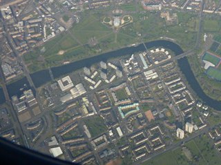
Hutchesontown is an inner-city area in Glasgow, Scotland. Mostly residential, it is situated directly south of the River Clyde and forms part of the wider historic Gorbals district, which is covered by the Southside Central ward under Glasgow City Council.

Laurieston is a district in the Gorbals area of the Scottish city of Glasgow. It is situated south of the River Clyde. It derives its name from James Laurie who, along with his brother, developed a large part of the district in the early 19th century.
Glasgow Blackfriars and Hutchesontown, representing parts of the city of Glasgow, Scotland, was a burgh constituency represented in the House of Commons of the Parliament of the United Kingdom from 1885 until 1918.

The A728 is a route number in Glasgow, Scotland applied to two connected roads.
The City of Glasgow Union Railway - City Union Line, also known as the Tron Line, was a railway company founded in Glasgow, Scotland, in 1864 to build a line connecting the railway systems north and south of the River Clyde, and to build a central passenger terminus and a general goods depot for the city. The through line, running from south-west to north-east across the city, opened in 1870–71, and the passenger terminal was St Enoch railway station, opened in 1876. The railway bridge across the Clyde was the first in the city.

The Kelvin Aqueduct is a navigable aqueduct in Glasgow, Scotland, which carries the Forth and Clyde Canal over the River Kelvin.

The A814 road in Scotland is a major arterial route within Glasgow, connecting the city centre to the west end. Running along the right (north) bank of the River Clyde, it continues further west through Clydebank and Dumbarton, leaving the suburban environment and serving as the main road for Helensburgh, turning north to meet the A83 at Arrochar, Argyll and Bute.
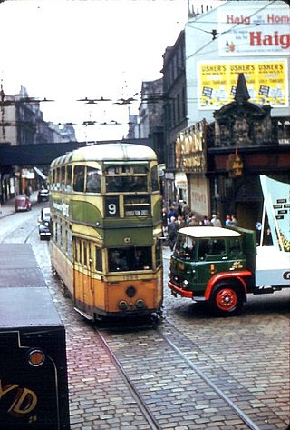
Glasgow Corporation Tramways were formerly one of the largest urban tramway systems in Europe. Over 1000 municipally-owned trams served the city of Glasgow, Scotland, with over 100 route miles by 1922. The system closed in 1962 and was the last city tramway in Great Britain.
Events from the year 1854 in Scotland.

The Albert Bridge is a road bridge that spans the River Clyde in Glasgow, Scotland, near Glasgow Green. The bridge opened in 1871. It links the Saltmarket in the city centre with Crown Street on the city’s south side. It is category A listed, and named after Queen Victoria's consort, Prince Albert.

Alexander Beith McDonald was a Scottish architect, who served as City Engineer and Surveyor in Glasgow Corporation's Office of Public Works between 1890 and 1914.

The Briggait is a category A listed building in Glasgow, Scotland, situated in the Merchant City area on the Bridgegate (A8) and Clyde Street (A814) just north of the River Clyde. Construction of the building was completed in 1873.