Westmont, Illinois

Last updated

Westmont
Village
Westmont il.jpg
Flag of Westmont, Illinois.png
Logo of Westmont, Illinois.png
Nickname(s): 
"Whiskey Hill", "Wet-mont", "Bestmont"
Motto(s): 
"The Progressive Village", "In The Middle Of It All"
DuPage County Illinois Incorporated and Unincorporated areas Westmont Highlighted.svg
Location of Westmont in DuPage County, Illinois.
Coordinates: 41°47′40″N87°58′35″W / 41.79444°N 87.97639°W / 41.79444; -87.97639
CountryFlag of the United States (23px).png  United States
StateIllinois
County DuPage
Township Downers Grove, York
Incorporated 1921
Government
  Type Mayor-trustee
   Mayor Ron Gunter
Area
[1]
  Total5.11 sq mi (13.23 km2)
  Land5.00 sq mi (12.96 km2)
  Water0.10 sq mi (0.27 km2)  2.14%
Population
 (2020)
  Total24,429
  Density4,881.89/sq mi (1,884.88/km2)
 Up 15.67% from 1990
Standard of living
   Per capita income $26,394 (median: $51,422)
   Home value $200,814 (median: $180,200 (2000))
ZIP code(s)
60559
Area code(s) 630 and 331
Geocode 80645
FIPS code 17-80645
Website www.westmont.il.gov
Demographics (2000) [2]
DemographicProportion
White 78.02%
Black 6.38%
Hispanic 6.98%
Asian 11.95%
Islander 0.00%
Native 0.13%
Other2.41%

Westmont is a village in DuPage County, Illinois, United States. Located in the southeastern portion of DuPage County, Westmont is a community of 5.03 square miles in area with a 2020 population of 24,429. [3] It is a southwest suburb of Chicago.

Contents

History

The area known as Westmont earlier had been inhabited by the Potawatami. After several failed attempts by the U.S. government to persuade the Native Americans to move from the area, in 1833 they agreed under coercion to vacate their land for a nominal payment. [4]

The development of the Illinois-Michigan Canal, authorized by the State of Illinois in the 1820s but delayed in construction until the 1830s, contributed to Westmont's early growth. [4] Many of the workers turned to farming when the economic panic of 1837 halted canal construction; agriculture became the major occupation with produce sold in nearby Chicago. The area around Westmont became one of the most prosperous sections of the state.

In order to transport agricultural products into the city of Chicago, construction of a plank road from Chicago began in 1840. The path traversed the nine-mile (14 km) swamp between Chicago and the area that later became Westmont; it reached Naperville by 1851. [4] Today, this path is known as Ogden Avenue (U.S. Route 34).

The plank road soon became inadequate; in 1858, local incorporated towns and villages petitioned the Chicago, Burlington and Quincy Railroad to build a branch line from Aurora to Chicago that would pass through their towns. [4] The railroad line was approved, with the first train in 1864. "Gregg's Milk Station, [5] " from which Westmont developed, was a stop to load agricultural and dairy products. The town transitioned gradually from an agricultural community to a commuter community, with the early growth and development centered around the railroad station.

In the early 1900s, plats for the Village of Westmont were laid out and roads were dedicated; incorporation was decided by a vote of 41-28 in 1921. Westmont was officially incorporated on November 4, 1921; Vince Pastor served as the first president of the Village Board. [4]

The Village did not encourage concentrated commercial or industrial growth until the 1950s, with the development of some light service companies, industrial firms, and wholesaling firms. However, it was not until the 1960s and 1970s that Westmont began to grow in earnest; Westmont High School did not open until 1974. New subdivisions and multiple-family housing units led to the tripling of the population.[ citation needed ]

The current Westmont Public Library building opened in 1993. [6]

Notable people

Geography

Westmont is located at 41°47′40″N87°58′35″W / 41.79444°N 87.97639°W / 41.79444; -87.97639 (41.794480, -87.976433). [8] It is bounded on the north by the Village of Oak Brook, on the east by the Village of Clarendon Hills, on the south by the City of Darien and on the west by the Village of Downers Grove. It is nearly wholly within Downers Grove Township.

According to the 2021 census gazetteer files, Westmont has a total area of 5.11 square miles (13.23 km2), of which 5.00 square miles (12.95 km2) (or 97.94%) is land and 0.11 square miles (0.28 km2) (or 2.06%) is water. [9]

Demographics

Historical population
CensusPop.Note
1930 2,733
1940 3,04411.4%
1950 3,40211.8%
1960 5,99776.3%
1970 8,83247.3%
1980 17,35396.5%
1990 21,22822.3%
2000 24,55415.7%
2010 24,6850.5%
2020 24,429−1.0%
U.S. Decennial Census [10]
2000 Census population pyramid for Westmont WestmontILUSAPopulationPyramid.png
2000 Census population pyramid for Westmont

As of the 2020 census [11] there were 24,429 people, 10,485 households, and 6,175 families residing in the village. The population density was 4,782 inhabitants per square mile (1,846/km2). There were 11,161 housing units at an average density of 2,185 per square mile (844/km2). The racial makeup of the village was 64.85% White, 6.97% African American, 0.43% Native American, 14.72% Asian, 0.07% Pacific Islander, 5.50% from other races, and 7.47% from two or more races. Hispanic or Latino of any race were 12.72% of the population.

There were 10,485 households, out of which 27.0% had children under the age of 18 living with them, 46.51% were married couples living together, 9.63% had a female householder with no husband present, and 41.11% were non-families. 36.57% of all households were made up of individuals, and 16.50% had someone living alone who was 65 years of age or older. The average household size was 3.07 and the average family size was 2.31.

The village's age distribution consisted of 20.4% under the age of 18, 6.9% from 18 to 24, 27.1% from 25 to 44, 27.4% from 45 to 64, and 18.3% who were 65 years of age or older. The median age was 40.1 years. For every 100 females, there were 85.8 males. For every 100 females age 18 and over, there were 85.3 males.

The median income for a household in the village was $69,902, and the median income for a family was $97,583. Males had a median income of $54,184 versus $40,258 for females. The per capita income for the village was $43,229. About 8.3% of families and 11.3% of the population were below the poverty line, including 16.0% of those under age 18 and 12.1% of those age 65 or over.

Economy

According to the 2021 Comprehensive Financial Report, the top employers in Westmont are: [12]

#Employer# of Employees
1First Student Charter270
2Unit School District 201256
3 Autonation 255
4Village of Westmont218
5 Mariano's 200

The town officially opened a 94 unit luxury residential apartment building dubbed Quincy Station in 2022, a transit-oriented and pet-friendly development. Part of a larger effort towards revitalizing the Central Business District in Westmont. [13]

Transportation

Westmont has a Metra station on Metra's BNSF Railway Line, which provides daily rail service between Aurora, Illinois and Chicago's Union Station. U.S. Route 34, Interstate 88 located north of the Village, Interstate 55 to the South, Interstate 294 to the East and Interstate 355 to the West provide road access to the Chicago Region.

Pace provides bus service on Route 715 connecting Westmont to Glen Ellyn and other destinations. [14]

See also

Related Research Articles

<span class="mw-page-title-main">Loraine, Illinois</span> Village in Illinois, United States

Loraine is a village in Adams County, Illinois, United States. The population was 300 at the 2020 census.

<span class="mw-page-title-main">Buda, Illinois</span> Village in Illinois, United States

Buda is a village in Bureau County, Illinois, United States. The population was 482 at the 2020 census. It is part of the Ottawa Micropolitan Statistical Area.

<span class="mw-page-title-main">Seatonville, Illinois</span> Village in Illinois, United States

Seatonville is a village in Bureau County, Illinois, United States. The population was 321 at the 2020 census. It is part of the Ottawa Micropolitan Statistical Area.

<span class="mw-page-title-main">Broadview, Illinois</span> Village in Illinois, United States

Broadview is a village in Cook County, Illinois, 12 miles (19 km) west of downtown Chicago. As of the 2020 census it had a population of 7,998.

<span class="mw-page-title-main">Forest View, Illinois</span> Village in Illinois, United States

Forest View is a village in Cook County, Illinois, United States. Per the 2020 census, the population was 792. It is primarily an industrial corridor adjacent to the Chicago neighborhood of Garfield Ridge, which is on the village's southern border.

<span class="mw-page-title-main">Oak Brook, Illinois</span> Suburb of Chicago

Oak Brook is a village in DuPage County, Illinois, United States. The population was 8,163 at the 2020 census.

<span class="mw-page-title-main">Riverside, Illinois</span> Village in Illinois, United States

Riverside is a suburban village in Cook County, Illinois, United States. The population of the village was 9,298 at the 2020 census. It is a suburb of Chicago, located roughly 9 miles (14 km) west of downtown Chicago and 2 miles (3 km) outside city limits. A significant portion of the village is in the Riverside Landscape Architecture District, designated a National Historic Landmark in 1970.

<span class="mw-page-title-main">Clarendon Hills, Illinois</span> Village in Illinois, United States

Clarendon Hills is a village in DuPage County, Illinois, United States. The population was 8,702 at the 2020 census. It is a south-west suburb of Chicago.

<span class="mw-page-title-main">Darien, Illinois</span> City in Illinois, United States

Darien is a city in DuPage County, Illinois, United States. Per the 2020 census, the population was 22,011. A southwestern suburb of Chicago, Darien was named after the town of Darien, Connecticut. Darien is just north of I-55 and Historic U.S. Route 66. The entire south edge of the town borders Waterfall Glen.

<span class="mw-page-title-main">Willowbrook, DuPage County, Illinois</span> Village in Illinois, United States

Willowbrook is a village in DuPage County, Illinois, United States, in the Chicagoland area. Per the 2020 census, the population was 9,236. It is a southwestern suburb of Chicago.

<span class="mw-page-title-main">Avon, Illinois</span> Village in Illinois, United States

Avon is a village in Fulton County, Illinois, United States. The population was 704 at the 2020 census.

<span class="mw-page-title-main">Minooka, Illinois</span> Village in Illinois, United States

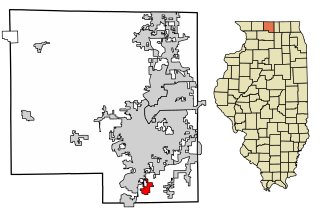
Minooka is a village in Grundy, Kendall, and Will counties, Illinois, United States. The population was 12,758 at the 2020 census, up from 10,924 at the 2010 census. The village is part of the Chicago metropolitan area.

<span class="mw-page-title-main">Clifton, Illinois</span> Village in Illinois, United States

Clifton is a village in Chebanse Township, Iroquois County, Illinois, United States. The population was 1,468 at the 2010 census, up from 1,317 at the 2000 census.

<span class="mw-page-title-main">Lostant, Illinois</span> Village in Illinois, United States

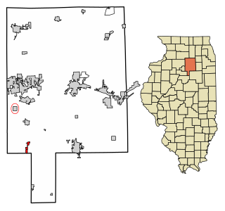
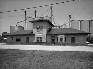
Lostant is a village in LaSalle County, Illinois, United States. The population was 423 at the 2020 census, down from 498 at the 2010 census. It is part of the Ottawa Micropolitan Statistical Area.

<span class="mw-page-title-main">North Henderson, Illinois</span> Village in Illinois, United States

North Henderson is a village in Mercer County, Illinois, United States. The population was 162 at the 2020 census.

<span class="mw-page-title-main">Pulaski, Illinois</span> Village in Illinois, United States

Pulaski is a village in Pulaski County, Illinois, United States. The population was 235 at the 2010 census. The village is named in honor of Polish Revolutionary War hero Casimir Pulaski.

<span class="mw-page-title-main">Sidell, Illinois</span> Village in Illinois, United States

Sidell is a village in Sidell Township, Vermilion County, Illinois, United States. It is part of the Danville, Illinois Metropolitan Statistical Area. The population was 617 at the 2010 census.

<span class="mw-page-title-main">New Milford, Illinois</span> Village in Illinois, United States

New Milford is a village in Winnebago County, Illinois, United States on the south bank of the Kishwaukee River overlooking the south side of Rockford. It is part of the Rockford, Illinois Metropolitan Statistical Area. The population was 697 at the 2010 census, up from 541 in 2000.

<span class="mw-page-title-main">Guys Mills, Pennsylvania</span> Census-designated place in Pennsylvania, United States

Guys Mills is a census-designated place in Crawford County, Pennsylvania, United States. The population was 124 at the 2010 census.

<span class="mw-page-title-main">York Township, DuPage County, Illinois</span> Township in Illinois, United States

York Township is one of nine townships in DuPage County, Illinois, USA. As of the 2020 census, its population was 128,425 and it contained 53,543 housing units.

References

  1. "2020 U.S. Gazetteer Files". United States Census Bureau. Retrieved March 15, 2022.
  2. 2000 United States Census Data
  3. "Westmont (village) QuickFacts from the US Census Bureau". Archived from the original on June 9, 2012. Retrieved July 5, 2012.
  4. 1 2 3 4 5 Village of Westmont. "History of Westmont" . Retrieved August 2, 2014.
  5. "Westmont Historical Society - Gregg House Museum".
  6. "History".
  7. "Muddy Waters Park". recplanet.com. Retrieved June 4, 2023.
  8. "US Gazetteer files: 2010, 2000, and 1990". United States Census Bureau. February 12, 2011. Retrieved April 23, 2011.
  9. Bureau, US Census. "Gazetteer Files". Census.gov. Retrieved June 29, 2022.
  10. "Census of Population and Housing". Census.gov. Retrieved June 4, 2015.
  11. "Explore Census Data". data.census.gov. Retrieved June 28, 2022.
  12. "2021 ANNUAL COMPREHENSIVE FINANCIAL REPORT" . Retrieved October 29, 2023.
  13. "Local Announcement: Ribbon Cutting Ceremony Makes Quincy Station Westmont Official". October 19, 2022.
  14. "RTA System Map" (PDF). Retrieved January 30, 2024.