Edmonton Strathcona is a federal electoral district in Alberta, Canada, that has been represented in the House of Commons of Canada since 1953. It spans the south-central part of the city of Edmonton. In the periods 2008–2015 and 2019–2021, during the 40th, 41st, and 43rd Canadian Parliaments, Edmonton Strathcona was the only federal riding in Alberta not represented by the Conservative Party.

Anthony Henday Drive (Highway 216) is a 78-kilometre (48 mi) freeway that encircles Edmonton, Alberta. It is a heavily travelled commuter and truck bypass route with the southwest quadrant serving as a portion of the CANAMEX Corridor that links Canada to the United States and Mexico. Henday is one of the busiest highways in Western Canada, carrying over 108,000 vehicles per day in 2019 at its busiest point near West Edmonton Mall. Rush hour congestion is common on the four-lane section in southwest Edmonton, where traffic levels have risen due to rapid suburban development. Work began in fall 2019 to widen this section to six lanes by the end of 2022.
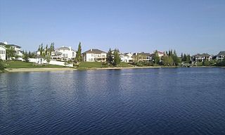
Twin Brooks is a residential neighbourhood in south Edmonton, Alberta, Canada. It is located at the confluence of the Whitemud Creek and the Blackmud Creek, hence the origin of the name Twin Brooks. An artificial lake is situated in the neighbourhood, with George P. Nicholson Elementary School located near it.
Laurier Heights is a residential neighbourhood in west Edmonton, Alberta, Canada overlooking the North Saskatchewan River valley. A portion of the neighbourhood along Buena Vista Road is located in the river valley, and this portion is sometimes called Buena Vista.

The Waskahegan Trail is a walking/hiking trail that runs through and around Edmonton, Alberta, Canada. It is 309 kilometres (192 mi) and runs through a mix of public and private land. Landowners are paid nothing. Their permission is given on the understanding that it can be withdrawn at any time for any reason. The trail is managed by a volunteer board, the Waskahegan Trail Association (WTA).

Grandview Heights is a residential neighbourhood in south west Edmonton, Alberta, Canada. It is built on land that had been owned in the 1880s by a family named McCauley.
Bulyea Heights is a residential neighbourhood in the Riverbend area of south west Edmonton, Alberta, Canada. The neighbourhood overlooks Whitemud Creek Ravine. The neighbourhood is named for George H. V. Bulyea, first Lieutenant-Governor of the Province of Alberta.
Ramsay Heights is a residential neighbourhood in south west Edmonton, Alberta, Canada overlooking the North Saskatchewan River valley. It is named for Walter Ramsay, who came to the city in 1899 as a teacher and later became the city's first commercial florist.
Brookside is a residential neighbourhood in south west Edmonton, Alberta, Canada overlooking the North Saskatchewan River valley and Whitemud Creek ravine.
Terwillegar Drive is a developing freeway in south-west Edmonton, Alberta. It is under construction, with the majority of its intersection at-grade, it retains its arterial road status. Once completed, it will be the third freeway in Edmonton not to have a highway designation after Groat Road and Wayne Gretzky Drive. South of Windermere Boulevard the roadway goes by 170 Street SW.
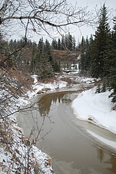
Blackmud Creek is a creek in Edmonton that flows into Whitemud Creek. The creek starts at Saunders Lake East of Nisku and runs northwest into the City, joining Whitemud Creek in the neighbourhood of Twin Brooks.
50 Street is the designated name of two major arterial roads in east Edmonton, Alberta. Separated by the North Saskatchewan River, it is mostly straight, and runs the entire south-north length of Edmonton as well as the suburb of Beaumont. The Yellowhead Trail and 50 Street junction is the start of Highway 15, it then goes north to Manning Drive, which it follows from there. Highway 814 used follow 50 Street between Edmonton and Beaumont, until the Beaumont government took control of the road. The northside section of 50 Street is presently segmented by the developing community of Cy Becker with grading in place for a future interchange at Anthony Henday Drive; however, there is no timeline for construction.
97/98/101 Avenue and Baseline Road is a major arterial road in central Edmonton and north Sherwood Park, Alberta. It connects Downtown Edmonton with the mature residential neighborhoods on the city's eastern edge, as well as Refinery Row and Sherwood Park.
Quesnell Heights is a neighbourhood in west Edmonton, Alberta, Canada. It is bounded by the Rio Terrace neighbourhood across 149 Street to the west, Whitemud Drive to the north and east, the North Saskatchewan River valley to the south, Quesnell Heights is also the smallest neighbourhood in Edmonton.
Rio Terrace is a neighbourhood in west Edmonton, Alberta, Canada. It is bounded by the Patricia Heights neighbourhood across 156 Street to the west, the Lynnwood neighbourhood across Whitemud Drive to the north, the Quesnell Heights neighbourhood across 149 Street to the east, and the North Saskatchewan River valley to the south.
Patricia Heights is a neighbourhood in west Edmonton, Alberta, Canada. It is bounded by the Patricia Ravine of the North Saskatchewan River valley and ravine system to the south and southwest, the Westridge neighbourhood to the west, the Elmwood and Lynnwood neighbourhoods across Whitemud Drive to the north, and the Rio Terrace neighbourhood across 156 Street to the east.
Fulton Creek is a minor tributary which flows into the North Saskatchewan River. Fulton Creek originates within The Meadows area of Edmonton, Alberta. As with other urban Edmonton waterways, with long stretches running through underground culverts, and water volume managed by other urban land uses and for erosion control, Fulton Creek has been labeled a lost creek.
Calgary Trail and Gateway Boulevard are a pair of major arterial roadways in Edmonton, Alberta. Gateway Boulevard carries northbound traffic while Calgary Trail carries southbound traffic. From south of 31 Avenue, they form a two-way freeway separated by a median; for this portion, the roadway maintains the separate names for northbound and southbound traffic. Near 31 Avenue, Calgary Trail and Gateway Boulevard separate and become parallel one-way arterial roadways to Saskatchewan Drive, at the edge of the North Saskatchewan River valley. Designated as part of Highway 2 south of Whitemud Drive, it is Edmonton's main southern entrance and is both a major commuter route, connecting to the Edmonton International Airport and Leduc, as well as a regional connection to Red Deer and Calgary.