Basford, Staffordshire

Last updated

Basford
Staffordshire UK location map.svg
Red pog.svg
Basford
Location within Staffordshire
OS grid reference SJ858469
District
Shire county
Region
Country England
Sovereign state United Kingdom
Post town Newcastle
Postcode district ST5
Dialling code 01782
Police Staffordshire
Fire Staffordshire
Ambulance West Midlands
UK Parliament
List of places
UK
England
Staffordshire
53°01′10″N2°12′45″W / 53.0194°N 2.2126°W / 53.0194; -2.2126

Basford is a suburb which sits on high ground between Newcastle-under-Lyme and Stoke-on-Trent in Staffordshire, England.

Contents

History

The Roman road of Rykeneld Street from Wolstanton to Stoke would have run through Basford.

Basford's lofty position was first served by a 1759 turnpike road which was called "Fowlea Bank" by the 1770s, the name referring to the Fowlea Brook which runs through nearby Etruria and has formed the valley. [1] This old road still exists today, complete with its steep 1 in 8 gradient, surmounted by the substantial "Queen's Arms Inn" first built in 1769. After descending this bank, the crossing of the Fowlea into Etruria was then often a matter of fording the swampy valley bottom. This may have given rise to the later recorded name of Basford, being a local conflation of 'Bank' and 'Ford'.

In 1828 an easier 1 in 14 deep road cutting was made a short distance from the old road, and thereafter this became the main road linking Etruria with Wolstanton and Newcastle-under-Lyme. The banked footings of the base of this new road swept very high above the Fowlea Brook, ensuring easy passage across the valley bottom in all weathers. The new bank began to being referred to in documents as "Basford Hill" or "Basford Bank" by the 1830s. [1]

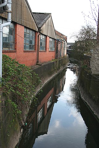
Due to abundant well-drained clay all along the valley ridge, tile and brick making is documented here as far back as the late 1600s. Rhead's book Staffordshire Pots and Potters (1906) found only a one-man water-pipe business in Basford at 1818, but noted traces of a possible early pottery: "... there were scattered foundations of what might have been a pottery in King's fields, with the remains of low arches as of oven or kiln 'mouths'." During the 1830s, the area along the base of the escarpment featured the full range of brick and tile yards and small ceramics manufactories, increasingly working at an industrial scale. [1] Despite this, substantial pockets of fields and woods persisted, notably the Etruria Woods. As late as 1929 aerial photography reveals large fields of corn and wheat being harvested directly alongside large tile-works at Basford. [2]

Basford Lawn Tennis Club was founded in 1883 and was originally sited on the present-day car park behind The Queen's Hotel (formerly the "Queen's Arms Inn"), but moved to its present location of West Avenue in 1926. The club hosted an exhibition match between Fred Perry and 'Bunny' Austin on 11 May 1936. [3]

From the 1890s onwards the area saw substantial development of vegetable growing allotments, many of which still exist today as large active allotment sites.

Hartshill and Basford Halt was a railway station located on the Market Drayton branch of the North Staffordshire Railway, and this enabled Basford people to travel to Newcastle-under-Lyme and Keele by train. The Halt closed in 1926.

The Potteries Loop Line local railway (Etruria to Kidsgrove) was closed by the notorious Dr. Beeching cuts in spring 1964. This meant it was no longer possible to travel from Etruria station to Hanley or Burslem by train.

In the 1970s a very major physical intervention in the geography of the area was the construction of the A500 road, running north–south along the escarpment bottom. This involved a complex new road interchange being built at the bottom of Basford Bank.

In 1986 Basford became home to Europe's first purpose-built theatre in the round, when the New Vic Theatre was built on the Newcastle-under-Lyme side of Basford. This replaced the nearby Victoria Theatre at Hartshill.

As some heavy industry became defunct, various open space regeneration and reclamation schemes were undertaken from the 1990s onwards. For instance, at Haydon Street there is now a large tree-edged playing field known as "Basford Open Space" which is now called "Basford Park". The field was once the site of industrial works, but has seen major reclamation and improvements, including a paved cycle-path. Another new feature of the area is the extensive and modern children's play area nicknamed "The Grum", on a former railway tunnel entrance between Victoria Street and the Shelton New Road, which now also includes sports features such as skate ramps and a basketball court.

The Etruria railway station, very near the foot of the Basford Bank and serving Basford, was closed to passengers in 2005.

Religion

The Church of England parish church of Basford is St. Mark's Church on Basford Park Road in the deanery of Newcastle-under-Lyme, Staffordshire. [4]

There is also a Seventh-day Adventist church on Victoria Street which was registered for worship in 1948. [5]

Basford had a Wesleyan Methodist chapel opposite St. Mark's Church on Basford Park Road. Built by 1902, it was demolished in the early 2000s and the site was redeveloped with apartments.

Literary associations

The writer H. G. Wells lived in Basford from March to June 1888 [6] while convalescing from illness. In his autobiography he wrote "I found... the strange landscape of the Five Towns with its blazing iron foundries, its steaming canals, its clay-whitened pot-banks and the marvellous effects of its dust and smoke-laden atmosphere, very stimulating..." "...at Etruria my real writing began..." There he began the early drafts of what would become his famous The Time Machine (1895). He planned a vast melodrama set in the Five Towns, but the only section known to survive is the macabre short story "The Cone". [7] [8]

Related Research Articles

<span class="mw-page-title-main">Staffordshire</span> County of England

Staffordshire is a landlocked ceremonial county in the West Midlands of England. It borders Cheshire to the north-west, Derbyshire and Leicestershire to the east, Warwickshire to the south-east, the West Midlands county and Worcestershire to the south, and Shropshire to the west. The largest settlement is the city of Stoke-on-Trent; the county town is Stafford.

<span class="mw-page-title-main">Stoke-upon-Trent</span> Human settlement in England

Stoke-upon-Trent, also called Stoke, is one of the six towns that along with Hanley, Burslem, Fenton, Longton and Tunstall form the city of Stoke-on-Trent, in Staffordshire, England.

<span class="mw-page-title-main">Stoke-on-Trent</span> City and unitary authority in England

Stoke-on-Trent is a city and unitary authority area in Staffordshire, England, with an area of 36 square miles (93 km2). In 2021, the city had an estimated population of 258,400. It is the largest settlement in Staffordshire and is surrounded by the towns of Newcastle-under-Lyme, Alsager, Kidsgrove and Biddulph, which form a conurbation around the city.

<span class="mw-page-title-main">Newcastle-under-Lyme</span> Market town in Staffordshire, England

Newcastle-under-Lyme is a market town and the administrative centre of the Borough of Newcastle-under-Lyme in Staffordshire, England. It is adjacent to the city of Stoke-on-Trent. In 2021 the population was 75,082.

<span class="mw-page-title-main">Borough of Newcastle-under-Lyme</span> Non-metropolitan district and borough in England

The Borough of Newcastle-under-Lyme is a local government district with borough status in Staffordshire, England.

<span class="mw-page-title-main">Burslem</span> Human settlement in England

Burslem is one of the six towns that along with Hanley, Tunstall, Fenton, Longton and Stoke-upon-Trent form part of the city of Stoke-on-Trent in Staffordshire, England. It is often referred to as the "mother town" of Stoke on Trent.

Etruria is a suburb of Stoke-on-Trent, Staffordshire, England.

<span class="mw-page-title-main">Tunstall, Staffordshire</span> Human settlement in England

Tunstall is one of the six towns that, along with Burslem, Longton, Fenton, Hanley and Stoke-upon-Trent, amalgamated to form the City of Stoke-on-Trent in Staffordshire, England. It was one of the original six towns that federated to form the city. Tunstall is the most northern, and fourth largest town of the Potteries. It is situated in the very northwest of the city borough, with its north and west boundaries being the city limit. It stands on a ridge of land between Fowlea Brook to the west and Scotia Brook to the east, surrounded by old tile-making and brick-making sites, some of which date back to the Middle Ages.

<span class="mw-page-title-main">Chesterton, Staffordshire</span> Former mining village in Staffordshire, England

Chesterton is a former mining village on the edge of Newcastle-under-Lyme, in the Newcastle-under-Lyme district, in Staffordshire, England.

Basford may refer to:

<span class="mw-page-title-main">Wolstanton</span> Human settlement in England

Wolstanton is a suburban town on the outskirts of Newcastle-under-Lyme, in the Newcastle-under-Lyme district, in the county of Staffordshire, England.

<span class="mw-page-title-main">Cliffe Vale, Staffordshire</span> Human settlement in England

Cliff Vale is a district of the city of Stoke-on-Trent, and lies to the immediate south of Etruria and just east of Basford and Hartshill. Cliffe Vale is in the valley of the Fowlea Brook, now better known as Etruria Valley. There are industrial and employment uses along the A500, and new residential developments along the Trent and Mersey Canal. The Shelton New Road (B5045) passes through from east to west. The area is sometimes called Cliff Vale by the city council, and is part of the Hartshill electoral ward.

<span class="mw-page-title-main">Newcastle-under-Lyme railway station</span> Disused railway station in Staffordshire, England

Newcastle-under-Lyme railway station was a railway station that served the town of Newcastle-under-Lyme, Staffordshire, England. It was opened by the North Staffordshire Railway in 1852.

Hartshill and Basford Halt was a railway station located between the Stoke-on-Trent and Newcastle-under-Lyme stations on the Market Drayton branch of the North Staffordshire Railway, approx 1.5 miles (2.4 km) east of Newcastle.

<span class="mw-page-title-main">Hartshill Park</span> Nature reserve in Stoke-on-Trent, England

Hartshill Park is a large nature reserve stretching along the western edge of the city of Stoke-on-Trent, England. The park is a patchwork of different habitats, including five ponds. It is notable for being part of a Norman deer hunting park that has survived as open space into the modern era. It is a local nature reserve.

<span class="mw-page-title-main">Potteries Electric Traction Company</span>

The Potteries Electric Traction Company operated a tramway service in The Potteries between 1899 and 1928.

Rykeneld Street or Ryknield Street was a Roman road which ran through the northern Midlands of England from Deva (Chester) to Derventio (Derby) via what is now Stoke-on-Trent. It is not to be confused with the Icknield Street. It has in the past also been called by Victorian antiquarians the "Via Devina". The territory traversed would have been that of the Cornovii.

<span class="mw-page-title-main">Fowlea Brook</span> Stream in Staffordshire, England

Fowlea Brook rises in Staffordshire and flows through the northern parts of Stoke-on-Trent, England. It is a tributary stream of the River Trent, and is 6 miles (9.7 km) long.

References

  1. 1 2 3 "Stoke-upon-Trent - Buildings, manors and estates". British History Online. Retrieved 29 September 2010.
  2. "The Etruria Tileries, Newcastle-under-Lyme, 1929". Historic Environment Scotland. Retrieved 24 June 2017.
  3. "About Basford Lawn Tennis Club". Basford Lawn Tennis Club. Archived from the original on 11 October 2010. Retrieved 28 September 2010.
  4. "St. Mark's Church, Basford, Stoke on Trent". The Church Of England. Retrieved 28 September 2010.
  5. "Roman Catholicism and Protestant Nonconformity". British History Online. Retrieved 29 September 2010.
  6. H. G. Wells writer stayed in this house during the year 1888. Open Plaques, accessed 12 May 2016.
  7. An Experiment in Autobiography, by H. G. Wells: Chapter 6 The University of Adelaide eBooks.
  8. Page 90 John R Hammond, A Preface to H. G. Wells, Routledge 2014.