East Howe

Last updated

East Howe
East Howe, Peter's News - geograph.org.uk - 870138.jpg
Newsagent's and former post office in East Howe
Dorset UK location map.svg
Red pog.svg
East Howe
Location within Dorset
OS grid reference SZ071953
Unitary authority
Ceremonial county
Region
Country England
Sovereign state United Kingdom
Post town BOURNEMOUTH
Postcode district BH10
Dialling code 01202
Police Dorset
Fire Dorset and Wiltshire
Ambulance South Western
UK Parliament
List of places
UK
England
Dorset
50°45′25″N1°54′04″W / 50.757°N 1.901°W / 50.757; -1.901 Coordinates: 50°45′25″N1°54′04″W / 50.757°N 1.901°W / 50.757; -1.901

East Howe is a residential district of the town of Bournemouth, Dorset on the south coast of England.

Contents

Origins

The district takes its name from the now-archaic English word "howe", variously defined as denoting a depression or a stretch of high ground. [1] There is a ridge of high ground stretching across to the west, which appears to have given rise to the toponyms High Howe, West Howe and East Howe, certainly prior to 1826 when all three settlements were marked on Greenwood's map of Dorset. Previously, a 'How Corner' had featured on Paterson's 1785 map of Dorset, seemingly denoting a bend in the Poole to Ringwood road (now the A348) as it passed through the High Howe area.

'Headless Cross Lane'

East Howe is approached from the ancient district of Kinson via East Howe Lane, which was known as 'Headless Cross Lane' in the 1920s on account of the T-shape formed by its junction with Wimborne Road. [2] This T-junction was marked as 'Headless Cross' on Ordnance Survey maps between 1888 and 1969. Previously it had been known as 'Rigler's Cross' after William Rigler, a landowner at the time of the 1851 census, whose descendants still live in the Kinson and East Howe areas. [3] The junction was reconfigured in 1962 when Broadway Lane was extended to meet up with Headless Cross; around the same time, land on the south-west side of the junction was acquired by Bournemouth Borough Council who proceeded to lay it out as a recreation area. The area was to be christened 'Headless Cross Park', but on reflection this was thought to sound too gruesome and 'East Howe Recreation Ground' was suggested as an alternative. [4]

Brook Road

Further south, East Howe Lane is joined by Brook Road in which there once stood Howe Lodge, an eighteenth-century property, thought to have been home to the local smuggler and landowner Isaac Gulliver. Described as a "rambling battlemented manor house", [5] it was demolished in 1958 to allow for road-widening. [6] Its last tenant prior to demolition was William Charles Veal, who rented it from Bournemouth Borough Council and ran a timber-yard there; when digging in the garden, soon after he moved in around 1947, he came upon a brick tunnel and was able to walk along it for 30 or 40 yards before it came to a sudden stop. The tunnel was accessed via a cellar beneath a trapdoor in the living room, presumably a relic of Gulliver's smuggling past. [7]

Politics

East Howe is part of the Bournemouth West parliamentary constituency. East Howe is divided between two wards for elections to Bournemouth, Christchurch and Poole Council; Kinson and Redhill and Northbourne. [8]

Related Research Articles

Isaac Gulliver English smuggler

Isaac Gulliver (1745–1822) was an English smuggler based on the South Coast. Gulliver and his gang ran fifteen luggers to transport gin, silk, lace and tea from the Continent to Poole Bay and came to control the coast from Lymington on The Solent in Hampshire, through Dorset to Torbay in Devon. He was known as "King of the Dorset Smugglers" and was also referred to as "the gentle smuggler who never killed a man". His men, who whitened their hair and wore smock-frocks, were known as the "white-wigs".

Mid Dorset and North Poole (UK Parliament constituency)

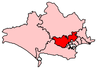
Mid Dorset and North Poole is a constituency represented in the House of Commons of the UK Parliament since 2015 by Michael Tomlinson, a Conservative.

Bournemouth West (UK Parliament constituency) UK Parliament constituency in England since 1950

Bournemouth West is a parliamentary constituency represented in the House of Commons of the UK Parliament since 2010 by Conor Burns, a Conservative.

Branksome, Dorset Human settlement in England

Branksome is a suburb of Poole in Dorset, England. The area consists of residential properties and also a number of commercial and industrial areas.

South East Dorset conurbation

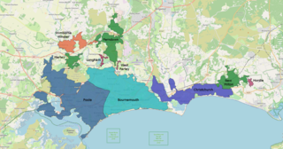
The South East Dorset conurbation is a multi-centred conurbation on the south coast of Dorset in England. The main population centres are Bournemouth, Christchurch and Poole, which together form the single unitary authority of Bournemouth, Christchurch and Poole; however, the urbanised area spreads into the Dorset unitary authority and into the New Forest District as far east as Barton on Sea. There are a number of satellite towns peripheral to these main urban centres. In clockwise rotation these include: Wareham, Verwood and Ringwood (Hampshire). The urban area is generally surrounded by a green belt.

Bear Cross Human settlement in England

Bear Cross is a suburb on the north-western edge of Bournemouth, Dorset, taking its name from the crossroads made by the main road (A348) between Poole and Ringwood and the Wimborne Road/Magna Road (A341).

Kinson Human settlement in England

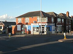
Kinson is a former village which has been absorbed by the town of Bournemouth in the county of Dorset in England. The area became part of Bournemouth on 1 April 1931. There were two electoral wards containing the name Kinson. Their joint population at the 2011 Census was 19,824.

History of Bournemouth

The History of Bournemouth and human settlement in the surrounding area goes back for thousands of years.

Transport in Dorset

Dorset is a county in South West England. The county is largely rural and therefore does not have a dense transport network, and is one of the few English counties without a motorway. Due to its position on the English Channel coast, and its natural sheltered harbours, it has a maritime history, though lack of inland transport routes have led to the decline of its ports.

The Salisbury and Dorset Junction Railway was a railway that ran in the English counties of Wiltshire, Hampshire and Dorset from 1866 until its closure in 1964. Working from Salisbury, trains left the Salisbury to Southampton line at the remote Alderbury Junction. Here there was a signal box, some railway cottages and two platforms on the main line for staff use only. The line ambled south through rural surroundings to meet the Southampton and Dorchester Railway at West Moors. Trains continued through Wimborne to Poole and Bournemouth West.

Southampton and Dorchester Railway

The Southampton and Dorchester Railway was an English railway company formed to join Southampton in Hampshire with Dorchester in Dorset, with hopes of forming part of a route from London to Exeter. It received Parliamentary authority in 1845 and opened in 1847. It was promoted by Charles Castleman of Wimborne Minster, and became known as Castleman's Corkscrew because of the meandering route it followed.

Ensbury Park Human settlement in England

Ensbury Park is a mainly residential suburb of Bournemouth, in Dorset, England. It includes the housing estate of Slades Farm and lies within the ward district of Northbourne and Redhill.

Bournemouth Corporation Tramways

Bournemouth Corporation Tramways served the town of Bournemouth in Dorset from 23 July 1902 until 8 April 1936.

West Howe Human settlement in England

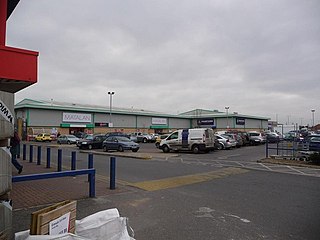
West Howe is a suburb of Bournemouth, Dorset, England, located in the north-west provinces of the borough.

Turbary Park

Turbary Park is an area of West Howe, Bournemouth in Dorset. Turbary Park is south of Kinson and north of Wallisdown.

Kinson (ward) Electoral ward in Bournemouth, Dorset, England

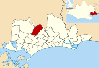
Kinson is a ward in Bournemouth, Dorset. Since 2019, the ward has elected 3 councillors to Bournemouth, Christchurch and Poole Council.

References

  1. West Howe History Group, West Howe Proper (Wimborne: Word and Action (Dorset) Ltd., 1983), p. 18.
  2. J. F. Parsons, A Companion Guide to North Bournemouth (Bournemouth: Bournemouth Local Studies Publications, 1981), p. 23.
  3. A. J. McKinstry, 'Crosses Revisited', in The Journal of the Christchurch Local History Society (November 2011).
  4. Ibid.
  5. The Bournemouth Times, 27 December 1957.
  6. The Bournemouth Times, 11 April 1958.
  7. The Bournemouth Daily Echo, 4 July 1953.
  8. "Kinson (Ward, United Kingdom) - Population Statistics, Charts, Map and Location". citypopulation.de. Retrieved 9 May 2021.