Springbourne

Last updated

Springbourne
Springbourne, Holdenhurst Road - geograph.org.uk - 1094544.jpg
Holdenhurst Road, Springbourne
Dorset UK location map.svg
Red pog.svg
Springbourne
Location within Dorset
OS grid reference SZ105924
Unitary authority
Ceremonial county
Region
Country England
Sovereign state United Kingdom
Post town BOURNEMOUTH
Postcode district BH1
Dialling code 01202
Police Dorset
Fire Dorset and Wiltshire
Ambulance South Western
UK Parliament
List of places
UK
England
Dorset
50°44′N1°51′W / 50.73°N 1.85°W / 50.73; -1.85

Springbourne is a suburb of Bournemouth in Dorset, England (historically in Hampshire). [1] It occupies the north-east part of the main built-up area, north of Boscombe. Its formal boundaries are Northcote Road to the west, the Wessex Way (A338) to the north, Ashley Road to the east, and the railway line to the south.

Contents

Its main road, Holdenhurst Road, was formerly the A338, the main road into Bournemouth from the north and north-east. It has now been bypassed, but it is still one of the main shopping streets and bus routes of Bournemouth.

History

The original suburb of Springbourne covered 93 acres (380,000 m2) and at one time was known as Boscombe Heath. The area gets its name from an old spring that came from near the Windham Road end of Spring Road. The stream then wandered underground to Boscombe Chine and out to sea. [2]

Springbourne began its life as a village providing accommodation to craftsmen and artisans employed in the growing town of Bournemouth; many of the cottages they lived in, built in the mid- to late Victorian era, can be seen today in the Northcote and Lytton Road areas. Later came avenues of mainly Edwardian houses, the roads named after US presidents and statesmen, e.g. Garfield Avenue, Washington Avenue.

The Cricketers Cricketers Public House, Springbourne, Bournemouth. - geograph.org.uk - 1035890.jpg
The Cricketers

The Cricketers Arms (1867) in Windham Road is one of the oldest pubs in Bournemouth. Originally known as The Cricketers Hotel, it was named after the cricket ground that once existed on land opposite, now the site of the Bournemouth Council depot adjoining the railway line and Southcote Road.

The pub's original stables and coach house are still standing and heritage experts reckon the front of the pub was extended a short distance around 1910. The stained glass windows and the bar are thought to date from the same time and, according to stories handed down by regulars, the bar was taken from a cruise ship.

Bournemouth-born boxing world champion Freddie Mills lived in nearby Spring Road and used to drink in the Cricketers. [3]

Springbourne Library Springbourne Public Library, Holdenhurst Road - geograph.org.uk - 1016303.jpg
Springbourne Library

Springbourne Library opened in 1909 and was made possible by its benefactor, Andrew Carnegie, it being one of the many Carnegie libraries, a scheme created by Andrew Carnegie, that involved building 2509 libraries worldwide, 660 of which were built in the UK. Andrew Carnegie started this scheme as a Philanthropist, after retiring from business and selling his steel enterprises to Mr J. P. Morgan for $6 billion.

Frederick Abberline was a Chief Inspector for the London Metropolitan Police and was a prominent police figure in the investigation into the Jack the Ripper murders of 1888. He retired to Springbourne - firstly to 4 Methuen Road (demolished, in the 1960s, to make room for Wessex Way), then to "Estcourt", 195 Holdenhurst Road, where he died in 1930. A plaque commemorating Abberline was unveiled at the latter property on 29 September 2001. [4]

In 2011 Springbourne Gardens, a pocket park, was opened alongside Springbourne Library.

Politics

Springbourne is part of the Bournemouth East constituency. Springbourne is also part of the East Cliff and Springbourne ward which elects three councillors to Bournemouth, Christchurch and Poole Council.

Related Research Articles

<span class="mw-page-title-main">Bournemouth</span> Town in Dorset, England

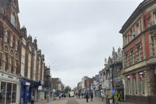
Bournemouth is a coastal resort town on the south coast in the Bournemouth, Christchurch and Poole borough of Dorset, England. The town had a population of 183,491 at the 2011 census making it the largest town in the county; the town is part of the South East Dorset conurbation, which has a population of 465,000.

<span class="mw-page-title-main">Boscombe</span> Suburb of Bournemouth, England

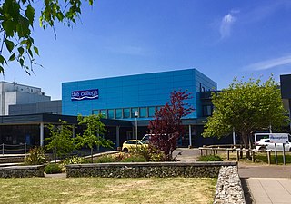
Boscombe is a suburb of Bournemouth, England. Historically in Hampshire, but today in Dorset, it is located to the east of Bournemouth town centre and west of Southbourne.

<span class="mw-page-title-main">A35 road</span> Major road in southern England

The A35 is a major road in southern England, connecting Honiton in Devon and Southampton in Hampshire. It is a trunk road for some of its length. Most of its route passes through Dorset and the New Forest. It originally connected Exeter and Southampton, the original A35 ran along what is now the A3052 joining the present road at Charmouth.

<span class="mw-page-title-main">Upton, Dorset</span> Human settlement in England

Upton is a town in south-east Dorset, England. Upton is to the east of Holton Heath and Upton Heath, and to the north of the Poole suburb of Hamworthy. It is the second largest town in the Purbeck Hills.

<span class="mw-page-title-main">Frederick Abberline</span> British policeman

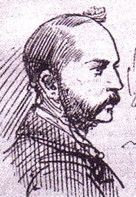
Frederick George Abberline was a British chief inspector for the London Metropolitan Police. He is best known for being a prominent police figure in the investigation into the Jack the Ripper serial killer murders of 1888.

<span class="mw-page-title-main">Levenshulme</span> Suburb of Manchester, England

Levenshulme is an area of Manchester, in Greater Manchester, England, bordering Fallowfield, Longsight, Gorton, Burnage, Heaton Chapel and Reddish; it is approximately halfway between Stockport and Manchester city centre on the A6. Levenshulme is predominantly residential with numerous fast food shops, public houses and antique stores. It has a multi-cultural and multi-ethnic population of 15,430 at the 2011 Census. The Manchester to London railway line passes through Levenshulme railway station.

<span class="mw-page-title-main">Bournemouth East (UK Parliament constituency)</span> UK Parliament constituency in England since 1974

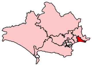
Bournemouth East is a parliamentary constituency in Dorset represented in the House of Commons of the UK Parliament since 2005 by Tobias Ellwood, a Conservative.

<span class="mw-page-title-main">Portswood</span> Human settlement in England

Portswood is a suburb and Electoral Ward of Southampton, England. The suburb lies to the north-north-east of the city centre and is bounded by Freemantle, Highfield, Swaythling, St. Denys and Bevois Valley.

<span class="mw-page-title-main">A338 road</span> Road in southern England

The A338 is a major primary route in southern England, that runs from the junction with the A35 at Poole in Dorset to the junction with the A420 at Besselsleigh in Oxfordshire, a distance of 84 miles (135 km).

<span class="mw-page-title-main">Holdenhurst</span> Human settlement in England

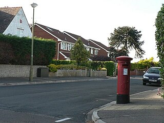
Holdenhurst is a small isolated village situated in the green belt land of the north-east suburbs of Bournemouth, England. The village comprises fewer than 30 dwellings, two farms and the parish church. There are no shops and few local facilities in the village.

<span class="mw-page-title-main">Bournemouth and Poole College</span> Educational provider in Bournemouth and Pool

<span class="mw-page-title-main">Bournemouth Borough Council</span>

Bournemouth Borough Council was the local authority of Bournemouth in Dorset, England and ceased to exist on 1 April 2019. It was a unitary authority, although between 1974 and 1997 it was an administrative district council with Dorset. Previously most of the borough was part of Hampshire.

<span class="mw-page-title-main">History of Bournemouth</span> Coastal city in southern England

The history of Bournemouth and human settlement in the surrounding area goes back for thousands of years. Bournemouth is a coastal city on the island of Great Britain in Dorset, England, United Kingdom.

<span class="mw-page-title-main">Transport in Dorset</span>

Dorset is a county in South West England. The county is largely rural and therefore does not have a dense transport network, and is one of the few English counties without a motorway. Due to its position on the English Channel coast, and its natural sheltered harbours, it has a maritime history, though lack of inland transport routes have led to the decline of its ports.

Winton is a suburb of Bournemouth in Dorset, England. It lies approximately 1 mile (1.6 km) north of Bournemouth town centre, along Wimborne Road. Winton is to the east of Wallisdown, Victoria Park and Talbot Woods and south of Moordown.

<span class="mw-page-title-main">Littledown</span> Human settlement in England

Littledown is a suburb of Bournemouth, in Dorset, England. Originally it was a small settlement to the south of the much more important Holdenhurst Village, and for centuries it existed as a huddle of farm buildings on the edge of heathland. As the town of Bournemouth expanded, Littledown remained as a farming community with areas of open fields on the town's northern edge, with the Cooper-Dean family residing in Littledown House. Eventually however the only Cooper-Dean descendants were two spinster sisters who sold Littledown House, with the surrounding farmland, to Bournemouth Council in the early 1980s. After public discussion on what the Council would do with the area, eventually much of the land was sold off for housing, although a large section was set by for a park and a sports centre.

<span class="mw-page-title-main">Royal Bournemouth Hospital</span> Hospital in Dorset, England

The Royal Bournemouth Hospital is an acute general hospital in Bournemouth, Dorset, England. It is managed by the University Hospitals Dorset NHS Foundation Trust. The hospital was managed by The Royal Bournemouth and Christchurch Hospitals NHS Foundation Trust until the merger with Poole Hospital NHS Foundation Trust on 1 October 2020.

<span class="mw-page-title-main">Ensbury Park</span> Human settlement in England

Ensbury Park is a mainly residential suburb of Bournemouth, in Dorset, England. It includes the housing estate of Slades Farm and lies within the ward district of Northbourne and Redhill.

<span class="mw-page-title-main">Lansdowne, Bournemouth</span> Human settlement in England

Lansdowne is a suburb of Bournemouth. It occupies the north-east part of the main built-up area around Bournemouth Town Centre.

<span class="mw-page-title-main">Northbourne, Bournemouth</span>

Northbourne is a suburb of Bournemouth, Dorset in England. It is in the north of the town and borders Ensbury Park.

References

  1. "Great Britain and Ireland - interactive county map".
  2. BH Life (PDF) (March 2007 ed.), Bournemouth: Bournemouth Borough Council, 2007, archived from the original (PDF) on 27 September 2007
  3. "Daily Echo". Daily Echo. 8 May 2007. Retrieved 19 January 2014.
  4. https://www.casebook.org/images/Abberline%20Plaque.pdf [ bare URL PDF ]

Commons-logo.svg Media related to Springbourne at Wikimedia Commons