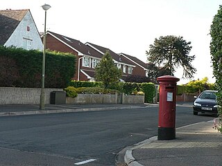
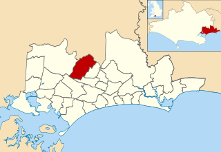
Turbary Park is an area of West Howe, Bournemouth in Dorset. Turbary Park is south of Kinson and north of Wallisdown.
Turbary Park is an area of West Howe, Bournemouth in Dorset. Turbary Park is south of Kinson and north of Wallisdown.

Turbary Common is the largest area of heathland in North Bournemouth. It is also a Site of Special Scientific Interest. [1] The habitats include scrub, wooded areas and both wet and dry heath. [2]
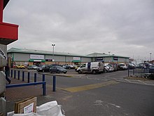
Turbary Park is served by the Turbary Retail Park. [3] Also in the area is the NHS Turbary Park Medical Centre. [4]
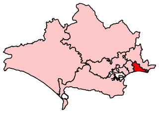
Turbary Park is part of the Bournemouth West constituency. Turbary Park is part of the Kinson ward which elects three councillors to Bournemouth, Christchurch and Poole Council. [5]

Bournemouth is a coastal resort town on the south coast in the Bournemouth, Christchurch and Poole unitary authority area in the ceremonial county of Dorset, England. The town's urban subdivision had a population of 187,503 at the 2011 census making it the largest town in the county; the town is part of the South East Dorset conurbation, which has a population of 465,000.
Bournemouth East is a parliamentary constituency in Dorset represented in the House of Commons of the UK Parliament since 2005 by Tobias Ellwood, a Conservative.

Bournemouth West is a parliamentary constituency in Dorset represented in the House of Commons of the UK Parliament since 2010 by Conor Burns, a Conservative.
Bournemouth Borough Council was the local authority for Bournemouth in Dorset, England between 1974 and 2019. Prior to 1974 Bournemouth had been a county borough within Hampshire. Under the Local Government Act 1972 Bournemouth became a non-metropolitan district within Dorset on 1 April 1974, with the same boundaries as the former county borough. On 1 April 1997 it became a unitary authority, taking over the functions previously provided for the area by Dorset County Council. In 2019 the council was abolished, merging with Christchurch and Poole to form Bournemouth, Christchurch and Poole.

Shiremoor is a village in Tyne and Wear, Northern England. It is in the Metropolitan Borough of North Tyneside and formerly governed under Northumberland. In the 2011 census, it was included in the Tynemouth area of Tyneside. It is near the North East Green Belt, which surrounds Tyneside, Wearside and Durham. It is located around 3+1⁄2 miles from Whitley Bay.

Kinson is a former village which has been absorbed by the town of Bournemouth in the county of Dorset in England. The area became part of Bournemouth on 1 April 1931. There were two electoral wards containing the name Kinson. Their joint population at the 2011 Census was 19,824.

Pentwyn is a district, community and electoral ward in the east of Cardiff, Wales, located northeast of the city centre. Llanedeyrn is immediately to the south, Cyncoed to the west, Pontprennau to the north and the Rhymney River forms the eastern border. The population of the ward taken at the 2011 census was 15,634.

Bournemouth Borough Council was the local authority of Bournemouth in Dorset, England and ceased to exist on 1 April 2019. It was a unitary authority, although between 1974 and 1997 it was an administrative district council with Dorset. Previously most of the borough was part of Hampshire.

Ensbury Park is a mainly residential suburb of Bournemouth, in Dorset, England. It includes the housing estate of Slades Farm and lies within the ward district of Northbourne and Redhill.

West Howe is a suburb of Bournemouth, Dorset, England, located in the north-west provinces of the borough.

Townsend is a area of Bournemouth, Dorset. It is located in the suburbs along the north eastern boundary of the town and is close to the Royal Bournemouth Hospital.
Northbourne is a suburb of Bournemouth, Dorset in England. It is in the north of the town and borders Ensbury Park.

Redhill is a northern suburb of Bournemouth, Dorset in England.

Strouden Park or Strouden is an area of Bournemouth, Dorset, England.

Bournemouth Town Centre is an area of Bournemouth, Dorset. The town centre is the central business district and is located near the coast between West Cliff and East Cliff.

Victoria Park is an area of Bournemouth, Dorset. The area is south of Moordown, north-west of Winton and east of Talbot Village, Wallisdown and Ensbury Park.

Meyrick Park is a suburb and area of Bournemouth, Dorset. The park itself features a main field with rugby pitches, surrounded by elevated woodland on both sides and a golf course around the western side. Dog-walking is permitted on both, and the paved path along the main field is often used to get to the town centre.
Kinson is an electoral ward in Bournemouth, Dorset, England. Since 2019, the ward has elected 3 councillors to Bournemouth, Christchurch and Poole Council.
50°45.1′N1°55.1′W / 50.7517°N 1.9183°W
| | This Dorset location article is a stub. You can help Wikipedia by expanding it. |