Barringha, Queensland

Last updated

Barringha
Queensland
Hills Behind Townsville - panoramio.jpg
Views from Barringha
Australia Queensland location map.svg
Red pog.svg
Barringha
Coordinates 19°31′45″S146°48′53″E / 19.5291°S 146.8147°E / -19.5291; 146.8147 (Barringha (centre of locality))
Population61 (SAL 2021) [1]
Postcode(s) 4816
Area121.1 km2 (46.8 sq mi)
Time zone AEST (UTC+10:00)
Location
LGA(s) City of Townsville
State electorate(s) Burdekin
Federal division(s) Kennedy
Suburbs around Barringha:
Pinnacles Ross River Toonpan
Granite Vale Barringha Mount Elliot
Granite Vale Woodstock Majors Creek

Barringha is a locality in the City of Townsville, Queensland, Australia. [2] In the 2021 census, Barringha had a population of 61 people. [3]

Contents

History

The Townsville Motocross Track opened in 1925. [4]

In the 1980s, the second stage of the Ross River Dam necessitated a deviation of the Flinders Highway and Mount Isa railway line (which otherwise ran straight north-south) further east. This was completed by 1986 and resulted in the closure of Toonpan and Barringha railway stations on the removed route; they were not re-established on new route. [5] [6] [7] [8]

The locality was officially named and bounded on 27 July 1991. [2]

Demographics

In the 2016 census, Barringha had a population of 62 people. [9]

In the 2021 census, Barringha had a population of 61 people. [3]

Education

There are no schools in Barringha. The nearest government primary school is Woodstock State School in neighbouring Woodstock to the south. The nearest government secondary school is William Ross State High School in Annandale in Townsville. [10]

Attractions

Townsville Motocross Track, Barringha, 2008 Townsville Motocross Track, Barringha, 2008 06.jpg
Townsville Motocross Track, Barringha, 2008

The Townsville Motocross Track is at 8 Buck Road ( 19°34′16″S146°50′17″E / 19.5710°S 146.8381°E / -19.5710; 146.8381 (Townsville Motocross Track) ). It is operated by the Townsville Motorcycle Club. It is also known as the Woodstock Motocross and Dirt Track (but, with current locality boundaries, it is not in Woodstock). [11] [4]

The Sporting Shooters have a range at 1057 Mountview Road ( 19°33′36″S146°54′00″E / 19.5599°S 146.8999°E / -19.5599; 146.8999 (Sporting Shooters range) ). [12]

Related Research Articles

<span class="mw-page-title-main">South Townsville, Queensland</span> Suburb of Townsville, Queensland, Australia

South Townsville is a coastal suburb of Townsville in the City of Townsville, Queensland, Australia. In the 2016 census, South Townsville had a population of 2,353 people.

<span class="mw-page-title-main">Railway Estate, Queensland</span> Suburb of Townsville, Queensland, Australia

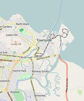
Railway Estate is a suburb of Townsville in the City of Townsville, Queensland, Australia. In the 2016 census Railway Estate had a population of 2,852 people.

<span class="mw-page-title-main">Woodstock, Queensland</span> Suburb of City of Townsville, Queensland, Australia

Woodstock is a rural town and locality in the City of Townsville, Queensland, Australia. In the 2021 census, the locality of Woodstock had a population of 270 people.

<span class="mw-page-title-main">Kelso, Queensland</span> Suburb of Townsville, Queensland, Australia

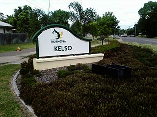
Kelso is a suburb in the City of Townsville, Queensland, Australia. In the 2021 census, Kelso had a population of 10,599 people.

<span class="mw-page-title-main">Cluden, Queensland</span> Suburb of Townsville, Queensland, Australia

Cluden is an outer southern suburb of Townsville in the City of Townsville, Queensland, Australia. In the 2016 census Cluden had a population of 427 people.

<span class="mw-page-title-main">Balgal Beach, Queensland</span> Suburb of Townsville, Queensland, Australia

Balgal Beach is a coastal suburb and a beach in the City of Townsville, Queensland, Australia. The town of Balgal is within the locality. In the 2021 census, Balgal Beach had a population of 998 people.

<span class="mw-page-title-main">Mutarnee, Queensland</span> Suburb of City of Townsville, Queensland, Australia

Mutarnee is a rural town and coastal locality in the City of Townsville, Queensland, Australia. In the 2021 census, the locality of Mutarnee had a population of 120 people.

<span class="mw-page-title-main">Nome, Queensland</span> Suburb of City of Townsville, Queensland, Australia

Nome is a rural locality in the City of Townsville, Queensland, Australia. In the 2016 census, Nome had a population of 1,016 people.

Oak Valley is a rural residential locality in the City of Townsville, Queensland, Australia. In the 2016 census Oak Valley had a population of 487 people.

<span class="mw-page-title-main">Alligator Creek, Queensland (Townsville)</span> Suburb of City of Townsville, Queensland, Australia

Alligator Creek is a rural locality in the City of Townsville, Queensland, Australia.

Majors Creek is a locality split between the City of Townsville and the Shire of Burdekin, Queensland, Australia. In the 2016 census, Majors Creek had a population of 329 people.

<span class="mw-page-title-main">Mount Elliot, Queensland</span> Suburb of City of Townsville, Queensland, Australia

Mount Elliot is a rural locality in the City of Townsville, Queensland, Australia. It contains the mountain of the same name. In the 2021 census, Mount Elliot had "no people or a very low population".

<span class="mw-page-title-main">Mingela, Queensland</span> Town in Queensland, Australia

Mingela is a rural town and locality in the Charters Towers Region, Queensland, Australia. In the 2021 census, the locality of Mingela had a population of 14 people.

<span class="mw-page-title-main">Reid River, Queensland</span> Suburb of Charters Towers Region, Queensland, Australia

Reid River is a locality split between the Charters Towers Region and the City of Townsville in Queensland, Australia. In the 2021 census, Reid River had a population of 143 people.

<span class="mw-page-title-main">Florence Bay, Queensland</span> Suburb of Magnetic Island, Queensland, Australia

Florence Bay is a suburb of Magnetic Island in the City of Townsville, Queensland, Australia. In the 2021 census, Florence Bay had a population of 0 people.

<span class="mw-page-title-main">Burdell, Queensland</span> Suburb of Townsville, Queensland, Australia

Burdell is a suburb of Townsville in the City of Townsville, Queensland, Australia. In the 2021 census, Burdell had a population of 7,171 people.

<span class="mw-page-title-main">Mount Stuart, Queensland</span> Suburb of City of Townsville, Queensland, Australia

Mount Stuart is a locality in the City of Townsville, Queensland, Australia. In the 2021 census, Mount Stuart had a population of 95 people.

Julago is a rural locality in the City of Townsville, Queensland, Australia. It will be the site of a large masterplanned real estate development in the years ahead. In the 2021 census, Julago had a population of 384 people.

Toonpan is a rural locality in the City of Townsville, Queensland, Australia. In the 2021 census, Toonpan had a population of 62 people.

Rangewood is a suburb of Townsville in the City of Townsville, Queensland, Australia. In the 2021 census, Rangewood had a population of 1,084 people.

References

  1. Australian Bureau of Statistics (28 June 2022). "Barringha (suburb and locality)". Australian Census 2021 QuickStats. Retrieved 28 June 2022.  OOjs UI icon edit-ltr-progressive.svg
  2. 1 2 "Barringha – locality in City of Townsville (entry 44568)". Queensland Place Names. Queensland Government . Retrieved 16 November 2018.
  3. 1 2 Australian Bureau of Statistics (28 June 2022). "Barringha (SAL)". 2021 Census QuickStats. Retrieved 28 February 2023. OOjs UI icon edit-ltr-progressive.svg
  4. 1 2 "Woodstock Motocross Track - Townsville". Trackfinder. Archived from the original on 14 March 2020. Retrieved 25 August 2023.
  5. "Ross River Dam". Townsville City Council. Retrieved 8 February 2024.
  6. "Railway stations and sidings - Queensland". Queensland Open Data. Queensland Government. 2 October 2020. Archived from the original on 5 October 2020. Retrieved 5 October 2020.
  7. "Mount Elliott (Special)" (Map). Queensland Government. 1942. Retrieved 8 February 2024.
  8. "Queensland Globe". State of Queensland . Retrieved 8 February 2024.
  9. Australian Bureau of Statistics (27 June 2017). "Barringha (SSC)". 2016 Census QuickStats. Retrieved 20 October 2018. OOjs UI icon edit-ltr-progressive.svg
  10. "Queensland Globe". State of Queensland . Retrieved 24 August 2023.
  11. "Townsville Motorcycle Club". Facebook. Archived from the original on 25 August 2023. Retrieved 25 August 2023.
  12. "SSAA Thuringowa Branch". Sporting Shooters Association of Australia (Queensland). Archived from the original on 25 August 2023. Retrieved 25 August 2023.