Castle Hill, Queensland

Last updated

Castle Hill
Townsville,  Queensland
View From Castle Hill Townsville - panoramio (33).jpg
View from Castle Hill
Australia Queensland location map.svg
Red pog.svg
Castle Hill
Coordinates 19°15′21″S146°47′52″E / 19.2558°S 146.7977°E / -19.2558; 146.7977 (Castle Hill (centre of suburb))
Population972 (2021 census) [1]
 • Density423/km2 (1,095/sq mi)
Postcode(s) 4810
Area2.3 km2 (0.9 sq mi)
Time zone AEST (UTC+10:00)
Location3.7 km (2 mi) W of Townsville CBD
LGA(s) City of Townsville
State electorate(s) Townsville
Federal division(s) Herbert
Suburbs around Castle Hill:
Belgian Gardens Belgian Gardens North Ward
West End Castle Hill North Ward
West End West End Townsville City

Castle Hill is a suburb of Townsville in the City of Townsville, Queensland, Australia. [2] The suburb is based on and around the mountain of the same name. [3] The Indigenous name for the mountain is Cootharinga, sometimes written as Cooderinga. [4] [5] In the 2021 census, Castle Hill had a population of 972 people. [1]

Contents

Geography

Most of the suburb is taken up with the Castle Hill Reserve with only a small area in the north of the suburb being available for housing. [3]

History

Castle Hill is situated in the traditional Wulgurukaba Aboriginal country. [6] The origin of the suburb name is taken from the geographical feature Castle Hill, thought to be named by an early pastoralist Andrew Ball. The Aboriginal name Cudtheringa was recorded by Lieutenant George Poynter Heath, on advice from castaway James Morrill during a survey of Cleveland Bay in 1864. [7]

Demographics

In the 2011 census, Castle Hill had a population of 1,009 people. [8]

In the 2016 census, Castle Hill had a population of 941 people. [9]

In the 2021 census, Castle Hill had a population of 972 people. [1]

Heritage listings

The Castle Hill reserve is listed on the Queensland Heritage Register.

Related Research Articles

<span class="mw-page-title-main">Douglas, Queensland</span> Suburb of Townsville, Queensland, Australia

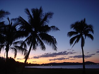
Douglas is a suburb of Townsville in the City of Townsville, Queensland, Australia. In the 2021 census, Douglas had a population of 7,780 people.

West End is an inner suburb of Townsville in the City of Townsville, Queensland, Australia. In the 2016 census, West End had a population of 4,064 people.

<span class="mw-page-title-main">Belgian Gardens, Queensland</span> Suburb of Townsville, Queensland, Australia

Belgian Gardens is an inner coastal suburb of Townsville in the City of Townsville, Queensland, Australia. In the 2021 census, Belgian Gardens had a population of 2,073 people.

<span class="mw-page-title-main">Rowes Bay, Queensland</span> Suburb of Townsville, Queensland, Australia

Rowes Bay is a suburb of Townsville in the City of Townsville, Queensland, Australia. In the 2016 census, Rowes Bay had a population of 573 people.

<span class="mw-page-title-main">Kelso, Queensland</span> Suburb of Townsville, Queensland, Australia

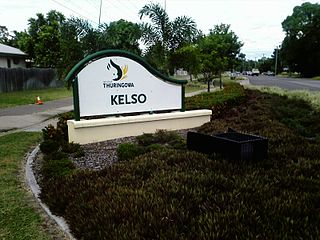
Kelso is a suburb in the City of Townsville, Queensland, Australia. In the 2021 census, Kelso had a population of 10,599 people.

Toolakea is a coastal town and suburb in the City of Townsville, Queensland, Australia. In the 2016 census, Toolakea had a population of 205 people.

Bluewater Park is a suburb of Bluewater in the City of Townsville, Queensland, Australia. In the 2021 census, Bluewater Park had a population of 1,066 people.

<span class="mw-page-title-main">Balgal Beach, Queensland</span> Suburb of Townsville, Queensland, Australia

Balgal Beach is a coastal suburb and a beach in the City of Townsville, Queensland, Australia. The town of Balgal is within the locality. In the 2021 census, Balgal Beach had a population of 998 people.

Toomulla is a coastal town and suburb in the City of Townsville, Queensland, Australia. In the 2021 census, the suburb of Toomulla had a population of 193 people.

<span class="mw-page-title-main">Nome, Queensland</span> Suburb of City of Townsville, Queensland, Australia

Nome is a rural locality in the City of Townsville, Queensland, Australia. In the 2021 census, Nome had a population of 990 people.

Hervey Range is a rural locality split between the City of Townsville and the Charters Towers Region, Queensland, Australia. In the 2021 census, Hervey Range had a population of 295 people.

<span class="mw-page-title-main">Black River, Queensland</span> Suburb of Townsville, Queensland, Australia

Black River is a northern suburb of Townsville in the City of Townsville, Queensland, Australia. In the 2021 census, Black River had a population of 1,493 people.

<span class="mw-page-title-main">Currajong, Queensland</span> Suburb of Townsville, Queensland, Australia

Currajong is a suburb in the City of Townsville, Queensland, Australia. In the 2021 census, Currajong had a population of 2,490 people.

<span class="mw-page-title-main">Alligator Creek, Queensland (Townsville)</span> Suburb of City of Townsville, Queensland, Australia

Alligator Creek is a rural locality in the City of Townsville, Queensland, Australia. In the 2021 census, Alligator Creek had a population of 1,550 people.

<span class="mw-page-title-main">Rosslea, Queensland</span> Suburb of Townsville, Queensland, Australia

Rosslea is a suburb of Townsville in the City of Townsville, Queensland, Australia. In the 2016 census Rosslea had a population of 1,732 people.

<span class="mw-page-title-main">Town Common, Queensland</span> Suburb of Townsville, Queensland, Australia

Town Common is a coastal suburb of Townsville in the City of Townsville, Queensland, Australia. In the 2021 census, Town Common had "no people or a very low population".

<span class="mw-page-title-main">Mount Elliot, Queensland</span> Suburb of City of Townsville, Queensland, Australia

Mount Elliot is a rural locality in the City of Townsville, Queensland, Australia. It contains the mountain of the same name. In the 2021 census, Mount Elliot had "no people or a very low population".

West Point is an island town and suburb of Magnetic Island in the City of Townsville, Queensland, Australia. In the 2016 census the suburb of West Point had a population of 32 people.

<span class="mw-page-title-main">Roseneath, Queensland</span> Suburb of Townsville, Queensland, Australia

Roseneath is an outer suburb of Townsville in the City of Townsville, Queensland, Australia. In the 2021 census, Roseneath had a population of 127 people.

Rangewood is a suburb of Townsville in the City of Townsville, Queensland, Australia. In the 2021 census, Rangewood had a population of 1,084 people.

References

  1. 1 2 3 Australian Bureau of Statistics (28 June 2022). "Castle Hill (SAL)". 2021 Census QuickStats. Retrieved 28 February 2023. OOjs UI icon edit-ltr-progressive.svg
  2. "Castle Hill – suburb in City of Townsville (entry 44582)". Queensland Place Names. Queensland Government . Retrieved 29 December 2020.
  3. 1 2 "Queensland Globe". State of Queensland . Retrieved 2 February 2021.
  4. "CLEVELAND BAY AND THE TOWNSHIP OF TOWNSVILLE". The Brisbane Courier . Vol. XX, no. 2, 386. Queensland, Australia. 21 September 1865. p. 2. Archived from the original on 1 October 2020. Retrieved 27 September 2017 via National Library of Australia.
  5. "Castle Hill (Mount Cutheringa) – hill in City of Townsville (entry 6446)". Queensland Place Names. Queensland Government . Retrieved 27 September 2017.
  6. "Traditional Landowners - History and Heritage". Archived from the original on 27 March 2020. Retrieved 25 June 2020.
  7. "Castle Hill – mountain in the City of Townsville (entry 6446)". Queensland Place Names. Queensland Government . Retrieved 26 July 2020.
  8. Australian Bureau of Statistics (31 October 2012). "Castle Hill (SSC)". 2011 Census QuickStats. Retrieved 2 December 2016. OOjs UI icon edit-ltr-progressive.svg
  9. Australian Bureau of Statistics (27 June 2017). "Castle Hill (SSC)". 2016 Census QuickStats. Retrieved 20 October 2018. OOjs UI icon edit-ltr-progressive.svg

Commons-logo.svg Media related to Castle Hill, Queensland at Wikimedia Commons