
Annandale is a suburb of Townsville in the City of Townsville, Queensland, Australia. In the 2016 census, Annandale had a population of 8,574 people.

Townsville Airport is a major Australian regional airport that services the city of Townsville, Queensland. The airport is also known as Townsville International Airport, and Garbutt Airport, a reference to its location in the Townsville suburb of Garbutt. Townsville Airport is serviced by major Australian domestic and regional airlines, and in 2011/12 handled 1.7 million passengers making it the 11th busiest airport in Australia.

Aitkenvale is a suburb of Townsville in the City of Townsville, Queensland, Australia. In the 2016 census Aitkenvale had a population of 4,790 people.

Mount Louisa is a residential suburb in the City of Townsville, Queensland, Australia. The suburb contains the mountain Mount Louisa. In the 2016 census, Mount Louisa had a population of 8,825 people.
Hyde Park is a suburb in the City of Townsville, Queensland, Australia. In the 2016 census Hyde Park had a population of 1,387 people.

RAAF Base Townsville is a Royal Australian Air Force (RAAF) air base located in Garbutt, 2 nautical miles west of Townsville in Queensland, Australia. It is the headquarters for No. 1 Wing Australian Air Force Cadets and, along with Lavarack Barracks, establishes Townsville as a key military centre. The base's airfield is shared with the Townsville Airport.
West End is an inner suburb of Townsville in the City of Townsville, Queensland, Australia. In the 2016 census, West End had a population of 4,064 people.
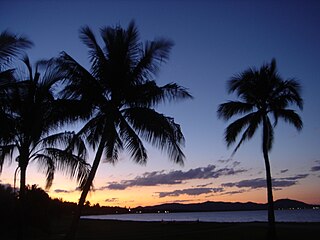
Rowes Bay is a coastal suburb of the City of Townsville, Queensland, Australia.

Deeragun is an outer western town and suburb of Townsville in the City of Townsville, Queensland, Australia. In the 2016 census, Deeragun had a population of 4,250 people.
Mundingburra is a suburb in the City of Townsville, Queensland, Australia. In the 2016 census, Mundingburra had a population of 3620 people.

Thuringowa Central is a suburb of Townsville in the City of Townsville, Queensland, Australia. In the 2016 census Thuringowa Central had a population of 2,023 people.

Townsville City is a coastal suburb and the central suburb of the City of Townsville, Queensland, Australia. In the 2016 census, the suburb of Townsville City had a population of 2,910 people.

Gulliver is a suburb in the City of Townsville, Queensland, Australia. In the 2016 census Gulliver had a population of 2,825 people.
Mount St John is an industrial suburb of Townsville in the City of Townsville, Queensland, Australia. In the 2016 census Mount St John had a population of 62 people.

Currajong is a suburb in the City of Townsville, Queensland, Australia. In the 2016 census, Currajong had a population of 2,548 people.

Town Common is a coastal suburb in the City of Townsville, Queensland, Australia. It is locally known as "The Common".

Richmond Hill is a suburb of Charters Towers in the Charters Towers Region, Queensland, Australia. In the 2016 census Richmond Hill had a population of 2,488 people.
The RAAF Townsville Aviation Heritage Centre, TAHC, was first opened in 1983 in a small facility housed within the confines of the Townsville RAAF base. Its original purpose was to provide to the general public a medium for displaying the military aviation heritage of North Queensland through artefacts, photographic displays and memorabilia. Initially, the Museum was under the direction of RAAF Museum Point Cook and was open to the public once a month. The Heritage Centre displays a variety of uniforms, insignia, medical supplies, training materials, weaponry, rations and many models of airplanes. Some unusual artefacts include a pack of study cards schools the student in Survival of Atomic Attack and Silhouette cards teach ship identification from the air. Some unopened medical supplies from the 1940s complete with written instructions are also featured.

Bohle is a northern suburb in the City of Townsville, Queensland, Australia. In the 2016 census, Bohle had a population of 85 people.

Burdell is a suburb of Townsville in the City of Townsville, Queensland, Australia. In the 2016 census Burdell had a population of 5,814 people.

