Thuringowa Central, Queensland

Last updated

Thuringowa Central
Townsville,  Queensland
Welcome to the City of Thuringowa.jpg
Australia Queensland location map.svg
Red pog.svg
Thuringowa Central
Thuringowa Central, Queensland
Coordinates 19°18′50″S146°43′31″E / 19.3138°S 146.7252°E / -19.3138; 146.7252 (Thuringowa Central (centre of suburb))
Population1,953 (2021 census) [1]
 • Density1,028/km2 (2,660/sq mi)
Postcode(s) 4817
Area1.9 km2 (0.7 sq mi)
Time zone AEST (UTC+10:00)
Location
LGA(s) City of Townsville
State electorate(s) Thuringowa
Federal division(s) Herbert
Suburbs around Thuringowa Central:
Kirwan Kirwan Kirwan
Kirwan Thuringowa Central Kirwan
Condon Douglas Douglas

Thuringowa Central is a suburb of Townsville in the City of Townsville, Queensland, Australia. [2] In the 2021 census, Thuringowa Central had a population of 1,953 people. [1]

Contents

Geography

Shaped like an inverted letter "T", Thuringowa Central consists of residential housing in the north, commercial building in the centre and south-west, and recreational areas along the Ross River in the south-east. [3]

Ross River Road runs through from east to west, and Garbutt–Upper Ross Road runs along part of the eastern boundary. [4]

History

Ross River Provisional School opened on 11 April 1881 but closed soon after. It reopened on 26 January 1885. On 1 January it became Ross River State School. Circa 1935 tt was renamed Weir State School. [5]

Thuringowa Central was the central business district of the former City of Thuringowa before its amalgamation with the adjacent City of Townsville in 2008.

When Thuringowa was a city most visitors did not know the location of the city's centre, so in 2004 the Thuringowa city Mayor developed the city centre masterplan to complement the Riverway project. [6]

The Thuringowa Central library opened in 1986 and underwent a major refurbishment in 2016. [7]

Demographics

In the 2016 census Thuringowa Central had a population of 2,023 people. [8]

In the 2021 census, Thuringowa Central had a population of 1,953 people. [1]

Education

Weir State School is a government primary (Prep-6) school for boys and girls at 592 Ross River Road ( 19°18′55″S146°44′04″E / 19.3152°S 146.7345°E / -19.3152; 146.7345 (Weir State School) ). [9] [10] In 2018, the school had an enrolment of 706 students with 52 teachers (51 full-time equivalent) and 33 non-teaching staff (23 full-time equivalent). [11] It includes a special education program. [9]

The suburb is also served by The Willow State School to the north-west in neighbouring Kirwan and Kirwan State School to the north, also in Kirwan. [3]

There is no secondary school in Thuringowa Central. The nearest government secondary school is Kirwan State High School to the north-east in Kirwan. [3]

Facilities

Despite the name, Kirwan Police Station is at 76 Thuringowa Drive in Thuringowa Central ( 19°18′36″S146°43′51″E / 19.3099°S 146.7307°E / -19.3099; 146.7307 (Kirwan Police Station) ). [12] [13] [14] Kirwan Fire Station is immediately adjacent at 84 Thuringowa Drive ( 19°18′34″S146°43′53″E / 19.3095°S 146.7313°E / -19.3095; 146.7313 (Kirwan Fire Station) ). [12] Kirwan Ambulance Station is around the corner at 5 Hinchinbrook Drive ( 19°18′33″S146°43′51″E / 19.3091°S 146.7308°E / -19.3091; 146.7308 (Kirwan Ambulance Station) ). [12]

Also despite its name, Kirwan Health Campus is at 138-158 Thuringowa Drive ( 19°18′15″S146°43′55″E / 19.3042°S 146.7320°E / -19.3042; 146.7320 (Kirwan Health Campus) ). [15] It provides a range of services including specialist medical clinics, an aged care centre, a brain injury care centre, and an adolescent mental health unit offering inpatient and day care. [16]

Amenities

The Willows Shopping Centre is a major retail centre bounded by Carthew Street to the north, Thuringowa Drive to the east, Hervey Range Road to the south, and Kern Brothers Drive to the west ( 19°18′58″S146°43′36″E / 19.3160°S 146.7266°E / -19.3160; 146.7266 (Willows Shopping Centre) ). [17] [18] [3] Thuringowa Central Post Shop is in the Willows Shopping Centre ( 19°18′55″S146°43′38″E / 19.3153°S 146.7272°E / -19.3153; 146.7272 (Thuringowa Central Post Shop) ). [19] [20]

Sunland Plaza is a shopping centre at 14 Hervey Range Roaa ( 19°19′09″S146°43′38″E / 19.3192°S 146.7271°E / -19.3192; 146.7271 (Sunland Plaza) ). [18]

One of the two Townsville Council Chambers, Thuringowa Soundshell, and Reading Cinemas are located in this suburb.[ citation needed ]

Thuringowa Central is the headquarters for CityLibraries Townsville and is situated at 86 Thuringowa Drive ( 19°18′31″S146°43′53″E / 19.3085°S 146.7313°E / -19.3085; 146.7313 (Thuringowa Central public library) ). [21] [22] Services offered include community meeting rooms and free public wifi. [23] Access to the Library collections, services and events can be found on the CityLibraries Townsville website. [24]

Pinnacles Art Gallery is within the Riverway Arts Centre at 20 Village Boulevard ( 19°18′30″S146°43′54″E / 19.3082°S 146.7317°E / -19.3082; 146.7317 (Pinnacles Gallery) ). [18] It is operated by the Townsville City Council and features works by North Queensland artists and touring exhibitions. [25]

Kirwan Uniting Church is at 18 Hinchinbrook Drive ( 19°18′28″S146°43′49″E / 19.3079°S 146.7304°E / -19.3079; 146.7304 (Kirwan Uniting Church) ). [26] [27] It is part of the North Queensland Presbytery of the Uniting Church in Australia. [28]

Willows Presbyterian Church is at 26 Carthew Street ( 19°18′49″S146°43′36″E / 19.3135°S 146.7267°E / -19.3135; 146.7267 (Willows Presbyterian Church) ). [18]

Related Research Articles

<span class="mw-page-title-main">Garbutt, Queensland</span> Suburb of Townsville, Queensland, Australia

Garbutt is a suburb of Townsville in the City of Townsville, Queensland, Australia. It is home to the Townsville International Airport and RAAF Townsville. In the 2021 census, Garbutt had a population of 2,309 people.

<span class="mw-page-title-main">Aitkenvale, Queensland</span> Suburb of Townsville, Queensland, Australia

Aitkenvale is a suburb of Townsville in the City of Townsville, Queensland, Australia. In the 2021 census, Aitkenvale had a population of 4,797 people.

<span class="mw-page-title-main">Mount Louisa, Queensland</span> Suburb of Townsville, Queensland, Australia

Mount Louisa is a residential suburb in the City of Townsville, Queensland, Australia. The suburb contains the mountain Mount Louisa. In the 2021 census, Mount Louisa had a population of 9,227 people.

Hyde Park is a suburb in the City of Townsville, Queensland, Australia. In the 2021 census, Hyde Park had a population of 1,374 people.

<span class="mw-page-title-main">Kirwan, Queensland</span> Suburb of Townsville, Queensland, Australia

Kirwan is a suburb in the City of Townsville, Queensland, Australia. In the 2021 census, Kirwan had a population of 20,780 people.

Alice River is an outer south-western suburb of Townsville in the City of Townsville, Queensland, Australia. It was previously known as Rupertswood. In the 2021 census, Alice River had a population of 2,685 people.

<span class="mw-page-title-main">Idalia, Queensland</span> Suburb of Townsville, Queensland, Australia

Idalia is a southern suburb in the City of Townsville, Queensland, Australia. In the 2021 census, Idalia had a population of 4,563 people.

Condon is a suburb of Townsville in the City of Townsville, Queensland, Australia. In the 2021 census, Condon had a population of 5,894 people.

<span class="mw-page-title-main">Kelso, Queensland</span> Suburb of Townsville, Queensland, Australia

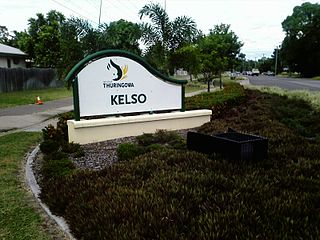
Kelso is a suburb in the City of Townsville, Queensland, Australia. In the 2021 census, Kelso had a population of 10,599 people.

<span class="mw-page-title-main">Rasmussen, Queensland</span> Suburb of Townsville, Queensland, Australia

Rasmussen is a suburb of Townsville in the City of Townsville, Queensland, Australia. In the 2021 census, Rasmussen had a population of 4,669 people.

<span class="mw-page-title-main">Townsville City, Queensland</span> Suburb of Townsville, Queensland, Australia

Townsville City is a coastal suburb at the centre of the City of Townsville, Queensland, Australia. In the 2021 census, the suburb of Townsville City had a population of 2,945 people.

<span class="mw-page-title-main">Bluewater, Queensland</span> Town in Queensland, Australia

Bluewater is a town and coastal suburb in the City of Townsville, Queensland, Australia. In the 2016 census the suburb of Bluewater had a population of 1,040 people.

Saunders Beach is a coastal town and suburb of Townsville in the City of Townsville, Queensland, Australia. In the 2016 census, the suburb of Saunders Beach had a population of 409 people.

<span class="mw-page-title-main">Rollingstone, Queensland</span> Town in Queensland, Australia

Rollingstone is a rural town and coastal locality in the City of Townsville, Queensland, Australia. In the 2016 census, the locality of Rollingstone had a population of 125 people.

<span class="mw-page-title-main">Bohle Plains, Queensland</span> Suburb of Townsville, Queensland, Australia

Bohle Plains is a locality in Townsville in the City of Townsville, Queensland, Australia. In the 2021 census, Bohle Plains had a population of 3,989 people.

<span class="mw-page-title-main">Shaw, Queensland</span> Suburb of Townsville, Queensland, Australia

Shaw is a locality in the City of Townsville, Queensland, Australia. In the 2021 census, Shaw had a population of 760 people.

<span class="mw-page-title-main">Heatley, Queensland</span> Suburb of Townsville, Queensland, Australia

Heatley is a suburb in the City of Townsville, Queensland, Australia. In the 2021 census, Heatley had a population of 3,907 people.

Granite Vale is a rural locality in the City of Townsville, Queensland, Australia. In the 2021 census, Granite Vale had "no people or a very low population".

Gumlow is a peri-urban locality in the City of Townsville, Queensland, Australia. In the 2021 census, Gumlow had a population of 142 people.

Rangewood is a suburb of Townsville in the City of Townsville, Queensland, Australia. In the 2021 census, Rangewood had a population of 1,084 people.

References

  1. 1 2 3 Australian Bureau of Statistics (28 June 2022). "Thuringowa Central (SAL)". 2021 Census QuickStats. Retrieved 28 February 2023. OOjs UI icon edit-ltr-progressive.svg
  2. "Thuringowa Central – suburb in City of Townsville (entry 45229)". Queensland Place Names. Queensland Government . Retrieved 21 July 2021.
  3. 1 2 3 4 "Queensland Globe". State of Queensland . Retrieved 24 October 2021.
  4. Google (26 April 2023). "Thuringowa Central" (Map). Google Maps . Google. Retrieved 26 April 2023.
  5. Queensland Family History Society (2010), Queensland schools past and present (Version 1.01 ed.), Queensland Family History Society, ISBN   978-1-921171-26-0
  6. http://www.thuringowa.qld.gov.au/council/departments/planning/masterplan.htm%5B%5D
  7. "Public Libraries Statistical Bulletin 2016-17" (PDF). Public Libraries Connect. State Library of Queensland. November 2017. p. 16. Archived (PDF) from the original on 30 January 2018. Retrieved 29 January 2018.
  8. Australian Bureau of Statistics (27 June 2017). "Thuringowa Central (SSC)". 2016 Census QuickStats. Retrieved 20 October 2018. OOjs UI icon edit-ltr-progressive.svg
  9. 1 2 "State and non-state school details". Queensland Government. 9 July 2018. Archived from the original on 21 November 2018. Retrieved 21 November 2018.
  10. "Weir State School". Archived from the original on 30 July 2021. Retrieved 24 October 2021.
  11. "ACARA School Profile 2018". Australian Curriculum, Assessment and Reporting Authority. Archived from the original on 27 August 2020. Retrieved 28 January 2020.
  12. 1 2 3 "Emergency services facilities - Queensland". Queensland Open Data. Queensland Government. 18 November 2020. Archived from the original on 24 November 2020. Retrieved 24 November 2020.
  13. "Kirwan Station". Queensland Police . Archived from the original on 6 April 2021. Retrieved 24 October 2021.
  14. Google (24 October 2021). "Kirwan Police Station" (Map). Google Maps . Google. Retrieved 24 October 2021.
  15. "Landmark Areas - Queensland". Queensland Open Data. Queensland Government. 18 November 2020. Archived from the original on 21 November 2020. Retrieved 21 October 2020.
  16. "Kirwan Health Campus". Townsville Hospital and Health Service. Archived from the original on 11 March 2021. Retrieved 24 October 2021.
  17. "Willows Shopping Centre". Archived from the original on 6 May 2021. Retrieved 24 October 2021.
  18. 1 2 3 4 "Building areas - Queensland". Queensland Open Data. Queensland Government. 17 November 2020. Archived from the original on 23 October 2020. Retrieved 17 November 2020.
  19. Google (24 October 2021). "Thuringowa Central Post Shop" (Map). Google Maps . Google. Retrieved 24 October 2021.
  20. "Thuringowa Central Post Shop". Australia Post . Archived from the original on 24 October 2021. Retrieved 24 October 2021.
  21. "Public Libraries Connect Directory of Public Libraries". Public Libraries Connect. 10 April 2014. Archived from the original on 24 January 2018. Retrieved 24 January 2018.
  22. "Using your Library". Townsville City Council . 15 September 2021. Archived from the original on 29 January 2018. Retrieved 24 October 2021.
  23. "Queensland Public Libraries Statistical Bulletin 2016-17" (PDF). Public Libraries Connect. November 2017. Archived (PDF) from the original on 30 January 2018. Retrieved 24 January 2018.
  24. "City Libraries Townsville". City Libraries Townsville. Archived from the original on 24 June 2018. Retrieved 24 January 2018.
  25. "Pinnacles Gallery". Townsville City Council . 6 April 2021. Archived from the original on 10 March 2021. Retrieved 24 October 2021.
  26. "About Us". Kirwan Uniting Church. Retrieved 24 October 2021.
  27. Google (24 October 2021). "Kirwan Uniting Church" (Map). Google Maps . Google. Retrieved 24 October 2021.
  28. "Queensland congregations and faith communities" (PDF). Uniting Church in Australia, Queensland Synod . March 2019. Retrieved 19 October 2021.