Kensington, California

Last updated

Kensington
Blake House (University of California Presidential Residence) 2.jpg
Contra Costa County California Incorporated and Unincorporated areas Kensington Highlighted.svg
Location in Contra Costa County and the state of California
Coordinates: 37°54′38″N122°16′49″W / 37.91056°N 122.28028°W / 37.91056; -122.28028 [1]
Country Flag of the United States (23px).png  United States
State California
County Contra Costa
Government
   County Board District 1:
John Gioia
   State Senate Nancy Skinner (D) [2]
   State Assembly Buffy Wicks (D) [3]
   U. S. Congress John Garamendi (D) [4]
Area
[5]
  Total0.956 sq mi (2.48 km2)
  Land0.947 sq mi (2.45 km2)
  Water0.009 sq mi (0.02 km2)  0.97%
Elevation
[1]
587 ft (179 m)
Population
 (2010)
  Total5,077
  Density5,300/sq mi (2,100/km2)
Time zone UTC-8 (PST)
  Summer (DST) UTC-7 (PDT)
ZIP codes
94707, 94708
Area code 510, 341
GNIS ID [1] [6] [7] 1658891, 2408472
FIPS code [1] [7] 06-38086

Kensington is an unincorporated community and census designated place located in the Berkeley Hills, in the East Bay, part of the San Francisco Bay Area, in Contra Costa County, California. In the 20th century it was considered part of Berkeley, although it is across the county line. House numbers follow the pattern used in Berkeley, and Kensington shares two zip codes with the Berkeley Hills area.

Contents

The population was 5,077 at the 2010 census. [8] [9] Kensington’s community is mostly highly educated and affluent, and it contains only single family residential houses. It is among the safest and cleanest places in the United States, with one of the nation’s top public elementary schools. Many distinguished University of California, Berkeley professors, Nobel Prize laureates, and other notable San Francisco Bay Area professionals reside or have resided in Kensington, such as University of California, Berkeley’s theoretical physicist and professor of physics Robert Oppenheimer who was the Director of the Manhattan Project’s Project Y that developed the atomic bombs during World War II.

Law and government

Kensington is an unincorporated community of Contra Costa County that borders Alameda County. Unlike many unincorporated communities, Kensington has local jurisdiction over its police department, park services, refuse collection and fire department. These are governed by two elected boards. The five-member Kensington Police Protection and Community Services District (KPPCSD) Board oversees the police department, park services, and refuse collection. The five-member Kensington Fire District Board oversees the fire department and emergency medical services, of which the day-to-day function is outsourced to the fire department of El Cerrito, a neighboring city. The Kensington Municipal Advisory Board (KMAC) is a commission whose members are appointed by the Contra Costa County Board of Supervisors. KMAC is charged with land-use and development review and provides recommendations to the county planning and public works departments.

The sewer system is maintained by the Stege Sanitary District, which also includes the city of El Cerrito and the Richmond Annex area of Richmond. The East Bay Municipal Utility District supplies water and wastewater treatment services. [10] AC Transit operates local transit service.

History

Don Victor Castro, a Californio ranchero and politician, owned the area where Kensington was founded, as part of his Rancho San Pablo. Don Victor Castro.jpg
Don Víctor Castro, a Californio ranchero and politician, owned the area where Kensington was founded, as part of his Rancho San Pablo.

The area that is now Kensington was originally the territory of the Huchiun band of the Ohlone Indigenous people who occupied much of the East Bay of the San Francisco Bay Area. The Pedro Fages mapping expedition passed through the area in 1772.

In 1823, the Republic of Mexico granted Rancho San Pablo, an extent of land lying north of Cerrito Creek and the Rancho San Antonio, including that portion of land that is now Kensington, to Francisco María Castro, a veteran of the Mexican Army and former alcalde of San José. In 1831 his youngest son, Victor Castro, inherited the southern portion of the rancho, including what is now Kensington.

In 1892, Anson Blake purchased a portion of Castro's land, most of which is now Kensington.

George Shima bought ten acres north of Cerrito Creek and east of the present day Arlington Avenue in about 1911, intending to build a home there. He hosted an annual community picnic on the property for some time.

Land development companies had bought most of the Kensington area by 1911, when it was first surveyed. The area was named "Kensington" that year by Robert Brousefield, a surveyor who had lived in the London district of South Kensington in the Royal Borough of Kensington and Chelsea at one time. The first subdivisions were Kensington Park and Berkeley Park west of Arlington Avenue, with most streets named for locations in England, and Berkeley Highlands, with most streets named for colleges and universities.

Farmers in Kensington resisted inclusion in the city of El Cerrito when it was incorporated in 1917, and local voters have rejected incorporation various times since then.

In the 1920s, the East Bay Municipal Utility District (EBMUD) constructed an aqueduct through the Berkeley Hills to transport water from the San Pablo Reservoir to a still-active pumping facility in Kensington, located just above the Colusa Circle. Some of the water received by this facility is pumped up the hill to the Summit Reservoir located at the top of Spruce Street. The rest is pumped to other reservoirs serving the East Bay.

The population of Kensington was 226 in 1920, 1,423 in 1930, 3,355 in 1940, and reached a peak of 6,601 in 1950.

During World War II, J. Robert Oppenheimer lived at 10 Kenilworth Court where he held meetings of the American Communist Party, while simultaneously working on top secret atomic bomb work, and denying any involvement with such political groups. The house is often mistakenly described as being in Berkeley. Later in his life, Oppenheimer lived at 1 Eagle Hill, also in Kensington. [11]

Entrance to Ardmore Path Ardmore Path, Kensington, California 2.jpg
Entrance to Ardmore Path

Until 1948, streetcar line #7 of the Key System ran to Kensington from Berkeley along Arlington Avenue, terminating in the small commercial area at Amherst Avenue. The streetcar was then replaced by an AC Transit bus route of the same number, which continues to run along Arlington Avenue. The streetcar service played an important role in the development of Kensington, and was fed by a network of mid-block pedestrian paths, most of which persist to this day. The pathways, which traverse Kensington, were offered for dedication for public use to the County of Contra Costa at the time the various subdivision maps were recorded. The County never accepted the offer of dedication, and accordingly, the ownership of the pathways has been in a state of uncertainty. Some of the pathways are used by the public regularly, and some have fallen into disuse, are overgrown with foliage, or have been absorbed into neighboring properties.

Stein's pharmacy at Amherst and Arlington Commercial district at Arlington & Amherst.jpg
Stein's pharmacy at Amherst and Arlington

The late local historian Louis Stein Jr. lived and worked in Kensington, maintaining a pharmacy on the corner of Amherst and Arlington Avenue. For many years, he kept one of the East Bay's oldest horsecars in his yard—one that had probably seen service between Temescal, Oakland and the University of California in Berkeley. The horsecar is now at the Western Railway Museum. [12]

Geography

According to the United States Census Bureau, the CDP has a total area of 1.0 square mile (2.6 km2).

Kensington borders Berkeley and Albany to the south, El Cerrito to its west and north, and Wildcat Canyon Regional Park and Tilden Regional Park to the east.

Kensington Circus / Colusa Circle BasedKensington.jpg
Kensington Circus / Colusa Circle

Kensington is mostly single-family residential, with two small shopping districts. One of these is located on Arlington Avenue (at Amherst), the other centered on the Colusa Circle.

Demographics

Kensington's current demographics result from the historical trend of white flight. In the 1950s, many white residents of nearby Richmond, California moved to Kensington as the African American population of Richmond increased tenfold to meet the needs of its growing wartime and post-war industrial base. [13]

Historical population
CensusPop.Note
U.S. Decennial Census [14]

2010

At the 2010 census 5,077 people, 2,199 households, and 1,417 families resided in the CDP. The population density was 5,361.1 inhabitants per square mile (2,069.9/km2). There were 2,305 housing units at an average density of 2,409.7 per square mile (930.4/km2). The racial makeup of the CDP was 78.1% White (74.8% non-Hispanic), 2.6% African American (2.5% non-Hispanic), 0.3% Native American, 12.0% Asian, 1.1% from other races, and 5.9% from two or more races. 5.2% of the population was Hispanic or Latino of any race. [15]

The census reported that 100% of the population lived in households.

Of the 2,199 households 25.8% had children under the age of 18 living in them, 54.9% were opposite-sex married couples living together, 7.0% had a female householder with no husband present, and 2.5% had a male householder with no wife present. 4.1% of households were unmarried opposite-sex partnerships and 2.0% were same-sex married couples or partnerships. 26.6% were one person and 12.5% were one person aged 65 or older. The average household size was 2.31 and the average family size was 2.76.

The age distribution was 18.4% under the age of 18, 3.2% aged 18 to 24, 20.9% aged 25 to 44, 35.2% aged 45 to 64, and 22.2% 65 or older. The median age was 49.5 years. For every 100 females, there were 89.7 males. For every 100 females age 18 and over, there were 88.7 males.

There were 2,305 housing units, of which 2,199 were occupied, of which 82.9% were owner-occupied and 17.1% were occupied by renters. The homeowner vacancy rate was 1.1%; the rental vacancy rate was 5.0%. 83.8% of the population lived in owner-occupied housing units and 16.2% lived in rental housing units.

2000

At the 2000 census there were 4,936 people, 2,192 households, and 1,372 families in the CDP. The population density was 4,301.9 inhabitants per square mile (1,661.0/km2). There were 2,245 housing units at an average density of 1,956.6 per square mile (755.4/km2). The racial makeup of the CDP was 81.77% White, 2.55% Black or African American, 0.24% Native American, 10.58% Asian, 0.02% Pacific Islander, 0.91% from other races, and 3.93% from two or more races. 3.48% of the population were Hispanic or Latino of any race. [16] Of the 2,192 households 23.8% had children under the age of 18 living with them, 53.5% were married couples living together, 6.6% had a female householder with no husband present, and 37.4% were non-families. 26.7% of households were one person and 12.5% were one person aged 65 or older. The average household size was 2.25 and the average family size was 2.69.

The age distribution was 17.7% under the age of 18, 3.1% from 18 to 24, 25.4% from 25 to 44, 31.7% from 45 to 64, and 22.1% 65 or older. The median age was 47 years. For every 100 females, there were 89.9 males. For every 100 females age 18 and over, there were 89.3 males.

The median household income was $93,247 and the median family income was $102,601. Males had a median income of $71,278 versus $55,347 for females. The per capita income for the CDP was $55,275. About 1.7% of families and 3.3% of the population were below the poverty line, including 3.0% of those under age 18 and 3.8% of those age 65 or over.

Education

Hilltop Elementary, Kensington Hilltop Elementary.jpg
Hilltop Elementary, Kensington

The Kensington Branch Library of the Contra Costa County Library enjoys one of the highest circulation per capita rates of any Contra Costa County Library. [17] Kensington Hilltop Elementary School serves to educate Kindergarten to 6th grade. Kensington is served by the West Contra Costa Unified School District. Children may also attend private schools in other nearby cities.

Religious institutions

There are two churches in Kensington, Arlington Community Church (United Church of Christ), completed and dedicated in 1948, and the Unitarian Universalist Church of Berkeley, which in 1961 moved from its original home in Berkeley to land in Kensington purchased from church member and architect Bernard Maybeck. There is also a Tibetan Buddhist meditation center and a Carmelite monastery adjacent to Blake Garden.

Points of interest

See also

Related Research Articles

<span class="mw-page-title-main">Richmond, California</span> City in California, United States

Richmond is a city in western Contra Costa County, California, United States. The city was incorporated on August 7, 1905, and has a city council. Located in the San Francisco Bay Area's East Bay region, Richmond borders San Pablo, Albany, El Cerrito and Pinole in addition to the unincorporated communities of North Richmond, Hasford Heights, Kensington, El Sobrante, Bayview-Montalvin Manor, Tara Hills, and East Richmond Heights, and for a short distance San Francisco on Red Rock Island in the San Francisco Bay.

<span class="mw-page-title-main">Albany, California</span> City in California, United States

Albany is a city on the east shore of San Francisco Bay in northwestern Alameda County, California. The population was 20,271 at the 2020 census.

<span class="mw-page-title-main">Contra Costa County, California</span> County in California, United States

Contra Costa County is a county located in the U.S. state of California, in the East Bay of the San Francisco Bay Area. As of the 2020 United States Census, the population was 1,165,927. The county seat is Martinez. It occupies the northern portion of the East Bay region of the San Francisco Bay Area and is primarily suburban. The county's name refers to its position on the other side of the bay from San Francisco. Contra Costa County is included in the San Francisco–Oakland–Berkeley, CA Metropolitan Statistical Area.

<span class="mw-page-title-main">Alamo, California</span> Unincorporated community in California, United States

Alamo is an unincorporated community and census-designated place (CDP) in Contra Costa County, California, in the United States. It is a suburb located in the San Francisco Bay Area's East Bay region, approximately 28 miles (45 km) east of San Francisco. Alamo is equidistant from the city of Walnut Creek and the incorporated town of Danville. As of the 2020 census, the population was 15,314.

<span class="mw-page-title-main">Bay Point, California</span> CDP in California, United States

Bay Point, formerly West Pittsburg and originally Bella Vista is a census-designated place located in the East Bay region of the San Francisco Bay Area in Contra Costa County, California. Bay Point is just west of Pittsburg, California, and northeast of Concord, California, on the southern shore of Suisun Bay. The population of Bay Point was 21,349 as of 2010. The Pittsburg/Bay Point Station of the Bay Area Rapid Transit (BART) rail system is located adjacent to Bay Point in Pittsburg. The community is traversed by a freeway, State Route 4, the California Delta Highway. Being unincorporated, Bay Point does not have its own police department. The community is policed by the California Highway Patrol and the Contra Costa County Sheriff's Office. The ZIP code is 94565, and the area code is 925.

<span class="mw-page-title-main">Brentwood, California</span> City in California, United States

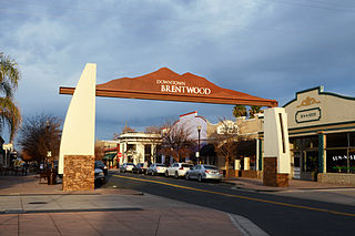
Brentwood is a city in Contra Costa County, California, United States. It is located in the East Bay region of the San Francisco Bay Area. The population is 66,854 as of 2022, an increase of 287% from 23,302 at the 2000 census.

<span class="mw-page-title-main">Byron, California</span> Census designated place in California, United States

Byron is a census designated place (CDP) in Contra Costa County, California, United States.

<span class="mw-page-title-main">Discovery Bay, California</span> Census-designated place in California, United States

Discovery Bay is a census-designated place (CDP) in eastern Contra Costa County, California in the United States, about 60 miles (97 km) from San Francisco. It is located in the San Francisco Bay Area. As of 2020, its population was 15,358, a 15% percent gain from 13,352 at the 2010 census.

<span class="mw-page-title-main">East Richmond Heights, California</span> Unincorporated community in California, United States

East Richmond Heights is an unincorporated community and census-designated place (CDP) in western Contra Costa County, California, United States. Its population was 3,280 at the 2010 census.

<span class="mw-page-title-main">El Cerrito, California</span> City in California, United States

El Cerrito is a city in Contra Costa County, California, United States, and forms part of the San Francisco Bay Area. It has a population of 25,962 according to the 2020 census. El Cerrito was founded by refugees from the 1906 San Francisco earthquake. It was incorporated in 1917 as a village with 1,500 residents. As of the census in 2022, there were 25,583 people and 10,637 households in the city.

<span class="mw-page-title-main">El Sobrante, Contra Costa County, California</span> Census-designated place in United States

El Sobrante is a census-designated place (CDP) in Contra Costa County, California, United States. The population was 12,669 at the 2010 census.

<span class="mw-page-title-main">Hercules, California</span> City in California, United States

Hercules is a city in western Contra Costa County, California. Situated along the coast of San Pablo Bay, it is located in the eastern region of the San Francisco Bay Area, about 10 miles (16 km) north of Berkeley, California. As of the 2020 census, its population was 26,016, according to the United States Census Bureau. The site of Hercules was first developed in 1881 as a manufacturing facility of the California Powder Works for the production of its patented dynamite formulation, Hercules powder. In 1882, the Hercules Powder Company was incorporated and assumed responsibility for the Hercules site. It was one of several explosive manufacturers that were active along the Pinole shoreline in the late 19th to the mid-20th century. The small company town that grew up near the facility subsequently became known as "Hercules", and was incorporated at the end of 1900. Starting in the 1970s, Hercules was heavily redeveloped as suburban bedroom community that lies along the I-80 corridor in Western Contra Costa County. It has a very ethnically diverse population.

<span class="mw-page-title-main">Knightsen, California</span> Census-designated place in California, United States

Knightsen is a census-designated place (CDP) in Contra Costa County, California, in the United States. As of the 2010 census, the CDP population was 1,568, up from 861 reported in the 2000 census.

<span class="mw-page-title-main">Pacheco, California</span> Census-designated place in California, United States

Pacheco is a census-designated place (CDP) in Contra Costa County, California. The population was 3,685 at the 2010 census. It is bounded by Martinez to the north and west, Concord to the east, and Pleasant Hill to the south.

<span class="mw-page-title-main">Rodeo, California</span> Census-designated place in California, United States

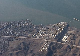
Rodeo is a census-designated place (CDP) located in Contra Costa County, California, in the East Bay sub-region of the San Francisco Bay Area, on the eastern shore of San Pablo Bay, 25 miles northeast of San Francisco. The population was 9,653 at the 2020 census. The town is named for the rodeos common in the late 19th century. Cattle from the surrounding hills were regularly driven down through the old town to a loading dock on the shoreline of San Pablo Bay for shipment to slaughterhouses, a practice which continued through the early 20th century. The town of Rodeo is served by the Interstate 80 freeway and State Route 4. The Southern Pacific Railroad main line passes through Rodeo. Rodeo has not been a stop on the railroad since the 1950s.

<span class="mw-page-title-main">San Pablo, California</span> City in California, United States

San Pablo is an enclave city in Contra Costa County, California, United States. The city of Richmond surrounds nearly the whole city. The population was 32,127 at the 2020 census. The current Mayor is Abel Pineda. Currently, the City Council consists of Abel Pineda, Patricia Ponce, Arturo Cruz, Elizabeth Pabon-Alvarado, and Rita Xavier. Ponce is the Vice Mayor, and Cruz, Pabon-Alvarado, and Xavier are Council Members. Dorothy Gantt is the city Clerk. Viviana Toledo is the city Treasurer.

<span class="mw-page-title-main">Tara Hills, California</span> Census-designated place in California, United States

Tara Hills is a census-designated place (CDP) in Contra Costa County, California, United States. The population was 5,126 at the 2010 census.

<span class="mw-page-title-main">Waldon, California</span> Former Census-designated place in California, United States

Waldon is a former census-designated place (CDP) in Contra Costa County, California, United States. The population was 5,133 at the 2000 census. It is served by Pleasant Hill/​Contra Costa Centre station on the Bay Area Rapid Transit (BART) Yellow Line, and by Interstate 680. The area has been undergoing a series of transit-oriented development projects under the auspices of the Contra Costa Centre Transit Village public/private partnership.

<span class="mw-page-title-main">El Cerrito, Riverside County, California</span> Census-designated place in Riverside County, California, United States

El Cerrito is a census-designated place (CDP) in Riverside County, California, United States. It is an unincorporated area mostly surrounded by the city of Corona. The population was 5,100 at the 2010 census, up from 4,590 at the 2000 census.

San Miguel is a census-designated place in Contra Costa County, California. San Miguel sits at an elevation of 249 feet (76 m). The 2010 United States census reported San Miguel's population was 3,392.

References

  1. 1 2 3 4 "Kensington (Contra Costa County, California)". Geographic Names Information System . United States Geological Survey . Retrieved May 11, 2014.
  2. "Senators". State of California. Retrieved March 30, 2013.
  3. "Members Assembly". State of California. Retrieved July 5, 2023.
  4. "California's 8th Congressional District - Representatives & District Map". Civic Impulse, LLC. Retrieved March 9, 2013.
  5. "2010 Census U.S. Gazetteer Files – Places – California". United States Census Bureau.
  6. "Kensington Census Designated Place". Geographic Names Information System . United States Geological Survey . Retrieved May 11, 2014.
  7. 1 2 "FIPS55 Data: California". FIPS55 Data . United States Geological Survey. February 23, 2006. Archived from the original on June 18, 2006. Retrieved May 11, 2014.{{cite web}}: External link in |work= (help)
  8. Kensington Improvement Club, ed. (2000). Kensington Past and Present. Woodford Press. ISBN   978-0-942627-76-3.
  9. Durham, David L. (1998). California's Geographic Names: A Gazetteer of Historic and Modern Names of the State. Clovis, Calif.: Word Dancer Press. p. 648. ISBN   1-884995-14-4.
  10. Public Services | Kensington Police Protection & Community Services District. Kensingtoncalifornia.org. Retrieved on 2013-07-15.
  11. Kevin Starr, Embattled Dreams: California in War and Peace 1940–1950, p317.
  12. "Contra Costa County Historical Society". Archived from the original on July 29, 2007. Retrieved April 23, 2011.
  13. Kirp, David L. (December 1, 1983). Just Schools: The Idea of Racial Equality in American Education. University of California Press. ISBN   978-0-520-05084-6.
  14. "Census of Population and Housing". Census.gov. Retrieved June 4, 2016.
  15. "2010 Census Interactive Population Search: CA - Kensington CDP". U.S. Census Bureau. Archived from the original on July 15, 2014. Retrieved July 12, 2014.
  16. "U.S. Census website". United States Census Bureau . Retrieved January 31, 2008.
  17. "Kensington, California Archived 2011-06-06 at the Wayback Machine ." U.S. Census Bureau. Retrieved on April 1, 2010.