The area was originally known as Woodberry Down. However, the construction of the Seven Sisters Road and the consequent establishment of the Manor House Tavern gave rise to the alternative name Manor House Crossroads[1] and with the arrival of the tube station in 1932, the area immediately around the tube station began to be known as Manor House. The demolition of the once very fashionable area of Woodberry Down and its replacement with one of London's biggest public housing estates resulted in 'Woodberry Down Estate' being used to refer to the public housing area and 'Manor House' for the area beyond. With the regeneration of the area during the early part of the 21st Century, the area is now being referred to once again by its nineteenth-century name of 'Woodberry Down'.
Location
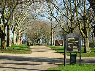
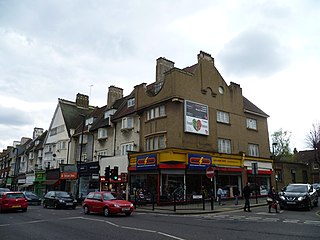
Built up during the middle part of the nineteenth century as part of an area called Woodberry Down, Manor House is now a small district without a formal town centre, but distant enough from other town centres that it has come to be referred to as an area. Taking its name from the Manor House Tavern (see below), via the Manor House tube station, it is centred at the junction of Seven Sisters Road and Green Lanes. The western border is defined by Finsbury Park in the neighbourhood of Harringay. Its other borders are defined by the New River, which loops around it on three sides.[2] The area consists mainly of the Woodberry Down development and the Woodberry Down reservoirs. The reservoirs were constructed in 1833 to purify the New River water and to act as a water reserve. The East reservoir is now a nature reserve known as Woodberry Wetlands, following a redevelopment in 2016 as part of the wider regeneration of Woodberry Down, and the West Reservoir is now a leisure facility, offering sailing, canoeing and other water sports. On its western edge stands the former filter house, now set out as a visitor centre with a café; some of the old hydraulic machinery can be viewed in the main hall. The pumping station at the reservoir gates, converted to a climbing centre in 1995 was designed in a distinctive castellated style by Robert Billings under the supervision of William Chadwell Mylne and built in 1854–56. [3] There are also two small shopping areas, playgrounds, three schools and a pub.
The area was known as 'Berrie Down Wood' in the seventeenth century and 'Wood Berry Downs Meadow' a hundred years later.[4]
Building started on Green Lanes with the appearance in 1821 of a large house at a spot that would later be the site of the junction with Woodberry Down (the road). Further north on Green Lanes, just to the south of the New River, Northumberland House, a three-storeyed building with a pillared entrance, balustrade, and urns on its roof, was completed in 1822.[5][6] It was sold for conversion to a 'private lunatic asylum' in 1826[7] It was then used as a private mental hospital until it was demolished in 1955.[8] One of its most famous patients was Vivienne Haigh-Wood Eliot, first wife of the American poet T.S. Eliot,[9] who lived at the hospital from 1938 until her death in 1947.[10]
A thatched cottage, with Gothic windows, was constructed on the boundary with the borough of Tottenham by 1825. Woodberry Down Cottages, four detached houses on the south side of Woodberry Down, had been built by 1829. Manor House tavern was built nearby in 1830. With the development of Finsbury Park almost a certainty, the land to the south and east of the present-day park was acquired by the Ecclesiastical Commissioners as ideal for building. The park was laid out between 1857 and 1869 and the adjacent land was sold to builders.
During the 1860s, Thomas John Angell, who appears to have been a speculator rather than a builder,[11] built Finsbury Park Villas. This was a terrace of at least twelve houses, which, starting with the Finsbury Park Tavern, ran northward along Green Lanes from its junction with the new Woodberry Grove.
At around the same time, Angell and a London builder Thomas Oldis were responsible for development that began to spread eastward along the north side of Seven Sisters Road. From 1868 to 1870 large detached houses with gardens running down to the New River were built at the east end of Seven Sisters Road. In 1867 3 acres (12,000m2) were leased on the southern side of the eastern end of the road, for the building of four detached or nine 'substantial' houses; three detached houses were built by 1871. An architect, William Reddall of Finsbury, was one of those who leased the houses.[11] Woodberry Down was laid out in 1868, when it was extended eastward from Lordship Road, and villas were built on the south side in the late 1860s. The area was the northern section of a district called Brownswood Park (named after Brownswood Manor) and was regarded as a particularly select suburb.[11]
However, with the increasing suburbanisation of the area, mainly for the middle and lower middle classes, many of the original families had moved out by 1895 and others were being replaced by poorer people in 1913. Social decline continued, until in 1954 the district was inhabited mainly by students, foreigners, and the working class, with most houses containing four or five families and all in decay.[11]
Twentieth-century redevelopment – the Woodberry Down Estate
From 1949 through to the 1970s much of the area was redeveloped, the old houses being demolished and replaced with a large council development known locally as Woodberry Down. The LCC compulsorily purchased the area for this purpose in 1934 in order to alleviate chronic housing shortages, but work did not begin till after the Second World War. Construction began in 1949 and the 57 blocks of flats were completed in 1962.
Initially, the estate offered greatly improved living conditions for tenants. However, over time, the estate suffered the problems of comparably idealistic, post-war, social housing projects. By the late 1980s, many of the flats were in a poor state of repair, while many more were empty and boarded up with metal shutters.
1980s squatter community
Throughout the 1980s and 1990s the increasing number of abandoned properties on the estate became occupied by a growing squatter community. The squatters at Woodberry Down Estate were predominantly young punks from all over the UK and Ireland. Several had squatted previously in the Noel Park area in Wood Green. The squatters’ relationship with tenants ranged from amicable to antagonistic, but the two communities generally managed to co-exist without too much hostility. The strong community spirit, which existed among residents in the 1950s was still evident to a lesser extent during this time, and the estate managed to avoid the more extreme crime and social problems often associated with inner-city housing projects. The sharp increase in numbers of squatters has clear links to the huge increases in homelessness in London that resulted from Thatcherite policies, such as the Right to Buy scheme (introduced in the Housing Act 1980).[12]
The Manor House Tavern
The Original Manor House pub, looking north towards Harringay, c.1860
The tavern was the source of the name of the tube station and consequently the immediate vicinity. The first tavern on the site was built by Stoke Newington builder Thomas Widdows[11] between 1830 and 1834[13] next to the turnpike on Green Lanes. Prior to this date a cottage had existed on the site,[14] but in 1829 an Act of Parliament was passed to permit the building of the Seven Sisters Road. Thomas Widdows was both the owner of the house and its occupant.[15] With the building soon to be sited on the junction of the existing Green Lanes turnpike road and the new Seven Sisters Road, Widdows no doubt saw a roadside tavern as an excellent investment.
The new building was within sight of the Hornsey Wood Tavern, which had been formed out of the old Copt Hall, the manor house of the Manor of Brownswood.[11][16] It is possible that its name was taken from this connection.[17] The land itself however was on the demesne of Stoke Newington Manor.[18] At around the time that the pub was first built, on the southern boundary of the demesne, on Church Street, a school called Manor School was operating.[19] The school was next door to the trading premises of Thomas Widdows, builder of the pub. So it is equally possible that the 'Manor House' name was just a fashionable name, more related to the connection with Stoke Newington Manor.
Robert Baily, the first of many Manor House Tavern landlords, described his establishment as a 'public house and tea-gardens'[20] He placed the following advertisement in the Morning Advertiser on 30 June 1834.
Robert Baily, late of the Eyre Tavern, St John’s Wood, having taken the above newly erected House, fitted up in a most superior manner, and commanding extensive and delightful views, solicit from his friends and the public that support he has hitherto been favoured with, assuring them that no exertion shall be wanting on his part to merit their patronage. The Grounds adjoining are admirably calculated for Cricket, Trap-ball, or any other amusement requiring space. There is likewise a large Garden and Bowling green, good Stabling, lock-up Coach-houses, &c. Dinners for Public and Private Parties. An Ordinary on Sundays at two o’clock.
Baily died just three years later. In 1838 the tavern was taken over by George Stacey who had previously been at the Adelaide Tavern in Hackney Road.[21] The tavern changed hands again several times after Stacey.[22]
On 25 October 1843 Queen Victoria and Prince Albert 'visited' the pub when they were travelling by carriage from Windsor to Cambridge. The route included the still relatively new Seven Sisters Road and a stop was made at the Manor House Tavern for the first change of horses.[23] A tablet with the following inscription was placed on the side of the pub.
QVEENE VICTORIA HALTED HERE YE 25TH Oct A.D. 1843
In 1851 it was purchased by James Toomer.[24] According to the Morning Post, Toomer was 'well respected in literary and theatrical circles'.[25] The new owner added function rooms including a banqueting hall and ballroom which became known as the Manor House Assembly Rooms. Soon after purchase he obtained licences for both music and dancing and the pub became a regular venue for events of both sorts.[26] In the summer of 1870 Toomer advertised a new ballroom[27] and later that summer sold the pub. The advertisement of sale gave the following description:
The Manor House, Roadside Inn and Wine Vaults The above property has for years been recognised as one of the best in its class which is amply testified by the enormous and peculiarly profitable trade attached thereto; and in order that no misconception may arise as to the nature of the business, the auctioneers deem it wise to announce the tavern business and trade dinners have been discontinued for several years and the present returns are entirely confined to the counter and grounds from which sources they amount upwards are £5,000 pounds per annum.[28]
The building was bought by John Charles Kay who sold it two years later to Samuel Perrin [29] A further change of ownership in 1878 saw the pub in the hands of Stephen Medcalf. In 1879 Morris Benjamin made an application to renew the music and dancing licence as the licensee.[30] In 1890 it was taken on by James Swinyard who remodelled and modernised it shortly after the sale. Swinyard managed the pub till his death in 1910. Subsequently, his widow Amelia took over the licence until the late 1920s. In 1930 the imminent arrival of the Piccadilly Line led to the widening of the road, the demolition of the old tavern [31] and the erection of current building. Behind the new building, offices were built for London Transport[32] To the chagrin of her sons, Amelia Swinyard sold the pub to a buyer who then received the compensation when the pub's land was taken to accommodate these buildings. Amelia died in October 1937, aged 90 at the Kenwood Nursing Home in Muswell Hill.
Since 2007, Woodberry Down has been undergoing a phased redevelopment which involved the construction of more than 5,500 modern flats on the site, 41% of which will be affordable, for an investment of c. £1bn.[34][35] The plan was initially conceived during a time of economic growth under the New Labour administration in the late 1990s. In 2002, a structural assessment concluded that 54% (31 out of 57 existing buildings) were beyond economic repair. To progress the redevelopment, Hackney Council struck a deal with Genesis Housing Association and Berkeley Homes for the estate's demolition and redevelopment. The urban regeneration project has been amongst the largest in the UK and is due to complete in 2035.
In 2021, the construction of a Travelodge hotel opposite the tube station was completed.
Phases of the redevelopment
Phase 1 comprised a number of sites across Woodberry Down. The construction started in 2009 and was completed in 2019. It included the construction of the Skyline, tallest residential building in North London.
Phase 2 comprises an area of 4.3 hectares, south of Seven Sisters Road, east of Green Lanes and north of the West Reservoir. This phase involves the construction of 4 buildings, totalling 850 homes (of which 109 are social rented, 200 shared ownership and 543 private), and was completed in 2022.[36]
Phase 3 was approved by the Planning Committee in September 2020. The area covers 2.2 hectares at the southeast corner of Seven Sisters Road and Woodberry Grove, where 4 residential blocks of 6 to 20 storeys are to be constructed, comprising 584 new homes (of which 117 are for social rent, 126 for shared ownership and 341 private). The plan also includes the construction of a public park and the addition of 175 new trees. An energy centre, which will provide heat to the whole development, will also be built on the site. Works were originally expected to commence in 2017 but did not start until 2020, with the first homes expected to be completed by 2024.[37]
Phase 4 comprises the area at the southwest corner of Seven Sisters Road and Woodberry Grove. It was originally estimated to commence in 2020 with completion from 2023.
Phase 5 comprises the area south of Seven Sisters Road, north of the East Reservoir and east of Phase 3. It was originally estimated to commence in 2023 with completion from 2027.
Phase 6 comprises the area at the northwest corner of Seven Sisters Road and Woodberry Grove. It was originally estimated to commence in 2026 with completion from 2029.
Phase 7 comprises the area north of Seven Sisters Road at the eastern edge of the development. It was originally estimated to commence in 2029 with completion from 2032.
Phase 8 comprises the area at the northeast corner of Green Lanes and Woodberry Grove. It was originally estimated to commence in 2032 with completion from 2035.[38]
Prizes and awards
The first phase of the development produced 117 homes let by Genesis on social rents, and won the top prize for social housing at the Daily Telegraph British Homes Awards 2011.[39]
The redevelopment has been controversial,[41] with some commentators calling the plans 'state sponsored gentrification'.[42]
Governance
The area covers the Woodberry Down ward which is one of the wards in the London Borough of Hackney. Latest elections at the ward were held on 22 May 2014. There were 6,417 eligible voters and a turnout of 40.8%.
At the time of the 2011 census, there were 8,758 residents in Woodberry Down. The Woodberry Down Ward census findings revealed 50.0% of Woodberry Down's population was White (27.6% British, 19.9% Other, 2.3% Irish and 0.2% Gypsy or Irish Traveller). 25.4% was Black (6.4% Caribbean, 15.6% African, 3.4% Other), 10.3% was Asian (1.9% Indian, 0.8% Pakistani, 2.4% Bangladeshi, 2.2% Chinese and 3% Other) and 14.4% was other ethnic groups.
41.9% of the ward were Christian, 17.9% Muslim, 9.2% Jewish, 2.8% other religion, 17.9% had no religion and 10.6% did not state their religion. [44]
Image gallery
Manor House tube station entrance on the western side of Green Lanes, north of Seven Sisters' Road
Nicholl House (now demolished) was part of the Woodberry Down Estate. It has been falsely reported that the building featured in the film Schindler's List.[45]
View from a flat in the new development at Woodberry Down, March 2012
↑ Original plans of Northumberland House in Bulletin 51, Pickering & Chatto, May 2016
↑ Whilst no evidence has yet been unearthed that links the house to the Percys, the Dukes of Northumberland, the presence of the Percy lion over the gates suggests that there may have been a link. The Percys also had a historic connection to the area, once owning a house on Newington Green (Old and New London: Volume 2. Originally published by Cassell, Petter & Galpin, London, 1878)
↑ Morning Advertiser, page 1, 13 November 1826,London
↑ Roberts, Andrew. Northumberland House, The 1832 Madhouse Act and the Metropolitan Commission in Lunacy from 1832, Middlesex University, accessed 11 November 2009. Roberts cites Murphy, Elaine (2000) The Administration of Insanity in East London 1800-1870 PhD Thesis, University of London.
1 2 3 4 5 6 T. F. T. Baker & R. B. Pugh (Editors), A History of the County of Middlesex, Volume 6: Friern Barnet, Finchley, Hornsey with Highgate, Accessed online at British History Online, 1976
↑ Baker & Pugh (see previous reference) state that the pub was built "by 1832". However, the pub's first landlord advertised is as a new building in 1834, see below
↑ Described as "Cottage and Garden. On the Eastern Side of the Green Lanes, opposite the Road leading to Hornsey Wood House" in the Schedule of the Act to amend an Act of the Seventh Year of His Present Majesty for Consolidating the Trusts of the Several Turnpike Roads in the Neighbourhood of the Metropolis, North of the River Thames, and to make and maintain Two New or Branch Road to communicate with the said Metropolis Road, pp 853-863 of The Statutes of the United Kingdom of Great Britain and Ireland, Volume 11, George Eyre and Andrew Strahan, Printers to the King's Most Excellent Majesty, 1829". The cottage was built c. 1810. No building is shown on map OSD 152 / Serial 104 Hampstead 1807 - 08 at Hackney Archives, but one does appear on the 1814 Map of the Parish and Prebendal Manor of the Parish of Stoke Newington, also at Hackney Archives. On Crutchley's 1829 map, the building is labelled as "Lodge", a term often used at the time to refer to a very respectable villa type dwelling.
↑ Posted by Hugh on December 17, 2016 at 9:43 in Local History (See History Group for main postings); Discussions, View. "History of the Manor House Pub". harringayonline.com. Retrieved 1 December 2022.
↑ This was certainly the belief of Edwardian author JJ Sexby who wrote in his 1905 book, "In the neighbourhood of the (Finsbury) park we still have Brownswood Road and Manor-House Tavern to remind us of the Manor of Brownswood and of its manor-house, which has now disappeared" (The Municipal Gardens, and Open Spaces of London, Lt-Col J. J. Sexby, Elliot Stock 1905).
↑ A History of the County of Middlesex: Volume 8, Islington and Stoke Newington Parishes, Victoria County History, London, 1985. Pages 143-151.
↑ A History of the County of Middlesex: Volume 8, Islington and Stoke Newington Parishes, Victoria County History, London, 1985, Pages 217-223
↑ in November 1839 various newspapers carried the announcement of the bankruptcy of William Tombleson described as "late of the Manor-house tavern, Stoke Newington, tavern-keeper, publisher, dealer and chapman" (Wiltshire Independent - 28 November 1839). So it may well be that Tombleson took over the pub after Baily but didn't last long.
↑ The Morning Advertiser of 31 July 1849 notes a change of licensee from Catherine Harris to William Burnell. Records also show a Michael Harris insured as a victualler at the tavern in 1840 (Nat Archives ref MS 11936/567/1323901); no doubt this is Catherine's husband. So it may well have been the Harrises who were running the pub at the time of the royal visit.
↑ Queen Victoria's Journal in the Royal Archives at Windsor Castle, via www.armingford.net and William James Roe, Tottenham, Edmonton and Enfield Historical Notebook: With Some Incidental Notices of Harringay (or Hornsey), London 1952
↑ Morning Advertiser, 9 August 1851, and Clerkenwell News, 10 July 1858
↑ Notice of Intention to Apply; an Application for Renewal of a Music and Dancing Licence from Morris Benjamin, Licensed Victualler, of The Manor House, Green Lanes, held at London Metropolitan Archives
The London Borough of Hackney is a London borough in Inner London, England. The historical and administrative heart of Hackney is Mare Street, which lies 5 miles (8 km) north-east of Charing Cross. The borough is named after Hackney, its principal district. Southern and eastern parts of the borough are popularly regarded as being part of east London, with the northwest belonging to north London. Its population is 281,120 inhabitants.
Stoke Newington is an area occupying the northwest part of the London Borough of Hackney, England. The area is five miles northeast of Charing Cross. The Manor of Stoke Newington gave its name to Stoke Newington the ancient parish.
Finsbury Park is a public park in the London neighbourhood of Haringey, north London, England. The park lies on the southern-most edge of the London Borough of Haringey. It is in the area formerly covered by the historic parish of Hornsey, succeeded by the Municipal Borough of Hornsey. It was one of the first of the great London parks laid out in the Victorian era. The park borders the neighbourhoods of Harringay, Finsbury Park, Stroud Green, and Manor House.
Seven Sisters is a district of Tottenham, north London, England, at the eastern end of Seven Sisters Road, which runs from Tottenham High Road to join the A1 in Holloway.
The Metropolitan Borough of Stoke Newington was a metropolitan borough in the County of London between 1900 and 1965 when it became part of the London Borough of Hackney.
Harringay is a district of north London, England, within the London Borough of Haringey. It is centred on the section of Green Lanes running between the New River, where it crosses Green Lanes by Finsbury Park, and Duckett's Common, near Turnpike Lane.
Seven Sisters is a National Rail, London Overground and London Underground Victoria line station in the Seven Sisters area of the London Borough of Haringey, north London. The station has two entrances/exits, one on Tottenham High Road and the other on Seven Sisters Road.
Green Lanes is a main road in North London which forms part of the A105 road. Covering a distance of 6.3 miles (10.1 km) between Newington Green and Winchmore Hill, it is one of the longest streets in the capital, passing through the N16, N4, N8, N13 and N21 postcode areas.
Stoke Newington was an ancient parish in the county of Middlesex. It was both a civil parish, used for administrative purposes, and an ecclesiastical parish of the Church of England.
Hornsey was an ancient parish in the county of Middlesex. It was both a civil parish, used for administrative purposes, and an ecclesiastical parish of the Church of England.
Blackstock Road is a major road in North London, England, running from Seven Sisters Road south westerly to Highbury.
The history of Harringay tells the story of the development of the district of London five miles from its centre, affected by, but not always part of, the great city's history.
Finsbury Park is an area in north London, England, which grew up around an important railway interchange near the convergence of the Boroughs of Islington, Haringey and Hackney.
During this period Harringay emerged from the mist of prehistory as a thickly forested area of southern England. By 1750 most of the forest had been cleared for agriculture, although settlement was still sparse.
This significant period in Harringay's history witnessed the transition from a purely pastoral society and set the stage for the upheavals of the late 19th century.
The advance of late Victorian urbanisation during the last twenty years of the 19th century swept away the 18th and early 19th-century houses, their grounds and the farmland. By 1900 Harringay was completely urbanised.
Stroud Green in London, England, is a suburb adjacent to Finsbury Park in the northern part of Greater London. While most of the area is in the London Borough of Haringey, a very small part is in the London Borough of Islington. The Stroud Green Road not only forms the boundary between the two boroughs but is also the area's principal thoroughfare and a busy local shopping street, with many popular restaurants and bars.
Woodberry Down Comprehensive School was a secondary school located off the Seven Sisters Road in the Manor House area of North London. The now defunct school verges on three London boroughs: Hackney, Haringey and Islington. The school was opened in 1955, and closed in 1981 when it was amalgamated with Clissold School and renamed Stoke Newington School. The new school was founded in 1982 in the building of the former Clissold School.
The Dalston Synagogue was a Jewish place of worship in the London Borough of Islington, North London, from about 1885 to 1970. Jews fleeing the pogroms of the Russian Empire, and those beginning to leave the East End of London and move northwards towards Stoke Newington and Stamford Hill established a congregation in the neighbourhood by 1876. The Victorian Gothic building was erected in Poets Road in 1885, a street just outside the boundaries of Dalston, and became one of the leading members of the United Synagogues.
This page is based on this Wikipedia article Text is available under the CC BY-SA 4.0 license; additional terms may apply. Images, videos and audio are available under their respective licenses.