
Steuben County (stu-BEN) is a county located in the U.S. state of New York. As of the 2020 census, the population was 93,584. Its county seat is Bath. Its name is in honor of Baron von Steuben, a Prussian general who fought on the American side in the American Revolutionary War, though it is not pronounced the same.
Tyrone is a town in Schuyler County, New York, United States. The population was 1,650 at the 2020 census.
Wayne is a town located in the northeast corner of Steuben County, New York, United States. As of the 2020 census, the town population was 1,006. The town was named after the Revolutionary War general, Anthony Wayne.
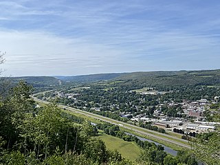
Bath is a town in Steuben County, New York, United States, with an area of 96.3 square miles and a population of 11,426 in 2020. Its largest settlement is the Village of Bath, which has an area of 2.9 sq mi and a population of 5,641. The Village is the county seat of Steuben County. The Town is located in the central part of the county, northwest of Elmira. The town and village are either named after the city of Bath in England or after Lady Bath, daughter of a landowner.
Canisteo is a town in Steuben County, New York, United States. The population was 3,294 at the 2020 census. The name was taken from a former Native American village located there, and is Iroquoian in origin.

New York State Route 15 (NY 15) is a north–south state highway located in western New York in the United States. The southern terminus of the route is officially at Interstate 390 (I-390) exit 3 south of the village of Wayland, although some signage indicating that NY 15 continues south to the northern terminus of U.S. Route 15 (US 15) in Painted Post still exists. The northern terminus of NY 15 is at an intersection with NY 31 in downtown Rochester. Outside of Monroe County, NY 15 is a rural two-lane highway. In the Rochester suburbs of Henrietta and Brighton, however, NY 15 is a major commercial strip, and the section in Rochester is a two-to-four lane street that serves commercial and residential areas.
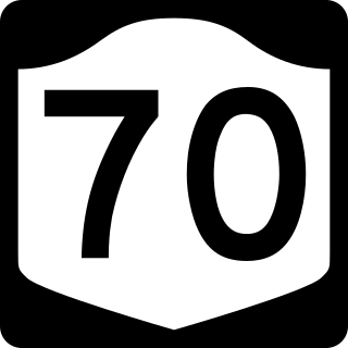
New York State Route 70 (NY 70) is a short state highway in the western portion of New York in the United States. It travels through three different counties in just 18.01 miles (28.98 km) and is the primary road to and from the village of Canaseraga. The western terminus of the route is at an intersection with NY 436 in the Livingston County town of Portage. Its eastern terminus is at a junction with NY 36 in the Steuben County town of Dansville. Although NY 70 is mostly signed north–south, it follows a more southeast–northwest alignment and is considered an east–west route by the New York State Department of Transportation (NYSDOT). The portion of the route between Dalton and Canaseraga parallels both Canaseraga Creek and the Norfolk Southern Railway's Southern Tier Line.

New York State Route 248 (NY 248) is a 31.43-mile-long (50.58 km) state highway in a remote part of the Southern Tier region of New York in the United States. The route, located close to the Pennsylvania state line, passes through Allegany and Steuben counties. In the former, it runs mostly east–west from its junction with NY 19 in Stannards; but in the latter turns northwards to its north end at NY 36 in Canisteo. NY 248 used to be signed north–south in Steuben County, however, those designation were replaced by new east–west signage around 2013.
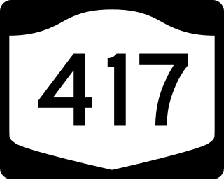
New York State Route 417 (NY 417) is an east–west state highway located in the Southern Tier of New York in the United States. It begins at exit 20 of the Southern Tier Expressway in the city of Salamanca and ends at a junction with NY 415 in Painted Post, west of the city of Corning. At 105.25 miles (169.38 km) in length, NY 417 is the longest of the state highways that were formerly part of NY 17 before the construction of the Southern Tier Expressway. It also diverges the most from the current NY 17, coming within 100 feet (30 m) of the Pennsylvania state line at one intersection.

New York State Route 415 (NY 415) is a state highway located entirely within Steuben County, New York, in the United States. It is a 42.83-mile (68.93 km) north–south trunk road that parallels in part, the Cohocton River, Interstate 86 (I-86) and I-390. The southern terminus of the route is at an intersection with NY 414 in the city of Corning. Its northern terminus is at a junction with NY 15 and NY 21 south of the village of Wayland. NY 415 serves several villages bypassed by the Southern Tier Expressway and I-390, such as Bath and Cohocton. The road also runs concurrent with New York State Bicycle Route 17 from its southern terminus to County Route 70A (CR 70A) in Avoca.
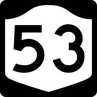
New York State Route 53 (NY 53) is a north–south state highway located in the Finger Lakes region of New York in the United States. It extends for 22.50 miles (36.21 km) from an intersection with NY 415 near the hamlet of Kanona in northern Steuben County to a junction with NY 21 in the village of Naples in southern Ontario County. Just north of Kanona, located within the town of Bath, NY 53 connects to the Southern Tier Expressway. About midway between Kanona and Naples, the route serves the hamlet of Prattsburgh.

New York State Route 225 (NY 225) is a state highway in the Southern Tier of New York in the United States. It is a 15.54-mile (25.01 km) loop route off NY 352 that connects the town of Big Flats and the city of Corning to the hamlet of Caton. The route begins in Big Flats and follows a generally east–west alignment across rural areas to Caton, where it turns to run in a north–south direction toward Corning. Development along the highway increases once it enters the Corning suburb of South Corning, and the rest of the route serves residential neighborhoods in South Corning and Corning. NY 225 is two lanes wide for its entire length; however, part of the highway in South Corning also has a center turn lane.

New York State Route 333 (NY 333) was an east–west state highway located in southeastern Steuben County, New York, in the United States. The western terminus of the route was at an intersection with County Route 11 (CR 11) and CR 24 in Risingville, a hamlet within the town of Thurston. Its eastern terminus was at a junction with NY 415 in the town of Campbell. In between, NY 333 passed through the hamlet of Thurston. The route was assigned as part of the 1930 renumbering of state highways in New York and remained unchanged until April 1, 1997, when ownership and maintenance of the route was transferred from the state of New York to Steuben County as part of a highway maintenance swap between the two levels of government. NY 333 was subsequently redesignated as County Route 333.

New York State Route 228 (NY 228) is a state highway in Schuyler County, New York, in the United States. It runs for 12.47 miles (20.07 km) in a northeast to southwest direction from an intersection with NY 224 in the village of Odessa to a junction with NY 227 in the hamlet of Perry City within the town of Hector. NY 228 has a short overlap with NY 79 in the Hector community of Mecklenburg. The route was assigned as part of the 1930 renumbering of state highways in New York; however, it initially ended at NY 79 in Mecklenburg, from where NY 79 went north to Perry City. NY 79 was realigned to head west from Mecklenburg in the early 1960s, at which time the NY 228 designation was extended northward over NY 79's former routing.

New York State Route 230 (NY 230) is a state highway in the Finger Lakes region of New York in the United States. NY 230 is an east–west highway between the eastern edge of Steuben County to the interior of adjacent Yates County. The western terminus of NY 230 is the community of Keuka in the town of Wayne on the edge of Keuka Lake at NY 54. The eastern terminus is at its junction with NY 14A in the town of Barrington, west of the village of Dundee.

New York State Route 274 (NY 274) is a 10.44-mile (16.80 km) state highway located entirely in Oneida County, New York, in the United States. The route begins at an intersection with NY 365 in the village of Holland Patent and heads north and west for 5 miles (8 km) in each direction to a junction with NY 46 at the hamlet of Frenchville in the town of Western. A two-lane highway its entire length, much of NY 274 is narrow and winding. The northwesternmost 2 miles (3.2 km) of the highway are particularly narrow and curved, running alongside a tributary of the Mohawk River. NY 274 was originally designated as part of New York State Route 46A, an alternate route of NY 46 between Rome and Western, in 1930 before gaining its current designation in the early 1950s.

New York State Route 371 (NY 371) is a north–south state highway in Steuben County, New York, in the United States. It runs for 4.83 miles (7.77 km) from an intersection with NY 415 in the village of Cohocton to a junction with NY 21 in the town of Cohocton. NY 371 follows the Cohocton River and the main line of the B&H Rail Corporation for virtually its entire length. Most of the route passes through rural areas located inside of a valley surrounding the river.
Coopers Plains is a hamlet and census-designated place (CDP) in the towns of Erwin and Campbell in Steuben County, New York, United States. As of the 2010 census, it had a population of 598.

Canisteo Center, New York is the original location of the Village of Canisteo, at the intersection of Canisteo River Road and Steuben County road 119. It was never incorporated.
South Canisteo is a hamlet in the Town of Canisteo, approximately 6 miles (9.7 km) southeast of the Village of Canisteo. It is located on New York Route 36 at its intersection with Steuben County route 21, Hog Back Road, and Steuben County route 31.


