Prattsburgh, New York

Last updated

Prattsburgh, New York
USA New York location map.svg
Red pog.svg
Prattsburgh
Usa edcp location map.svg
Red pog.svg
Prattsburgh
Coordinates: 42°32′N77°20′W / 42.533°N 77.333°W / 42.533; -77.333
Country United States
State New York
County Steuben
Area
[1]
  Total51.72 sq mi (133.94 km2)
  Land51.67 sq mi (133.82 km2)
  Water0.05 sq mi (0.13 km2)
Elevation
1,939 ft (591 m)
Population
 (2020) [2]
  Total1,985 Decrease2.svg
  Estimate 
(2021) [2]
1,968
  Density38.77/sq mi (14.97/km2)
Time zone UTC-5 (Eastern (EST))
  Summer (DST) UTC-4 (EDT)
ZIP code
14873
Area code 607
FIPS code 36-59718
GNIS feature ID0979395
Website www.townofprattsburgh.org

Prattsburgh is a town in Steuben County, New York, United States. The population was 1,985 at the 2020 census. [2] It is situated in the northeast part of the county, north of Bath.

Contents

History

Prattsburgh was formed from the town of Pulteney in 1813. [3] The Prattsburgh community is named after early settler Joel Pratt, who arrived around 1799 to purchase land. [4] Settlers arrived in 1801.

The former Kanona & Prattsburgh station in Prattsburgh Prattsburgh station.jpg
The former Kanona & Prattsburgh station in Prattsburgh

In Prattsburgh was the Franklin Institute, described as "old" about 1812. [5]

From c. 1889-1961 Prattsburgh was located on a railroad. The Kanona & Prattsburgh Railroad Company, the Kanona & Prattsburgh Railway Company, and the Prattsburgh Railway Corporation during the period operated an 11.44 single-track standard-gauge railroad from a connection with the Erie Railroad at Kanona to Prattsburgh. Intermediate stations included Wheeler, Beans, and Stickneys.

Geography

According to the United States Census Bureau, the town has a total area of 51.7 square miles (134 km2), of which, 51.7 square miles (134 km2) of it is land and 0.04 square miles (0.10 km2) of it (0.06%) is water.

The north town line is the border of Steuben County and Yates County.

New York State Route 53 is an important north-south highway in the town.

The town is at a higher altitude than most other parts of the county.

Demographics

Historical population
CensusPop.Note
1820 1,377
1830 2,39974.2%
1840 2,4552.3%
1850 2,78613.5%
1860 2,7900.1%
1870 2,479−11.1%
1880 2,349−5.2%
1890 2,170−7.6%
1900 2,1971.2%
1910 1,834−16.5%
1920 1,663−9.3%
1930 1,421−14.6%
1940 1,364−4.0%
1950 1,353−0.8%
1960 1,4487.0%
1970 1,5235.2%
1980 1,6578.8%
1990 1,89414.3%
2000 2,0649.0%
2010 2,0851.0%
2020 1,985−4.8%
2021 (est.)1,968 [2] −0.9%
U.S. Decennial Census [6]

As of the census [7] of 2000, there were 2,064 people, 809 households, and 567 families residing in the town. The population density was 39.9 inhabitants per square mile (15.4/km2). There were 1,167 housing units at an average density of 22.6 per square mile (8.7/km2). The racial makeup of the town was 96.17% White, 1.55% African American, 0.29% Native American, 0.10% Asian, 0.63% from other races, and 1.26% from two or more races. Hispanic or Latino of any race were 1.36% of the population.

There were 809 households, out of which 35.5% had children under the age of 18 living with them, 53.3% were married couples living together, 10.9% had a female householder with no husband present, and 29.9% were non-families. 24.2% of all households were made up of individuals, and 10.1% had someone living alone who was 65 years of age or older. The average household size was 2.55 and the average family size was 3.00.

In the town, the population was spread out, with 28.0% under the age of 18, 6.3% from 18 to 24, 27.9% from 25 to 44, 23.6% from 45 to 64, and 14.2% who were 65 years of age or older. The median age was 37 years. For every 100 females, there were 101.0 males. For every 100 females age 18 and over, there were 96.4 males.

The median income for a household in the town was $32,150, and the median income for a family was $36,250. Males had a median income of $28,421 versus $20,625 for females. The per capita income for the town was $15,008. About 12.9% of families and 17.5% of the population were below the poverty line, including 27.6% of those under age 18 and 5.9% of those age 65 or over.

Communities and locations in the Town of Prattsburgh

Famous people from Prattsburgh

Related Research Articles

<span class="mw-page-title-main">Steuben County, New York</span> County in New York, United States

Steuben County (stu-BEN) is a county located in the U.S. state of New York. As of the 2020 census, the population was 93,584. Its county seat is Bath. Its name is in honor of Baron von Steuben, a Prussian general who fought on the American side in the American Revolutionary War, though it is not pronounced the same. The county is part of the Southern Tier region of the state.

Leyden is a town in Lewis County, New York, United States. The population was 1,785 at the 2010 census. The town is in the southern part of the county and is north of Rome.

Springwater is a town in Livingston County, New York, United States. The population was 2,439 at the 2010 census. Springwater is in the southeast part of the county.

<span class="mw-page-title-main">Steuben, New York</span> Town in Oneida County, New York, US

Steuben is a town in Oneida County, New York, United States. The population was 1,110 at the 2010 census. The town is named after Baron von Steuben, a Prussian general who fought on the American side in the American Revolutionary War.

Tyrone is a town in Schuyler County, New York, United States. The population was 1,650 at the 2020 census.

Cameron is a town in Steuben County, New York, United States. The population is 898 as of 2020. The town is named after Dugald Cameron, an early settler and land agent of the Pulteney Estate.

Campbell is a town in Steuben County, New York, United States. The population was 3,163 at the 2020 census. The name is from Robert Campbell, an early landowner. The town is centrally located in the county and is northwest of Corning.

<span class="mw-page-title-main">Caton, New York</span> Town in New York, United States

Caton is a town in Steuben County, New York, United States. The population was 2,046 at the 2020 census. The town is named after Richard Caton.

<span class="mw-page-title-main">Erwin, New York</span> Town in New York, United States

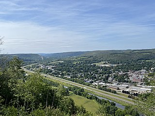
Erwin is a town in Steuben County, New York, United States. The population was 8,090 at the 2020 census. The name is that of an early settler, who became the first Town Supervisor. Erwin is in the southeast part of the county and is west of the city of Corning.

Hornby is a town in Steuben County, New York, United States. The population was 1,682 at the 2020 census. The name is from John Hornby, a land owner of the Pulteney Tract.

Hornellsville is a town in Steuben County, New York, United States. The population, not counting the city of Hornell, was 4,039 at the 2020 census. The name is taken from a prominent pioneer family.

Pulteney is a town in Steuben County, New York, United States. The population was 1,260 at the 2020 census. The name is derived from the name of the original pioneer tract of land.

Troupsburg is a town in Steuben County, New York, United States. The population was 1,016 at the 2020 census. The town is named after Robert Troup, an agent of the Pulteney Estate.

Urbana is a town in Steuben County, New York, United States. The population was 2,125 at the 2020 census.

West Union is a town in Steuben County, New York, United States. The population was 343 as of the 2020 decennial census.

<span class="mw-page-title-main">Wheeler, New York</span> Town in New York, United States

Wheeler is a town in Steuben County, New York, United States. The population was 1,136 at the 2020 census. The town is named after Captain Silas Wheeler, an early settler.

<span class="mw-page-title-main">Avoca, New York</span> Town in New York, United States

Avoca is a town in Steuben County, New York, United States. The population was 1,996 at the 2020 census.

<span class="mw-page-title-main">Bath, New York</span> Town in New York, United States

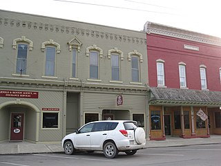
Bath is a town in Steuben County, New York, United States, with an area of 96.3 square miles and a population of 11,426 in 2020. Its largest settlement is the Village of Bath, which has an area of 2.9 sq mi and a population of 5,641. The Village is the county seat of Steuben County. The Town is located in the central part of the county, northwest of Elmira. The town and village are either named after the city of Bath in England or after Lady Bath, daughter of a landowner.

Cohocton is a town in Steuben County, New York, United States. The population was 2,268 at the 2020 census. The town contains a village, also called Cohocton and is located in the northwestern part of the county.

Wayland is a town in Steuben County, New York, United States. The population was 3,733 at the 2020 census.

References

  1. "2016 U.S. Gazetteer Files". United States Census Bureau. Retrieved July 5, 2017.
  2. 1 2 3 4 Bureau, US Census. "City and Town Population Totals: 2020—2021". Census.gov. US Census Bureau. Retrieved October 6, 2022.
  3. "Pulteney History – Town of Pulteney". pulteneyny.com. Retrieved June 17, 2021.
  4. kirkhouse. "Join Us for a Walk Through Prattsburgh". The Leader. Retrieved June 17, 2021.
  5. Cunningham, Henry J. (1912). History of Oneida County New York from 1700 to the Present Time. Vol. I. Chicago: S. ). Clarke Publishing Company. p. 356.
  6. "Census of Population and Housing". Census.gov. Retrieved June 4, 2015.
  7. "U.S. Census website". United States Census Bureau . Retrieved January 31, 2008.