West Union, New York

Last updated

West Union, New York
USA New York location map.svg
Red pog.svg
West Union, New York
Location within the state of New York
Coordinates: 42°3′14″N77°41′53″W / 42.05389°N 77.69806°W / 42.05389; -77.69806
Country United States
State New York
County Steuben
Area
[1]
  Total41.05 sq mi (106.32 km2)
  Land40.90 sq mi (105.94 km2)
  Water0.15 sq mi (0.38 km2)
Elevation
2,336 ft (712 m)
Population
 (2020)
  Total343
  Density8.38/sq mi (3.23/km2)
Time zone UTC-5 (Eastern (EST))
  Summer (DST) UTC-4 (EDT)
FIPS code 36-81105 [2]
GNIS feature ID0979629 [3]

West Union is a town in Steuben County, New York, United States. The population was 343 as of the 2020 decennial census.

Contents

The Town of West Union is in the southwest corner of the county and south of the city of Hornell, New York.

History

West Union was formed from part of the Town of Greenwood in 1845. Originally the names "Green" and "Union" were proposed for the town, but both names were deemed unsuitable due to other towns in the state using those names, in, respectively, Chenango County and Broome County.

Geography

According to the United States Census Bureau, the town has a total area of 41.1 square miles (106 km2), of which 41.0 square miles (106 km2) is land and 0.1 square miles (0.26 km2) (0.19%) is water.

The western town line is the border of Allegany County, and the southern town line is the border of Pennsylvania (Potter County).

New York State Route 248 passes through the town.

Demographics

Historical population
CensusPop.Note
1850 950
1860 1,39246.5%
1870 1,204−13.5%
1880 1,2715.6%
1890 1,167−8.2%
1900 1,025−12.2%
1910 985−3.9%
1920 781−20.7%
1930 715−8.5%
1940 630−11.9%
1950 504−20.0%
1960 430−14.7%
1970 426−0.9%
1980 4311.2%
1990 412−4.4%
2000 399−3.2%
2010 312−21.8%
2020 3439.9%
U.S. Decennial Census [4]

As of the census [2] of 2000, there were 399 people, 141 households, and 112 families residing in the town. The population density was 9.7 people per square mile (3.7 people/km2). There were 279 housing units at an average density of 6.8 per square mile (2.6/km2). The racial makeup of the town was 98.75% White, 0.75% Native American, 0.50% from other races. Hispanic or Latino of any race were 1.25% of the population.

There were 141 households, out of which 32.6% had children under the age of 18 living with them, 68.8% were married couples living together, 6.4% had a female householder with no husband present, and 19.9% were non-families. 14.2% of all households were made up of individuals, and 4.3% had someone living alone who was 65 years of age or older. The average household size was 2.83 and the average family size was 3.12.

In the town, the population was spread out, with 23.6% under the age of 18, 10.0% from 18 to 24, 27.3% from 25 to 44, 30.6% from 45 to 64, and 8.5% who were 65 years of age or older. The median age was 40 years. For every 100 females, there were 113.4 males. For every 100 females age 18 and over, there were 111.8 males.

The median income for a household in the town was $36,000, and the median income for a family was $45,313. Males had a median income of $27,143 versus $21,250 for females. The per capita income for the town was $14,061. About 6.8% of families and 10.8% of the population were below the poverty line, including 9.0% of those under age 18 and none of those age 65 or over.

Communities and locations in the Town of West Union

Related Research Articles

<span class="mw-page-title-main">Steuben, New York</span> Town in Oneida County, New York, US

Steuben is a town in Oneida County, New York, United States. The population was 1,110 at the 2010 census. The town is named after Baron von Steuben, a Prussian general who fought on the American side in the American Revolutionary War.

Tyrone is a town in Schuyler County, New York, United States. The population was 1,650 at the 2020 census.

Bradford is a town in Steuben County, New York, United States. The population was 811 at the 2020 census. The town is named after Major Robert Bradford, and is located in the northeastern section of the county, north of Corning.

Cameron is a town in Steuben County, New York, United States. The population is 898 as of 2020. The town is named after Dugald Cameron, an early settler and land agent of the Pulteney Estate.

Campbell is a town in Steuben County, New York, United States. The population was 3,163 at the 2020 census. The name is from Robert Campbell, an early landowner. The town is centrally located in the county and is northwest of Corning.

<span class="mw-page-title-main">Caton, New York</span> Town in New York, United States

Caton is a town in Steuben County, New York, United States. The population was 2,046 at the 2020 census. The town is named after Richard Caton.

Greenwood is a town in Steuben County, New York, United States. The population was 771 at the 2020 census.

<span class="mw-page-title-main">Howard, New York</span> Town in New York, United States

Howard is a town in Steuben County, New York, United States. The population was 1,380 at the 2020 census.

<span class="mw-page-title-main">Lindley, New York</span> Town in New York, United States

Lindley is a town in southern Steuben County, New York, United States. The population was 1,816 at the 2020 census. The town was named after the early settler Eleazer Lindsley.

Pulteney is a town in Steuben County, New York, United States. The population was 1,260 at the 2020 census. The name is derived from the name of the original pioneer tract of land.

Rathbone is a town in Steuben County, New York, United States. The population was 1,095 as of the 2020 census. The name comes from early settler, General Ransom Rathbone.

Thurston is a town in Steuben County, New York, United States. The population was 1,248 at the 2020 United States census. The town is named after early landowner William Thurston.

Troupsburg is a town in Steuben County, New York, United States. The population was 1,016 at the 2020 census. The town is named after Robert Troup, an agent of the Pulteney Estate.

Tuscarora township is a township in Steuben County, New York, United States. The population was 1,388 at the 2020 census. The township is named after the Tuscarora tribe.

Urbana is a town in Steuben County, New York, United States. The population was 2,125 at the 2020 census.

Wayne is a town located in the northeast corner of Steuben County, New York, United States. As of the 2020 census, the town population was 1,006. The town was named after the Revolutionary War general, Anthony Wayne.

<span class="mw-page-title-main">Wheeler, New York</span> Town in New York, United States

Wheeler is a town in Steuben County, New York, United States. The population was 1,136 at the 2020 census. The town is named after Captain Silas Wheeler, an early settler.

Woodhull is a town in Steuben County, New York, United States. The population was 1,719 at the time of the 2010 United States Census.

<span class="mw-page-title-main">Italy, New York</span> Town in New York, United States

Italy is a town located in Yates County, New York, United States. As of the 2010 census, the town had a total population of 1,141. The town takes its name from the country of Italy.

<span class="mw-page-title-main">Bath, New York</span> Town in New York, United States

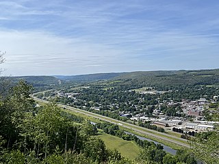
Bath is a town in Steuben County, New York, United States, with an area of 96.3 square miles and a population of 11,426 in 2020. Its largest settlement is the Village of Bath, which has an area of 2.9 sq mi and a population of 5,641. The Village is the county seat of Steuben County. The Town is located in the central part of the county, northwest of Elmira. The town and village are either named after the city of Bath in England or after Lady Bath, daughter of a landowner.

References

  1. "2016 U.S. Gazetteer Files". United States Census Bureau. Retrieved July 5, 2017.
  2. 1 2 "U.S. Census website". United States Census Bureau . Retrieved January 31, 2008.
  3. "US Board on Geographic Names". United States Geological Survey. October 25, 2007. Retrieved January 31, 2008.
  4. "Census of Population and Housing". Census.gov. Retrieved June 4, 2015.

42°05′42″N77°43′32″W / 42.09500°N 77.72556°W / 42.09500; -77.72556