Bellair, Missouri

Last updated

Bellair is an unincorporated community in Cooper County, Missouri, United States. [1] The community is on Missouri Route 5, approximately ten miles south-southwest of Boonville. [2]

Cooper County, Missouri County in the United States

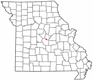
Cooper County is a county located in the central portion of the U.S. state of Missouri. As of the 2010 census, the population was 17,601. Its county seat is Boonville. The county was organized December 17, 1818 and named for Sarshell Cooper, a frontier settler who was killed by Native Americans near Arrow Rock in 1814. It is a part of the Columbia, Missouri metropolitan area.

Missouri Route 5 highway in Missouri

Missouri Route 5 is the longest state highway in Missouri and the only Missouri state highway to traverse the entire state. It is part of a three state, 650 mile highway 5. To the north, it continues into Iowa as Iowa Highway 5 and to the south it enters Arkansas as Highway 5. With only a few exceptions, it is two-lane for its entire length. Business Route 5 serves Milan and Ava.

Boonville, Missouri City in Missouri, United States

Boonville is a city in Cooper County, Missouri, United States. The population was 8,319 at the 2010 census. It is the county seat of Cooper County. The city was the site of a skirmish early in the Civil War, on July 17, 1861. Union forces defeated a small and poorly equipped force of the Missouri State Guard in the first Battle of Boonville. It is part of the Columbia, Missouri metropolitan area

History

Bellair was founded in the 1840s by T. P. Bell, and named for him. [3] A post office called Bellair was established in 1849, then was changed to Bell Air in 1864, and the post office closed in 1906. [4]

Related Research Articles

Henley, Missouri unincorporated community in Missouri

Henley is an unincorporated community in southwestern Cole County, Missouri, United States. It is located twelve miles east of Eldon.

Speed, Missouri Unincorporated community in Missouri, United States

Speed is an unincorporated community in Palestine Township, Cooper County, Missouri, United States.

Marion is an unincorporated community in Cole County, Missouri, United States. Marion is in the northern corner of the county. The community is located on Missouri Route 179 and overlooks the Missouri River to the east.

Osage City is an unincorporated community in Cole County, in the U.S. state of Missouri.

Pisgah is an unincorporated community in Cooper County, Missouri, United States. The community is located about two miles west of Pisgah Creek on Missouri Route O and eleven miles north-northwest of California. Bunceton is about eight miles to the west on Missouri Route J.

Millersburg is an unincorporated community in Callaway County, in the U.S. state of Missouri. It is located near the Boone-Callaway county line on the Owl Creek tributary of Cedar Creek. The Little Dixie Lake and Little Dixie Wildlife Management Area lie on Owl Creek just north of the community. It is on Missouri Route J about four miles south of I-70.

Sparta is an unincorporated community in Buchanan County, in the U.S. state of Missouri.

Osage Bend is an unincorporated community in Cole County, in the U.S. state of Missouri.

Stringtown is an unincorporated community in Cole County, in the U.S. state of Missouri.

Billingsville is an unincorporated community in Cooper County, in the U.S. state of Missouri.

Byberry is an extinct town in Cooper County, in the U.S. state of Missouri.

Chouteau Springs is an unincorporated community in Cooper County, in the U.S. state of Missouri.

Clarks Fork is an unincorporated community in Cooper County, in the U.S. state of Missouri.

Harriston is an unincorporated community in Cooper County, in the U.S. state of Missouri.

Lamine is an unincorporated community in Cooper County, in the U.S. state of Missouri.

New Lebanon, Missouri unincorporated community in Missouri

New Lebanon is an unincorporated community in Cooper County, in the U.S. state of Missouri.

Lone Elm is an unincorporated community in Cooper County, in the U.S. state of Missouri.

Overton is an unincorporated community in Cooper County, in the U.S. state of Missouri.

Pleasant Green is an unincorporated community in Cooper County, in the U.S. state of Missouri.

Big Creek is an unincorporated community in Texas County, in the U.S. state of Missouri. The community was located along Big Creek about 2.5 miles south of Yukon and one-half mile east of Missouri Route 137. The Big Creek school was south of the creek and the Big Creek church was about one half mile north along a county road.

References

  1. U.S. Geological Survey Geographic Names Information System: Bellair, Missouri
  2. Missouri Atlas & Gazetteer, DeLorme, 1998, First edition, p. 37, ISBN   0-89933-224-2
  3. "Cooper County Place Names, 1928–1945 (archived)". The State Historical Society of Missouri. Archived from the original on 24 June 2016. Retrieved 22 September 2016.
  4. "Post Offices". Jim Forte Postal History. Archived from the original on 6 March 2016. Retrieved 22 September 2016.

Coordinates: 38°49′59″N92°50′40″W / 38.83306°N 92.84444°W / 38.83306; -92.84444

Geographic coordinate system Coordinate system

A geographic coordinate system is a coordinate system that enables every location on Earth to be specified by a set of numbers, letters or symbols. The coordinates are often chosen such that one of the numbers represents a vertical position and two or three of the numbers represent a horizontal position; alternatively, a geographic position may be expressed in a combined three-dimensional Cartesian vector. A common choice of coordinates is latitude, longitude and elevation. To specify a location on a plane requires a map projection.