
Cooper County is located in the central portion of the U.S. state of Missouri. As of the 2020 United States census, the population was 17,103. Its county seat is Boonville. The county was organized December 17, 1818 and named for Sarshell Cooper, a frontier settler who was killed by Native Americans near Arrow Rock in 1814. It is a part of the Columbia, Missouri metropolitan area.
Rich Fountain is an unincorporated community in Osage County, Missouri, United States. It is located approximately three miles east of U.S. Route 63 and is fifteen miles southeast of Jefferson City.
High Point is an unincorporated community in southern Moniteau County, Missouri, United States. It is located ten miles south of California, approximately one mile west of Route 87 on Missouri Route C.

Clear Creek Township is one of fourteen townships in Cooper County, Missouri, USA. As of the 2000 census, its population was 439.

Kelly Township is one of fourteen townships in Cooper County, Missouri, USA. As of the 2000 census, its population was 676.

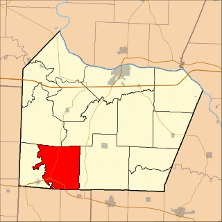
Lamine Township is one of 14 civil townships in Cooper County, in the U.S. state of Missouri. Twenty-two of Missouri's 114 counties, including Cooper County, have civil township governments. The other 92 counties have townships which are geographical but not governmental (civil). According to the 1860 Census, the population of Lamine Township was 830 . As of the 2020 Census, Lamine Township's population was 257.
Lebanon Township is one of fourteen townships in Cooper County, Missouri, USA. As of the 2000 census, its population was 333.

Palestine Township is one of fourteen townships in Cooper County, Missouri, USA. As of the 2000 census, its population was 367.
Osage City is an unincorporated community in Cole County, in the U.S. state of Missouri.
Pisgah is an unincorporated community in Cooper County, Missouri, United States. The community is located about two miles west of Pisgah Creek on Missouri Route O and eleven miles north-northwest of California. Bunceton is about eight miles to the west on Missouri Route J.
Marys Home is an unincorporated community in northern Miller County, in the U.S. state of Missouri. The community is on Missouri Route H, approximately two miles north of the Osage River. The town of Eugene in the southwest corner of Cole County is about four miles to the northwest, by Route H and Missouri Route 17.
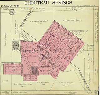
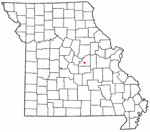
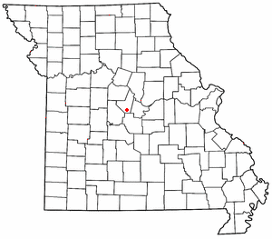
Chouteau Springs is an unincorporated community in Pilot Grove Township, Cooper County, in the U.S. state of Missouri.
Clarks Fork is an unincorporated community in Cooper County, in the U.S. state of Missouri. The community is located on Missouri Route 87 approximately one mile southeast of the stream Clark Fork. Boonville is approximately seven miles to the northwest.
Harriston is an unincorporated community in Cooper County, in the U.S. state of Missouri. The community was located along the Missouri–Kansas–Texas Railroad line approximately three miles southwest of Pilot Grove.
Lamine is an unincorporated community in Lamine Township, in Cooper County, in the U.S. state of Missouri.
Lone Elm is an unincorporated community in Cooper County, in the U.S. state of Missouri. The community is located at the intersection of Missouri routes KK and B approximately eleven miles south of Boonville.
Overton is an unincorporated community in northeast Cooper County, in the U.S. state of Missouri. The community is adjacent to the south edge of the Missouri River floodplain. Missouri Route 98 passes through the community and I-70 passes approximately 1/2 mile to the south. Boonville is eight miles to the west and Wooldridge is four miles to the southeast adjacent to the Cooper-Moniteau county line.
Pleasant Green is an unincorporated community in Cooper County, in the U.S. state of Missouri. The community is adjacent to the Missouri–Kansas–Texas Railroad just north of Missouri Route 135.
Case is an unincorporated community in northern Laclede County, in the U.S. state of Missouri. The community was on Missouri Route E approximately 1.5 miles northwest of Eldridge.
Oakland is an unincorporated community in Laclede County, in the Ozarks of southern Missouri. The community is located on Route B, two miles south of the junction of Route B with Missouri Route 32. The site lies five miles southeast of Lebanon.

